| Home | City Bus | Maps | Villages | Cities | Rail | Tourist Places | School | College | Pin Codes | Corona Cases Count |
| Distance Calculator Bus Services IFSC Codes Trace Mobile Number Weather Search Place Trace IP Available Cash ATM/Banks Locate Polling Booth Report an Error contact People |
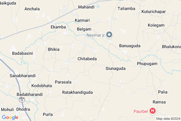
Chitabeda
Chitabeda Map
EDIT Map
Add Your House
 ..
..
Current Corona Virus Infected Patients Count in Nabarangpur District
| City Name | District Name | Total Covid cases |
|---|
Locality Name :
Chitabeda
( ଛିତବେଦଂ )
Tehsil Name : Jharigam
District : Nabarangpur
State : Odisha
Language : Oriya and Hindi
Current Time 07:00 AM
Date: Saturday , Apr 26,2025 (IST)
Time zone: IST (UTC+5:30)
Elevation / Altitude: 549 meters. Above Seal level
Telephone Code / Std Code: 06867
Assembly constituency : Jharigam assembly constituency
Assembly MLA : ramesh chandra majhi
Lok Sabha constituency : Nabarangpur parliamentary constituency
Parliament MP : RAMESH CHANDRA MAJHI
Serpanch Name :
Pin Code : 764076
Post Office Name : Jharigam
Commodities Prices : Nabarangpur(Umerkote) Market / Mandi
Chitabeda Live Weather
Temperature: 30.9 °C
clear sky
Humidity: 43%
Wind : 6.51 mt/sec towards SW
StationName : "Umarkot"
observed on Now
Temperature: 30.9 °C
clear sky
Humidity: 43%
Wind : 6.51 mt/sec towards SW
StationName : "Umarkot"
observed on Now
Chitabeda Weather Forecast for Next 5 days
27-04-2025
23.2°C to 38.6°C
clear sky, broken clouds, light rain
23.2°C to 38.6°C
clear sky, broken clouds, light rain
28-04-2025
22.7°C to 32.6°C
light rain, overcast clouds, broken clouds
22.7°C to 32.6°C
light rain, overcast clouds, broken clouds
29-04-2025
23.9°C to 37.1°C
broken clouds, clear sky, light rain, few clouds
23.9°C to 37.1°C
broken clouds, clear sky, light rain, few clouds
30-04-2025
24.1°C to 38.7°C
scattered clouds, clear sky, few clouds
24.1°C to 38.7°C
scattered clouds, clear sky, few clouds
01-05-2025
23.8°C to 38.3°C
clear sky, few clouds, moderate rain, light rain, scattered clouds
23.8°C to 38.3°C
clear sky, few clouds, moderate rain, light rain, scattered clouds
Rivers Near Chitabeda
Indravati
Narangi
Indravati
Narangi
About Chitabeda
Correct below Info and add more info about ChitabedaChitabeda is a Village in Jharigam Tehsil in Nabarangpur District of Odisha State, India. It is located 61 KM towards North from District head quarters Nabarangpur. 3 KM from Jharigam. 437 KM from State capital Bhubaneswar
Chitabeda Pin code is 764076 and postal head office is Jharigam .
Bhikia ( 4 KM ) , Ratakhandiguda ( 4 KM ) , Banuaguda ( 6 KM ) , Kanakote ( 9 KM ) , Junapani ( 9 KM ) are the nearby Villages to Chitabeda. Chitabeda is surrounded by Umerkote Tehsil towards west , Dabugam Tehsil towards South , Chandahandi Tehsil towards North , Papadahandi Tehsil towards South .
Umarkote , Nabarangapur , Kondagaon , Jagdalpur are the near by Cities to Chitabeda.
Chitabeda 2011 Census Details
Chitabeda Local Language is Oriya. Chitabeda Village Total population is 2002 and number of houses are 473. Female Population is 48.4%. Village literacy rate is 30.6% and the Female Literacy rate is 11.1%.
Population
| Census Parameter | Census Data |
| Total Population | 2002 |
| Total No of Houses | 473 |
| Female Population % | 48.4 % ( 968) |
| Total Literacy rate % | 30.6 % ( 613) |
| Female Literacy rate | 11.1 % ( 222) |
| Scheduled Tribes Population % | 26.0 % ( 520) |
| Scheduled Caste Population % | 9.8 % ( 196) |
| Working Population % | 58.0 % |
| Child(0 -6) Population by 2011 | 311 |
| Girl Child(0 -6) Population % by 2011 | 50.5 % ( 157) |
Chitabeda Census More Deatils.
Politics in Chitabeda
BJD is the major political party in this area.Polling Stations /Booths near Chitabeda
1)Sardhapur Uup School2)Jampada Primary School
3)Chikili Up School Room No. I
4)Chottaguda
5)Cheptiamba Up School
HOW TO REACH Chitabeda
By Rail
There is no railway station near to Chitabeda in less than 10 km.Colleges near Chitabeda
Indravati Project College,indravati. Parajabarangpadar
Address :
Maidal Pur Collage Maidal Pur
Address :
Bhrib College Dabugam
Address :
Pendranimahavidyalaumarakote
Address :
Panabeda Mahavidyalaya
Address : Chandahandi, Berhampur-760007.
Schools near Chitabeda
Govt Health Centers near Chitabeda
1) SC Santemra , SC Santemra , Santemra , Near High School2) SC Umergaon , SC Umergaon , Umergaon , School
3) Parla SC , , PARLA ,
Hospitals in Chitabeda,Jharigam
Primary Health Centre; Phupugam
Jharigam-Dabugam Rd; Phupugam; Odisha 764076; India
8.1 KM distance Detail
more ..
Colleges in Chitabeda,Jharigam
Jharigam Mahavidyalaya
Jharigam Main Rd; Uduliaguda Street; Jharigaon; Odisha 764076; India
9.9 KM distance Detail
more ..
Super Markets in Chitabeda,Jharigam
About Chitabeda &
History
How to reach Chitabeda
Tourist Places Near By Chitabeda
Schools in Chitabeda
Colleges in Chitabeda
Temperature & weather of Chitabeda
places in Chitabeda
Chitabeda photos
More Information
How to reach Chitabeda
Tourist Places Near By Chitabeda
Schools in Chitabeda
Colleges in Chitabeda
Temperature & weather of Chitabeda
places in Chitabeda
Chitabeda photos
More Information
Village Talk
Post News or Events about this Village
Near Cities
Umarkote 13 KM near
Nabarangapur 58 KM near
Kondagaon 76 KM near
Jagdalpur 78 KM near
Umarkote 13 KM near
Nabarangapur 58 KM near
Kondagaon 76 KM near
Jagdalpur 78 KM near
Near By Taluks
Jharigam 3 KM near
Umerkote 19 KM near
Dabugam 22 KM near
Chandahandi 32 KM near
Jharigam 3 KM near
Umerkote 19 KM near
Dabugam 22 KM near
Chandahandi 32 KM near
Near By Air Ports
Raipur Airport 203 KM near
Vishakhapatnam Airport 261 KM near
Rajahmundry Airport 322 KM near
Bhubaneswar Airport 415 KM near
Raipur Airport 203 KM near
Vishakhapatnam Airport 261 KM near
Rajahmundry Airport 322 KM near
Bhubaneswar Airport 415 KM near
Near By Tourist Places
Jagdalpur 78 KM near
Bastar 81 KM near
Kalahandi 100 KM near
Jeypore 101 KM near
Kanker 124 KM near
Jagdalpur 78 KM near
Bastar 81 KM near
Kalahandi 100 KM near
Jeypore 101 KM near
Kanker 124 KM near
Near By Districts
Nabarangpur 58 KM near
Bastar 72 KM near
Kalahandi 101 KM near
Koraput 113 KM near
Nabarangpur 58 KM near
Bastar 72 KM near
Kalahandi 101 KM near
Koraput 113 KM near
Near By RailWay Station
Koraput Junction Rail Way Station 116 KM near
Kantabanji Rail Way Station 122 KM near
Koraput Junction Rail Way Station 116 KM near
Kantabanji Rail Way Station 122 KM near