| Home | City Bus | Maps | Villages | Cities | Rail | Tourist Places | School | College | Pin Codes | Corona Cases Count |
| Distance Calculator Bus Services IFSC Codes Trace Mobile Number Weather Search Place Trace IP Available Cash ATM/Banks Locate Polling Booth Report an Error contact People |
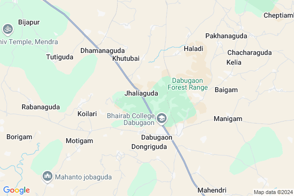
Jhaliaguda
Jhaliaguda Map
EDIT Map
Add Your House
 ..
..
Current Corona Virus Infected Patients Count in Nabarangpur District
| City Name | District Name | Total Covid cases |
|---|
Locality Name :
Jhaliaguda
( ଝଲିଆଗୁଡା )
Tehsil Name : Dabugam
District : Nabarangpur
State : Odisha
Language : Oriya and Hindi
Current Time 10:15 AM
Date: Wednesday , Feb 05,2025 (IST)
Time zone: IST (UTC+5:30)
Elevation / Altitude: 552 meters. Above Seal level
Telephone Code / Std Code: 06869
Assembly constituency : Dabugam assembly constituency
Assembly MLA : bhujabal majhi
Lok Sabha constituency : Nabarangpur parliamentary constituency
Parliament MP : RAMESH CHANDRA MAJHI
Serpanch Name :
Pin Code : 764072
Post Office Name : Dabugam
Commodities Prices : Nabarangpur(Umerkote) Market / Mandi
Jhaliaguda Live Weather
Temperature: 24.8 °C
overcast clouds
Humidity: 37%
Wind : 1.92 mt/sec towards S
StationName : "Umarkot"
observed on 2 Hours Back
Temperature: 24.8 °C
overcast clouds
Humidity: 37%
Wind : 1.92 mt/sec towards S
StationName : "Umarkot"
observed on 2 Hours Back
Jhaliaguda Weather Forecast for Next 5 days
06-02-2025
19.7°C to 33.1°C
overcast clouds, scattered clouds, broken clouds, clear sky
19.7°C to 33.1°C
overcast clouds, scattered clouds, broken clouds, clear sky
07-02-2025
18.1°C to 33.0°C
clear sky
18.1°C to 33.0°C
clear sky
08-02-2025
19.2°C to 31.8°C
clear sky
19.2°C to 31.8°C
clear sky
09-02-2025
18.2°C to 32.1°C
clear sky
18.2°C to 32.1°C
clear sky
10-02-2025
17.0°C to 32.7°C
clear sky
17.0°C to 32.7°C
clear sky
Rivers Near Jhaliaguda
Kandabindha
Turi
Kandabindha
Turi
About Jhaliaguda
Correct below Info and add more info about JhaliagudaJhaliaguda is a small Village/hamlet in Dabugam Tehsil in Nabarangpur District of Odisha State, India. It is located 39 KM towards North from District head quarters Nabarangpur. 2 KM from Dabugam. 434 KM from State capital Bhubaneswar
Jhaliaguda Pin code is 764072 and postal head office is Dabugam .
Manigam ( 7 KM ) , Medana ( 10 KM ) , Attigam ( 14 KM ) , Kanakote ( 14 KM ) , Bakadabeda ( 15 KM ) are the nearby Villages to Jhaliaguda. Jhaliaguda is surrounded by Papadahandi Tehsil towards East , Jharigam Tehsil towards North , Kosagumuda Tehsil towards South , Nabarangpur Tehsil towards South .
Umarkote , Nabarangapur , Jagdalpur , Jeypur are the near by Cities to Jhaliaguda.
Jhaliaguda 2011 Census Details
Jhaliaguda Local Language is Oriya. Jhaliaguda Village Total population is 684 and number of houses are 145. Female Population is 49.6%. Village literacy rate is 29.2% and the Female Literacy rate is 10.2%.
Population
| Census Parameter | Census Data |
| Total Population | 684 |
| Total No of Houses | 145 |
| Female Population % | 49.6 % ( 339) |
| Total Literacy rate % | 29.2 % ( 200) |
| Female Literacy rate | 10.2 % ( 70) |
| Scheduled Tribes Population % | 71.9 % ( 492) |
| Scheduled Caste Population % | 7.0 % ( 48) |
| Working Population % | 74.7 % |
| Child(0 -6) Population by 2011 | 139 |
| Girl Child(0 -6) Population % by 2011 | 52.5 % ( 73) |
Jhaliaguda Census More Deatils.
Politics in Jhaliaguda
BJD , INC are the major political parties in this area.Polling Stations /Booths near Jhaliaguda
1)Jhadasemela Pup School2)Chikili Ugup School
3)Katagan Pry School Room No.1
4)Pry School Kaliaguda
5)Jabaguda Pup School
HOW TO REACH Jhaliaguda
By Rail
There is no railway station near to Jhaliaguda in less than 10 km.Colleges near Jhaliaguda
Bhrib College Dabugam
Address :
Pendranimahavidyalaumarakote
Address :
Schools near Jhaliaguda
Govt Health Centers near Jhaliaguda
1) SC Santemra , SC Santemra , Santemra , Near High School2) SC Umergaon , SC Umergaon , Umergaon , School
3) SC Saruguda , SC Saruguda , Saruguda , Beside AWC
Hospitals in Jhaliaguda,Dabugam
Primary Health Centre; Phupugam
Jharigam-Dabugam Rd; Phupugam; Odisha 764076; India
21.3 KM distance Detail
more ..
Governement Offices near Jhaliaguda,Dabugam
Punya aim & archery shooting's
Jayanti Nagar.dabugam; Nabarangpur; Odisha 764072; India
3.5 KM distance Detail
About Jhaliaguda &
History
How to reach Jhaliaguda
Tourist Places Near By Jhaliaguda
Schools in Jhaliaguda
Colleges in Jhaliaguda
Temperature & weather of Jhaliaguda
places in Jhaliaguda
Jhaliaguda photos
More Information
How to reach Jhaliaguda
Tourist Places Near By Jhaliaguda
Schools in Jhaliaguda
Colleges in Jhaliaguda
Temperature & weather of Jhaliaguda
places in Jhaliaguda
Jhaliaguda photos
More Information
Village Talk
Post News or Events about this Village
Near Cities
Umarkote 31 KM near
Nabarangapur 36 KM near
Jagdalpur 64 KM near
Jeypur 79 KM near
Umarkote 31 KM near
Nabarangapur 36 KM near
Jagdalpur 64 KM near
Jeypur 79 KM near
Near By Taluks
Dabugam 2 KM near
Papadahandi 18 KM near
Jharigam 22 KM near
Kosagumuda 30 KM near
Dabugam 2 KM near
Papadahandi 18 KM near
Jharigam 22 KM near
Kosagumuda 30 KM near
Near By Air Ports
Raipur Airport 225 KM near
Vishakhapatnam Airport 239 KM near
Rajahmundry Airport 302 KM near
Bhubaneswar Airport 412 KM near
Raipur Airport 225 KM near
Vishakhapatnam Airport 239 KM near
Rajahmundry Airport 302 KM near
Bhubaneswar Airport 412 KM near
Near By Tourist Places
Jagdalpur 65 KM near
Bastar 68 KM near
Jeypore 78 KM near
Kalahandi 102 KM near
Dantewada 142 KM near
Jagdalpur 65 KM near
Bastar 68 KM near
Jeypore 78 KM near
Kalahandi 102 KM near
Dantewada 142 KM near
Near By Districts
Nabarangpur 36 KM near
Bastar 64 KM near
Koraput 91 KM near
Kalahandi 104 KM near
Nabarangpur 36 KM near
Bastar 64 KM near
Koraput 91 KM near
Kalahandi 104 KM near
Near By RailWay Station
Koraput Junction Rail Way Station 93 KM near
Therubali Rail Way Station 122 KM near
Koraput Junction Rail Way Station 93 KM near
Therubali Rail Way Station 122 KM near