| Home | City Bus | Maps | Villages | Cities | Rail | Tourist Places | School | College | Pin Codes | Corona Cases Count |
| Distance Calculator Bus Services IFSC Codes Trace Mobile Number Weather Search Place Trace IP Available Cash ATM/Banks Locate Polling Booth Report an Error contact People |
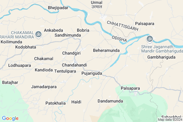
Chilligam
Chilligam Map
EDIT Map
Add Your House
 ..
..
Current Corona Virus Infected Patients Count in Nabarangpur District
| City Name | District Name | Total Covid cases |
|---|
Locality Name :
Chilligam
( ଚିଳଲିଗାଁ )
Tehsil Name : Chandahandi
District : Nabarangpur
State : Odisha
Language : Oriya and Hindi
Current Time 03:15 PM
Date: Tuesday , Apr 29,2025 (IST)
Time zone: IST (UTC+5:30)
Elevation / Altitude: 241 meters. Above Seal level
Telephone Code / Std Code: 06867
Assembly constituency : Jharigam assembly constituency
Assembly MLA : ramesh chandra majhi
Lok Sabha constituency : Nabarangpur parliamentary constituency
Parliament MP : RAMESH CHANDRA MAJHI
Serpanch Name :
Alternate Village Name : Chiligam
Commodities Prices : Devbhog Market / Mandi
Chilligam Live Weather
Temperature: 28.1 °C
scattered clouds
Humidity: 53%
Wind : 13.7 mt/sec towards W
StationName : "Umarkot"
observed on Now
Temperature: 28.1 °C
scattered clouds
Humidity: 53%
Wind : 13.7 mt/sec towards W
StationName : "Umarkot"
observed on Now
Chilligam Weather Forecast for Next 5 days
30-04-2025
26.4°C to 38.0°C
light rain, scattered clouds, clear sky
26.4°C to 38.0°C
light rain, scattered clouds, clear sky
01-05-2025
25.6°C to 40.3°C
scattered clouds, few clouds, overcast clouds, light rain
25.6°C to 40.3°C
scattered clouds, few clouds, overcast clouds, light rain
02-05-2025
26.2°C to 41.5°C
light rain, clear sky, scattered clouds
26.2°C to 41.5°C
light rain, clear sky, scattered clouds
03-05-2025
24.5°C to 41.8°C
clear sky, light rain
24.5°C to 41.8°C
clear sky, light rain
04-05-2025
24.9°C to 41.3°C
clear sky, scattered clouds, moderate rain, broken clouds, few clouds
24.9°C to 41.3°C
clear sky, scattered clouds, moderate rain, broken clouds, few clouds
National Highways Reachable To Chilligam
Nationa High Way :NH130C
Nationa High Way :NH130C
Rivers Near Chilligam
Narangi
Hatti
Narangi
Hatti
About Chilligam
Correct below Info and add more info about ChilligamChilligam is a small Village/hamlet in Chandahandi Tehsil in Nabarangpur District of Odisha State, India. It is located 80 KM towards North from District head quarters Nabarangpur. 410 KM from State capital Bhubaneswar
Chilligam is surrounded by Deobhog Tehsil towards East , Dharamagarh Tehsil towards East , Jharigam Tehsil towards South , Kokasara Tehsil towards East .
Umarkote , Bhawanipatna , Nabarangapur , Kantabanji are the near by Cities to Chilligam.
This Place is in the border of the Nabarangpur District and Raipur District. Raipur District Deobhog is East towards this place . It is near to the Chattisgarh State Border.
Chiligam 2011 Census Details
Chilligam Local Language is Oriya. Chiligam Village Total population is 738 and number of houses are 196. Female Population is 49.3%. Village literacy rate is 34.3% and the Female Literacy rate is 9.9%.
Population
| Census Parameter | Census Data |
| Total Population | 738 |
| Total No of Houses | 196 |
| Female Population % | 49.3 % ( 364) |
| Total Literacy rate % | 34.3 % ( 253) |
| Female Literacy rate | 9.9 % ( 73) |
| Scheduled Tribes Population % | 82.4 % ( 608) |
| Scheduled Caste Population % | 2.7 % ( 20) |
| Working Population % | 61.0 % |
| Child(0 -6) Population by 2011 | 129 |
| Girl Child(0 -6) Population % by 2011 | 46.5 % ( 60) |
Chiligam Census More Deatils.
Politics in Chilligam
BJD is the major political party in this area.Polling Stations /Booths near Chilligam
1)Jhaliaguda Anganwadi Centre2)Similipadar
3)Pujariguda Up School
4)Pujariguda Up School
5)Chakamal Primary School
HOW TO REACH Chilligam
By Rail
There is no railway station near to Chilligam in less than 10 km.Pincodes near Chilligam
764077 ( Chandahandi ) , 766103 ( Parla ) , 764076 ( Jharigam )Colleges near Chilligam
Panabeda Mahavidyalaya
Address : Chandahandi, Berhampur-760007.
Schools near Chilligam
Prathamika Bidyalaya,bhojpur
Address : Bhojpur/malgaon/chandahandi
Govt Health Centers near Chilligam
1) Parla SC , , PARLA ,2) SC Umergaon , SC Umergaon , Umergaon , School
3) SC BAMNIGUDA , SC BAMNIGUDA , SINAPALI ,
Petrol Bunks in Chilligam,Chandahandi
HP PETROL PUMP - UNNATI FUELS
HP Petrol Pump Rajim Devbhog Road Tah+vill. Deobhog; Chhattisgarh 493890; India
18.7 KM distance Detail
more ..
About Chilligam &
History
How to reach Chilligam
Tourist Places Near By Chilligam
Schools in Chilligam
Colleges in Chilligam
Temperature & weather of Chilligam
places in Chilligam
Chilligam photos
More Information
How to reach Chilligam
Tourist Places Near By Chilligam
Schools in Chilligam
Colleges in Chilligam
Temperature & weather of Chilligam
places in Chilligam
Chilligam photos
More Information
Village Talk
Post News or Events about this Village
Near Cities
Umarkote 41 KM near
Bhawanipatna 76 KM near
Nabarangapur 77 KM near
Kantabanji 90 KM near
Umarkote 41 KM near
Bhawanipatna 76 KM near
Nabarangapur 77 KM near
Kantabanji 90 KM near
Near By Taluks
Chandahandi 0 KM near
Deobhog 20 KM near
Dharamagarh 29 KM near
Jharigam 30 KM near
Chandahandi 0 KM near
Deobhog 20 KM near
Dharamagarh 29 KM near
Jharigam 30 KM near
Near By Air Ports
Raipur Airport 188 KM near
Vishakhapatnam Airport 277 KM near
Rajahmundry Airport 350 KM near
Bhubaneswar Airport 390 KM near
Raipur Airport 188 KM near
Vishakhapatnam Airport 277 KM near
Rajahmundry Airport 350 KM near
Bhubaneswar Airport 390 KM near
Near By Tourist Places
Kalahandi 76 KM near
Jagdalpur 110 KM near
Bastar 113 KM near
Jeypore 122 KM near
Kanker 129 KM near
Kalahandi 76 KM near
Jagdalpur 110 KM near
Bastar 113 KM near
Jeypore 122 KM near
Kanker 129 KM near
Near By Districts
Kalahandi 75 KM near
Nabarangpur 77 KM near
Bastar 105 KM near
Nuapada 120 KM near
Kalahandi 75 KM near
Nabarangpur 77 KM near
Bastar 105 KM near
Nuapada 120 KM near
Near By RailWay Station
Kantabanji Rail Way Station 90 KM near
Titlagarh Junction Rail Way Station 92 KM near
Kantabanji Rail Way Station 90 KM near
Titlagarh Junction Rail Way Station 92 KM near