| Home | City Bus | Maps | Villages | Cities | Rail | Tourist Places | School | College | Pin Codes | Corona Cases Count |
| Distance Calculator Bus Services IFSC Codes Trace Mobile Number Weather Search Place Trace IP Available Cash ATM/Banks Locate Polling Booth Report an Error contact People |
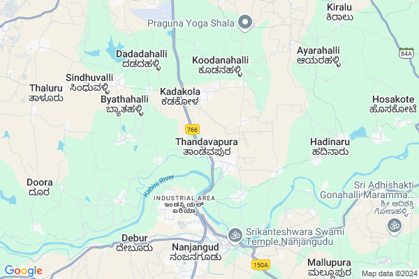
Thandavapura Map
EDIT Map
Add Your House
 ..
..
Current Corona Virus Infected Patients Count in Mysore District
| City Name | District Name | Total Covid cases |
|---|---|---|
| Mysuru District | Mysuru | 45 |
| Nanjangud | Mysuru | 25 |
| Nanjanagudu | Mysuru | 15 |
| Mysuru | Mysuru | 1 |
| Nanjangudu | Mysuru | 1 |
Locality Name :
Thandavapura
( ತಂಡವಪುರ )
Taluk Name : Nanjangud
District : Mysore
State : Karnataka
Division : Mysore
Language : Kannada and English
Current Time 06:48 AM
Date: Saturday , Apr 26,2025 (IST)
Time zone: IST (UTC+5:30)
Elevation / Altitude: 667 meters. Above Seal level
Telephone Code / Std Code: 08221
Assembly constituency : Varuna assembly constituency
Assembly MLA : Siddaramaiah
Lok Sabha constituency : Chamarajanagar parliamentary constituency
Parliament MP : V. SRINIVAS PRASAD
Serpanch Name :
Pin Code : 571302
Post Office Name : Thandavapura
Commodities Prices : Nanjangud Market / Mandi
Thandavapura Live Weather
Temperature: 23.7 °C
overcast clouds
Humidity: 86%
Wind : 1.83 mt/sec towards SW
StationName : "Nanjangūd"
observed on 1 Hours Back
Temperature: 23.7 °C
overcast clouds
Humidity: 86%
Wind : 1.83 mt/sec towards SW
StationName : "Nanjangūd"
observed on 1 Hours Back
Thandavapura Weather Forecast for Next 5 days
27-04-2025
23.5°C to 36.4°C
overcast clouds, broken clouds
23.5°C to 36.4°C
overcast clouds, broken clouds
28-04-2025
22.9°C to 37.1°C
overcast clouds, light rain, broken clouds
22.9°C to 37.1°C
overcast clouds, light rain, broken clouds
29-04-2025
23.0°C to 35.8°C
broken clouds, scattered clouds, few clouds, light rain, overcast clouds
23.0°C to 35.8°C
broken clouds, scattered clouds, few clouds, light rain, overcast clouds
30-04-2025
23.0°C to 35.0°C
overcast clouds, broken clouds, scattered clouds, light rain
23.0°C to 35.0°C
overcast clouds, broken clouds, scattered clouds, light rain
National Highways Reachable To Thandavapura
Nationa High Way :NH766;NH150A
Nationa High Way :NH766
Nationa High Way :NH766;NH150A
Nationa High Way :NH766
Rivers Near Thandavapura
Kabini :ಕಬಿನಿ :കബിനി
Kabini River
Kabini :ಕಬಿನಿ :കബിനി
Kabini River
About Thandavapura
Correct below Info and add more info about ThandavapuraThandavapura is a Village in Nanjangud Taluk in Mysore District of Karnataka State, India. It belongs to Mysore Division . It is located 19 KM towards South from District head quarters Mysore. 12 KM from Nanjangud. 156 KM from State capital Bangalore
Thandavapura Pin code is 571302 and postal head office is Thandavapura .
Kadakola ( 3 KM ) , Someshwarapura ( 5 KM ) , Hejjige ( 5 KM ) , Nanjangud ( 5 KM ) , Deviramanahalli ( 6 KM ) are the nearby Villages to Thandavapura. Thandavapura is surrounded by Mysore Taluk towards North , Tirumakudal-Narsipur Taluk towards East , Shrirangapattana Taluk towards North , Heggadadevankote Taluk towards west .
Nanjangud , Mysore , Shrirangapattana , Gundlupet are the near by Cities to Thandavapura.
Thandavapura 2011 Census Details
Thandavapura Local Language is Kannada. Thandavapura Village Total population is 5817 and number of houses are 1368. Female Population is 48.5%. Village literacy rate is 59.7% and the Female Literacy rate is 24.8%.
Population
| Census Parameter | Census Data |
| Total Population | 5817 |
| Total No of Houses | 1368 |
| Female Population % | 48.5 % ( 2820) |
| Total Literacy rate % | 59.7 % ( 3474) |
| Female Literacy rate | 24.8 % ( 1440) |
| Scheduled Tribes Population % | 7.1 % ( 412) |
| Scheduled Caste Population % | 6.2 % ( 361) |
| Working Population % | 34.8 % |
| Child(0 -6) Population by 2011 | 655 |
| Girl Child(0 -6) Population % by 2011 | 53.1 % ( 348) |
Thandavapura Census More Deatils.
Politics in Thandavapura
Indian National Congress (INC) is the major political party in this area.Polling Stations /Booths near Thandavapura
1)Government Higher Primary School (right Wing) Sarguru2)Government Higher Primary School (left Wing) Maraluru
3)Government Higher Primary School (bus Stand Opp) Nagarle
4)Government Higher Primary School (right Wing) Hadinaru
5)Government Higher Primary School (room No-2)
HOW TO REACH Thandavapura
By Rail
Tandavapura Rail Way Station , Sujata Puram Halt Rail Way Station are the very nearby railway stations to Thandavapura. Nanjangud Town Rail Way Station (near to Nanjangud) , Sujata Puram Halt Rail Way Station (near to Nanjangud) are the Rail way stations reachable from near by towns.By Road
Nanjangud , Tirumakudal - Narsipur , Chamrajnagar are the nearby by towns to Thandavapura having road connectivity to ThandavapuraColleges near Thandavapura
Govt.pu Collage Hanasoge
Address : Hanasoge
Sri Jayachamarajendra College Of Engineering
Address :
Government Cpc Polytechnic
Address :
Govt Pu Collage
Address : Bannikuppe Gate
Govt.pu College Hebbalu
Address : Govt Pu College Hebbalu
Schools in Thandavapura
Chirst School Thandavapura
Address : thandavapura , nanjanagud , mysore , Karnataka . PIN- 571302 , Post - Thandavapura
Ghps
Address : thandavapura , nanjanagud , mysore , Karnataka . PIN- 571302 , Post - Thandavapura
Govt Health Centers near Thandavapura
1) A.I.W.C.(ALLINDIAWOMENCONFERENCE) , , ,2) All India Institute of Speech and Hearing, Mysore , Naimisham Campus, Road No.3, T K Layout, Manasagangothri, , Mysuru, Karnataka ,
3) HOREYALA , SC Horeyala , Beguru Horeyla Main Road , PACC socitey
Sub Villages in Thandavapura
Hospitals in Thandavapura,Nanjangud
Primary Health Center
Kadakala; Mysore; NH-212; Ooty Mysore Road; Mysore; Mysore; Karnataka 571311; India
3.5 KM distance Detail
more ..
Petrol Bunks in Thandavapura,Nanjangud
HP PETROL PUMP - MAHADESHWARA SERVICE STATION
Khata NO: 914/771 Mysore NH-212 Tandavapura; Nanjangud Taluk; Ooty Rd; Bengaluru; Karnataka 571325; India
1.0 KM distance Detail
HP PETROL PUMP - BALAJI FUELS
Chikkaiahna Chatra; Ooty Road; NH-212 Tandavapura Village; Nanjangud Taluk; Bengaluru; Karnataka 571301; India
2.6 KM distance Detail
SAPTHAGIRI SERVICE STATION
NANJANGUD ON NILGIRI ROAD; MYSORE; Karnataka 571301; India
4.3 KM distance Detail
more ..
Colleges in Thandavapura,Nanjangud
MIT Thandavapura
NH 766; Nanjanagud Taluk; Mysore District; Thandavapura; Karnataka 571302; India
1.7 KM distance Detail
Government ITI Nanjangud
Industrial Area; Nanjanagudu; Karnataka 571302; India
5.0 KM distance Detail
JSS Polytechnic
Mysuru - Ooty Rd; Kempe Gowda Layout; Nanjanagudu; Karnataka 571301; India
6.2 KM distance Detail
Vidyavardhaka College
NH212; Ooty Road;; Nanjanagudu; Karnataka 571301; India
6.5 KM distance Detail
more ..
Schools in Thandavapura,Nanjangud
Holy Family Convent
Thandavapure; Thandavapura; Mysore; NH-212; Ooty Mysore Road; Mysore; Mysore; Karnataka 571301; India
0.9 KM distance Detail
Electronic Shops in Thandavapura,Nanjangud
POWER LINK ELECTRICALS
nagrara; Kanaka Nagar; Industrial Area; Nanjanagudu; Karnataka 571302; India
4.1 KM distance Detail
Police Stations near Thandavapura,Nanjangud
Traffic Police Station Nanjanagudu
Mysore - Ooty Road; Kempe Gowda Layout; Nanjanagudu; Karnataka 571301; India
6.4 KM distance Detail
Governement Offices near Thandavapura,Nanjangud
Karnataaka Industrial Area Development Board
Chikkayana Chatra; Mysore; NH-212; Ooty Mysore Road; Mysore; Mysore; Karnataka 571301; India
2.7 KM distance Detail
CESC Kadakola Section Office
KEB; National Highway 212; Kadakola; Karnataka 571311; India
3.5 KM distance Detail
About Thandavapura &
History
How to reach Thandavapura
Tourist Places Near By Thandavapura
Schools in Thandavapura
Colleges in Thandavapura
Temperature & weather of Thandavapura
places in Thandavapura
Thandavapura photos
More Information
How to reach Thandavapura
Tourist Places Near By Thandavapura
Schools in Thandavapura
Colleges in Thandavapura
Temperature & weather of Thandavapura
places in Thandavapura
Thandavapura photos
More Information
Village Talk
Post News or Events about this Village
Near Cities
Nanjangud 6 KM near
Mysore 17 KM near
Shrirangapattana 30 KM near
Gundlupet 45 KM near
Nanjangud 6 KM near
Mysore 17 KM near
Shrirangapattana 30 KM near
Gundlupet 45 KM near
Near By Taluks
Nanjangud 12 KM near
Mysore 16 KM near
Tirumakudal-Narsipur 31 KM near
Shrirangapattana 31 KM near
Nanjangud 12 KM near
Mysore 16 KM near
Tirumakudal-Narsipur 31 KM near
Shrirangapattana 31 KM near
Near By Air Ports
Mysore Airport 16 KM near
Peelamedu Airport 148 KM near
Calicut Airport 156 KM near
Bengaluru International Airport 178 KM near
Mysore Airport 16 KM near
Peelamedu Airport 148 KM near
Calicut Airport 156 KM near
Bengaluru International Airport 178 KM near
Near By Tourist Places
Nanjangud 6 KM near
Mysore 17 KM near
Srirangapatna 29 KM near
Bandipur National Park 59 KM near
Shivanasamundram 59 KM near
Nanjangud 6 KM near
Mysore 17 KM near
Srirangapatna 29 KM near
Bandipur National Park 59 KM near
Shivanasamundram 59 KM near
Near By Districts
Mysore 18 KM near
Chamarajanagar 42 KM near
Mandya 51 KM near
The Nilgiris 94 KM near
Mysore 18 KM near
Chamarajanagar 42 KM near
Mandya 51 KM near
The Nilgiris 94 KM near
Near By RailWay Station
Tandavapura Rail Way Station 0.3 KM near
Kadakola Rail Way Station 3.4 KM near
Sujata Puram Halt Rail Way Station 4.0 KM near
Mysuru Junction Rail Way Station 18 KM near
Shrirangapattana Rail Way Station 31 KM near
Tandavapura Rail Way Station 0.3 KM near
Kadakola Rail Way Station 3.4 KM near
Sujata Puram Halt Rail Way Station 4.0 KM near
Mysuru Junction Rail Way Station 18 KM near
Shrirangapattana Rail Way Station 31 KM near