| Home | City Bus | Maps | Villages | Cities | Rail | Tourist Places | School | College | Pin Codes | Corona Cases Count |
| Distance Calculator Bus Services IFSC Codes Trace Mobile Number Weather Search Place Trace IP Available Cash ATM/Banks Locate Polling Booth Report an Error contact People |
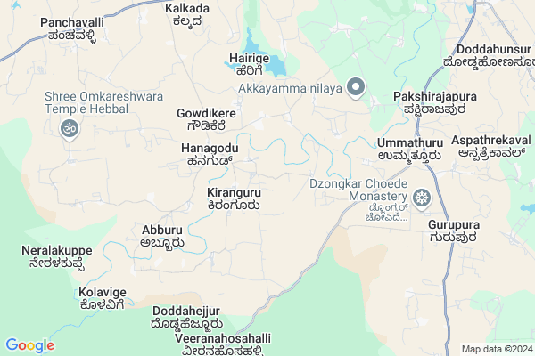
P Koppalu Map
EDIT Map
Add Your House
 ..
..
Current Corona Virus Infected Patients Count in Mysore District
| City Name | District Name | Total Covid cases |
|---|---|---|
| Mysuru District | Mysuru | 45 |
| Nanjangud | Mysuru | 25 |
| Nanjanagudu | Mysuru | 15 |
| Nanjangudu | Mysuru | 1 |
| Mysuru | Mysuru | 1 |
Locality Name :
P Koppalu
( ಪಿ ಕೊಪ್ಪಲು )
Taluk Name : Hunsur
District : Mysore
State : Karnataka
Division : Mysore
Language : Kannada and English
Current Time 10:20 PM
Date: Sunday , Apr 27,2025 (IST)
Time zone: IST (UTC+5:30)
Elevation / Altitude: 788 meters. Above Seal level
Telephone Code / Std Code: 08222
Assembly constituency : Hunsur assembly constituency
Assembly MLA : G.D. Harish Gowda
Lok Sabha constituency : Mysore parliamentary constituency
Parliament MP : PRATHAP SIMHA
Serpanch Name :
Pin Code : 571105
Post Office Name : Hunsur
Main Village Name : Parekoppalu
Commodities Prices : Hunsur Market / Mandi
National Highways Reachable To P Koppalu
Nationa High Way :NH766;NH150A
Nationa High Way :NH150A;NH275
Nationa High Way :NH766;NH150A
Nationa High Way :NH150A;NH275
Rivers Near P Koppalu
Kaveri :ಕಾವೇರಿ
Kaveri :ಕಾವೇರಿ
Kaveri :ಕಾವೇರಿ
Kaveri :ಕಾವೇರಿ
About P Koppalu
Correct below Info and add more info about P KoppaluP Koppalu is a small Village/hamlet in Hunsur Taluk in Mysore District of Karnataka State, India. It comes under Parekoppalu Panchayath. It belongs to Mysore Division . It is located 57 KM towards west from District head quarters Mysore. 17 KM from Hunsur. 201 KM from State capital Bangalore
P Koppalu Pin code is 571105 and postal head office is Hunsur .
P Koppalu is surrounded by Piriyapatna Taluk towards North , Heggadadevankote Taluk towards South , Virajpet Taluk towards west , Krishnarajanagara Taluk towards North .
Mysore , Nanjangud , Madikeri , Shrirangapattana are the near by Cities to P Koppalu.
Demographics of P Koppalu
Kannada is the Local Language here.Politics in P Koppalu
Bharatiya Janata Party , JD(S) , BJP , Janata Dal (Secular) (JD(S)) , INC are the major political parties in this area.Polling Stations /Booths near P Koppalu
1)Govt Higher Primary School [west Wing Right Side] Vontipalyabore Hunsur Town2)Govt Higher Primary School Dallalu
3)Govt Higher Primary School Doddabeechanahalli
4)Govt Higher Primary School Kademanuganahalli
5)Govt Higher Primary School Mayurapura
HOW TO REACH P Koppalu
By Rail
There is no railway station near to P Koppalu in less than 10 km. Chamarajapuram Rail Way Station (near to Mysore) , Mysuru Junction Rail Way Station (near to Mysore) , Krishnarajanagara Rail Way Station (near to Krishnarajanagara) , Hampapura Rail Way Station (near to Krishnarajanagara) are the Rail way stations reachable from near by towns.By Road
Hunsur , Krishnarajanagara , Mysore are the nearby by towns to P Koppalu having road connectivity to P KoppaluColleges near P Koppalu
Govt Pu Collage
Address : Bannikuppe Gate
Schools near P Koppalu
Lps & Hs Adulam, Vinobha Colony
Address : vinobha colony , hunsur , mysore , Karnataka . PIN- 571189 , Post - Rathnapuri Colony
Sri Manjunata High School
Address : hosa ramana halli , hunsur , mysore , Karnataka . PIN- 571103 , Post - Bilikere
Moorarji Resi Shale
Address : hunsur ward-18 , hunsur , mysore , Karnataka . PIN- 571105 , Post - Hunsur
Murarjidesayi, Bilikere
Address : belekere , hunsur , mysore , Karnataka . PIN- 571103 , Post - Bilikere
Govt Health Centers near P Koppalu
1) Mullur , building No 6-99/1 , banglagudde , gurupura panchayat2) Bettadabeedu , , ,
3) All India Institute of Speech and Hearing, Mysore , Naimisham Campus, Road No.3, T K Layout, Manasagangothri, , Mysuru, Karnataka ,
Petrol Bunks in P Koppalu,Hunsur
HP PETROL PUMP - SRI MANJUNATHESWARA SS
Hunsur-virajpet Road; Panchavalli Village;periyapatna Taluk;; Bengaluru; Karnataka 571107; India
2.6 KM distance Detail
more ..
Colleges in P Koppalu,Hunsur
Gyudmed Tantric College
Gyudmed Tantric University Hunsur Taluk; Mysore Dist.; Karnataka 57118; India
6.4 KM distance Detail
more ..
Schools in P Koppalu,Hunsur
Sri Manjunatha Education Trust
Santhekerekodi; Hunsur taluk; Mysore; Karnataka 571105; India
2.4 KM distance Detail
Super Markets in P Koppalu,Hunsur
arafa Fanciy
Kirjaji Rd; Muthumariyamman Kovil; Hunsur; Karnataka 571105; India
14.6 KM distance Detail
Governement Offices near P Koppalu,Hunsur
PWD Inspection Bungalow
Mysore Bantwal State Highway; Hunsur; Karnataka 571105; India
13.8 KM distance Detail
Assistant Regional Transport Office
Mangalore - Mysore Hwy; Mysore; Karnataka 571105; India
14.0 KM distance Detail
Hunsur Urban Development Authority
rotary shathabdhi road; Hunsur; Karnataka 571105; India
14.3 KM distance Detail
About P Koppalu &
History
How to reach P Koppalu
Tourist Places Near By P Koppalu
Schools in P Koppalu
Colleges in P Koppalu
Temperature & weather of P Koppalu
places in P Koppalu
P Koppalu photos
More Information
How to reach P Koppalu
Tourist Places Near By P Koppalu
Schools in P Koppalu
Colleges in P Koppalu
Temperature & weather of P Koppalu
places in P Koppalu
P Koppalu photos
More Information
Village Talk
Post News or Events about this Village
Near Cities
Mysore 53 KM near
Nanjangud 58 KM near
Madikeri 61 KM near
Shrirangapattana 62 KM near
Mysore 53 KM near
Nanjangud 58 KM near
Madikeri 61 KM near
Shrirangapattana 62 KM near
Near By Taluks
Hunsur 16 KM near
Piriyapatna 28 KM near
Heggadadevankote 31 KM near
Virajpet 40 KM near
Hunsur 16 KM near
Piriyapatna 28 KM near
Heggadadevankote 31 KM near
Virajpet 40 KM near
Near By Air Ports
Mysore Airport 54 KM near
Calicut Airport 139 KM near
Peelamedu Airport 180 KM near
Bajpe Airport 184 KM near
Mysore Airport 54 KM near
Calicut Airport 139 KM near
Peelamedu Airport 180 KM near
Bajpe Airport 184 KM near
Near By Tourist Places
Nagarhole 25 KM near
Kabini 36 KM near
Tholpetty 39 KM near
Dubare 39 KM near
Thirunelli 47 KM near
Nagarhole 25 KM near
Kabini 36 KM near
Tholpetty 39 KM near
Dubare 39 KM near
Thirunelli 47 KM near
Near By Districts
Mysore 54 KM near
Kodagu 62 KM near
Wayanad 78 KM near
Mandya 91 KM near
Mysore 54 KM near
Kodagu 62 KM near
Wayanad 78 KM near
Mandya 91 KM near
Near By RailWay Station
Krishnarajanagara Rail Way Station 34 KM near
Mysuru Junction Rail Way Station 54 KM near
Krishnarajanagara Rail Way Station 34 KM near
Mysuru Junction Rail Way Station 54 KM near