| Home | City Bus | Maps | Villages | Cities | Rail | Tourist Places | School | College | Pin Codes | Corona Cases Count |
| Distance Calculator Bus Services IFSC Codes Trace Mobile Number Weather Search Place Trace IP Available Cash ATM/Banks Locate Polling Booth Report an Error contact People |
 ..
..
Current Corona Virus Infected Patients Count in Muzaffarnagar District
| City Name | District Name | Total Covid cases |
|---|---|---|
| Muzaffarnagar District | Muzaffarnagar | 21 |
Block Name : Khatauli
District : Muzaffarnagar
State : Uttar Pradesh
Division : Saharanpur
Language : Hindi and Urdu, Punjabi
Current Time 07:51 PM
Date: Friday , Apr 25,2025 (IST)
Time zone: IST (UTC+5:30)
Elevation / Altitude: 239 meters. Above Seal level
Telephone Code / Std Code: 01396
Assembly constituency : Khatauli assembly constituency
Assembly MLA : Vikram Singh
Lok Sabha constituency : Muzaffarnagar parliamentary constituency
Parliament MP : Sanjeev Kumar Balyan
Serpanch Name :
Pin Code : 251201
Post Office Name : Sugar Mill Road Khatauli
Alternate Village Name : Chhachharpur
Commodities Prices : Khatauli Market / Mandi
Temperature: 37.0 °C
scattered clouds
Humidity: 4%
Wind : 4.2 mt/sec towards NW
StationName : "Phalauda"
observed on 53 Mins Back
28.7°C to 37.8°C
clear sky, scattered clouds
27.7°C to 42.3°C
broken clouds, overcast clouds
27.8°C to 41.5°C
overcast clouds, broken clouds, scattered clouds
26.3°C to 42.9°C
few clouds, clear sky
27.2°C to 42.3°C
clear sky, few clouds, scattered clouds, broken clouds
OverView of Chhacharpur
About the history of chhachharpur. In 1854,there was two brothers Harsha Pal and Dishondi Pal.
Who established This village. They both were migrated village to village for his survival and nobody let them live in our village.Before the village chhachharpur they both lived in a village PAMANAWALI. But they was not adjustable in That village. So they searched about a new place to live. After all that they lived at This place called CHHACHHARPUR. And now the 11th generation of these two brothers are living in chhachharpur. And Now This village is known as Gadariya Village (Pal village) because here the population of Pal society is maximum. Here some other cast also live in the village which are least in number in comparison to Gadariyas.
According to Census 2011 information the location code or village code of Chhacharpur village is 111295. Chhacharpur village is located in Khatauli Tehsil of Muzaffarnagar district in Uttar Pradesh, India. It is situated 17km away from sub-district headquarter Khatauli and 41km away from district headquarter Muzaffar Nagar. As per 2009 stats, CHHACHHARPUR village is also a gram panchayat.
The total geographical area of village is 126.18 hectares. Chhacharpur has a total population of 1,967 peoples. There are about 321 houses in Chhacharpur village. Khatauli is nearest town to Chhacharpur which is approximately 16km away.
Edit below overview about Chhacharpur
Nationa High Way :NH34
Nationa High Way :NH709A
Kali
Yamuna :যমুনা :યમુના :यमुना :ಯಮುನಾ :यमुना :யமுனை :Ямуна :https://1drv.ms/b/s!Ar-WXIFaX7UdgQuO6WpVrTr6YYsQ
About Chhacharpur
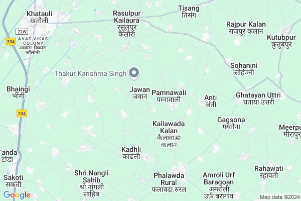
Chhacharpur is a Village in Khatauli Block in Muzaffarnagar District of Uttar Pradesh State, India. It belongs to Saharanpur Division . It is located 33 KM towards South from District head quarters Muzaffarnagar. 8 KM from Khatauli Rural. 474 KM from State capital Lucknow
Chhacharpur Pin code is 251201 and postal head office is Sugar Mill Road Khatauli .
Pamnawali ( 1 KM ) , Kailawada Kalan ( 2 KM ) , Jandheri Jatan ( 2 KM ) , Khaanpur ( 2 KM ) , Galibpur ( 2 KM ) are the nearby Villages to Chhacharpur. Chhacharpur is surrounded by Mawana Kalan Block towards South , Jansath Block towards North , Daurala Block towards South , Sardhana Block towards west .
Hastinapur , Sardhana , Muzaffarnagar , Meerut are the near by Cities to Chhacharpur.
This Place is in the border of the Muzaffarnagar District and Meerut District. Meerut District Daurala is South towards this place .
Chhacharpur 2011 Census Details
Chhacharpur Local Language is Hindi. Chhacharpur Village Total population is 1967 and number of houses are 321. Female Population is 47.2%. Village literacy rate is 65.6% and the Female Literacy rate is 22.8%.
Population
| Census Parameter | Census Data |
| Total Population | 1967 |
| Total No of Houses | 321 |
| Female Population % | 47.2 % ( 928) |
| Total Literacy rate % | 65.6 % ( 1291) |
| Female Literacy rate | 22.8 % ( 449) |
| Scheduled Tribes Population % | 0.0 % ( 0) |
| Scheduled Caste Population % | 11.9 % ( 234) |
| Working Population % | 39.7 % |
| Child(0 -6) Population by 2011 | 281 |
| Girl Child(0 -6) Population % by 2011 | 49.8 % ( 140) |
Chhacharpur Census More Deatils.
Politics in Chhacharpur
BJP , RLD , SP , BSP , BKKGP are the major political parties in this area.Polling Stations /Booths near Chhacharpur
1)Junior High School Jandheri2)Prathmik Vidhalya Room No. 1 Rataur
3)Prathmik Vidhalya Room No. 2 Pimora
4)Prathmik Vidhalya Room No. 3 Mehalki
5)Prathmik Vidyalay Jasaula Room No.-1
HOW TO REACH Chhacharpur
By Rail
Khatauli Rail Way Station , Sakhoti Tanda Rail Way Station are the very nearby railway stations to Chhacharpur.Colleges near Chhacharpur
Shree Pran Nath Inter College Ratanpuri (m.nagar)Schools in Chhacharpur
J.h.s.chhachharpurGovt Health Centers near Chhacharpur
1) Jasola , SC , Jasola , Water Tank2) Phalawada M-c , , ,
3) Ladpur , SC , Ladpur , NA
Schools in Chhacharpur,Khatauli
Electronic Shops in Chhacharpur,Khatauli
Super Markets in Chhacharpur,Khatauli
Local Parks in Chhacharpur,Khatauli
Police Stations near Chhacharpur,Khatauli
Governement Offices near Chhacharpur,Khatauli
How to reach Chhacharpur
Tourist Places Near By Chhacharpur
Schools in Chhacharpur
Colleges in Chhacharpur
Temperature & weather of Chhacharpur
places in Chhacharpur
Chhacharpur photos
More Information
Village Talk
Post News or Events about this Village
Hastinapur 19 KM near
Sardhana 23 KM near
Muzaffarnagar 32 KM near
Meerut 32 KM near
Khatauli 7 KM near
Mawana Kalan 12 KM near
Jansath 15 KM near
Sardhana 17 KM near
Muzaffarnagar Airport 29 KM near
Indira Gandhi International Airport 114 KM near
Dehra Dun Airport 137 KM near
Pantnagar Airport 182 KM near
Hastinapur 22 KM near
Meerut 32 KM near
Roorkee 80 KM near
panipat 93 KM near
Haridwar 97 KM near
Muzaffarnagar 31 KM near
Meerut 33 KM near
Bijnor 38 KM near
Baghpat 72 KM near
Khatauli Rail Way Station 9 KM near
Meerut Cantt. Rail Way Station 29 KM near