| Home | City Bus | Maps | Villages | Cities | Rail | Tourist Places | School | College | Pin Codes | Corona Cases Count |
| Distance Calculator Bus Services IFSC Codes Trace Mobile Number Weather Search Place Trace IP Available Cash ATM/Banks Locate Polling Booth Report an Error contact People |
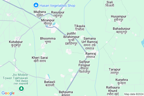
Hashampur
Hashampur Map
EDIT Map
Add Your House
 ..
..
Current Corona Virus Infected Patients Count in Muzaffarnagar District
| City Name | District Name | Total Covid cases |
|---|---|---|
| Muzaffarnagar District | Muzaffarnagar | 21 |
Locality Name :
Hashampur
( हाशमपुर )
Block Name : Jansath
District : Muzaffarnagar
State : Uttar Pradesh
Division : Saharanpur
Language : Hindi and Urdu, Punjabi
Current Time 07:55 AM
Date: Tuesday , Apr 29,2025 (IST)
Time zone: IST (UTC+5:30)
Elevation / Altitude: 242 meters. Above Seal level
Telephone Code / Std Code: 01396
Assembly constituency : Meerapur assembly constituency
Assembly MLA : Chandan Chauhan
Lok Sabha constituency : Bijnor parliamentary constituency
Parliament MP : MALOOK NAGAR
Serpanch Name :
Pin Code : 251320
Post Office Name : Ramraj
Alternate Village Name : Hasampur
Commodities Prices : Mawana Market / Mandi
Hashampur Live Weather
Temperature: 26.7 °C
broken clouds
Humidity: 43%
Wind : 7.06 mt/sec towards SE
StationName : "MÄ«rÄ\u0081npur"
observed on 3 Mins Back
Temperature: 26.7 °C
broken clouds
Humidity: 43%
Wind : 7.06 mt/sec towards SE
StationName : "MÄ«rÄ\u0081npur"
observed on 3 Mins Back
Hashampur Weather Forecast for Next 5 days
30-04-2025
27.3°C to 39.0°C
scattered clouds, few clouds, clear sky, broken clouds
27.3°C to 39.0°C
scattered clouds, few clouds, clear sky, broken clouds
01-05-2025
26.2°C to 41.1°C
overcast clouds, broken clouds, scattered clouds
26.2°C to 41.1°C
overcast clouds, broken clouds, scattered clouds
02-05-2025
27.4°C to 42.0°C
overcast clouds, broken clouds, scattered clouds
27.4°C to 42.0°C
overcast clouds, broken clouds, scattered clouds
03-05-2025
25.0°C to 41.0°C
overcast clouds, broken clouds, clear sky, light rain
25.0°C to 41.0°C
overcast clouds, broken clouds, clear sky, light rain
04-05-2025
25.6°C to 41.3°C
overcast clouds, scattered clouds, light rain
25.6°C to 41.3°C
overcast clouds, scattered clouds, light rain
Edit below overview about Hashampur
Edit below overview about Hashampur
OverView of Hashampur
Hashampur village is located between miranpur and ramraj and the population of village is 5000 peopleEdit below overview about Hashampur
National Highways Reachable To Hashampur
Nationa High Way :NH34
Nationa High Way :NH709A
Nationa High Way :NH34
Nationa High Way :NH709A
Rivers Near Hashampur
Hindon River
Kali
Hindon River
Kali
About Hashampur
Hashampur is a Village in Jansath Block in Muzaffarnagar District of Uttar Pradesh State, India. It belongs to Saharanpur Division . It is located 41 KM towards East from District head quarters Muzaffarnagar. 11 KM from Jansath. 463 KM from State capital Lucknow
Hashampur Pin code is 251320 and postal head office is Ramraj .
Samana Urf Ramraj ( 3 KM ) , Bhooma ( 4 KM ) , Kithora ( 4 KM ) , Kheri Sarai ( 4 KM ) , Sikhreda ( 6 KM ) are the nearby Villages to Hashampur. Hashampur is surrounded by Hastinapur Block towards South , Mawana Kalan Block towards South , Bijnor Block towards East , Khatauli Block towards west .
Hastinapur , Bijnaur , Muzaffarnagar , Sardhana are the near by Cities to Hashampur.
Hashampur 2011 Census Details
Hashampur Local Language is Hindi. Hashampur Village Total population is 6608 and number of houses are 1022. Female Population is 48.1%. Village literacy rate is 60.7% and the Female Literacy rate is 24.4%.
Population
| Census Parameter | Census Data |
| Total Population | 6608 |
| Total No of Houses | 1022 |
| Female Population % | 48.1 % ( 3180) |
| Total Literacy rate % | 60.7 % ( 4008) |
| Female Literacy rate | 24.4 % ( 1615) |
| Scheduled Tribes Population % | 0.0 % ( 0) |
| Scheduled Caste Population % | 19.8 % ( 1310) |
| Working Population % | 29.3 % |
| Child(0 -6) Population by 2011 | 1026 |
| Girl Child(0 -6) Population % by 2011 | 47.8 % ( 490) |
Hashampur Census More Deatils.
Politics in Hashampur
RLD , BSP are the major political parties in this area.Polling Stations /Booths near Hashampur
1)Prathmik Vidhalya Ghatayan Dakshini2)Prathmik Vidhalya Room No. 2 Gadla
3)Prathmik Kanya Pathshala Ghatayan Uttari
4)Prathmik Vidhalya Room No. 1 Nijampur
5)Prathmik Vidhalya Room No. 1 Gadla
HOW TO REACH Hashampur
By Rail
There is no railway station near to Hashampur in less than 10 km.Colleges near Hashampur
Acharya Gurukul Mahavidyalaya Arya Samaj
Address :
Acharya Gurukul Mahavidyalaya Arya Samaj Chitaura Jhal Jansath Muzaffarnagar
Address :
Bit.bhagwatpuram M.nagar
Address :
Modren Inter College
Address :
Rajkeya Kanya Inter Collage Mehalki
Address :
Schools near Hashampur
Jhs Syali
Address : siali , jansath , muzaffarnagar , Uttar Pradesh . PIN- 251320 , Post - Ramraj
Jhs Kasampur Bhoomma
Address : kasampur bhoomma , jansath , muzaffarnagar , Uttar Pradesh . PIN- 251315 , Post - Miranpur
Jhs Rahrwa Lalpur
Address : raharwa lal pur , jansath , muzaffarnagar , Uttar Pradesh . PIN- 251320 , Post - Ramraj
Jhs Rataur
Address : ratur , jansath , muzaffarnagar , Uttar Pradesh . PIN- 251314 , Post - Tehsil Jansath
Govt Health Centers near Hashampur
1) Hasimpur , Hasimpur sub center , ,2) Ramraj-II , Thanay Ka Back Graund RamrajII , Main roaid , Main roaid
3) New PHC Miranpur , meeraspur phc Kabtestsan , meeraspur phc Kabtestsan , Main Roaid Kithoada
Schools in Hashampur,Jansath
Electronic Shops in Hashampur,Jansath
Super Markets in Hashampur,Jansath
Local Parks in Hashampur,Jansath
Police Stations near Hashampur,Jansath
Governement Offices near Hashampur,Jansath
About Hashampur &
History
How to reach Hashampur
Tourist Places Near By Hashampur
Schools in Hashampur
Colleges in Hashampur
Temperature & weather of Hashampur
places in Hashampur
Hashampur photos
More Information
How to reach Hashampur
Tourist Places Near By Hashampur
Schools in Hashampur
Colleges in Hashampur
Temperature & weather of Hashampur
places in Hashampur
Hashampur photos
More Information
Village Talk
Post News or Events about this Village
Near Cities
Hastinapur 13 KM near
Bijnaur 21 KM near
Muzaffarnagar 39 KM near
Sardhana 42 KM near
Hastinapur 13 KM near
Bijnaur 21 KM near
Muzaffarnagar 39 KM near
Sardhana 42 KM near
Near By Taluks
Jansath 11 KM near
Hastinapur 13 KM near
Mawana Kalan 18 KM near
Bijnor 22 KM near
Jansath 11 KM near
Hastinapur 13 KM near
Mawana Kalan 18 KM near
Bijnor 22 KM near
Near By Air Ports
Muzaffarnagar Airport 40 KM near
Indira Gandhi International Airport 129 KM near
Dehra Dun Airport 131 KM near
Pantnagar Airport 164 KM near
Muzaffarnagar Airport 40 KM near
Indira Gandhi International Airport 129 KM near
Dehra Dun Airport 131 KM near
Pantnagar Airport 164 KM near
Near By Tourist Places
Hastinapur 12 KM near
Meerut 45 KM near
Roorkee 76 KM near
Haridwar 87 KM near
Moradabad 102 KM near
Hastinapur 12 KM near
Meerut 45 KM near
Roorkee 76 KM near
Haridwar 87 KM near
Moradabad 102 KM near
Near By Districts
Bijnor 21 KM near
Muzaffarnagar 39 KM near
Meerut 46 KM near
Jyotiba Phule Nagar 69 KM near
Bijnor 21 KM near
Muzaffarnagar 39 KM near
Meerut 46 KM near
Jyotiba Phule Nagar 69 KM near
Near By RailWay Station
Khatauli Rail Way Station 26 KM near
Muzaffarnagar Rail Way Station 39 KM near
Khatauli Rail Way Station 26 KM near
Muzaffarnagar Rail Way Station 39 KM near