| Home | City Bus | Maps | Villages | Cities | Rail | Tourist Places | School | College | Pin Codes | Corona Cases Count |
| Distance Calculator Bus Services IFSC Codes Trace Mobile Number Weather Search Place Trace IP Available Cash ATM/Banks Locate Polling Booth Report an Error contact People |
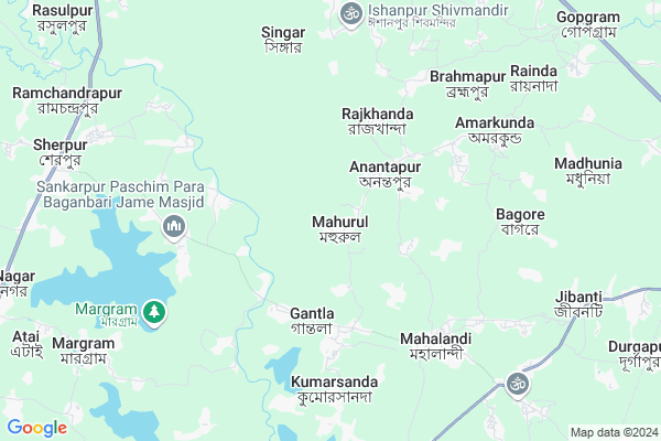
Mahurul
Mahurul Map
EDIT Map
Add Your House
 ..
..
Current Corona Virus Infected Patients Count in Murshidabad District
| City Name | District Name | Total Covid cases |
|---|
Locality Name :
Mahurul
( মহুরুল )
Block Name : Nabagram
District : Murshidabad
State : West Bengal
Division : Presidency
Language : Bengali and English
Current Time 06:20 AM
Date: Saturday , Apr 26,2025 (IST)
Time zone: IST (UTC+5:30)
Elevation / Altitude: 35 meters. Above Seal level
Telephone Code / Std Code: 03482
Assembly constituency : Nabagram assembly constituency
Assembly MLA : Kanai Chandra Mondal
Lok Sabha constituency : Jangipur parliamentary constituency
Parliament MP : KHALILUR RAHAMAN
Serpanch Name :
Pin Code : 742136
Post Office Name : Gokarna
Commodities Prices : Kandi Market / Mandi
Mahurul Live Weather
Temperature: 28.1 °C
clear sky
Humidity: 77%
Wind : 5.81 mt/sec towards S
StationName : "West Bengal"
observed on Now
Temperature: 28.1 °C
clear sky
Humidity: 77%
Wind : 5.81 mt/sec towards S
StationName : "West Bengal"
observed on Now
Mahurul Weather Forecast for Next 5 days
27-04-2025
27.8°C to 42.3°C
clear sky
27.8°C to 42.3°C
clear sky
28-04-2025
25.4°C to 39.9°C
clear sky, overcast clouds, light rain, broken clouds
25.4°C to 39.9°C
clear sky, overcast clouds, light rain, broken clouds
29-04-2025
24.0°C to 35.6°C
light rain, broken clouds, scattered clouds, overcast clouds
24.0°C to 35.6°C
light rain, broken clouds, scattered clouds, overcast clouds
30-04-2025
23.0°C to 30.0°C
light rain, broken clouds, overcast clouds
23.0°C to 30.0°C
light rain, broken clouds, overcast clouds
01-05-2025
23.1°C to 34.7°C
overcast clouds, light rain, moderate rain
23.1°C to 34.7°C
overcast clouds, light rain, moderate rain
Rivers Near Mahurul
Brahmani
Dwaraka
Brahmani
Dwaraka
About Mahurul
Correct below Info and add more info about MahurulMahurul is a Village in Nabagram Block in Murshidabad District of West Bengal State, India. It belongs to Presidency Division . It is located 20 KM towards west from District head quarters Baharampur. 11 KM from Nabagram. 202 KM from State capital Kolkata
Mahurul Pin code is 742136 and postal head office is Gokarna .
Kumarsanda ( 5 KM ) , Indrani ( 9 KM ) , Margram ( 10 KM ) , Nabagram ( 11 KM ) , Shibpur ( 12 KM ) are the nearby Villages to Mahurul. Mahurul is surrounded by Nabagram Block towards North , Khargram Block towards west , Kandi Block towards South , Berhampore Block towards East .
Baharampur , Murshidabad , Rampurhat , Sainthia are the near by Cities to Mahurul.
This Place is in the border of the Murshidabad District and Birbhum District. Birbhum District Nalhati-ii is west towards this place .
Mahurul 2011 Census Details
Mahurul Local Language is Bengali. Mahurul Village Total population is 3772 and number of houses are 891. Female Population is 49.7%. Village literacy rate is 57.6% and the Female Literacy rate is 26.3%.
Population
| Census Parameter | Census Data |
| Total Population | 3772 |
| Total No of Houses | 891 |
| Female Population % | 49.7 % ( 1876) |
| Total Literacy rate % | 57.6 % ( 2171) |
| Female Literacy rate | 26.3 % ( 992) |
| Scheduled Tribes Population % | 0.0 % ( 0) |
| Scheduled Caste Population % | 4.2 % ( 160) |
| Working Population % | 28.4 % |
| Child(0 -6) Population by 2011 | 572 |
| Girl Child(0 -6) Population % by 2011 | 49.1 % ( 281) |
Mahurul Census More Deatils.
Politics in Mahurul
CPM , All India Trinamool Congress , INC are the major political parties in this area.Polling Stations /Booths near Mahurul
1)Mohurul Bayenpara Ssk R-12)Mohurul Pry. School
3)Mobarakpur Pry. School Room No. 2
4)Dangapara Pry. School R-1
5)Anandamoyee Vidya Mandir Room-2
HOW TO REACH Mahurul
By Rail
There is no railway station near to Mahurul in less than 10 km.Colleges near Mahurul
Minerva Academy Educational & Welfer Socity
Address :
Nabagram Amar Chand Kundo College
Address :
Schools near Mahurul
Bagmara B.b.m. Vidyaniketan
Address : kiriteswari/iv , nabagram , murshidabad , West Bengal . PIN- 742149 , Post - Murshidabad
Pathardanga Osmaala H.madrasah
Address : hazbibidanga/ix , nabagram , murshidabad , West Bengal . PIN- 742184 , Post - Kuli
Dafarpur Rajat Kanchan High
Address : shibpore/ii , nabagram , murshidabad , West Bengal . PIN- 742187 , Post - Radharghat
Jibantitala High School
Address : narayanpur/xi , nabagram , murshidabad , West Bengal . PIN- 742186
Govt Health Centers near Mahurul
1) Anantapur S/C , , ,2) Sadal HQ SC , Sadal SC , Sadal , Near MSK School
3) Amarkunda , , ,
Colleges in Mahurul,Nabagram
Professional Institute Of Hotel Management
Indrani High School Road; Indrani; Sherpur; West Bengal; India
10.0 KM distance Detail
Syed Muztoba Ali College Of Education
Vill P.O Sherpur; P.S Khargram; Dist.; Gantla Ghat Road; Gantla; West Bengal 742159; India
10.1 KM distance Detail
Alinagar Teacher's Training Collage
Ramchandrapur; West Bengal 742159; India
10.3 KM distance Detail
more ..
Schools in Mahurul,Nabagram
MARN School
village - Mahurul ;p.o -mahurul -anantapur; p.s; Nabagram; West Bengal pin - 742136; India
0.5 KM distance Detail
Mohurul Primary School
Dangapara - Mahurul Rd; Mahurul; West Bengal 742136; India
0.8 KM distance Detail
About Mahurul &
History
How to reach Mahurul
Tourist Places Near By Mahurul
Schools in Mahurul
Colleges in Mahurul
Temperature & weather of Mahurul
places in Mahurul
Mahurul photos
More Information
How to reach Mahurul
Tourist Places Near By Mahurul
Schools in Mahurul
Colleges in Mahurul
Temperature & weather of Mahurul
places in Mahurul
Mahurul photos
More Information
Village Talk
Post News or Events about this Village
Near Cities
Baharampur 18 KM near
Murshidabad 23 KM near
Rampurhat 36 KM near
Sainthia 55 KM near
Baharampur 18 KM near
Murshidabad 23 KM near
Rampurhat 36 KM near
Sainthia 55 KM near
Near By Taluks
Murshidabad-Jiagunj 10 KM near
Nabagram 10 KM near
Khargram 12 KM near
Kandi 19 KM near
Murshidabad-Jiagunj 10 KM near
Nabagram 10 KM near
Khargram 12 KM near
Kandi 19 KM near
Near By Air Ports
Netaji Subhas Chandra Bose Airport 186 KM near
Bagdogra Airport 321 KM near
Rupsi Airport 327 KM near
Ranchi Airport 330 KM near
Netaji Subhas Chandra Bose Airport 186 KM near
Bagdogra Airport 321 KM near
Rupsi Airport 327 KM near
Ranchi Airport 330 KM near
Near By Tourist Places
Murshidabad 21 KM near
Suri 67 KM near
Pakur 70 KM near
Santiniketan 71 KM near
Mayapur 91 KM near
Murshidabad 21 KM near
Suri 67 KM near
Pakur 70 KM near
Santiniketan 71 KM near
Mayapur 91 KM near
Near By Districts
Murshidabad 20 KM near
Birbhum 68 KM near
Pakur 71 KM near
Dumka 97 KM near
Murshidabad 20 KM near
Birbhum 68 KM near
Pakur 71 KM near
Dumka 97 KM near
Near By RailWay Station
Khagraghat Road Rail Way Station 15 KM near
Azimganj Junction Rail Way Station 24 KM near
Khagraghat Road Rail Way Station 15 KM near
Azimganj Junction Rail Way Station 24 KM near