| Home | City Bus | Maps | Villages | Cities | Rail | Tourist Places | School | College | Pin Codes | Corona Cases Count |
| Distance Calculator Bus Services IFSC Codes Trace Mobile Number Weather Search Place Trace IP Available Cash ATM/Banks Locate Polling Booth Report an Error contact People |
Hajbibidanga
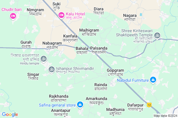
Hajbibidanga Map
EDIT Map
Add Your House
 ..
..
Current Corona Virus Infected Patients Count in Murshidabad District
| City Name | District Name | Total Covid cases |
|---|
Locality Name :
Hajbibidanga
( হাজ্বীবিডাঙ্গা )
Block Name : Nabagram
District : Murshidabad
State : West Bengal
Division : Presidency
Language : Bengali and English
Current Time 10:12 AM
Date: Wednesday , Mar 12,2025 (IST)
Time zone: IST (UTC+5:30)
Elevation / Altitude: 35 meters. Above Seal level
Telephone Code / Std Code: 03482
Assembly constituency : Nabagram assembly constituency
Assembly MLA : Kanai Chandra Mondal
Lok Sabha constituency : Jangipur parliamentary constituency
Parliament MP : KHALILUR RAHAMAN
Serpanch Name :
Pin Code : 742181
Post Office Name : Nabagram (Murshidabad)
Commodities Prices : Lalbagh Market / Mandi
Rivers Near Hajbibidanga
Brahmani
Dwaraka
Brahmani
Dwaraka
About Hajbibidanga
Correct below Info and add more info about HajbibidangaHajbibidanga is a Village in Nabagram Block in Murshidabad District of West Bengal State, India. It belongs to Presidency Division . It is located 18 KM towards west from District head quarters Baharampur. 211 KM from State capital Kolkata
Hajbibidanga Pin code is 742181 and postal head office is Nabagram (Murshidabad).
Hajbibidanga is surrounded by Murshidabad-Jiagunj Block towards South , Berhampore Block towards East , Sagardighi Block towards North , Khargram Block towards west .
Baharampur , Murshidabad , Rampurhat , Paschim Punropara are the near by Cities to Hajbibidanga.
This Place is in the border of the Murshidabad District and Birbhum District. Birbhum District Nalhati-ii is west towards this place .
Demographics of Hajbibidanga
Bengali is the Local Language here.Politics in Hajbibidanga
CPM , All India Trinamool Congress , INC are the major political parties in this area.Polling Stations /Booths near Hajbibidanga
1)Nealishpara Pry. School Room-32)Bhimpur Pry. School
3)Jagannathpur Pry. School Room-2
4)Palsa Pry. School Room No. 2
5)Polladanga Pry. School
HOW TO REACH Hajbibidanga
By Rail
Barala Rail Way Station is the very nearby railway stations to Hajbibidanga.Colleges near Hajbibidanga
Minerva Academy Educational & Welfer Socity
Address :
Nabagram Amar Chand Kundo College
Address :
Schools near Hajbibidanga
Bagmara B.b.m. Vidyaniketan
Address : kiriteswari/iv , nabagram , murshidabad , West Bengal . PIN- 742149 , Post - Murshidabad
Pathardanga Osmaala H.madrasah
Address : hazbibidanga/ix , nabagram , murshidabad , West Bengal . PIN- 742184 , Post - Kuli
Dafarpur Rajat Kanchan High
Address : shibpore/ii , nabagram , murshidabad , West Bengal . PIN- 742187 , Post - Radharghat
Jibantitala High School
Address : narayanpur/xi , nabagram , murshidabad , West Bengal . PIN- 742186
Govt Health Centers near Hajbibidanga
1) Gopegram SC , , , Rainda2) Chanak , , ,
3) Diara SC , Dag No-381 , Mohalla-Diara , Hazinasratmolla Diara High School
Hospitals in Hajbibidanga,Nabagram
Palsanda Primary Health Center
palsanda palsanda; Satyara Ghat Rd; Lalbagh; Burhanpur; Madhya Pradesh 450331; India
1.7 KM distance Detail
more ..
Petrol Bunks in Hajbibidanga,Nabagram
Chaudhuri Refilling Station
HP Petrol Pump; NH-34; Chainage 206KM P.O. P.S. Nabagram.Sibpur Toll plaza; Mukundapur; West Bengal 742187; India
7.5 KM distance Detail
Tirupati Service Station
Rupsing;near bagdogra; Check Post; West Bengal; India
12.9 KM distance Detail
more ..
Colleges in Hajbibidanga,Nabagram
Rosomoyee Vivekananda Topoban Pathagar B.Ed College
Palsanda; West Bengal 742238; India
1.5 KM distance Detail
gousaia ajejia alimea spretiail arabic univarsity
Saundighi; West Bengal 742122; India
9.3 KM distance Detail
Gousia Azizia Alimia Spiritual Arabic University & Seva Mission Trust
Saundighi; West Bengal 742235; India
9.4 KM distance Detail
more ..
Schools in Hajbibidanga,Nabagram
Netaji Subhas Academy
Lalbagh- Palsanda Road; Palsanda; West Bengal 742238; India
1.3 KM distance Detail
About Hajbibidanga &
History
How to reach Hajbibidanga
Tourist Places Near By Hajbibidanga
Schools in Hajbibidanga
Colleges in Hajbibidanga
Temperature & weather of Hajbibidanga
places in Hajbibidanga
Hajbibidanga photos
More Information
How to reach Hajbibidanga
Tourist Places Near By Hajbibidanga
Schools in Hajbibidanga
Colleges in Hajbibidanga
Temperature & weather of Hajbibidanga
places in Hajbibidanga
Hajbibidanga photos
More Information
Village Talk
Post News or Events about this Village
Near Cities
Baharampur 15 KM near
Murshidabad 16 KM near
Rampurhat 40 KM near
Paschim Punropara 56 KM near
Baharampur 15 KM near
Murshidabad 16 KM near
Rampurhat 40 KM near
Paschim Punropara 56 KM near
Near By Taluks
Nabagram 0 KM near
Murshidabad-Jiagunj 12 KM near
Berhampore 17 KM near
Sagardighi 20 KM near
Nabagram 0 KM near
Murshidabad-Jiagunj 12 KM near
Berhampore 17 KM near
Sagardighi 20 KM near
Near By Air Ports
Netaji Subhas Chandra Bose Airport 194 KM near
Bagdogra Airport 312 KM near
Rupsi Airport 316 KM near
Ranchi Airport 338 KM near
Netaji Subhas Chandra Bose Airport 194 KM near
Bagdogra Airport 312 KM near
Rupsi Airport 316 KM near
Ranchi Airport 338 KM near
Near By Tourist Places
Murshidabad 14 KM near
Pakur 65 KM near
Suri 76 KM near
Santiniketan 81 KM near
Mayapur 98 KM near
Murshidabad 14 KM near
Pakur 65 KM near
Suri 76 KM near
Santiniketan 81 KM near
Mayapur 98 KM near
Near By Districts
Murshidabad 17 KM near
Pakur 65 KM near
Birbhum 77 KM near
Dumka 102 KM near
Murshidabad 17 KM near
Pakur 65 KM near
Birbhum 77 KM near
Dumka 102 KM near
Near By RailWay Station
Khagraghat Road Rail Way Station 13 KM near
Azimganj Junction Rail Way Station 15 KM near
Khagraghat Road Rail Way Station 13 KM near
Azimganj Junction Rail Way Station 15 KM near