| Home | City Bus | Maps | Villages | Cities | Rail | Tourist Places | School | College | Pin Codes | Corona Cases Count |
| Distance Calculator Bus Services IFSC Codes Trace Mobile Number Weather Search Place Trace IP Available Cash ATM/Banks Locate Polling Booth Report an Error contact People |
 ..
..
Current Corona Virus Infected Patients Count in Murshidabad District
| City Name | District Name | Total Covid cases |
|---|
Block Name : Khargram
District : Murshidabad
State : West Bengal
Division : Presidency
Language : Bengali and English
Current Time 06:31 PM
Date: Wednesday , Feb 05,2025 (IST)
Time zone: IST (UTC+5:30)
Elevation / Altitude: 27 meters. Above Seal level
Telephone Code / Std Code: 03484
Assembly constituency : Khargram assembly constituency
Assembly MLA : Ashis Marjit
Lok Sabha constituency : Jangipur parliamentary constituency
Parliament MP : KHALILUR RAHAMAN
Serpanch Name :
Pin Code : 742159
Post Office Name :
Commodities Prices : Rampurhat Market / Mandi
OverView of Jhilli
Ch. Arjun singh gurjar :zamindar of village tudila and near by other 11 villages(gurikha, ekhara, tukeda, nounera, mahe, lahchura, katwah haji, malanpur, singhwari, madhou ka pura, jhawalpura) who was famous for his self-styled kingship. He rose his sword against scindia to safe guard famous dacoits donger and buturi sikarwar from scindia and opposed his offer of zagir of two more village in return of the dacoits. He attacked many zamindar's of bhind, gwalior and collected taxes from them. He gave thousands of land to jats, brahmans, harijans in his tenure.
Edit below overview about Jhilli
Nationa High Way :NH114
Brahmani
Dwaraka
About Jhilli
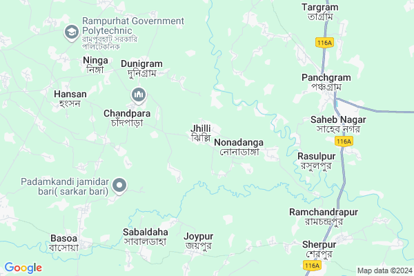
Jhilli is a Village in Khargram Block in Murshidabad District of West Bengal State, India. It belongs to Presidency Division . It is located 39 KM towards west from District head quarters Baharampur. 14 KM from Khargram. 215 KM from State capital Kolkata
Jhilli Pin code is 742159 and postal head office is .
Sabaldaha ( 6 KM ) , Rasulpur ( 7 KM ) , Panchgram ( 7 KM ) , Indrani ( 10 KM ) , Mahammadpur ( 13 KM ) are the nearby Villages to Jhilli. Jhilli is surrounded by Rampurhat-Ii Block towards west , Nalhati-I Block towards North , Nalhati-Ii Block towards west , Rampurhat-I Block towards west .
Rampurhat , Baharampur , Murshidabad , Sainthia are the near by Cities to Jhilli.
Jhilli 2011 Census Details
Jhilli Local Language is Bengali. Jhilli Village Total population is 5162 and number of houses are 1293. Female Population is 49.5%. Village literacy rate is 50.0% and the Female Literacy rate is 22.4%.
Population
| Census Parameter | Census Data |
| Total Population | 5162 |
| Total No of Houses | 1293 |
| Female Population % | 49.5 % ( 2555) |
| Total Literacy rate % | 50.0 % ( 2581) |
| Female Literacy rate | 22.4 % ( 1156) |
| Scheduled Tribes Population % | 2.2 % ( 112) |
| Scheduled Caste Population % | 40.3 % ( 2081) |
| Working Population % | 32.5 % |
| Child(0 -6) Population by 2011 | 595 |
| Girl Child(0 -6) Population % by 2011 | 49.4 % ( 294) |
Jhilli Census More Deatils.
Politics in Jhilli
CPM , All India Trinamool Congress , INC are the major political parties in this area.Polling Stations /Booths near Jhilli
1)Khaspur Etlapara Ssk2)Jhilli High School Room-2
3)Khaspur Primary School Room-1
4)Kharsa F. B. Primary School
5)Jhilli Dakshin Primary School Room-1
HOW TO REACH Jhilli
By Rail
There is no railway station near to Jhilli in less than 10 km.Colleges near Jhilli
Jatindra Rajendra MahavidyalayaSchools in Jhilli
Jhilli High SchoolGovt Health Centers near Jhilli
1) Dunigram PHC SC , Dunigram PHC , DUNIGRAM PHC , DUNIGRAM PHC2) Koyemba SC , Koyemba SC , MALPARA , KOYEMBA P.SCHOOL & CANALPAR
3) Basantapur SC , Basanatapur , Pathdanga Masque Para , Sastitala
Hospitals in Jhilli,Khargram
Acharya Chikitshaloy
P.O-Nonadanga; Murshidabad; Jhilli; West Bengal 731241; India
0.7 KM distance Detail
Dr Kalyanmay Acharya
Vill-Jhilli;P.O-Nonadanga;Dist-Murshidabad;Pin-731241;P.S-Khargram; Jhilli; West Bengal 731241; India
0.7 KM distance Detail
Jhilli Hospital
Vill-Nonadanaga;P.O-Nonadanga Murshidabad; 731241; West Bengal 731241; India
1.9 KM distance Detail
more ..
Colleges in Jhilli,Khargram
Professional Institute Of Hotel Management
Indrani High School Road; Indrani; Sherpur; West Bengal; India
9.5 KM distance Detail
more ..
Schools in Jhilli,Khargram
BMS Computer Centre Jhilli
Jhilli High School Road; Jhilli; West Bengal 742159; India
0.5 KM distance Detail
Jhilli High School
Vill-Jhilli;P.O-Nonadanga;Murshidabad;731241; Jhilli; West Bengal 731241; India
0.6 KM distance Detail
Electronic Shops in Jhilli,Khargram
Rejia Mobile Servicing Centreরিজিয়া মোবাইল সারভিসিং সেনটার
Nonadanga; West Bengal 742159; India
2.0 KM distance Detail
Police Stations near Jhilli,Khargram
Khargram Police Station
Baadshahi Road; Near Post Office; Khargram; West Bengal 742147; India
20.0 KM distance Detail
Sagardighi Police Station
Opp: Sagardighi Post Office; Sagardighi; District: Murshidabad; West Bengal 742226; India
22.1 KM distance Detail
Governement Offices near Jhilli,Khargram
Gopalpur Health Center
Vill-Gopalpur; P.O-Nonadanga;Birbhum-731241; Purbba Gopalpur; West Bengal 731241; India
2.5 KM distance Detail
How to reach Jhilli
Tourist Places Near By Jhilli
Schools in Jhilli
Colleges in Jhilli
Temperature & weather of Jhilli
places in Jhilli
Jhilli photos
More Information
Village Talk
Post News or Events about this Village
Rampurhat 19 KM near
Baharampur 35 KM near
Murshidabad 37 KM near
Sainthia 49 KM near
Khargram 13 KM near
Rampurhat-Ii 15 KM near
Nalhati-I 17 KM near
Nalhati-Ii 18 KM near
Netaji Subhas Chandra Bose Airport 199 KM near
Bagdogra Airport 314 KM near
Ranchi Airport 318 KM near
Rupsi Airport 330 KM near
Murshidabad 36 KM near
Pakur 57 KM near
Suri 57 KM near
Santiniketan 69 KM near
Dumka 80 KM near
Murshidabad 37 KM near
Pakur 58 KM near
Birbhum 58 KM near
Dumka 80 KM near
Rampurhat Junction Rail Way Station 18 KM near
Nalhati Junction Rail Way Station 19 KM near