| Home | City Bus | Maps | Villages | Cities | Rail | Tourist Places | School | College | Pin Codes | Corona Cases Count |
| Distance Calculator Bus Services IFSC Codes Trace Mobile Number Weather Search Place Trace IP Available Cash ATM/Banks Locate Polling Booth Report an Error contact People |
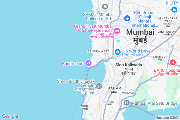
Bandstand
Bandstand Map
EDIT Map
Add Your House
 ..
..
Current Corona Virus Infected Patients Count in Mumbai District
| City Name | District Name | Total Covid cases |
|---|---|---|
| Mumbai District | Mumbai | 2989 |
| MCGM | Mumbai | 107 |
| Mumbai | Mumbai | 44 |
| Mumbai Suburb | Mumbai | 4 |
| Mumbai City | Mumbai | 3 |
| Navi Mumbai | Mumbai | 1 |
| Dadra and Nagar Haveli | Mumbai | 1 |
Village Name :
Bandstand
( बॅण्डस्टॅण्ड )
City Name : Mumbai
District : Mumbai
State : Maharashtra
Region : Konkan
Division : Konkan
Language : Marathi and Marwari, Bihari, English, Hindi, Persian And Urdu
Current Time 08:07 PM
Date: Friday , Apr 25,2025 (IST)
Time zone: IST (UTC+5:30)
Elevation / Altitude: 3 meters. Above Seal level
Telephone Code / Std Code: 022
Ward : MMR Boundary Ward
Assembly constituency : Vandre West assembly constituency
Assembly MLA : Adv. Ashish Babaji Shelar
Lok Sabha constituency : Mumbai-North-Central parliamentary constituency
Parliament MP : POONAM MAHAJAN
Pin Code : 400050
Post Office Name : Bandra West
Commodities Prices : Mumbai Market / Mandi
Bandstand Live Weather
Temperature: 28.7 °C
clear sky
Humidity: 73%
Wind : 3.95 mt/sec towards NW
StationName : "Breach Candy"
observed on 58 Mins Back
Temperature: 28.7 °C
clear sky
Humidity: 73%
Wind : 3.95 mt/sec towards NW
StationName : "Breach Candy"
observed on 58 Mins Back
Bandstand Weather Forecast for Next 5 days
26-04-2025
28.0°C to 28.5°C
few clouds, scattered clouds
28.0°C to 28.5°C
few clouds, scattered clouds
27-04-2025
27.7°C to 29.1°C
scattered clouds, clear sky, broken clouds, few clouds
27.7°C to 29.1°C
scattered clouds, clear sky, broken clouds, few clouds
28-04-2025
27.6°C to 29.1°C
clear sky, scattered clouds, few clouds
27.6°C to 29.1°C
clear sky, scattered clouds, few clouds
29-04-2025
27.1°C to 29.1°C
clear sky, few clouds
27.1°C to 29.1°C
clear sky, few clouds
30-04-2025
27.5°C to 28.8°C
clear sky
27.5°C to 28.8°C
clear sky
National Highways Reachable To Bandstand
Nationa High Way :NH48
Nationa High Way :NH548
Nationa High Way :NH48
Nationa High Way :NH548
About Bandstand
Correct below Info and add more info about BandstandBandstand is a Locality in Mumbai City in Maharashtra State, India. It belongs to Konkan region . It is belongs to Konkan Division .
Bandstand Pin code is 400050 and postal head office is Bandra West .
Bandra Reclamation , Nityanand Nagar , Chimbai Village , Indiraji Nagar , Santosh Nagar are the nearby Localities to Bandstand.
Mumbai , Navi Mumbai , Uran , Mira-Bhayandar are the nearby Cities to Mumbai.
It is near to arabian sea. There is a chance of humidity in the weather.
Demographics of Bandstand
Marathi is the Local Language here.Politics in Bandstand
BJP , INC are the major political parties in this area.Polling Stations /Booths near Bandstand
1)Marshalling Yard2)Mount Merry High School
3)Mount Merry High School
4)Mount Merry High School
5)Stree Mandal Santacruz Hiravati Hall Gr. Flr. South Side
HOW TO REACH Bandstand
By Rail
Bandra Rail Way Station , Bandra Terminus Rail Way Station are the very nearby railway station to Bandstand.Local Bus
Municipal Garden / Band Stand Bus Station , Father Agnel Ashram Bus Station , Sisters Bungalow Bus Station , Bandra Worli Sea Link Toll Plaza Bus Station , Mount Mary Steps (Municipal Garden) Bus Station are the nearby by Local Bus Stops to Bandstand . runs Number of busses from Bandstand to different Places.Bus Stops near Bandstand
Municipal Garden / Band Stand Father Agnel Ashram Sisters Bungalow Bandra Worli Sea Link Toll Plaza Mount Mary Steps (Municipal Garden)Loacl Bus Routes Travel from Bandstand
A-74EXP ACEXP ( Colaba Depot - Goregaon / Oshiwara Depot )A-76EXP ACEXP ( Colaba Depot - Gorai Depot )
211 ( Father Agnel Ashram - Father Agnel Ashram )
214 ( Mount Mary Steps (Municipal Garden) - Mount Mary Steps (Municipal Garden) )
A-70EXP ACEXP ( Nehru Planetarium - Mira Road Station ( E) )
More..
Govt Health Centers near Bandstand
1) Sherly Rajan , Flemingo Bldg. , Carmel Church , Near MET College, Vadora Rd.2) Bandra Bhabha , K.B.Bhabha Municipal General Hospital, , Bandra (W) , Bandra (W)
3) Guru Nanak , Gurunanak Mun. Disp , Ambedkar Rd ,
Hospitals in Bandstand,Mumbai
Shabnam Hospital
597; Salt Pan Rd; Azad Mohalla; Sangam Nagar; Wadala; Mumbai; Maharashtra 400037; India
7.3 KM distance Detail
WE FOR EVERY TEARS FOUNDATION
Room no. 109; B.A.D. Marg;; Anandwadi; Wadala(E);; Mumbai; Maharashtra 400037; India
7.3 KM distance Detail
Dr.Dharmaraj Ingle
Salt Pan Road; Sangam Nagar; Wadala; Mumbai; Maharashtra 400037; India
7.3 KM distance Detail
Varsha Medical & General Store
Salt Pan Rd; Wadala East; Sangam Nagar; Mumbai; Maharashtra 400037; India
7.4 KM distance Detail
more ..
Petrol Bunks in Bandstand,Mumbai
UNIVERSAL MOTORS ADHOC
Behind 'C' INSTLN. SEWREE; Mumbai; Maharashtra 400015; India
7.6 KM distance Detail
Indian Oil Petrol Pump
A/5; G.T.B.; HOSPITAL; DOCTOR'S QUARTERS; SEWRI; Mumbai; Maharashtra 400015; India
7.9 KM distance Detail
Bharat Petroleum
Sewri Fort; 31; Sewri Ford Road; MPT; Sewri; Mumbai; Maharashtra 400015; India
8.2 KM distance Detail
BAJRANG AUTO SERVICE ADHOC
Behind 'C' INSTLN. SEWREE; Mumbai; Maharashtra 400001; India
8.9 KM distance Detail
more ..
Colleges in Bandstand,Mumbai
Vidyalankar Campus
A/WING; Vidyalankar College Rd; Kalaram Nagar; Dosti Acres; Antop Hill; Mumbai; Maharashtra 400037; India
7.3 KM distance Detail
M-block VIT
Vidyalankar College Rd; Sangam Nagar; Mumbai; Maharashtra 400037; India
7.4 KM distance Detail
Adarsha Junior College
Bhavtiya Kamala Nagar; Mumbai; Maharashtra 400037; India
7.4 KM distance Detail
Vivekanand Education Society Institute of Management Studies And Research
Hashu Advani Memorial Complex; 495/497; कलेक्टर कॉलोनी; Chembur East; Mumbai; Maharashtra 400074; India
8.6 KM distance Detail
more ..
Schools in Bandstand,Mumbai
BRIGHT Tutorials
9; RJ Gaikwad Rd; Anand Nagar; R J Gaikwad Wadala East; Wadala; Mumbai; Maharashtra 400037; India
7.3 KM distance Detail
Symphony School Of Music
C/Wing; Wadala Road; Bhakti Park; Chembur East; Mumbai; Maharashtra 400074; India
8.0 KM distance Detail
Tree House Play Group
001; Shubh Apt.; Plt No 2; Aziz Baug; Mahul Road; Opp Ryan Intl School; Chembur;; Mumbai; Maharashtra 400074; India
8.7 KM distance Detail
Swami Vivekananda High School
कलेक्टर कॉलोनी; Kurla East; Mumbai; Maharashtra 400074; India
8.9 KM distance Detail
Devkibai Bhojraj Chanrai School
कलेक्टर कॉलोनी; Chembur East; Mumbai; Maharashtra 400074; India
8.9 KM distance Detail
Electronic Shops in Bandstand,Mumbai
SNC Pvt Ltd
Vasinaka; Mahul Road;; Chembur;; Mumbai; Maharashtra 400074; India
7.5 KM distance Detail
Guru Kripa Photo Studio
Shop No 8B; Opp Jhama Sweets; Dr CG Road; Chembur Colony; Mumbai; Maharashtra 400074; India
8.8 KM distance Detail
SHREE FILMS DIGITAL PHOTO STUDIO
Dr. c.g.Road; Chembur camp; nr. golf club; chembur; Mumbai; Maharashtra 400074; India
8.8 KM distance Detail
Super Markets in Bandstand,Mumbai
YADAV Kirana Shop
Wadala East; Deen Bandhu Nagar; Mumbai; Maharashtra 400037; India
7.3 KM distance Detail
Juki Machine Shop
7; Salt Pan Rd; Vijay Nagar; Antop Hill; Mumbai; Maharashtra 400037; India
7.4 KM distance Detail
Foodkart
Shop no 9; saffire building; bhakti park complex;; Wadala East; Mumbai; Maharashtra 400037; India
7.8 KM distance Detail
Local Parks in Bandstand,Mumbai
Apple Garden
Ambapada; Bhakti Park; Chembur East; Mumbai; Maharashtra 400074; India
8.0 KM distance Detail
Police Stations near Bandstand,Mumbai
Police Station R. C. F
Survey No 12 B; 13 B; CTS No 213; 215; 216; Rc Marg; Chembur; Mumbai; Maharashtra 400074; India
8.8 KM distance Detail
Crime Branch
Dr Choitram Gidwani Road; Indira Nagar; Chembur; Mumbai; Maharashtra 400074; India
9.1 KM distance Detail
Chembur Police Station
Opposite Basant Park Society; Ramakrishna Chemburkar Marg; Chembur; Mumbai; Maharashtra 400071; India
9.1 KM distance Detail
Governement Offices near Bandstand,Mumbai
Thomas Transport Pvt. Ltd.
Door No. 2/ 11; Koli Samaj Building; Sewree East; Mumbai - 400015; India
7.9 KM distance Detail
Taxpert Professionals Pvt Ltd
Julian Alps; Bhakti Park; Chembur East; Mumbai; Maharashtra 400703; India
7.9 KM distance Detail
Jaikali Engineering Company Private Limited
Plot No 469 near B.P.C.L main gate ambapada; mahul Village Chembur; Mumbai; Maharashtra 400074; India
8.6 KM distance Detail
About Bandstand &
History
How to reach Bandstand
Tourist Places Near By Bandstand
Schools in Bandstand
Colleges in Bandstand
Temperature & weather of Bandstand
places in Bandstand
Bandstand photos
More Information
How to reach Bandstand
Tourist Places Near By Bandstand
Schools in Bandstand
Colleges in Bandstand
Temperature & weather of Bandstand
places in Bandstand
Bandstand photos
More Information
Locality Talk
Post News or Events about this Locality
Near Cities
Mumbai 9 KM near
Navi Mumbai 22 KM near
Uran 27 KM near
Mira-Bhayandar 30 KM near
Mumbai 9 KM near
Navi Mumbai 22 KM near
Uran 27 KM near
Mira-Bhayandar 30 KM near
Near By Taluks
Mumbai 6 KM near
Navi Mumbai 25 KM near
Thane 26 KM near
Uran 28 KM near
Mumbai 6 KM near
Navi Mumbai 25 KM near
Thane 26 KM near
Uran 28 KM near
Near By Air Ports
Chhatrapati Shivaji International Airport 8 KM near
Lohegaon Airport 142 KM near
Gandhinagar Airport 163 KM near
Diu Airport 304 KM near
Chhatrapati Shivaji International Airport 8 KM near
Lohegaon Airport 142 KM near
Gandhinagar Airport 163 KM near
Diu Airport 304 KM near
Near By Tourist Places
Mumbai 5 KM near
Madh Island 11 KM near
Madh-Marve 15 KM near
Manori 20 KM near
Thane 22 KM near
Mumbai 5 KM near
Madh Island 11 KM near
Madh-Marve 15 KM near
Manori 20 KM near
Thane 22 KM near
Near By Districts
Mumbai 9 KM near
Thane 27 KM near
Raigad 49 KM near
Pune 139 KM near
Mumbai 9 KM near
Thane 27 KM near
Raigad 49 KM near
Pune 139 KM near
Near By RailWay Station
Bandra Rail Way Station 2.6 KM near
Bandra Terminus Rail Way Station 2.6 KM near
Mahim Junction Rail Way Station 3.5 KM near
Dadar Western Rail Way Station 4 KM near
Bandra Rail Way Station 2.6 KM near
Bandra Terminus Rail Way Station 2.6 KM near
Mahim Junction Rail Way Station 3.5 KM near
Dadar Western Rail Way Station 4 KM near