| Home | City Bus | Maps | Villages | Cities | Rail | Tourist Places | School | College | Pin Codes | Corona Cases Count |
| Distance Calculator Bus Services IFSC Codes Trace Mobile Number Weather Search Place Trace IP Available Cash ATM/Banks Locate Polling Booth Report an Error contact People |
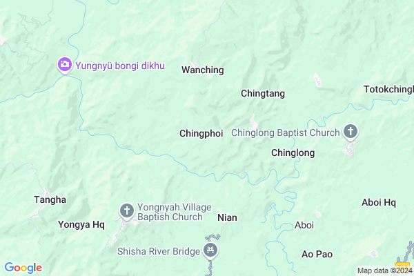
Chingphoi Map
EDIT Map
Add Your House
 ..
..
Current Corona Virus Infected Patients Count in Mon District
| City Name | District Name | Total Covid cases |
|---|
Locality Name :
Chingphoi
( चिंगफोई )
Tehsil Name : Wakching
District : Mon
State : Nagaland
Language : English and Khasi, Garo
Current Time 01:22 PM
Date: Wednesday , Feb 05,2025 (IST)
Time zone: IST (UTC+5:30)
Assembly constituency : assembly constituency
Assembly MLA :
Lok Sabha constituency : parliamentary constituency
Parliament MP :
Serpanch Name :
Pin Code : 798622
Post Office Name : Naginimora
Commodities Prices : Longleng Market / Mandi
National Highways Reachable To Chingphoi
Nationa High Way :NH715K
Nationa High Way :NH702D
Nationa High Way :NH715K
Nationa High Way :NH702D
Rivers Near Chingphoi
Dikhu
Chengo
Dikhu
Chengo
About Chingphoi
Correct below Info and add more info about ChingphoiChingphoi is a Village in Wakching Tehsil in Mon District of Nagaland State, India. It is located 22 KM towards west from District head quarters Mon. 8 KM from Wakching Chingla. 372 KM from State capital Shillong
Chingphoi Pin code is 798622 and postal head office is Naginimora .
Chinglong ( 5 KM ) , Shiyong ( 9 KM ) , Wakching Chingla ( 9 KM ) , Ngangching ( 13 KM ) , Sowa ( 13 KM ) are the nearby Villages to Chingphoi. Chingphoi is surrounded by Tamlu Tehsil towards west , Longleng Tehsil towards South , Chen Tehsil towards East , Mon Tehsil towards East .
Tuensang , Sibsagar , Mokokchung , Mariani are the near by Cities to Chingphoi.
This Place is in the border of the Mon District and Longleng District. Longleng District Tamlu is west towards this place .
Chingphoi 2011 Census Details
Chingphoi Local Language is English. Chingphoi Village Total population is 611 and number of houses are 168. Female Population is 48.1%. Village literacy rate is 42.1% and the Female Literacy rate is 17.0%.
Population
| Census Parameter | Census Data |
| Total Population | 611 |
| Total No of Houses | 168 |
| Female Population % | 48.1 % ( 294) |
| Total Literacy rate % | 42.1 % ( 257) |
| Female Literacy rate | 17.0 % ( 104) |
| Scheduled Tribes Population % | 99.0 % ( 605) |
| Scheduled Caste Population % | 0.0 % ( 0) |
| Working Population % | 53.5 % |
| Child(0 -6) Population by 2011 | 126 |
| Girl Child(0 -6) Population % by 2011 | 40.5 % ( 51) |
Chingphoi Census More Deatils.
HOW TO REACH Chingphoi
By Rail
There is no railway station near to Chingphoi in less than 10 km.Schools near Chingphoi
Schools in Chingphoi,Wakching
Tamlu Government High school ;Longleng Nagaland
Longleng; Nagaland 798613; India
14.7 KM distance Detail
Electronic Shops in Chingphoi,Wakching
Super Markets in Chingphoi,Wakching
Local Parks in Chingphoi,Wakching
Governement Offices near Chingphoi,Wakching
About Chingphoi &
History
How to reach Chingphoi
Tourist Places Near By Chingphoi
Schools in Chingphoi
Colleges in Chingphoi
Temperature & weather of Chingphoi
places in Chingphoi
Chingphoi photos
More Information
How to reach Chingphoi
Tourist Places Near By Chingphoi
Schools in Chingphoi
Colleges in Chingphoi
Temperature & weather of Chingphoi
places in Chingphoi
Chingphoi photos
More Information
Village Talk
Post News or Events about this Village
Near Cities
Tuensang 49 KM near
Sibsagar 49 KM near
Mokokchung 51 KM near
Mariani 58 KM near
Tuensang 49 KM near
Sibsagar 49 KM near
Mokokchung 51 KM near
Mariani 58 KM near
Near By Taluks
Wakching 8 KM near
Tamlu 10 KM near
Longleng 18 KM near
Chen 19 KM near
Wakching 8 KM near
Tamlu 10 KM near
Longleng 18 KM near
Chen 19 KM near
Near By Air Ports
Rowriah Airport 75 KM near
Chabua Airport 107 KM near
Lilabari Airport 117 KM near
Dimapur Airport 152 KM near
Rowriah Airport 75 KM near
Chabua Airport 107 KM near
Lilabari Airport 117 KM near
Dimapur Airport 152 KM near
Near By Tourist Places
Mon 31 KM near
Tuensang 49 KM near
Sibsagar 50 KM near
Mokokchung 54 KM near
Jorhat 72 KM near
Mon 31 KM near
Tuensang 49 KM near
Sibsagar 50 KM near
Mokokchung 54 KM near
Jorhat 72 KM near
Near By Districts
Longleng 17 KM near
Mon 21 KM near
Tuensang 49 KM near
Sivasagar 49 KM near
Longleng 17 KM near
Mon 21 KM near
Tuensang 49 KM near
Sivasagar 49 KM near
Near By RailWay Station
Simaluguri Junction Rail Way Station 37 KM near
Amguri Junction Rail Way Station 42 KM near
Simaluguri Junction Rail Way Station 37 KM near
Amguri Junction Rail Way Station 42 KM near