| Home | City Bus | Maps | Villages | Cities | Rail | Tourist Places | School | College | Pin Codes | Corona Cases Count |
| Distance Calculator Bus Services IFSC Codes Trace Mobile Number Weather Search Place Trace IP Available Cash ATM/Banks Locate Polling Booth Report an Error contact People |
Gobraha
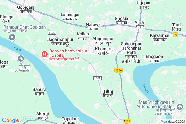
Gobraha Map
EDIT Map
Add Your House
 ..
..
Current Corona Virus Infected Patients Count in Mirzapur District
| City Name | District Name | Total Covid cases |
|---|---|---|
| Mirzapur District | Mirzapur | 5 |
Locality Name :
Gobraha
( गोबरहा )
Block Name : Kon
District : Mirzapur
State : Uttar Pradesh
Division : Mirzapur
Language : Hindi and Urdu, Agariya, Awadhi
Current Time 11:16 AM
Date: Monday , Apr 28,2025 (IST)
Time zone: IST (UTC+5:30)
Assembly constituency : Mirzapur assembly constituency
Assembly MLA : Ratnakar Mishra
Lok Sabha constituency : Mirzapur parliamentary constituency
Parliament MP : Anupriya Singh Patel
Serpanch Name :
Commodities Prices : Mirzapur Market / Mandi
Gobraha Live Weather
Temperature: 33.5 °C
clear sky
Humidity: 25%
Wind : 2.96 mt/sec towards SE
StationName : "MirzÄ\u0081pur"
observed on 1 Hours Back
Temperature: 33.5 °C
clear sky
Humidity: 25%
Wind : 2.96 mt/sec towards SE
StationName : "MirzÄ\u0081pur"
observed on 1 Hours Back
Gobraha Weather Forecast for Next 5 days
29-04-2025
26.5°C to 40.3°C
few clouds, scattered clouds, broken clouds
26.5°C to 40.3°C
few clouds, scattered clouds, broken clouds
30-04-2025
25.7°C to 40.3°C
broken clouds, overcast clouds, clear sky
25.7°C to 40.3°C
broken clouds, overcast clouds, clear sky
01-05-2025
25.7°C to 40.7°C
clear sky
25.7°C to 40.7°C
clear sky
02-05-2025
24.7°C to 40.7°C
clear sky, scattered clouds, moderate rain, light rain, overcast clouds
24.7°C to 40.7°C
clear sky, scattered clouds, moderate rain, light rain, overcast clouds
03-05-2025
26.8°C to 39.4°C
overcast clouds, broken clouds, scattered clouds, clear sky, light rain, few clouds
26.8°C to 39.4°C
overcast clouds, broken clouds, scattered clouds, clear sky, light rain, few clouds
National Highways Reachable To Gobraha
Nationa High Way :NH35
Nationa High Way :NH19
Nationa High Way :NH35
Nationa High Way :NH19
Rivers Near Gobraha
Assi River
Assi River
Assi River
Assi River
About Gobraha
Correct below Info and add more info about GobrahaGobraha is a Village in Kon Block in Mirzapur District of Uttar Pradesh State, India. It belongs to Mirzapur Division . It is located 13 KM towards North from District head quarters Mirzapur. 6 KM from Kon. 279 KM from State capital Lucknow
Dhaurahara ( 1 KM ) , Anurudhpur Purab Patti ( 1 KM ) , Chindlikh ( 2 KM ) , Mishradhap ( 2 KM ) , Jagapatti ( 3 KM ) are the nearby Villages to Gobraha. Gobraha is surrounded by Aurai Block towards North , Mirzapur Block towards South , Nagar (City) Block towards South , Chhanvey Block towards west .
Mirzapur , Varanasi , Phulpur , Jaunpur are the near by Cities to Gobraha.
Gobraha 2011 Census Details
Gobraha Local Language is Hindi. Gobraha Village Total population is 1038 and number of houses are 118. Female Population is 45.7%. Village literacy rate is 52.0% and the Female Literacy rate is 16.5%.
Population
| Census Parameter | Census Data |
| Total Population | 1038 |
| Total No of Houses | 118 |
| Female Population % | 45.7 % ( 474) |
| Total Literacy rate % | 52.0 % ( 540) |
| Female Literacy rate | 16.5 % ( 171) |
| Scheduled Tribes Population % | 0.0 % ( 0) |
| Scheduled Caste Population % | 12.0 % ( 125) |
| Working Population % | 26.8 % |
| Child(0 -6) Population by 2011 | 195 |
| Girl Child(0 -6) Population % by 2011 | 45.1 % ( 88) |
Gobraha Census More Deatils.
Politics in Gobraha
BJP , SP , BSP are the major political parties in this area.Polling Stations /Booths near Gobraha
1)P.m.s. Vijaypur2)P.s.chilh
3)Hindu B.u.m.v. Wasliganj
4)P.s.khamhariya Kalan
5)P.s.khulua
HOW TO REACH Gobraha
By Rail
Ahimanpur Rail Way Station , Madhosingh Rail Way Station are the very nearby railway stations to Gobraha.Pincodes near Gobraha
221306 ( Khamaria (Varanasi) ) , 231312 ( Chilh ) , 221301 ( Aurai (Sant Ravidas Nagar) )Colleges near Gobraha
Swami Govindashram Inter College Pairapur Mirzapur
Address :
Jokhulal Piyaridevi Mahavidyalay Newadhiya Bhateware Mirzapur
Address :
Smt. Deokali Inter College Jamalpur Mirzapur
Address :
Addarsh Ball Vidyaly Narayanpur Mirjapur
Address :
Babu Gulab Singh Gaharavar Mahvidyalay,banhaita, Gaura, Mirzapur
Address :
Schools near Gobraha
U.p.s. Saripatti
Address : saree patti , kone , mirzapur , Uttar Pradesh . PIN- 231312 , Post - Chilh
U.p.s. Bhogawan
Address : bhogaon , kone , mirzapur , Uttar Pradesh . PIN- 231312 , Post - Chilh
U.p.s. B.d. Singh Gobaraha
Address : gobarahan , kone , mirzapur , Uttar Pradesh . PIN- 231312 , Post - Chilh
U.p.s. Semara
Address : semara , kone , mirzapur , Uttar Pradesh . PIN- 231312 , Post - Chilh
Govt Health Centers near Gobraha
1) Garthama , , ,2) Mhagaon , , ,
3) Marui , , ,
Petrol Bunks in Gobraha,Kon
ANUSHREE FILLING STATION
RO IN SONEBARSA DST MIRZAPUR; MIRZAPUR; Uttar Pradesh 231312; India
7.9 KM distance Detail
Bharat Petroleum
Purjagir Mawaiya; Mirzapur; SH-5; Bhadohi Mirzapur Road; Purjageer; Purjageer; Uttar Pradesh 231001; India
7.9 KM distance Detail
Indian Oil Petrol Pump
Jagdishpur; Mirzapur; SH-5; Bhadohi Mirzapur Road; Vindhyanchal; Vindhyanchal; Uttar Pradesh 231001; India
9.0 KM distance Detail
more ..
Colleges in Gobraha,Kon
Prabhawati Devi Memorial College Of Education And Training
Majhali Patti Chak; Uttar Pradesh 231312; India
2.1 KM distance Detail
Gajraj Singh Private ITI Mirzapur
Patehara; pakhawaiya; Mirzapur; Uttar Pradesh 231312; India
2.4 KM distance Detail
more ..
Super Markets in Gobraha,Kon
Vindhya Inter Prises
Shanti Devi Path; Vindhyachal; Rasulpur Urf Shivpur; Uttar Pradesh 231307; India
8.6 KM distance Detail
ARNAV PHOTO STATE
K.B.P.G.COLLEGE; Musaffarganj Rd; Gosain Tola; Mirzapur; Uttar Pradesh 231001; India
12.0 KM distance Detail
Big shop
Lal Diggi Rd; Lal Diggi; Gosain Tola; Mirzapur-cum-Vindhyachal; Uttar Pradesh 231001; India
12.6 KM distance Detail
Police Stations near Gobraha,Kon
Police Station Vindhyachal
25°09'46. 82°30'33.; 2; Main Rd 3; Kamla Nagar; Kotra Sultanabad; Bhopal; Madhya Pradesh 462003; India
8.7 KM distance Detail
Governement Offices near Gobraha,Kon
SHIV VALLEY
Doodh Nath Chungi; Kantit; Vindhyachal; Mirzapur; Uttar Pradesh 231307; India
10.4 KM distance Detail
About Gobraha &
History
How to reach Gobraha
Tourist Places Near By Gobraha
Schools in Gobraha
Colleges in Gobraha
Temperature & weather of Gobraha
places in Gobraha
Gobraha photos
More Information
How to reach Gobraha
Tourist Places Near By Gobraha
Schools in Gobraha
Colleges in Gobraha
Temperature & weather of Gobraha
places in Gobraha
Gobraha photos
More Information
Village Talk
Post News or Events about this Village
Near Cities
Mirzapur 13 KM near
Varanasi 54 KM near
Phulpur 60 KM near
Jaunpur 69 KM near
Mirzapur 13 KM near
Varanasi 54 KM near
Phulpur 60 KM near
Jaunpur 69 KM near
Near By Taluks
Aurai 6 KM near
Kon 7 KM near
Mirzapur 12 KM near
Nagar (City) 15 KM near
Aurai 6 KM near
Kon 7 KM near
Mirzapur 12 KM near
Nagar (City) 15 KM near
Near By Air Ports
Varanasi Airport 47 KM near
Bamrauli Airport 90 KM near
Gorakhpur Airport 215 KM near
Amausi Airport 263 KM near
Varanasi Airport 47 KM near
Bamrauli Airport 90 KM near
Gorakhpur Airport 215 KM near
Amausi Airport 263 KM near
Near By Tourist Places
Vindhyachal 8 KM near
Varanasi 53 KM near
Sarnath 60 KM near
Jaunpur 65 KM near
Allahabad 81 KM near
Vindhyachal 8 KM near
Varanasi 53 KM near
Sarnath 60 KM near
Jaunpur 65 KM near
Allahabad 81 KM near
Near By Districts
Mirzapur 13 KM near
Sant Ravidas Nagar 14 KM near
Varanasi 54 KM near
Jaunpur 66 KM near
Mirzapur 13 KM near
Sant Ravidas Nagar 14 KM near
Varanasi 54 KM near
Jaunpur 66 KM near
Near By RailWay Station
Ahimanpur Rail Way Station 2.8 KM near
Madhosingh Rail Way Station 5.6 KM near
Almau Halt Rail Way Station 7.6 KM near
Vindhyachal Rail Way Station 8 KM near
Gyanpur Road Rail Way Station 11 KM near
Ahimanpur Rail Way Station 2.8 KM near
Madhosingh Rail Way Station 5.6 KM near
Almau Halt Rail Way Station 7.6 KM near
Vindhyachal Rail Way Station 8 KM near
Gyanpur Road Rail Way Station 11 KM near