| Home | City Bus | Maps | Villages | Cities | Rail | Tourist Places | School | College | Pin Codes | Corona Cases Count |
| Distance Calculator Bus Services IFSC Codes Trace Mobile Number Weather Search Place Trace IP Available Cash ATM/Banks Locate Polling Booth Report an Error contact People |
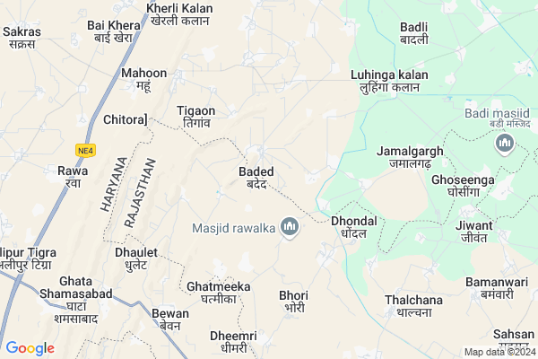
Baded
Baded Map
EDIT Map
Add Your House
 ..
..
Current Corona Virus Infected Patients Count in Mewat District
| City Name | District Name | Total Covid cases |
|---|
Locality Name :
Baded
( बड्ड )
Tehsil Name : Ferozepur Jhirka
District : Mewat
State : Haryana
Division : Gurgaon
Language : Hindi and Punjabi
Current Time 10:08 AM
Date: Tuesday , Apr 29,2025 (IST)
Time zone: IST (UTC+5:30)
Elevation / Altitude: 191 meters. Above Seal level
Assembly constituency : Ferozepur Jhirka assembly constituency
Assembly MLA : Om Prakash Yadav
Lok Sabha constituency : Gurgaon parliamentary constituency
Parliament MP : RAO INDERJIT SINGH
Serpanch Name :
Pin Code : 122104
Post Office Name : Ferozepur Jhirka
Commodities Prices : Kosikalan Market / Mandi
Baded Live Weather
Temperature: 30.4 °C
clear sky
Humidity: 30%
Wind : 5.56 mt/sec towards E
StationName : "PÅ«nÄ\u0081hÄ\u0081na"
observed on 1 Hours Back
Temperature: 30.4 °C
clear sky
Humidity: 30%
Wind : 5.56 mt/sec towards E
StationName : "PÅ«nÄ\u0081hÄ\u0081na"
observed on 1 Hours Back
Baded Weather Forecast for Next 5 days
30-04-2025
29.8°C to 40.1°C
clear sky
29.8°C to 40.1°C
clear sky
01-05-2025
28.4°C to 42.6°C
clear sky
28.4°C to 42.6°C
clear sky
02-05-2025
29.5°C to 43.9°C
clear sky, few clouds, overcast clouds
29.5°C to 43.9°C
clear sky, few clouds, overcast clouds
03-05-2025
29.1°C to 42.2°C
overcast clouds, scattered clouds, few clouds, light rain
29.1°C to 42.2°C
overcast clouds, scattered clouds, few clouds, light rain
04-05-2025
29.5°C to 40.5°C
light rain, overcast clouds, broken clouds
29.5°C to 40.5°C
light rain, overcast clouds, broken clouds
National Highways Reachable To Baded
Nationa High Way :NH248BB
Nationa High Way :NH44
Nationa High Way :NH248BB
Nationa High Way :NH44
Rivers Near Baded
Sindh
Sindh
About Baded
Correct below Info and add more info about BadedBaded is a Village in Ferozepur Jhirka Tehsil in Mewat District of Haryana State, India. It belongs to Gurgaon Division . It is located 40 KM towards South from District head quarters Nuh. 10 KM from Ferozepur Jhirka. 382 KM from State capital Chandigarh
Baded Pin code is 122104 and postal head office is Ferozepur Jhirka .
Gokalpur ( 3 KM ) , Manota ( 5 KM ) , Dungeja ( 5 KM ) , Malhaka ( 5 KM ) , Bubalheri ( 6 KM ) are the nearby Villages to Baded. Baded is surrounded by Punahana Tehsil towards East , Nagina Tehsil towards North , Kaman Tehsil towards East , Nagar Pahari Tehsil towards South .
Hodal , Nagar , Palwal , Sohna are the near by Cities to Baded.
This Place is in the border of the Mewat District and Bharatpur District. Bharatpur District Nagar Pahari is South towards this place . It is near to the Rajasthan State Border.
Baded 2011 Census Details
Baded Local Language is Hindi. Baded Village Total population is 3917 and number of houses are 545. Female Population is 48.3%. Village literacy rate is 32.0% and the Female Literacy rate is 9.0%.
Population
| Census Parameter | Census Data |
| Total Population | 3917 |
| Total No of Houses | 545 |
| Female Population % | 48.3 % ( 1891) |
| Total Literacy rate % | 32.0 % ( 1252) |
| Female Literacy rate | 9.0 % ( 354) |
| Scheduled Tribes Population % | 0.0 % ( 0) |
| Scheduled Caste Population % | 2.3 % ( 89) |
| Working Population % | 23.5 % |
| Child(0 -6) Population by 2011 | 958 |
| Girl Child(0 -6) Population % by 2011 | 48.9 % ( 468) |
Baded Census More Deatils.
Politics in Baded
INC , INLD are the major political parties in this area.Polling Stations /Booths near Baded
1)091-g.p.s. Dondal2)093-g.s.s.s. Baded R/w
3)G.m.s. Multhan R/w
4)094-g.s.s.s. Baded L/w
5)089-g.p.s. Anchwari
HOW TO REACH Baded
By Rail
There is no railway station near to Baded in less than 10 km.Colleges near Baded
Svm Institute Of Education F.p Jhirka
Address : Near Bus Stand F.p Jhirka
D.p. Institute Of Computer Education (dpice)
Address : Parjapati Dharamshala,
near Aadarsh Vidya Mandir School, Firozpur Jhirka
Schools in Baded
Gsss Baded
Address : baded , f.p jhirka , mewat , Haryana . PIN- 122109
Govt Health Centers near Baded
1) Gokulpur , Sub Center Gokulpur , ,2) Bubalheri , Bubalheri , Near bagla wali masjid ,
3) Lohinga kalan , Sub Center Lohinga kalan , ,
Hospitals in Baded,Ferozepur Jhirka
Doctor. Sarfaraz.CMS MD.Al-FIZA Alwar Hospital
Dungeja; Haryana 122508; India
4.3 KM distance Detail
more ..
Petrol Bunks in Baded,Ferozepur Jhirka
HP PETROL PUMP - SHRI GANESH FILLING STATION
Ferozepur Jhirka Kama Road; Gurgaon; Haryana 122104; India
8.3 KM distance Detail
more ..
Governement Offices near Baded,Ferozepur Jhirka
Atal Seva Center
Pahari; Bharatpur; SH-45; Bharatpur Road; Nagar; Nagar; Rajasthan 321204; India
11.7 KM distance Detail
About Baded &
History
How to reach Baded
Tourist Places Near By Baded
Schools in Baded
Colleges in Baded
Temperature & weather of Baded
places in Baded
Baded photos
More Information
How to reach Baded
Tourist Places Near By Baded
Schools in Baded
Colleges in Baded
Temperature & weather of Baded
places in Baded
Baded photos
More Information
Village Talk
Post News or Events about this Village
Near Cities
Hodal 33 KM near
Nagar 46 KM near
Palwal 49 KM near
Sohna 56 KM near
Hodal 33 KM near
Nagar 46 KM near
Palwal 49 KM near
Sohna 56 KM near
Near By Taluks
Ferozepur Jhirka 10 KM near
Punahana 14 KM near
Nagina 18 KM near
Kaman 18 KM near
Ferozepur Jhirka 10 KM near
Punahana 14 KM near
Nagina 18 KM near
Kaman 18 KM near
Near By Air Ports
Indira Gandhi International Airport 94 KM near
Kheria Airport 125 KM near
Sanganeer Airport 187 KM near
Muzaffarnagar Airport 212 KM near
Indira Gandhi International Airport 94 KM near
Kheria Airport 125 KM near
Sanganeer Airport 187 KM near
Muzaffarnagar Airport 212 KM near
Near By Tourist Places
Dabchick 33 KM near
Nuh 38 KM near
Govardhan 55 KM near
Sohna 56 KM near
Alwar 60 KM near
Dabchick 33 KM near
Nuh 38 KM near
Govardhan 55 KM near
Sohna 56 KM near
Alwar 60 KM near
Near By Districts
Mewat 38 KM near
Palwal 49 KM near
Alwar 60 KM near
Rewari 72 KM near
Mewat 38 KM near
Palwal 49 KM near
Alwar 60 KM near
Rewari 72 KM near
Near By RailWay Station
Kosi Kalan Rail Way Station 39 KM near
Chata Rail Way Station 45 KM near
Kosi Kalan Rail Way Station 39 KM near
Chata Rail Way Station 45 KM near