| Home | City Bus | Maps | Villages | Cities | Rail | Tourist Places | School | College | Pin Codes | Corona Cases Count |
| Distance Calculator Bus Services IFSC Codes Trace Mobile Number Weather Search Place Trace IP Available Cash ATM/Banks Locate Polling Booth Report an Error contact People |
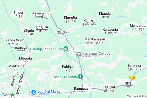
Depal
Depal Map
EDIT Map
Add Your House
 ..
..
Current Corona Virus Infected Patients Count in Medinipur East District
| City Name | District Name | Total Covid cases |
|---|
Locality Name :
Depal
( দেপাল )
Block Name : Ramnagar-ii
District : Medinipur East
State : West Bengal
Division : Burdwan
Language : Bengali
Current Time 07:27 AM
Date: Saturday , Apr 26,2025 (IST)
Time zone: IST (UTC+5:30)
Elevation / Altitude: 4 meters. Above Seal level
Telephone Code / Std Code: 03229
Assembly constituency : Egra assembly constituency
Assembly MLA : Tarun Kumar Maity
Lok Sabha constituency : Medinipur parliamentary constituency
Parliament MP : Dilip Ghosh
Serpanch Name :
Pin Code : 721448
Post Office Name : Paniparul
Commodities Prices : Egra/contai Market / Mandi
Edit below overview about Depal
Edit below overview about Depal
OverView of Depal
Depal is a Village in Ramnagar-ii Block in Medinipur East District of West Bengal State, India. It belongs to Burdwan Division . It is located 85 KM towards South from District head quarters Tamluk. 9 KM from Ramnagar-Ii. 146 KM from State capital KolkataEdit below overview about Depal
National Highways Reachable To Depal
Nationa High Way :NH12
Nationa High Way :NH116B;SH4
Nationa High Way :NH12
Nationa High Way :NH116B;SH4
Rivers Near Depal
Subarnarekha River
Subarnarekha River
About Depal
Depal is a Village in Ramnagar-ii Block in Medinipur East District of West Bengal State, India. It belongs to Burdwan Division . It is located 85 KM towards South from District head quarters Tamluk. 9 KM from Ramnagar-Ii. 146 KM from State capital Kolkata
Depal Pin code is 721448 and postal head office is Paniparul .
Paldhui ( 3 KM ) , Ramnagar-i ( 7 KM ) , Dubda ( 8 KM ) , Balisai ( 9 KM ) , Gobra ( 9 KM ) are the nearby Villages to Depal. Depal is surrounded by Ramnagar-Ii Block towards East , Contai-I Block towards East , Bhograi Block towards west , Mohanpur Block towards North .
Contai , Jaleswar , Balasore , Haldia are the near by Cities to Depal.
It is near to bay of bengal. There is a chance of humidity in the weather.
Depal 2011 Census Details
Depal Local Language is Bengali. Depal Village Total population is 3359 and number of houses are 694. Female Population is 49.2%. Village literacy rate is 82.8% and the Female Literacy rate is 38.4%.
Population
| Census Parameter | Census Data |
| Total Population | 3359 |
| Total No of Houses | 694 |
| Female Population % | 49.2 % ( 1654) |
| Total Literacy rate % | 82.8 % ( 2782) |
| Female Literacy rate | 38.4 % ( 1291) |
| Scheduled Tribes Population % | 0.1 % ( 4) |
| Scheduled Caste Population % | 7.4 % ( 248) |
| Working Population % | 40.7 % |
| Child(0 -6) Population by 2011 | 294 |
| Girl Child(0 -6) Population % by 2011 | 50.7 % ( 149) |
Depal Census More Deatils.
Politics in Depal
DSP(P) , DSP , Bharatiya Janata Party , AITC , CPI are the major political parties in this area.Polling Stations /Booths near Depal
1)Chhotonalgeria Primary Vidyalay(uttarangsha)haripara2)Boyespur Prathamik Vidyalay
3)Sannihari Prathamik Vidyalay
4)Kamardiha Prathamik School
5)Kapasda Shitala Primary School (r-1)
HOW TO REACH Depal
By Rail
Ramnagar Bengal Rail Way Station , Tikra Ph Rail Way Station are the very nearby railway stations to Depal.Colleges near Depal
Palpara College
Address :
Haldia Institute Of Technology
Address :
Moyna College
Address : Moyna, Purba Medinipur, Pin-7216
Mugberia Gangadhar Mahavidyalaya
Address : Vill+p.o- Bhupatinagar,purbamedinipur
Schools in Depal
Depal Purbanagsha S.s.k
Address : depal , ramnagar -ii , purba medinipur , West Bengal . PIN- 721453 , Post - Depal
Govt Health Centers near Depal
1) Digha A.K. BPHC , JL. No. - 86, Plot No. - 1800 Mouza - Khadal Gobra , Padima-II GP , Behind Neheru Market2) Gotsanda PHC , Gotsanda, Begunia, Mohanpur Paschim Medinipur , ,
3) Gotsanda SC , Gotsanda, Begunia, Mohanpur Paschim Medinipur , ,
Hospitals in Depal,Ramnagar-ii
Depal - Baranga-Hamirpur Rd
Hamirpur - Depal Rd; Depal; Baranga; West Bengal 721453; India
0.5 KM distance Detail
Hamirpur General Hospital
Hamirpur - Depal Rd; Baranga; West Bengal 721453; India
1.7 KM distance Detail
more ..
Petrol Bunks in Depal,Ramnagar-ii
HP PETROL PUMP - MRITYUNJAY SERVICE STATION
Village & P.O. Mandar Dist.; Durgapur; West Bengal 721441; India
4.7 KM distance Detail
Bharat Petroleum Om filling Station
Dakshin Basulipat; West Bengal 721441; India
5.9 KM distance Detail
Omfilling Station
Om filling station Ramnagar; Egra Ramnagar Road; Ramnagar; Dakshin Basulipat; West Bengal 721441; India
5.9 KM distance Detail
more ..
Colleges in Depal,Ramnagar-ii
Ramnagar B. Ed. College
Hamirpur - Depal Rd; Baranga; West Bengal 721453; India
0.8 KM distance Detail
Ramnagar B.Ed. College
Plot No. 512;513;515; Depal Village; Dist. Purba Medinipur; Ramnagar; West Bengal 721453; India
0.8 KM distance Detail
Ramnagar College
Egra Ramnagar Road; Gaurangabar; Shikarbar; West Bengal 721453; India
1.8 KM distance Detail
more ..
Schools in Depal,Ramnagar-ii
Depal Baneswar Charubala Vidyamandir
Near Depal Bus Stand; Depar Shasanbar; West Bengal 721453; India
0.2 KM distance Detail
Depal Primary School
Depal Bus Stand; Depal; Block- Ramnagar II; Depar Shasanbar; West Bengal 721453; India
0.2 KM distance Detail
Nibedita Sangeet Sikhayatan - Pranab Kumar Das
Near Depal Haat; Egra Ramnagar Road; Purba Medinipur; Ramnagar; West Bengal 721448; India
0.4 KM distance Detail
St.Xavier's Student Convent
Near Giri More; Depar Shasanbar; West Bengal 721453; India
0.5 KM distance Detail
Electronic Shops in Depal,Ramnagar-ii
ss - infotech(disha studio)Asish kumar guchhait
Egra Ramnagar Road; Depar Shasanbar; West Bengal 721453; India
0.1 KM distance Detail
Sohel Mobile Solution
Egra Ramnagar Road; Depal; Depar Shasanbar; West Bengal 721453; India
0.2 KM distance Detail
Super Markets in Depal,Ramnagar-ii
Annapurna Bhandar(চাল দোকান )
College More Bus Stop; E g r a; Egra Ramnagar Road; Gaurangabar; Shikarbar; West Bengal 721453; India
1.6 KM distance Detail
Police Stations near Depal,Ramnagar-ii
S.I. Office (Ramnagar Circle)
Ramnagar;; Saiyadpur; West Bengal 721441; India
6.8 KM distance Detail
Ramnagar Police Station
Digha - Contai Rd; Ramnagar; Talga Chhari; West Bengal 721441; India
7.2 KM distance Detail
Governement Offices near Depal,Ramnagar-ii
Depal Gram Panchayat
Opposite to Depal High School; Depal Bus Stand; Depal; Block- Ramnagar II; Depar Shasanbar; West Bengal 721453; India
0.2 KM distance Detail
Paldhui Panchayat Office
Near Lalupul; Egra Ramnagar Road; Sabitrapur; West Bengal 721453; India
3.2 KM distance Detail
About Depal &
History
How to reach Depal
Tourist Places Near By Depal
Schools in Depal
Colleges in Depal
Temperature & weather of Depal
places in Depal
Depal photos
More Information
How to reach Depal
Tourist Places Near By Depal
Schools in Depal
Colleges in Depal
Temperature & weather of Depal
places in Depal
Depal photos
More Information
Village Talk
Post News or Events about this Village
Near Cities
Contai 23 KM near
Jaleswar 37 KM near
Balasore 76 KM near
Haldia 77 KM near
Contai 23 KM near
Jaleswar 37 KM near
Balasore 76 KM near
Haldia 77 KM near
Near By Taluks
Ramnagar-I 7 KM near
Ramnagar-Ii 8 KM near
Contai-I 17 KM near
Bhograi 18 KM near
Ramnagar-I 7 KM near
Ramnagar-Ii 8 KM near
Contai-I 17 KM near
Bhograi 18 KM near
Near By Air Ports
Netaji Subhas Chandra Bose Airport 153 KM near
Bhubaneswar Airport 272 KM near
Ranchi Airport 323 KM near
Gaya Airport 479 KM near
Netaji Subhas Chandra Bose Airport 153 KM near
Bhubaneswar Airport 272 KM near
Ranchi Airport 323 KM near
Gaya Airport 479 KM near
Near By Tourist Places
Mandarmani 6 KM near
Digha 13 KM near
Sagardwip 64 KM near
Chandipur 70 KM near
Haldia 76 KM near
Mandarmani 6 KM near
Digha 13 KM near
Sagardwip 64 KM near
Chandipur 70 KM near
Haldia 76 KM near
Near By Districts
Baleshwar 80 KM near
Medinipur East 81 KM near
Medinipur West 89 KM near
Mayurbhanj 97 KM near
Baleshwar 80 KM near
Medinipur East 81 KM near
Medinipur West 89 KM near
Mayurbhanj 97 KM near
Near By RailWay Station
Ramnagar Bengal Rail Way Station 6.9 KM near
Tikra Ph Rail Way Station 8.3 KM near
Badalpur Ph Rail Way Station 8.3 KM near
Digha Rail Way Station 14 KM near
Kanthi P Halt Rail Way Station 22 KM near
Ramnagar Bengal Rail Way Station 6.9 KM near
Tikra Ph Rail Way Station 8.3 KM near
Badalpur Ph Rail Way Station 8.3 KM near
Digha Rail Way Station 14 KM near
Kanthi P Halt Rail Way Station 22 KM near