| Home | City Bus | Maps | Villages | Cities | Rail | Tourist Places | School | College | Pin Codes | Corona Cases Count |
| Distance Calculator Bus Services IFSC Codes Trace Mobile Number Weather Search Place Trace IP Available Cash ATM/Banks Locate Polling Booth Report an Error contact People |
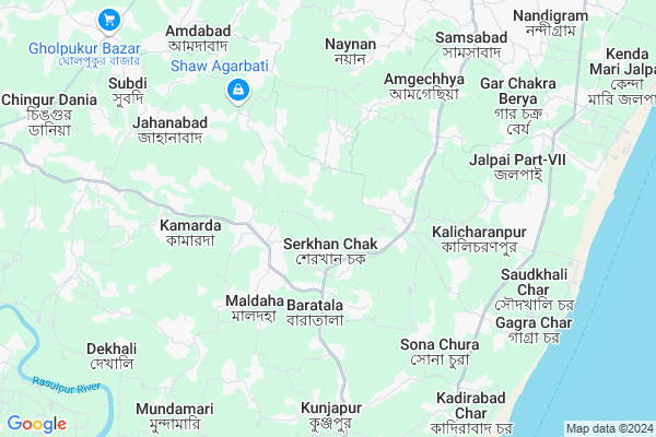
Haria
Haria Map
EDIT Map
Add Your House
 ..
..
Current Corona Virus Infected Patients Count in Medinipur East District
| City Name | District Name | Total Covid cases |
|---|
Locality Name :
Haria
( হারিয়ে )
Block Name : Khejuri-i
District : Medinipur East
State : West Bengal
Division : Burdwan
Language : Bengali
Current Time 06:15 AM
Date: Saturday , Apr 26,2025 (IST)
Time zone: IST (UTC+5:30)
Elevation / Altitude: 5 meters. Above Seal level
Telephone Code / Std Code: 03224
Assembly constituency : Khejuri assembly constituency
Assembly MLA : Santanu Pramanik
Lok Sabha constituency : Kanthi parliamentary constituency
Parliament MP : Adhikari Sisir
Serpanch Name :
Pin Code : 721430
Post Office Name : Haria
Commodities Prices : Egra/contai Market / Mandi
Haria Live Weather
Temperature: 27.3 °C
clear sky
Humidity: 88%
Wind : 6.98 mt/sec towards S
StationName : "Contai"
observed on 1 Hours Back
Temperature: 27.3 °C
clear sky
Humidity: 88%
Wind : 6.98 mt/sec towards S
StationName : "Contai"
observed on 1 Hours Back
Haria Weather Forecast for Next 5 days
27-04-2025
27.3°C to 32.8°C
clear sky, few clouds
27.3°C to 32.8°C
clear sky, few clouds
28-04-2025
27.5°C to 34.4°C
few clouds, broken clouds, scattered clouds, overcast clouds
27.5°C to 34.4°C
few clouds, broken clouds, scattered clouds, overcast clouds
29-04-2025
27.2°C to 32.8°C
broken clouds, overcast clouds, few clouds, light rain
27.2°C to 32.8°C
broken clouds, overcast clouds, few clouds, light rain
30-04-2025
25.3°C to 31.9°C
scattered clouds, few clouds, clear sky, light rain, overcast clouds
25.3°C to 31.9°C
scattered clouds, few clouds, clear sky, light rain, overcast clouds
National Highways Reachable To Haria
Nationa High Way :NH12
Nationa High Way :NH116B
Nationa High Way :NH12
Nationa High Way :NH116B
Rivers Near Haria
Rasulpur River :রসুলপুর নদী
Haldi River :হলদী নদী
Rasulpur River :রসুলপুর নদী
Haldi River :হলদী নদী
About Haria
Correct below Info and add more info about HariaHaria is a Village in Khejuri-i Block in Medinipur East District of West Bengal State, India. It belongs to Burdwan Division . It is located 45 KM towards South from District head quarters Tamluk. 97 KM from State capital Kolkata
Haria Pin code is 721430 and postal head office is Haria .
Haria is surrounded by Khejuri-Ii Block towards South , Nandigram-I Block towards North , Nandigram-Ii Block towards North , Deshapran Block towards South .
Haldia , Contai , Tamluk , Uluberia are the near by Cities to Haria.
It is near to bay of bengal. There is a chance of humidity in the weather.
Demographics of Haria
Bengali is the Local Language here.Politics in Haria
CPM , AITC , SP , All India Trinamool Congress are the major political parties in this area.Polling Stations /Booths near Haria
1)Arabaga State Planned Primary School2)Baharganj Gunadhar S.s.k
3)Kalyachak Junior Basic School
4)Jagannathchak Primary School
5)Kamarda High School
HOW TO REACH Haria
By Rail
There is no railway station near to Haria in less than 10 km.Colleges near Haria
Palpara College
Address :
Haldia Institute Of Technology
Address :
Moyna College
Address : Moyna, Purba Medinipur, Pin-7216
Mugberia Gangadhar Mahavidyalaya
Address : Vill+p.o- Bhupatinagar,purbamedinipur
Schools near Haria
Ajaya A. Vidyamandir High
Address : birbandar / xiv , khejuri -i , purba medinipur , West Bengal . PIN- 721430 , Post - Haria
Tikashi U.k.b. Vidyayatan
Address : tikashi / viii , khejuri -i , purba medinipur , West Bengal . PIN- 721430 , Post - Haria
Kalagachia J. Vidyapith
Address : kalahechia / vi , khejuri -i , purba medinipur , West Bengal . PIN- 721432 , Post - Kalagachia (East Midnapore)
Kamarda High School
Address : kamarda / x , khejuri -i , purba medinipur , West Bengal . PIN- 721432 , Post - Kalagachia (East Midnapore)
Govt Health Centers near Haria
1) Maheshpur PHC , 623, 624, 625, 626 , Gokulnagar GP-6 , Maheshpur Bazar & Maheshpur High School2) Ghoraghata SC , Not Available , Amtalia GP , Near Ghoraghata Adarsha High School
3) Dihi Mukundapur SC , Not Available , Amtalia GP , Near Pakar Pole
Hospitals in Haria,Khejuri-i
maheshpur hospital
Nandigram Tekhali Road; Nandigram; West Bengal 721631; India
7.1 KM distance Detail
Amdabad Primary Health Centre
Reapara - Gholpukur Bazar Rd; Amdabad; West Bengal 721650; India
8.3 KM distance Detail
Nandigram Hospital
Chandipur - Nandigram Rd; Nandigram; West Bengal 721631; India
10.4 KM distance Detail
more ..
Colleges in Haria,Khejuri-i
Sitananda College
Dist-Purba Medinipur; Nandigram; West Bengal 721631; India
10.9 KM distance Detail
Purba Medinipur GK College of Education
Heria-Khejuri-Boga Rd; Tikashi; West Bengal 721430; India
11.5 KM distance Detail
more ..
Schools in Haria,Khejuri-i
Amgachia Primary School
Nandigram Tekhali Road; Nandigram; West Bengal 721631; India
7.0 KM distance Detail
Manasa Mondier
West Beng Parulbari; Nandigram Tekhali Road; Nandigram; West Bengal 721631; India
7.1 KM distance Detail
Electronic Shops in Haria,Khejuri-i
Mobile Reparing Centre Amgachia
Nandigram Tekhali Road; Nandigram; West Bengal 721631; India
7.1 KM distance Detail
মহামায়া সাইকেল রিপেয়ারিং শপ and মহা মায়া পুতুল থিয়েটার
Chingur Dania; West Bengal 721430; India
9.2 KM distance Detail
Local Parks in Haria,Khejuri-i
Golden Jublee Park
Indian Oil Township Cluster 10; Haldia; West Bengal 721631; India
18.5 KM distance Detail
Police Stations near Haria,Khejuri-i
Nandigram Police Station
Chandipur -Nandigram Road; Purba Medinipur District; Nandigram; West Bengal 721631; India
10.6 KM distance Detail
Khejuri Police Station
Boga-Shyampur-Bidyapith Road; Janka; West Bengal 721431; India
11.5 KM distance Detail
Governement Offices near Haria,Khejuri-i
Office of The Addl. Dist. Sub-Registrar
Nandigram; West Bengal 721631; India
10.7 KM distance Detail
About Haria &
History
How to reach Haria
Tourist Places Near By Haria
Schools in Haria
Colleges in Haria
Temperature & weather of Haria
places in Haria
Haria photos
More Information
How to reach Haria
Tourist Places Near By Haria
Schools in Haria
Colleges in Haria
Temperature & weather of Haria
places in Haria
Haria photos
More Information
Village Talk
Post News or Events about this Village
Near Cities
Haldia 26 KM near
Contai 28 KM near
Tamluk 45 KM near
Uluberia 69 KM near
Haldia 26 KM near
Contai 28 KM near
Tamluk 45 KM near
Uluberia 69 KM near
Near By Taluks
Khejuri-I 0 KM near
Khejuri-Ii 6 KM near
Nandigram-I 7 KM near
Nandigram-Ii 11 KM near
Khejuri-I 0 KM near
Khejuri-Ii 6 KM near
Nandigram-I 7 KM near
Nandigram-Ii 11 KM near
Near By Air Ports
Netaji Subhas Chandra Bose Airport 105 KM near
Bhubaneswar Airport 323 KM near
Ranchi Airport 345 KM near
Singerbhil Airport 451 KM near
Netaji Subhas Chandra Bose Airport 105 KM near
Bhubaneswar Airport 323 KM near
Ranchi Airport 345 KM near
Singerbhil Airport 451 KM near
Near By Tourist Places
Haldia 25 KM near
Sagardwip 30 KM near
Raichak 39 KM near
Mandarmani 54 KM near
Bakkhali 60 KM near
Haldia 25 KM near
Sagardwip 30 KM near
Raichak 39 KM near
Mandarmani 54 KM near
Bakkhali 60 KM near
Near By Districts
Medinipur East 43 KM near
24 Paraganas South 83 KM near
Kolkata 87 KM near
Howrah 91 KM near
Medinipur East 43 KM near
24 Paraganas South 83 KM near
Kolkata 87 KM near
Howrah 91 KM near
Near By RailWay Station
Kanthi P Halt Rail Way Station 29 KM near
Tamluk Rail Way Station 41 KM near
Kanthi P Halt Rail Way Station 29 KM near
Tamluk Rail Way Station 41 KM near