| Home | City Bus | Maps | Villages | Cities | Rail | Tourist Places | School | College | Pin Codes | Corona Cases Count |
| Distance Calculator Bus Services IFSC Codes Trace Mobile Number Weather Search Place Trace IP Available Cash ATM/Banks Locate Polling Booth Report an Error contact People |
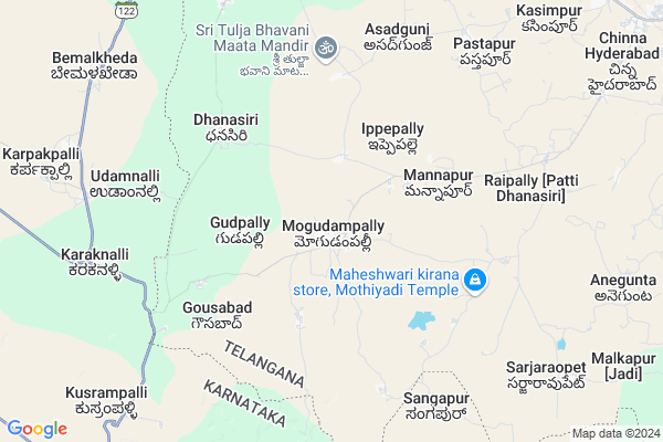
Mogdampalle Map
EDIT Map
Add Your House
 ..
..
Current Corona Virus Infected Patients Count in Medak District
| City Name | District Name | Total Covid cases |
|---|---|---|
| Sangareddy District | Sangareddy | 7 |
| Medak District | Medak | 5 |
Locality Name :
Mogdampalle
( మోగడంపల్లె )
Mandal Name : Zahirabad
District : Medak
State : Telangana
Region : Telangana
Language : Telugu
Current Time 04:38 PM
Date: Monday , Apr 28,2025 (IST)
Time zone: IST (UTC+5:30)
Elevation / Altitude: 635 meters. Above Seal level
Telephone Code / Std Code: 08451
Assembly constituency : Zahirabad assembly constituency
Assembly MLA : Koninty Manik Rao
Lok Sabha constituency : Zahirabad parliamentary constituency
Parliament MP : B.B.PATIL
Serpanch Name :
Pin Code : 502221
Post Office Name : Charakpally
Alternate Village Name : Mugadampally
Commodities Prices : Zaheerabad Market / Mandi
National Highways Reachable To Mogdampalle
Nationa High Way :NH65
Nationa High Way :Old NH9
Nationa High Way :NH65
Nationa High Way :Old NH9
Rivers Near Mogdampalle
Saranala :ಸರನಾಲಾ
Saranala :ಸರನಾಲಾ
About Mogdampalle
Correct below Info and add more info about MogdampalleMogdampalle is a Village in Zahirabad Mandal in Medak District of Telangana State, India. It belongs to Telangana region . As part Telangana Districts re-organisation , Mogdampalle Village Zahirabad Mandal re organised from Medak District to Sangareddy district. It is located 72 KM towards west from District head quarters Sangareddi. 12 KM from Zahirabad N.P.
Mogdampalle Pin code is 502221 and postal head office is Charakpally .
Mannapur ( 3 KM ) , Ippepalle ( 4 KM ) , Gousabad ( 5 KM ) , Dhanasiri ( 5 KM ) , Vittunaik Thanda ( 6 KM ) are the nearby Villages to Mogdampalle. Mogdampalle is surrounded by Chincholi Mandal towards South , Kohir Mandal towards East , Nyalkal Mandal towards North , Jharasangam Mandal towards East .
Zahirabad , Bidar , Tandur , Sadasivpet are the near by Cities to Mogdampalle.
Mogdampalle 2011 Census Details
Mogdampalle Local Language is Telugu. Mogdampalle Village Total population is 10948 and number of houses are 2045. Female Population is 48.6%. Village literacy rate is 38.6% and the Female Literacy rate is 14.4%.
Population
| Census Parameter | Census Data |
| Total Population | 10948 |
| Total No of Houses | 2045 |
| Female Population % | 48.6 % ( 5321) |
| Total Literacy rate % | 38.6 % ( 4229) |
| Female Literacy rate | 14.4 % ( 1581) |
| Scheduled Tribes Population % | 43.7 % ( 4783) |
| Scheduled Caste Population % | 10.7 % ( 1167) |
| Working Population % | 48.4 % |
| Child(0 -6) Population by 2011 | 1722 |
| Girl Child(0 -6) Population % by 2011 | 47.5 % ( 818) |
Mogdampalle Census More Deatils.
Politics in Mogdampalle
TDP , TRS , INC are the major political parties in this area.Polling Stations /Booths near Mogdampalle
1)Mogudampally2)Mirzapur (nyalkal )
3)Mogudam Palli
4)Mogudampally
5)Nyamathabad
HOW TO REACH Mogdampalle
By Road
Zahirabad is the Nearest Town to Mogdampalle. Zahirabad is 15 km from Mogdampalle. Road connectivity is there from Zahirabad to Mogdampalle.By Rail
There is no railway station near to Mogdampalle in less than 10 km. How ever there are railway Stations from Near By town Zahirabad. are the railway Stations near to Zahirabad. You can reach from Zahirabad to Mogdampalle by road after .Colleges near Mogdampalle
Tara Govt Degree And Pg College
Address :
J N T U, Sultanpur
Address :
Governament Junior College Hadnoor
Address :
Govt.junior College,siddipet
Address :
Government Polytechnic College
Address :
Schools in Mogdampalle
Zphs Mogudmplly
Address : mogdampalle , zaheerabad , medak , Andhra Pradesh . PIN- 502226
Vanitha Model Hs Mogudmplly
Address : mogdampalle , zaheerabad , medak , Andhra Pradesh . PIN- 502226
Mpups Vittu Naik Thanda
Address : mogdampalle , zaheerabad , medak , Andhra Pradesh . PIN- 502226
Govt Health Centers near Mogdampalle
1) SubCentre, Mogudampally , Mar-44 , Boini Street , Near Busstand2) SubCentre, Mannapur , 22-Feb , Buruju Street , Beside Buruju
3) SubCentre, Dhanasiri , , Gousabad Road , Beside Veternary SubCentre
Sub Villages in Mogdampalle
Hospitals in Mogdampalle,Zahirabad
Government Veterinary Hospital; Mogudampally
Mogudampally; Telangana 502221; India
0.8 KM distance Detail
more ..
Petrol Bunks in Mogdampalle,Zahirabad
New Ammar Filling Station Indian Oil
Zaheerabad; Medak; NH-9; Mumbai Highway; Zaheerabad; Zaheerabad; Telangana 502220; India
10.0 KM distance Detail
more ..
Colleges in Mogdampalle,Zahirabad
Govt. Degree College (Patancheru)
Beside police station; near Bus stand; Patancheru; Telangana 502220; India
11.6 KM distance Detail
Sri Vani Degree and P.G. College
Mahal Complex; Medak; NH-09; Mumbai Highway; Zaheerabad; Zaheerabad; Telangana 502220; India
15.5 KM distance Detail
more ..
Schools in Mogdampalle,Zahirabad
Mandal Parishad Primary School; Mogudampally (T/M and U/M)
Eppepally Rd; Mogudampally; Telangana 502221; India
0.6 KM distance Detail
Electronic Shops in Mogdampalle,Zahirabad
Cycle taxi & tent house
hanuman temple Rd; Dhanasiri; Telangana 502221; India
5.4 KM distance Detail
Super Markets in Mogdampalle,Zahirabad
S R S R BROTHERS KIRANA AND GENERAL STORE RAJGIRA TQ DIST BIDER
; Hokrana K; Karnataka 585403; India
12.9 KM distance Detail
Local Parks in Mogdampalle,Zahirabad
Public Garden
LIG-II Phase; Shanti Nagar; Zaheerabad; Telangana 502220; India
15.8 KM distance Detail
Governement Offices near Mogdampalle,Zahirabad
Gram Phanchayat Office Humnabad
Bemelkhada; Bemalkheda; Bidar; SH-122; Bangoor Karaknalli Road; Humnabad; Humnabad; Karnataka 585227; India
10.7 KM distance Detail
Golla Kurma Yadava Sangam Office; Zhb
Government Girls High School Zaheerabad; Subhash Gunj; Zaheerabad; Telangana 502220; India
15.3 KM distance Detail
About Mogdampalle &
History
How to reach Mogdampalle
Tourist Places Near By Mogdampalle
Schools in Mogdampalle
Colleges in Mogdampalle
Temperature & weather of Mogdampalle
places in Mogdampalle
Mogdampalle photos
More Information
How to reach Mogdampalle
Tourist Places Near By Mogdampalle
Schools in Mogdampalle
Colleges in Mogdampalle
Temperature & weather of Mogdampalle
places in Mogdampalle
Mogdampalle photos
More Information
Village Talk
Post News or Events about this Village
Near Cities
Zahirabad 16 KM near
Bidar 36 KM near
Tandur 47 KM near
Sadasivpet 53 KM near
Zahirabad 16 KM near
Bidar 36 KM near
Tandur 47 KM near
Sadasivpet 53 KM near
Near By Taluks
Zahirabad 11 KM near
Chincholi 23 KM near
Kohir 23 KM near
Nyalkal 30 KM near
Zahirabad 11 KM near
Chincholi 23 KM near
Kohir 23 KM near
Nyalkal 30 KM near
Near By Air Ports
Rajiv Gandhi International Airport 119 KM near
Latur Airport 157 KM near
Sholapur Airport 185 KM near
Nanded Airport 195 KM near
Rajiv Gandhi International Airport 119 KM near
Latur Airport 157 KM near
Sholapur Airport 185 KM near
Nanded Airport 195 KM near
Near By Tourist Places
Bidar 35 KM near
Gulbarga 86 KM near
Medak 105 KM near
Hyderabad 120 KM near
Tuljapur 177 KM near
Bidar 35 KM near
Gulbarga 86 KM near
Medak 105 KM near
Hyderabad 120 KM near
Tuljapur 177 KM near
Near By Districts
Bidar 36 KM near
Medak 69 KM near
Rangareddi 83 KM near
Gulbarga 86 KM near
Bidar 36 KM near
Medak 69 KM near
Rangareddi 83 KM near
Gulbarga 86 KM near
Near By RailWay Station
Zahirabad Rail Way Station 14 KM near
Bidar Rail Way Station 36 KM near
Zahirabad Rail Way Station 14 KM near
Bidar Rail Way Station 36 KM near