| Home | City Bus | Maps | Villages | Cities | Rail | Tourist Places | School | College | Pin Codes | Corona Cases Count |
| Distance Calculator Bus Services IFSC Codes Trace Mobile Number Weather Search Place Trace IP Available Cash ATM/Banks Locate Polling Booth Report an Error contact People |
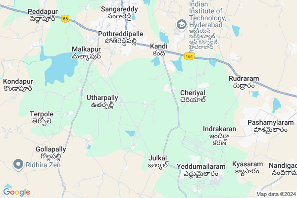
Kottala
Kottala Map
EDIT Map
Add Your House
 ..
..
Current Corona Virus Infected Patients Count in Medak District
| City Name | District Name | Total Covid cases |
|---|---|---|
| Sangareddy District | Sangareddy | 7 |
| Medak District | Medak | 5 |
Locality Name :
Kottala
( కొట్టాల )
Mandal Name : Sangareddy
District : Medak
State : Telangana
Region : Telangana
Language : Telugu
Current Time 08:06 AM
Date: Tuesday , Apr 29,2025 (IST)
Time zone: IST (UTC+5:30)
Elevation / Altitude: 574 meters. Above Seal level
Telephone Code / Std Code: 08455
Assembly constituency : Sangareddy assembly constituency
Assembly MLA : Chinta Prabhakar
Lok Sabha constituency : Medak parliamentary constituency
Parliament MP : Kotha Prabhakar Reddy
Serpanch Name :
Pin Code : 502285
Post Office Name : Kandi
Main Village Name : Kalvemula
Commodities Prices : Sangareddy Market / Mandi
Kottala Live Weather
Temperature: 27.7 °C
clear sky
Humidity: 46%
Wind : 2.67 mt/sec towards S
StationName : "SangÄ\u0081reddi"
observed on 1 Hours Back
Temperature: 27.7 °C
clear sky
Humidity: 46%
Wind : 2.67 mt/sec towards S
StationName : "SangÄ\u0081reddi"
observed on 1 Hours Back
Kottala Weather Forecast for Next 5 days
30-04-2025
28.4°C to 37.6°C
clear sky, scattered clouds, broken clouds
28.4°C to 37.6°C
clear sky, scattered clouds, broken clouds
01-05-2025
29.7°C to 39.1°C
broken clouds, few clouds, clear sky, overcast clouds, scattered clouds
29.7°C to 39.1°C
broken clouds, few clouds, clear sky, overcast clouds, scattered clouds
02-05-2025
28.2°C to 41.6°C
scattered clouds, clear sky, few clouds, broken clouds
28.2°C to 41.6°C
scattered clouds, clear sky, few clouds, broken clouds
03-05-2025
27.9°C to 41.0°C
broken clouds, clear sky, few clouds, overcast clouds
27.9°C to 41.0°C
broken clouds, clear sky, few clouds, overcast clouds
04-05-2025
29.9°C to 42.0°C
broken clouds, clear sky, scattered clouds
29.9°C to 42.0°C
broken clouds, clear sky, scattered clouds
National Highways Reachable To Kottala
Nationa High Way :NH65
Nationa High Way :NH65
About Kottala
Correct below Info and add more info about KottalaKottala is a small Village/hamlet in Sangareddy Mandal in Medak District of Telangana State, India. It comes under Kalvemula Panchayath. It belongs to Telangana region . As part Telangana Districts re-organisation , Kottala Village Sangareddy Mandal re organised from Medak District to Sangareddy,Sangareddy district. It is located 9 KM towards South from District head quarters Sangareddi. 6 KM from Sangareddy Municipality.
Kottala Pin code is 502285 and postal head office is Kandi .
Kottala is surrounded by Kondapur Mandal towards west , Shankarpally Mandal towards South , Patancheru Mandal towards East , Nawabpet Mandal towards west .
Sangareddy , Singapur , Sadasivpet , Vicarabad are the near by Cities to Kottala.
This Place is in the border of the Medak District and Rangareddi District. Rangareddi District Shankarpally is South towards this place .
Demographics of Kottala
Telugu is the Local Language here. Total population of Kottala is 2970 .Males are 1504 and Females are 1,466 living in 565 Houses. Total area of Kottala is 1186 hectares.Politics in Kottala
TDP , TRS , BJP , INC are the major political parties in this area.Polling Stations /Booths near Kottala
1)Kalavakunta2)Mansanpally
3)Kandi
4)Thopugonda
5)Kondapur
HOW TO REACH Kottala
By Road
Sangareddy is the Nearest Town to Kottala. Sangareddy is 13 km from Kottala. Road connectivity is there from Sangareddy to Kottala.By Rail
There is no railway station near to Kottala in less than 10 km.Colleges near Kottala
Tara Govt Degree And Pg College
Address :
St Anthony's Junior College Shanthi Nagar
Address :
Spoorthy Degree College
Address : Opposite Rythu Bazar,main Road, Sangareddy Medak Dist.
Sri Teja Junior College
Address :
Techbridge Computer Education
Address : By Pass Near Tara Degree College 2nd Gate, Sangareddy, Telangana 502001
Schools in Kottala
Zphs Kalivemula
Address : kalvemula , sangareddy , medak , Andhra Pradesh . PIN- 502285 , Post - Kandi
Govt Health Centers near Kottala
1) Subcentre Kalevamula , , BC COLONY , NEAR SCHOOL2) Subcentre Kothlapur , , BC COLONY , NEAR GOVT SCHOOL
3) Subcentre Kandi , , GRAM PANCHAYATH , GRAM PANCHAYATH
Hospitals in Kottala,Sangareddy
Sri Raghavendra Medical And General Store
5; 61 temple Road; Kandi; Telangana 502285; India
4.3 KM distance Detail
more ..
Petrol Bunks in Kottala,Sangareddy
HP PETROL PUMP - VIGNESH SERVICE STATION KANDI
Sy.no.617 & 619 A/2 Kandi Village Sangareddy Mandal; Secunderabad; 502285; India
3.3 KM distance Detail
more ..
Colleges in Kottala,Sangareddy
DVR College Of Engineering & Technology
NH 9; Near IIT – HYD Permanent Campus; Ahead Of Patancheru; Kandi; Kashipur Village; Hyderabad; Telangana 502285; India
2.1 KM distance Detail
Nagarjuna College of Education
H.No. 5-25; Sangareddy Mandal; Medak District; Kothlapur; Telangana 502001; India
4.7 KM distance Detail
more ..
Schools in Kottala,Sangareddy
Kendriya Vidyalaya HPC/CPM
HPC/CPM;Panchgram; HINDUSTAN PAPER MILL;PANCHGRAM;HAILAKANDI;ASSAM; Telangana 788802; India
0.9 KM distance Detail
Electronic Shops in Kottala,Sangareddy
Asha Digital Studio
Kandi; Sangareddy; NH65; Hyderabad; Telangana 502285; India
4.4 KM distance Detail
Super Markets in Kottala,Sangareddy
Sri Yadagiri Laxmi Narsimha Kirana & Xerox Lamination
Lig 11/Phase -1; Kothlapur X Road;; Hyderabad; Telangana 502295; India
5.8 KM distance Detail
Varsha Kirana & General Stores
176; SH 17 Sainagar Colony; Phase-3; SH 17; Sainagar Colony; Phase-3; Pothireddypally; Sangareddy; Telangana 502285; India
5.8 KM distance Detail
Local Parks in Kottala,Sangareddy
PRR GARDEN
Pothireddypalli Rd; Pothireddypally; Sangareddy; Telangana 502285; India
5.5 KM distance Detail
Police Stations near Kottala,Sangareddy
Rural Police Station
NH65; Pothireddypally; Sangareddy; Telangana 502295; India
5.5 KM distance Detail
Sangareddy Rural Police Station
Vidya Nagar Colony; Sangareddy; Telangana 502001; India
5.5 KM distance Detail
Governement Offices near Kottala,Sangareddy
MeeSeva Center
Venkateshwara Communications; Opp.Zp High School;Sangareddy; 4-56; Kandi; Telangana 502285; India
4.4 KM distance Detail
MeeSeva Center
9-91/2; Ss Communication; Pothireddypally; Near Govt. High School; Pothireddypally(V); Sangareddy(M); Medak(D);502295; Pothireddypally; Sangareddy; Telangana 502295; India
5.9 KM distance Detail
NIC National Informatics center
176; SH 17; Sainagar Colony; Phase-3; SH 17; Sainagar Colony; Phase-3; Pothireddypally; Sangareddy; Telangana 502285; India
6.1 KM distance Detail
About Kottala &
History
How to reach Kottala
Tourist Places Near By Kottala
Schools in Kottala
Colleges in Kottala
Temperature & weather of Kottala
places in Kottala
Kottala photos
More Information
How to reach Kottala
Tourist Places Near By Kottala
Schools in Kottala
Colleges in Kottala
Temperature & weather of Kottala
places in Kottala
Kottala photos
More Information
Village Talk
Post News or Events about this Village
Near Cities
Sangareddy 9 KM near
Singapur 10 KM near
Sadasivpet 19 KM near
Vicarabad 36 KM near
Sangareddy 9 KM near
Singapur 10 KM near
Sadasivpet 19 KM near
Vicarabad 36 KM near
Near By Taluks
Sangareddy 6 KM near
Kondapur 10 KM near
Shankarpally 13 KM near
Patancheru 17 KM near
Sangareddy 6 KM near
Kondapur 10 KM near
Shankarpally 13 KM near
Patancheru 17 KM near
Near By Air Ports
Rajiv Gandhi International Airport 54 KM near
Latur Airport 221 KM near
Nanded Airport 223 KM near
Sholapur Airport 257 KM near
Rajiv Gandhi International Airport 54 KM near
Latur Airport 221 KM near
Nanded Airport 223 KM near
Sholapur Airport 257 KM near
Near By Tourist Places
Hyderabad 50 KM near
Medak 65 KM near
Bidar 78 KM near
Gulbarga 152 KM near
Warangal 187 KM near
Hyderabad 50 KM near
Medak 65 KM near
Bidar 78 KM near
Gulbarga 152 KM near
Warangal 187 KM near
Near By Districts
Medak 9 KM near
Rangareddi 33 KM near
Hyderabad 46 KM near
Bidar 81 KM near
Medak 9 KM near
Rangareddi 33 KM near
Hyderabad 46 KM near
Bidar 81 KM near
Near By RailWay Station
Shankarpalli Rail Way Station 12 KM near
Lingampalli Rail Way Station 27 KM near
Shankarpalli Rail Way Station 12 KM near
Lingampalli Rail Way Station 27 KM near