| Home | City Bus | Maps | Villages | Cities | Rail | Tourist Places | School | College | Pin Codes | Corona Cases Count |
| Distance Calculator Bus Services IFSC Codes Trace Mobile Number Weather Search Place Trace IP Available Cash ATM/Banks Locate Polling Booth Report an Error contact People |
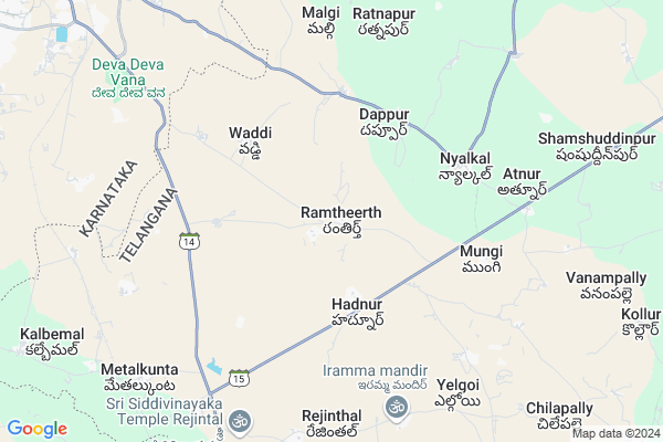
Ibrahimpur Map
EDIT Map
Add Your House
 ..
..
Current Corona Virus Infected Patients Count in Medak District
| City Name | District Name | Total Covid cases |
|---|---|---|
| Sangareddy District | Sangareddy | 7 |
| Medak District | Medak | 5 |
Locality Name :
Ibrahimpur
( ఇబ్రహీంపూర్ )
Mandal Name : Nyalkal
District : Medak
State : Telangana
Region : Telangana
Language : Telugu
Current Time 12:46 PM
Date: Monday , Apr 28,2025 (IST)
Time zone: IST (UTC+5:30)
Elevation / Altitude: 600 meters. Above Seal level
Telephone Code / Std Code: 08451
Assembly constituency : Zahirabad assembly constituency
Assembly MLA : Koninty Manik Rao
Lok Sabha constituency : Zahirabad parliamentary constituency
Parliament MP : B.B.PATIL
Serpanch Name :
Pin Code : 502256
Post Office Name : Nyalkal
Commodities Prices : Bidar Market / Mandi
National Highways Reachable To Ibrahimpur
Nationa High Way :NH65
Nationa High Way :Old NH9
Nationa High Way :NH65
Nationa High Way :Old NH9
Rivers Near Ibrahimpur
Manjira :Manjira :मांजरा :ಮಂಜೀರ :मांजरा :మంజీర
Mullamari :ಮುಲ್ಲಾಮಾರಿ
Manjira :Manjira :मांजरा :ಮಂಜೀರ :मांजरा :మంజీర
Mullamari :ಮುಲ್ಲಾಮಾರಿ
About Ibrahimpur
Correct below Info and add more info about IbrahimpurIbrahimpur is a Village in Nyalkal Mandal in Medak District of Telangana State, India. It belongs to Telangana region . As part Telangana Districts re-organisation , Ibrahimpur Village Nyalkal Mandal re organised from Medak District to Sangareddy district. It is located 63 KM towards west from District head quarters Sangareddi.
Ibrahimpur Pin code is 502256 and postal head office is Nyalkal .
Ibrahimpur is surrounded by Jharasangam Mandal towards East , Raikode Mandal towards East , Bidar Mandal towards west , Zahirabad Mandal towards South .
Bidar , Zahirabad , Sadasivpet , Sangareddy are the near by Cities to Ibrahimpur.
This Place is in the border of the Medak District and Bidar District. Bidar District Bidar is west towards this place . It is near to the Karnataka State Border.
Ibrahimpur 2011 Census Details
Ibrahimpur Local Language is Telugu. Ibrahimpur Village Total population is 1223 and number of houses are 224. Female Population is 51.5%. Village literacy rate is 44.6% and the Female Literacy rate is 19.1%.
Population
| Census Parameter | Census Data |
| Total Population | 1223 |
| Total No of Houses | 224 |
| Female Population % | 51.5 % ( 630) |
| Total Literacy rate % | 44.6 % ( 546) |
| Female Literacy rate | 19.1 % ( 233) |
| Scheduled Tribes Population % | 0.0 % ( 0) |
| Scheduled Caste Population % | 46.2 % ( 565) |
| Working Population % | 50.4 % |
| Child(0 -6) Population by 2011 | 145 |
| Girl Child(0 -6) Population % by 2011 | 54.5 % ( 79) |
Ibrahimpur Census More Deatils.
Politics in Ibrahimpur
TDP , TRS , INC are the major political parties in this area.Polling Stations /Booths near Ibrahimpur
1)Rajola2)Sedegutta Tanda
3)Gudpally
4)Gurjuwada
5)Hadnoor
HOW TO REACH Ibrahimpur
By Road
Bidar is the Nearest Town to Ibrahimpur. Bidar is 25 km from Ibrahimpur. Road connectivity is there from Bidar to Ibrahimpur.By Rail
Matalkunta Rail Way Station is the very nearby railway stations to Ibrahimpur. Also you can consider railway Stations from Near By town Bidar. Bidar Rail Way Station are the railway Stations near to Bidar. You can reach from Bidar to Ibrahimpur by road after .Colleges near Ibrahimpur
Governament Junior College Hadnoor
Address :
Schools in Ibrahimpur
Mpps Ibrahimpur
Address : ibrahimpur , nyalkal , medak , Andhra Pradesh . PIN- 502256 , Post - Nyalkal
Govt Health Centers near Ibrahimpur
1) SubCentre Hadnoor , , SCHOOL ROAD , OPP GOVT SCHOOL2) SubCentre Dappur , Apr-74 , SC Colony , Ambedakar Stacho
3) SubCentre Chalki , , Opp School , Chalki
Sub Villages in Ibrahimpur
Colleges in Ibrahimpur,Nyalkal
Osmania University PG COLLEGE
Near Jairabad; Mirzapur; Telangana 502249; India
10.4 KM distance Detail
more ..
Electronic Shops in Ibrahimpur,Nyalkal
jagannath hard ware & electric
Nizampet - Bidar Rd; Nyalkal; Telangana 502251; India
6.6 KM distance Detail
Tyre Puncer Centre; Naseeb Tyre Works; Tube Less Puncher Available
Gangaram; Telangana 502249; India
8.2 KM distance Detail
Super Markets in Ibrahimpur,Nyalkal
Vegetables and Fruits Wholesale Market Of Bidar
near hanuman temple; Hyderabad Road; Bidar; Karnataka 585401; India
13.6 KM distance Detail
Governement Offices near Ibrahimpur,Nyalkal
MeeSeva Center
1-57; ; ; Hadnoor; Hadnoor(V); Nyalkal(M); Medak(D);502251; Hadnoor; Telangana 502251; India
3.6 KM distance Detail
MEESEVA CENTRE
D.No 1-72/1; Sks Services; Basawesheara Colany; Near Hanuman Mandir; Nyalkal(V); Nyalkal(M); Medak(D);502256; Telangana 502256; India
5.6 KM distance Detail
About Ibrahimpur &
History
How to reach Ibrahimpur
Tourist Places Near By Ibrahimpur
Schools in Ibrahimpur
Colleges in Ibrahimpur
Temperature & weather of Ibrahimpur
places in Ibrahimpur
Ibrahimpur photos
More Information
How to reach Ibrahimpur
Tourist Places Near By Ibrahimpur
Schools in Ibrahimpur
Colleges in Ibrahimpur
Temperature & weather of Ibrahimpur
places in Ibrahimpur
Ibrahimpur photos
More Information
Village Talk
Post News or Events about this Village
Near Cities
Bidar 15 KM near
Zahirabad 18 KM near
Sadasivpet 47 KM near
Sangareddy 64 KM near
Bidar 15 KM near
Zahirabad 18 KM near
Sadasivpet 47 KM near
Sangareddy 64 KM near
Near By Taluks
Nyalkal 0 KM near
Jharasangam 15 KM near
Bidar 18 KM near
Raikode 18 KM near
Nyalkal 0 KM near
Jharasangam 15 KM near
Bidar 18 KM near
Raikode 18 KM near
Near By Air Ports
Rajiv Gandhi International Airport 120 KM near
Latur Airport 154 KM near
Nanded Airport 172 KM near
Sholapur Airport 201 KM near
Rajiv Gandhi International Airport 120 KM near
Latur Airport 154 KM near
Nanded Airport 172 KM near
Sholapur Airport 201 KM near
Near By Tourist Places
Bidar 12 KM near
Medak 81 KM near
Gulbarga 112 KM near
Hyderabad 116 KM near
Tuljapur 185 KM near
Bidar 12 KM near
Medak 81 KM near
Gulbarga 112 KM near
Hyderabad 116 KM near
Tuljapur 185 KM near
Near By Districts
Bidar 15 KM near
Medak 60 KM near
Rangareddi 89 KM near
Gulbarga 111 KM near
Bidar 15 KM near
Medak 60 KM near
Rangareddi 89 KM near
Gulbarga 111 KM near
Near By RailWay Station
Bidar Rail Way Station 16 KM near
Zahirabad Rail Way Station 19 KM near
Bidar Rail Way Station 16 KM near
Zahirabad Rail Way Station 19 KM near