| Home | City Bus | Maps | Villages | Cities | Rail | Tourist Places | School | College | Pin Codes | Corona Cases Count |
| Distance Calculator Bus Services IFSC Codes Trace Mobile Number Weather Search Place Trace IP Available Cash ATM/Banks Locate Polling Booth Report an Error contact People |
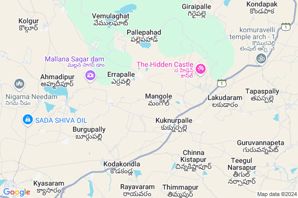
Mangole Map
EDIT Map
Add Your House
 ..
..
Current Corona Virus Infected Patients Count in Medak District
| City Name | District Name | Total Covid cases |
|---|---|---|
| Sangareddy District | Sangareddy | 7 |
| Medak District | Medak | 5 |
Locality Name :
Mangole
( మంగోల్ )
Mandal Name : Kondapak
District : Medak
State : Telangana
Region : Telangana
Language : Telugu
Current Time 05:41 PM
Date: Monday , Apr 28,2025 (IST)
Time zone: IST (UTC+5:30)
Elevation / Altitude: 547 meters. Above Seal level
Telephone Code / Std Code: 08710
Assembly constituency : Gajwel assembly constituency
Assembly MLA : Kalvakuntla Chandrashekar Rao
Lok Sabha constituency : Medak parliamentary constituency
Parliament MP : Kotha Prabhakar Reddy
Serpanch Name :
Pin Code : 502301
Post Office Name : Kuknoorpally
Commodities Prices : Cherial Market / Mandi
Edit below overview about Mangole
Edit below overview about Mangole
OverView of Mangole
Mangole happens to be the one of the first indian village from where one of the first women sarpanch was elected in the first panchayath elections, Her name was mrs zaheerunnisa begum.Edit below overview about Mangole
National Highways Reachable To Mangole
Nationa High Way :Old NH7
Nationa High Way :NH163
Nationa High Way :Old NH7
Nationa High Way :NH163
Rivers Near Mangole
Manjira :Manjira :मांजरा :ಮಂಜೀರ :मांजरा :మంజీర
Haldi
Manjira :Manjira :मांजरा :ಮಂಜೀರ :मांजरा :మంజీర
Haldi
About Mangole
Mangole is a Village in Kondapak Mandal in Medak District of Telangana State, India. It belongs to Telangana region . As part Telangana Districts re-organisation , Mangole Village Kondapak Mandal re organised from Medak District to Siddipet district. It is located 94 KM towards East from District head quarters Sangareddi. 11 KM from Kondapak.
Mangole Pin code is 502301 and postal head office is Kuknoorpally .
Medinipur ( 3 KM ) , Thipparam ( 3 KM ) , Pallepahad ( 5 KM ) , Chinna Kistapur ( 6 KM ) , Vemulaghat ( 6 KM ) are the nearby Villages to Mangole. Mangole is surrounded by Gajwel Mandal towards west , Jagdevpur Mandal towards South , Thoguta Mandal towards North , Cheriyal Mandal towards East .
Siddipet , Jangaon , Bhongir , Sircilla are the near by Cities to Mangole.
This Place is in the border of the Medak District and Warangal District. Warangal District Cheriyal is East towards this place .
Mangole 2011 Census Details
Mangole Local Language is Telugu. Mangole Village Total population is 2008 and number of houses are 470. Female Population is 51.8%. Village literacy rate is 48.7% and the Female Literacy rate is 20.9%.
Population
| Census Parameter | Census Data |
| Total Population | 2008 |
| Total No of Houses | 470 |
| Female Population % | 51.8 % ( 1040) |
| Total Literacy rate % | 48.7 % ( 977) |
| Female Literacy rate | 20.9 % ( 419) |
| Scheduled Tribes Population % | 0.2 % ( 5) |
| Scheduled Caste Population % | 17.4 % ( 349) |
| Working Population % | 50.7 % |
| Child(0 -6) Population by 2011 | 220 |
| Girl Child(0 -6) Population % by 2011 | 52.3 % ( 115) |
Mangole Census More Deatils.
Politics in Mangole
TDP , TRS , INC are the major political parties in this area.Polling Stations /Booths near Mangole
1)Mamidyala2)Yerrapally
3)Komatibanda
4)Mathpally
5)Meenajipeta
HOW TO REACH Mangole
By Road
Siddipet is the Nearest Town to Mangole. Siddipet is 30 km from Mangole. Road connectivity is there from Siddipet to Mangole.By Rail
There is no railway station near to Mangole in less than 10 km.Colleges near Mangole
Govt Jr College Kondapaka
Address : Govt Jr College Kondapaka
Medak College Of Engineering & Technology
Address : Kondapak, Siddipet, Medak Dist., - 502732
Sri Krupa Institute Of Pharmaceutical Sci.
Address : , Velkatta, Kondapak, Siddipet Division, Medak Dis
Schools in Mangole
Zphs Mangole
Address : mangole , kondapak , medak , Andhra Pradesh . PIN- 502301 , Post - Kuknoorpally
Govt Health Centers near Mangole
1) SubCentre Mangole , 2-38/1 , Near GP , Near GP2) Sub Centre Medinipur , 1-100 , Near GP , Near GP
3) SubCentre Thipparam , 2/10/2001 , Near GP , Near GP
Hospitals in Mangole,Kondapak
Krishna Sai Medical & General Stores
# 4-52; Gandhi Street; Kukunoorpally; Hyderabad; Telangana 502301; India
2.1 KM distance Detail
Sai Hiranya Hospital Dr Nani
Kukunoorpally - Thoguta Rd; Erravally; Telangana 502301; India
2.2 KM distance Detail
more ..
Petrol Bunks in Mangole,Kondapak
Jai Raj Filling Station Indian Oil Petrol Pump
Kukunoorpally; Medak; SH-1; Karimnagar Hyderabad; Kondapaka; Kondapaka; Telangana 502301; India
3.7 KM distance Detail
Shri Vidya Filling Station
# SH1; Siddipet Road; Rimmanguda; Hyderabad; Telangana 502311; India
8.8 KM distance Detail
Sri Datta Filling Station
Gajwel/Siddipet Road; Medak District; Ahamedipuram; Telangana 502278; India
9.3 KM distance Detail
more ..
Colleges in Mangole,Kondapak
Procadance Institute Of pharmaceutical Sciences
Kyasaram; Telangana 502311; India
10.8 KM distance Detail
BMR College
Rimmanaguda; Medak; SH-1; Karimnagar Hyderabad; Gajwel; Gajwel; Telangana 502312; India
11.7 KM distance Detail
more ..
Schools in Mangole,Kondapak
ZP High School(ZPHS) Model Building Erravally
Erravally; Telangana 502301; India
2.5 KM distance Detail
Super Markets in Mangole,Kondapak
Sri Food Mart
3-23; Gajwel - Pregnapur Rd; Pregnapur; Telangana 502278; India
13.8 KM distance Detail
Local Parks in Mangole,Kondapak
Kola Anjaneyulu Gardens
Hyderabad Ramagundam Road; beside petrol pump; Telangana 502301; India
3.6 KM distance Detail
Governement Offices near Mangole,Kondapak
Grama Panchayathi Kukunoorpally;Kondapak;Siddipet
Kukunoorpally; siddipet SH-1; Kondapaka Kondapaka; Telangana 502301; Karimnagar - Hyderabad Hwy; Telangana; India
3.3 KM distance Detail
Village Revenue Office
Kukunoorpally; Medak; SH-1; Karimnagar Hyderabad; Kondapaka; Kondapaka; Telangana 502301; India
3.3 KM distance Detail
MeeSeva Center
4-97/3; Venkateshwara Online Centre; Kukunoor Pally; Main Road; Kukunoorpally(V); Kondapak(M); Medak(D);502301; SH1; Telangana 502301; India
3.3 KM distance Detail
About Mangole &
History
How to reach Mangole
Tourist Places Near By Mangole
Schools in Mangole
Colleges in Mangole
Temperature & weather of Mangole
places in Mangole
Mangole photos
More Information
How to reach Mangole
Tourist Places Near By Mangole
Schools in Mangole
Colleges in Mangole
Temperature & weather of Mangole
places in Mangole
Mangole photos
More Information
Village Talk
Post News or Events about this Village
Near Cities
Siddipet 26 KM near
Jangaon 51 KM near
Bhongir 52 KM near
Sircilla 60 KM near
Siddipet 26 KM near
Jangaon 51 KM near
Bhongir 52 KM near
Sircilla 60 KM near
Near By Taluks
Gajwel 10 KM near
Kondapak 11 KM near
Jagdevpur 12 KM near
Thoguta 14 KM near
Gajwel 10 KM near
Kondapak 11 KM near
Jagdevpur 12 KM near
Thoguta 14 KM near
Near By Air Ports
Rajiv Gandhi International Airport 93 KM near
Nanded Airport 234 KM near
Latur Airport 280 KM near
Vijayawada Airport 295 KM near
Rajiv Gandhi International Airport 93 KM near
Nanded Airport 234 KM near
Latur Airport 280 KM near
Vijayawada Airport 295 KM near
Near By Tourist Places
Medak 63 KM near
Hyderabad 74 KM near
Warangal 98 KM near
Bidar 145 KM near
Nagarjunsagar 178 KM near
Medak 63 KM near
Hyderabad 74 KM near
Warangal 98 KM near
Bidar 145 KM near
Nagarjunsagar 178 KM near
Near By Districts
Hyderabad 69 KM near
Karimnagar 77 KM near
Medak 89 KM near
Warangal 95 KM near
Hyderabad 69 KM near
Karimnagar 77 KM near
Medak 89 KM near
Warangal 95 KM near
Near By RailWay Station
Aler Rail Way Station 45 KM near
Medchal Rail Way Station 49 KM near
Aler Rail Way Station 45 KM near
Medchal Rail Way Station 49 KM near