| Home | City Bus | Maps | Villages | Cities | Rail | Tourist Places | School | College | Pin Codes | Corona Cases Count |
| Distance Calculator Bus Services IFSC Codes Trace Mobile Number Weather Search Place Trace IP Available Cash ATM/Banks Locate Polling Booth Report an Error contact People |
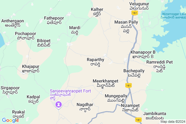
Raparthy Map
EDIT Map
Add Your House
 ..
..
Current Corona Virus Infected Patients Count in Medak District
| City Name | District Name | Total Covid cases |
|---|---|---|
| Sangareddy District | Sangareddy | 7 |
| Medak District | Medak | 5 |
Locality Name :
Raparthy
( రాపర్తి )
Mandal Name : Kalher
District : Medak
State : Telangana
Region : Telangana
Language : Telugu
Current Time 09:39 AM
Date: Thursday , Apr 24,2025 (IST)
Time zone: IST (UTC+5:30)
Elevation / Altitude: 375 meters. Above Seal level
Telephone Code / Std Code: 08465
Assembly constituency : Narayankhed assembly constituency
Assembly MLA : Patlolla Sanjeeva Reddy
Lok Sabha constituency : Zahirabad parliamentary constituency
Parliament MP : B.B.PATIL
Serpanch Name :
Pin Code : 502371
Post Office Name : Nizampet (Sangareddy)
Alternate Village Name : Raparthi
Commodities Prices : Pitlam Market / Mandi
Rivers Near Raparthy
Manjira :Manjira :मांजरा :ಮಂಜೀರ :मांजरा :మంజీర
Haldi
Manjira :Manjira :मांजरा :ಮಂಜೀರ :मांजरा :మంజీర
Haldi
About Raparthy
Correct below Info and add more info about RaparthyRaparthy is a Village in Kalher Mandal in Medak District of Telangana State, India. It belongs to Telangana region . As part Telangana Districts re-organisation , Raparthy Village Kalher Mandal re organised from Medak District to Sangareddy district. It is located 73 KM towards North from District head quarters Sangareddi. 2 KM from Kalher.
Raparthy Pin code is 502371 and postal head office is Nizampet (Sangareddy).
Bachepalle ( 5 KM ) , Nagdhar ( 6 KM ) , Kalher ( 6 KM ) , Mungepalle ( 6 KM ) , Bibipet ( 7 KM ) are the nearby Villages to Raparthy. Raparthy is surrounded by Shankarampet[A] Mandal towards South , Narayankhed Mandal towards South , Pitlam Mandal towards North , Nizamsagar Mandal towards North .
Bidar , Medak , Zahirabad , Kamareddy are the near by Cities to Raparthy.
This Place is in the border of the Medak District and Nizamabad District. Nizamabad District Pitlam is North towards this place .
Raparthy 2011 Census Details
Raparthy Local Language is Telugu. Raparthy Village Total population is 1677 and number of houses are 341. Female Population is 51.3%. Village literacy rate is 46.6% and the Female Literacy rate is 18.2%.
Population
| Census Parameter | Census Data |
| Total Population | 1677 |
| Total No of Houses | 341 |
| Female Population % | 51.3 % ( 860) |
| Total Literacy rate % | 46.6 % ( 782) |
| Female Literacy rate | 18.2 % ( 305) |
| Scheduled Tribes Population % | 0.0 % ( 0) |
| Scheduled Caste Population % | 17.5 % ( 293) |
| Working Population % | 54.6 % |
| Child(0 -6) Population by 2011 | 184 |
| Girl Child(0 -6) Population % by 2011 | 47.8 % ( 88) |
Raparthy Census More Deatils.
Politics in Raparthy
TRS , Patlolla Sanjeeva Reddy are the major political parties in this area.Polling Stations /Booths near Raparthy
1)Mandala Parishat Primary School Bahcepally2)Mpps Rana Pur
3)Mandala Parishad Primary School Wasar
4)Zpps Narayankhed
5)Mandala Parishat Pramary School Sardhar Tanda
HOW TO REACH Raparthy
By Road
Zahirabad is the Nearest Town to Raparthy. Zahirabad is 90 km from Raparthy. Road connectivity is there from Zahirabad to Raparthy.By Rail
There is no railway station near to Raparthy in less than 10 km. How ever there are railway Stations from Near By town Zahirabad. are the railway Stations near to Zahirabad. You can reach from Zahirabad to Raparthy by road after .Colleges near Raparthy
Tara Govt Degree And Pg College
Address :
J N T U, Sultanpur
Address :
Governament Junior College Hadnoor
Address :
Govt.junior College,siddipet
Address :
Government Polytechnic College
Address :
Schools in Raparthy
Mpups Raparthy
Address : raparthy , kalher , medak , Andhra Pradesh . PIN- 502371 , Post - Nizampet (Sangareddy)
Govt Health Centers near Raparthy
1) SubCenter Bache Pally , , Bachepally , G.P.Bulding2) SubCentre Krishnapoor , , Krishnapoor , G.P.Bulding
3) SubCentre Sultanabad , , nallavagu , OPP TSRS HOSTEL
Sub Villages in Raparthy
Local Parks in Raparthy,Kalher
Governement Offices near Raparthy,Kalher
MeeSeva Center
Koudinya Services; Main Road; Opp Bus Stand; Bache Pally(V); Kalher(M);; 3-70; SNA Rd; Telangana 502371; India
4.6 KM distance Detail
MeeSeva Center
Pranathi Xerox; Main Road; Zphs Kalher; 40/1; Kalher; Telangana 502371; India
7.0 KM distance Detail
Grama Panchayathi Vil: Mardi; Mdl: Kalher; Dist Medak.
Mardi; Telangana 502287; India
7.3 KM distance Detail
About Raparthy &
History
How to reach Raparthy
Tourist Places Near By Raparthy
Schools in Raparthy
Colleges in Raparthy
Temperature & weather of Raparthy
places in Raparthy
Raparthy photos
More Information
How to reach Raparthy
Tourist Places Near By Raparthy
Schools in Raparthy
Colleges in Raparthy
Temperature & weather of Raparthy
places in Raparthy
Raparthy photos
More Information
Village Talk
Post News or Events about this Village
Near Cities
Bidar 46 KM near
Medak 51 KM near
Zahirabad 62 KM near
Kamareddy 62 KM near
Bidar 46 KM near
Medak 51 KM near
Zahirabad 62 KM near
Kamareddy 62 KM near
Near By Taluks
Kalher 2 KM near
Narayankhed 14 KM near
Shankarampet[A] 14 KM near
Pitlam 15 KM near
Kalher 2 KM near
Narayankhed 14 KM near
Shankarampet[A] 14 KM near
Pitlam 15 KM near
Near By Air Ports
Rajiv Gandhi International Airport 132 KM near
Nanded Airport 143 KM near
Latur Airport 165 KM near
Sholapur Airport 234 KM near
Rajiv Gandhi International Airport 132 KM near
Nanded Airport 143 KM near
Latur Airport 165 KM near
Sholapur Airport 234 KM near
Near By Tourist Places
Bidar 45 KM near
Medak 51 KM near
Hyderabad 121 KM near
Gulbarga 156 KM near
Warangal 210 KM near
Bidar 45 KM near
Medak 51 KM near
Hyderabad 121 KM near
Gulbarga 156 KM near
Warangal 210 KM near
Near By Districts
Bidar 46 KM near
Medak 70 KM near
Nizamabad 72 KM near
Rangareddi 111 KM near
Bidar 46 KM near
Medak 70 KM near
Nizamabad 72 KM near
Rangareddi 111 KM near
Near By RailWay Station
Bidar Rail Way Station 47 KM near
Kamareddi Rail Way Station 63 KM near
Bidar Rail Way Station 47 KM near
Kamareddi Rail Way Station 63 KM near