| Home | City Bus | Maps | Villages | Cities | Rail | Tourist Places | School | College | Pin Codes | Corona Cases Count |
| Distance Calculator Bus Services IFSC Codes Trace Mobile Number Weather Search Place Trace IP Available Cash ATM/Banks Locate Polling Booth Report an Error contact People |
Ramchandrapur
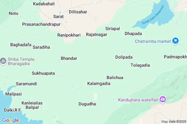
Ramchandrapur Map
EDIT Map
Add Your House
 ..
..
Current Corona Virus Infected Patients Count in Mayurbhanj District
| City Name | District Name | Total Covid cases |
|---|
Locality Name :
Ramchandrapur
( ରାମଚନ୍ଦ୍ରପୁର )
Tehsil Name : Kaptipada
District : Mayurbhanj
State : Odisha
Language : Oriya and Hindi
Current Time 12:39 PM
Date: Friday , Mar 14,2025 (IST)
Time zone: IST (UTC+5:30)
Elevation / Altitude: 14 meters. Above Seal level
Telephone Code / Std Code: 06795
Assembly constituency : Karanjia assembly constituency
Assembly MLA : bijay kumar naik
Lok Sabha constituency : Keonjhar parliamentary constituency
Parliament MP : Chandrani Murmu
Serpanch Name :
Commodities Prices : Udala Market / Mandi
Ramchandrapur Live Weather
Temperature: 40.5 °C
clear sky
Humidity: 11%
Wind : 3.7 mt/sec towards SW
StationName : "Soro"
observed on Now
Temperature: 40.5 °C
clear sky
Humidity: 11%
Wind : 3.7 mt/sec towards SW
StationName : "Soro"
observed on Now
Ramchandrapur Weather Forecast for Next 5 days
15-03-2025
22.0°C to 41.1°C
clear sky
22.0°C to 41.1°C
clear sky
16-03-2025
21.7°C to 42.2°C
clear sky
21.7°C to 42.2°C
clear sky
17-03-2025
21.8°C to 41.8°C
clear sky, scattered clouds, few clouds
21.8°C to 41.8°C
clear sky, scattered clouds, few clouds
18-03-2025
22.4°C to 41.3°C
clear sky, few clouds, scattered clouds, broken clouds
22.4°C to 41.3°C
clear sky, few clouds, scattered clouds, broken clouds
19-03-2025
23.6°C to 42.4°C
scattered clouds, few clouds, clear sky
23.6°C to 42.4°C
scattered clouds, few clouds, clear sky
National Highways Reachable To Ramchandrapur
Nationa High Way :NH16
Nationa High Way :NH18
Nationa High Way :NH16
Nationa High Way :NH18
Rivers Near Ramchandrapur
Swarnarekha :Subarnarekha River
Gonda
Swarnarekha :Subarnarekha River
Gonda
About Ramchandrapur
Correct below Info and add more info about RamchandrapurRamchandrapur is a Village in Kaptipada Tehsil in Mayurbhanj District of Odisha State, India. It is located 81 KM towards South from District head quarters Baripada. 20 KM from Kaptipada. 159 KM from State capital Bhubaneswar
Ranipokhari ( 4 KM ) , Sarat ( 7 KM ) , Dewanbahali ( 8 KM ) , Labanyadeipur ( 9 KM ) , Padmapokhari ( 11 KM ) are the nearby Villages to Ramchandrapur. Ramchandrapur is surrounded by Kaptipada Tehsil towards North , Oupada Tehsil towards East , Hatadihi Tehsil towards South , Thakurmunda Tehsil towards west .
Anandapur , Soro , Bhadrak , Basudebpur are the near by Cities to Ramchandrapur.
Ramchandrapur 2011 Census Details
Ramchandrapur Local Language is Oriya. Ramchandrapur Village Total population is 1383 and number of houses are 243. Female Population is 48.1%. Village literacy rate is 16.3% and the Female Literacy rate is 5.2%.
Population
| Census Parameter | Census Data |
| Total Population | 1383 |
| Total No of Houses | 243 |
| Female Population % | 48.1 % ( 665) |
| Total Literacy rate % | 16.3 % ( 225) |
| Female Literacy rate | 5.2 % ( 72) |
| Scheduled Tribes Population % | 99.5 % ( 1376) |
| Scheduled Caste Population % | 0.4 % ( 5) |
| Working Population % | 48.2 % |
| Child(0 -6) Population by 2011 | 385 |
| Girl Child(0 -6) Population % by 2011 | 48.3 % ( 186) |
Ramchandrapur Census More Deatils.
Politics in Ramchandrapur
BJD , is the major political party in this area.Polling Stations /Booths near Ramchandrapur
1)Digdhar Nodal Ups2)Raipal Ugmes
3)Ranipat Ps
4)Simigan Ps
5)Kalakada Pups
HOW TO REACH Ramchandrapur
By Rail
There is no railway station near to Ramchandrapur in less than 10 km.Pincodes near Ramchandrapur
757079 ( Sarat ) , 757106 ( Salchua ) , 756059 ( Kupari )Colleges near Ramchandrapur
Mahatma Gandhi Mahavidyalaya
Address :
Laxmikanta College
Address :
Angarapada College,raruan
Address :
Jb Collage
Address :
Maa Duarshani College .kuabuda
Address :
Schools near Ramchandrapur
Badsimilia Govt Girls Hs
Address : badsimilia , kaptipada , mayurbhanj , Sikkim . PIN- 757040 , Post - Kaptipada
Gopabandhu Bidyapitha
Address : siriapal , kaptipada , mayurbhanj , Sikkim . PIN- 757079 , Post - Sarat
Upendranath Hs
Address : padmapokhari , kaptipada , mayurbhanj , Sikkim . PIN- 757106 , Post - Salchua
Chakradharpur Hs
Address : chakradharpur , kaptipada , mayurbhanj , Sikkim . PIN- 757077 , Post - Nudadiha
Govt Health Centers near Ramchandrapur
1) SABARANGA , , , L.I CENTRE2) Sarasada SC , , , AFTER SARSADA HIGH SCHOOL,NATIONAL HIGHWAY 5 SIDE
3) Biruhan SC , Gadadhar Panda , Biruhan , Near Biruhan AWC
Hospitals in Ramchandrapur,Kaptipada
Kuradhighasa Maa Durga Stadium
.keonjher;; Kuradhighasa; Odisha 758078; India
18.4 KM distance Detail
more ..
Schools in Ramchandrapur,Kaptipada
Jawahar Navodaya Vidyalaya; Hadagarh;keonjhar
Hadagarh Dam; Odisha 758023; India
17.0 KM distance Detail
Governement Offices near Ramchandrapur,Kaptipada
About Ramchandrapur &
History
How to reach Ramchandrapur
Tourist Places Near By Ramchandrapur
Schools in Ramchandrapur
Colleges in Ramchandrapur
Temperature & weather of Ramchandrapur
places in Ramchandrapur
Ramchandrapur photos
More Information
How to reach Ramchandrapur
Tourist Places Near By Ramchandrapur
Schools in Ramchandrapur
Colleges in Ramchandrapur
Temperature & weather of Ramchandrapur
places in Ramchandrapur
Ramchandrapur photos
More Information
Village Talk
Post News or Events about this Village
Near Cities
Anandapur 35 KM near
Soro 37 KM near
Bhadrak 43 KM near
Basudebpur 52 KM near
Anandapur 35 KM near
Soro 37 KM near
Bhadrak 43 KM near
Basudebpur 52 KM near
Near By Taluks
Khaira 19 KM near
Kaptipada 19 KM near
Oupada 22 KM near
Hatadihi 31 KM near
Khaira 19 KM near
Kaptipada 19 KM near
Oupada 22 KM near
Hatadihi 31 KM near
Near By Air Ports
Bhubaneswar Airport 156 KM near
Ranchi Airport 269 KM near
Netaji Subhas Chandra Bose Airport 284 KM near
Gaya Airport 449 KM near
Bhubaneswar Airport 156 KM near
Ranchi Airport 269 KM near
Netaji Subhas Chandra Bose Airport 284 KM near
Gaya Airport 449 KM near
Near By Tourist Places
Barehipani & Joranda Barehipani & Joranda Falls 45 KM near
Chandipur 75 KM near
Baripada 79 KM near
Cuttack 129 KM near
Digha 135 KM near
Barehipani & Joranda Barehipani & Joranda Falls 45 KM near
Chandipur 75 KM near
Baripada 79 KM near
Cuttack 129 KM near
Digha 135 KM near
Near By Districts
Bhadrak 42 KM near
Baleshwar 61 KM near
Jajapur 67 KM near
Mayurbhanj 78 KM near
Bhadrak 42 KM near
Baleshwar 61 KM near
Jajapur 67 KM near
Mayurbhanj 78 KM near
Near By RailWay Station
Soro Rail Way Station 38 KM near
Bhadrak Rail Way Station 40 KM near
Soro Rail Way Station 38 KM near
Bhadrak Rail Way Station 40 KM near