| Home | City Bus | Maps | Villages | Cities | Rail | Tourist Places | School | College | Pin Codes | Corona Cases Count |
| Distance Calculator Bus Services IFSC Codes Trace Mobile Number Weather Search Place Trace IP Available Cash ATM/Banks Locate Polling Booth Report an Error contact People |
Notto
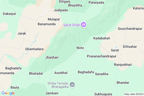
Notto Map
EDIT Map
Add Your House
 ..
..
Current Corona Virus Infected Patients Count in Mayurbhanj District
| City Name | District Name | Total Covid cases |
|---|
Locality Name :
Notto
( ନତତ୍ତ )
Tehsil Name : Kaptipada
District : Mayurbhanj
State : Odisha
Language : Oriya and Hindi
Current Time 11:40 AM
Date: Friday , Mar 14,2025 (IST)
Time zone: IST (UTC+5:30)
Elevation / Altitude: 14 meters. Above Seal level
Telephone Code / Std Code: 06795
Assembly constituency : Karanjia assembly constituency
Assembly MLA : bijay kumar naik
Lok Sabha constituency : Keonjhar parliamentary constituency
Parliament MP : Chandrani Murmu
Serpanch Name :
Pin Code : 757038
Post Office Name : Thakurmunda
Alternate Village Name : Noto
Commodities Prices : Anandapur Market / Mandi
Notto Live Weather
Temperature: 38.2 °C
few clouds
Humidity: 14%
Wind : 3.28 mt/sec towards SW
StationName : "Soro"
observed on Now
Temperature: 38.2 °C
few clouds
Humidity: 14%
Wind : 3.28 mt/sec towards SW
StationName : "Soro"
observed on Now
Notto Weather Forecast for Next 5 days
15-03-2025
21.1°C to 39.8°C
clear sky
21.1°C to 39.8°C
clear sky
16-03-2025
20.6°C to 40.6°C
clear sky
20.6°C to 40.6°C
clear sky
17-03-2025
20.7°C to 40.9°C
clear sky, scattered clouds, few clouds
20.7°C to 40.9°C
clear sky, scattered clouds, few clouds
18-03-2025
21.3°C to 41.0°C
clear sky, scattered clouds, overcast clouds, broken clouds
21.3°C to 41.0°C
clear sky, scattered clouds, overcast clouds, broken clouds
19-03-2025
22.0°C to 41.1°C
few clouds, clear sky, scattered clouds
22.0°C to 41.1°C
few clouds, clear sky, scattered clouds
National Highways Reachable To Notto
Nationa High Way :NH16
Nationa High Way :NH18
Nationa High Way :NH16
Nationa High Way :NH18
Rivers Near Notto
Swarnarekha :Subarnarekha River
Gonda
Swarnarekha :Subarnarekha River
Gonda
About Notto
Correct below Info and add more info about NottoNotto is a Village in Kaptipada Tehsil in Mayurbhanj District of Odisha State, India. It is located 84 KM towards South from District head quarters Baripada. 27 KM from Kaptipada. 161 KM from State capital Bhubaneswar
Notto Pin code is 757038 and postal head office is Thakurmunda .
Sarat ( 7 KM ) , Jarak ( 8 KM ) , Champajhar ( 9 KM ) , Ranipokhari ( 9 KM ) , Labanyadeipur ( 13 KM ) are the nearby Villages to Notto. Notto is surrounded by Kaptipada Tehsil towards East , Anandapur Tehsil towards South , Khaira Tehsil towards East , Hatadihi Tehsil towards South .
Anandapur , Soro , Karanjia , Bhadrak are the near by Cities to Notto.
Noto 2011 Census Details
Notto Local Language is Oriya. Noto Village Total population is 1705 and number of houses are 373. Female Population is 50.0%. Village literacy rate is 28.2% and the Female Literacy rate is 8.8%.
Population
| Census Parameter | Census Data |
| Total Population | 1705 |
| Total No of Houses | 373 |
| Female Population % | 50.0 % ( 852) |
| Total Literacy rate % | 28.2 % ( 481) |
| Female Literacy rate | 8.8 % ( 150) |
| Scheduled Tribes Population % | 78.8 % ( 1343) |
| Scheduled Caste Population % | 0.0 % ( 0) |
| Working Population % | 55.3 % |
| Child(0 -6) Population by 2011 | 352 |
| Girl Child(0 -6) Population % by 2011 | 48.9 % ( 172) |
Noto Census More Deatils.
Politics in Notto
BJD , is the major political party in this area.Polling Stations /Booths near Notto
1)Niunty Ugups2)Mituani Ps
3)Bharandia Nups
4)Panasapal Ps
5)Jhumukakudar Nups
HOW TO REACH Notto
By Rail
There is no railway station near to Notto in less than 10 km.Colleges near Notto
Mahatma Gandhi Mahavidyalaya
Address :
Laxmikanta College
Address :
Angarapada College,raruan
Address :
Jb Collage
Address :
Maa Duarshani College .kuabuda
Address :
Schools in Notto
Haladiasahi Pups
Address : noto , kaptipada , mayurbhanj , Sikkim . PIN- 757079 , Post - Sarat
Govt Health Centers near Notto
1) SABARANGA , , , L.I CENTRE2) Sarasada SC , , , AFTER SARSADA HIGH SCHOOL,NATIONAL HIGHWAY 5 SIDE
3) Kabatabandha SC , Upaswasthya kendra Kabatbandha , 44 , PHC N Campous
Hospitals in Notto,Kaptipada
Thakurmunda Hospital
hospital; Thakurmunda; Thakurmunda; Odisha 757038; India
18.5 KM distance Detail
more ..
Petrol Bunks in Notto,Kaptipada
Labanya kishan seva kendra (ksk)
Jarak - Thakurmunda Rd; Reliance Colony; Pandaposi; Odisha 757038; India
17.7 KM distance Detail
Basuli Filling Station
Thakurmunda SH -53; Thakurmunda; Odisha 757038; India
18.2 KM distance Detail
more ..
Colleges in Notto,Kaptipada
Maa Basuli Degree College
Thakurmunda - Udala Rd; Thakurmunda; Odisha 757038; India
16.9 KM distance Detail
more ..
About Notto &
History
How to reach Notto
Tourist Places Near By Notto
Schools in Notto
Colleges in Notto
Temperature & weather of Notto
places in Notto
Notto photos
More Information
How to reach Notto
Tourist Places Near By Notto
Schools in Notto
Colleges in Notto
Temperature & weather of Notto
places in Notto
Notto photos
More Information
Village Talk
Post News or Events about this Village
Near Cities
Anandapur 31 KM near
Soro 51 KM near
Karanjia 53 KM near
Bhadrak 53 KM near
Anandapur 31 KM near
Soro 51 KM near
Karanjia 53 KM near
Bhadrak 53 KM near
Near By Taluks
Thakurmunda 18 KM near
Kaptipada 26 KM near
Anandapur 27 KM near
Khaira 32 KM near
Thakurmunda 18 KM near
Kaptipada 26 KM near
Anandapur 27 KM near
Khaira 32 KM near
Near By Air Ports
Bhubaneswar Airport 157 KM near
Ranchi Airport 258 KM near
Netaji Subhas Chandra Bose Airport 290 KM near
Gaya Airport 439 KM near
Bhubaneswar Airport 157 KM near
Ranchi Airport 258 KM near
Netaji Subhas Chandra Bose Airport 290 KM near
Gaya Airport 439 KM near
Near By Tourist Places
Barehipani & Joranda Barehipani & Joranda Falls 39 KM near
Baripada 81 KM near
Chandipur 86 KM near
Cuttack 130 KM near
Nandan Kanan National Park 140 KM near
Barehipani & Joranda Barehipani & Joranda Falls 39 KM near
Baripada 81 KM near
Chandipur 86 KM near
Cuttack 130 KM near
Nandan Kanan National Park 140 KM near
Near By Districts
Bhadrak 52 KM near
Baleshwar 72 KM near
Jajapur 73 KM near
Mayurbhanj 80 KM near
Bhadrak 52 KM near
Baleshwar 72 KM near
Jajapur 73 KM near
Mayurbhanj 80 KM near
Near By RailWay Station
Soro Rail Way Station 51 KM near
Bhadrak Rail Way Station 51 KM near
Soro Rail Way Station 51 KM near
Bhadrak Rail Way Station 51 KM near