| Home | City Bus | Maps | Villages | Cities | Rail | Tourist Places | School | College | Pin Codes | Corona Cases Count |
| Distance Calculator Bus Services IFSC Codes Trace Mobile Number Weather Search Place Trace IP Available Cash ATM/Banks Locate Polling Booth Report an Error contact People |
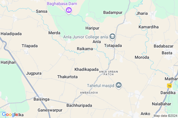
Rangada
Rangada Map
EDIT Map
Add Your House
 ..
..
Current Corona Virus Infected Patients Count in Mayurbhanj District
| City Name | District Name | Total Covid cases |
|---|
Locality Name :
Rangada
( ରଙ୍ଗଡ଼ )
Tehsil Name : Betnoti
District : Mayurbhanj
State : Odisha
Language : Oriya and Hindi
Current Time 01:59 PM
Date: Monday , Apr 28,2025 (IST)
Time zone: IST (UTC+5:30)
Elevation / Altitude: 51 meters. Above Seal level
Telephone Code / Std Code: 06793
Assembly constituency : Badasahi assembly constituency
Assembly MLA : ganeswar patra
Lok Sabha constituency : Balasore parliamentary constituency
Parliament MP : PRATAP CHANDRA SARANGI
Serpanch Name :
Pin Code : 757052
Post Office Name : Jugpura
Commodities Prices : Betnoti Market / Mandi
Rangada Live Weather
Temperature: 26.6 °C
clear sky
Humidity: 61%
Wind : 3.1 mt/sec towards SE
StationName : "Remuna"
observed on 2 Mins Back
Temperature: 26.6 °C
clear sky
Humidity: 61%
Wind : 3.1 mt/sec towards SE
StationName : "Remuna"
observed on 2 Mins Back
Rangada Weather Forecast for Next 5 days
29-04-2025
26.5°C to 30.3°C
moderate rain, light rain, scattered clouds, broken clouds
26.5°C to 30.3°C
moderate rain, light rain, scattered clouds, broken clouds
30-04-2025
22.8°C to 36.4°C
scattered clouds, clear sky, moderate rain, heavy intensity rain, overcast clouds, broken clouds, few clouds
22.8°C to 36.4°C
scattered clouds, clear sky, moderate rain, heavy intensity rain, overcast clouds, broken clouds, few clouds
01-05-2025
23.8°C to 34.3°C
clear sky, few clouds, heavy intensity rain, light rain, overcast clouds, scattered clouds
23.8°C to 34.3°C
clear sky, few clouds, heavy intensity rain, light rain, overcast clouds, scattered clouds
02-05-2025
21.5°C to 33.3°C
few clouds, clear sky, light rain, moderate rain, heavy intensity rain, overcast clouds
21.5°C to 33.3°C
few clouds, clear sky, light rain, moderate rain, heavy intensity rain, overcast clouds
03-05-2025
23.1°C to 33.7°C
broken clouds, clear sky, scattered clouds, overcast clouds
23.1°C to 33.7°C
broken clouds, clear sky, scattered clouds, overcast clouds
National Highways Reachable To Rangada
Nationa High Way :NH16
Nationa High Way :NH116B;SH4
Nationa High Way :NH16
Nationa High Way :NH116B;SH4
Rivers Near Rangada
Budhabalanga
Subarnarekha River
Budhabalanga
Subarnarekha River
About Rangada
Correct below Info and add more info about RangadaRangada is a small Village/hamlet in Betnoti Tehsil in Mayurbhanj District of Odisha State, India. It is located 42 KM towards South from District head quarters Baripada. 9 KM from Betnoti. 230 KM from State capital Bhubaneswar
Rangada Pin code is 757052 and postal head office is Jugpura .
Durgapur ( 3 KM ) , Totapada ( 3 KM ) , Raghabpur ( 5 KM ) , Chanchhipada ( 5 KM ) , Merda ( 5 KM ) are the nearby Villages to Rangada. Rangada is surrounded by Rasgovindpur Tehsil towards North , Basta Tehsil towards East , Baleshwar Tehsil towards South , Morada Tehsil towards North .
Balasore , Baleshwar , Jaleswar , Baripada are the near by Cities to Rangada.
Rangada 2011 Census Details
Rangada Local Language is Oriya. Rangada Village Total population is 524 and number of houses are 126. Female Population is 50.4%. Village literacy rate is 59.9% and the Female Literacy rate is 25.6%.
Population
| Census Parameter | Census Data |
| Total Population | 524 |
| Total No of Houses | 126 |
| Female Population % | 50.4 % ( 264) |
| Total Literacy rate % | 59.9 % ( 314) |
| Female Literacy rate | 25.6 % ( 134) |
| Scheduled Tribes Population % | 38.9 % ( 204) |
| Scheduled Caste Population % | 0.0 % ( 0) |
| Working Population % | 49.2 % |
| Child(0 -6) Population by 2011 | 62 |
| Girl Child(0 -6) Population % by 2011 | 64.5 % ( 40) |
Rangada Census More Deatils.
Politics in Rangada
BJD is the major political party in this area.Polling Stations /Booths near Rangada
1)Beguniabani Ps2)Barttana Ps
3)Raghupur Ps
4)Purunapani P.s
5)Purunapani Ps
HOW TO REACH Rangada
By Rail
Thakurtota Rail Way Station , Jugpura Rail Way Station are the very nearby railway stations to Rangada.Colleges near Rangada
Mahatma Gandhi Mahavidyalaya
Address :
Indic Institute Of Design & Research, Bhubaneswar
Address : Khurda, Orissapin - 752055
Schools near Rangada
Govt (ssd) Girls Hs
Address : s.s.nahandasole , betnoti , mayurbhanj , Sikkim . PIN- 757100 , Post - Bahanada Sathilo
C.t. Girls Hs
Address : khuntapur , betnoti , mayurbhanj , Sikkim . PIN- 757028 , Post - Baisinga
Sathilo Hs
Address : sathilo , betnoti , mayurbhanj , Sikkim . PIN- 757100 , Post - Bahanada Sathilo
Dinabandhu Hs
Address : ambagadia , betnoti , mayurbhanj , Sikkim . PIN- 756028 , Post - Rupsa
Govt Health Centers near Rangada
1) Sunhat OH , Sunhat OH , Sunhat , Near SBI ATM2) SABARANGA , , , L.I CENTRE
3) JAMUKESWAR , Jamukeswar CHC , Jamukeswar , Near Shiva Temple
Hospitals in Rangada,Betnoti
Totapada Primary Health Centre
Anla Urban Patch; Totapada; Odisha 757052; India
4.4 KM distance Detail
more ..
Petrol Bunks in Rangada,Betnoti
Indian Oil Petrol Pump
Mayurbhanj; Mayurbhanj; NH-5; Baharagora Chennai Highway; Baripada; Baripada; Odisha 757028; India
10.3 KM distance Detail
more ..
Colleges in Rangada,Betnoti
Anla Junior College
Haripur; Anla Urban Patch; Sanajahata; Odisha 757052; India
4.2 KM distance Detail
Priyansi Radhe +2 Science Residential College
Nachhipuria; Odisha 757028; India
8.3 KM distance Detail
more ..
Schools in Rangada,Betnoti
Raghunath High School;Raikama
Raghunath High School; Raikama; Baisinga; Odisha 757052; India
1.6 KM distance Detail
KHADIKAPADA U.G.M.E. SCHOOL
Anla Urban Patch; Khadikapada; Odisha 757052; India
2.7 KM distance Detail
Electronic Shops in Rangada,Betnoti
Laxmi Communication; Rathasahi; Totapada
Anla Urban Patch; Totapada; Odisha 757052; India
4.0 KM distance Detail
About Rangada &
History
How to reach Rangada
Tourist Places Near By Rangada
Schools in Rangada
Colleges in Rangada
Temperature & weather of Rangada
places in Rangada
Rangada photos
More Information
How to reach Rangada
Tourist Places Near By Rangada
Schools in Rangada
Colleges in Rangada
Temperature & weather of Rangada
places in Rangada
Rangada photos
More Information
Village Talk
Post News or Events about this Village
Near Cities
Balasore 25 KM near
Baleshwar 25 KM near
Jaleswar 33 KM near
Baripada 41 KM near
Balasore 25 KM near
Baleshwar 25 KM near
Jaleswar 33 KM near
Baripada 41 KM near
Near By Taluks
Betnoti 8 KM near
Rasgovindpur 14 KM near
Basta 19 KM near
Baleshwar 20 KM near
Betnoti 8 KM near
Rasgovindpur 14 KM near
Basta 19 KM near
Baleshwar 20 KM near
Near By Air Ports
Netaji Subhas Chandra Bose Airport 207 KM near
Bhubaneswar Airport 223 KM near
Ranchi Airport 277 KM near
Gaya Airport 445 KM near
Netaji Subhas Chandra Bose Airport 207 KM near
Bhubaneswar Airport 223 KM near
Ranchi Airport 277 KM near
Gaya Airport 445 KM near
Near By Tourist Places
Chandipur 30 KM near
Baripada 41 KM near
Digha 64 KM near
Mandarmani 67 KM near
Barehipani & Joranda Barehipani & Joranda Falls 74 KM near
Chandipur 30 KM near
Baripada 41 KM near
Digha 64 KM near
Mandarmani 67 KM near
Barehipani & Joranda Barehipani & Joranda Falls 74 KM near
Near By Districts
Baleshwar 25 KM near
Mayurbhanj 40 KM near
Bhadrak 94 KM near
Medinipur West 99 KM near
Baleshwar 25 KM near
Mayurbhanj 40 KM near
Bhadrak 94 KM near
Medinipur West 99 KM near
Near By RailWay Station
Thakurtota Rail Way Station 4.9 KM near
Jugpura Rail Way Station 7.4 KM near
Nuagaon Mayurbhanj Road Rail Way Station 8.9 KM near
Rupsa Junction Rail Way Station 10 KM near
Basta Rail Way Station 10 KM near
Thakurtota Rail Way Station 4.9 KM near
Jugpura Rail Way Station 7.4 KM near
Nuagaon Mayurbhanj Road Rail Way Station 8.9 KM near
Rupsa Junction Rail Way Station 10 KM near
Basta Rail Way Station 10 KM near