| Home | City Bus | Maps | Villages | Cities | Rail | Tourist Places | School | College | Pin Codes | Corona Cases Count |
| Distance Calculator Bus Services IFSC Codes Trace Mobile Number Weather Search Place Trace IP Available Cash ATM/Banks Locate Polling Booth Report an Error contact People |
Ranasul
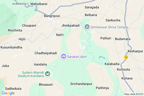
Ranasul Map
EDIT Map
Add Your House
 ..
..
Current Corona Virus Infected Patients Count in Mayurbhanj District
| City Name | District Name | Total Covid cases |
|---|
Locality Name :
Ranasul
( ରଣସ୍ୱଳ )
Tehsil Name : Bangriposi
District : Mayurbhanj
State : Odisha
Language : Oriya and Hindi
Current Time 08:26 PM
Date: Tuesday , Apr 29,2025 (IST)
Time zone: IST (UTC+5:30)
Elevation / Altitude: 50 meters. Above Seal level
Telephone Code / Std Code: 06792
Assembly constituency : Bangriposi assembly constituency
Assembly MLA : sudam marndi
Lok Sabha constituency : Mayurbhanj parliamentary constituency
Parliament MP : BISHWESWAR TUDU
Serpanch Name :
Pin Code : 757032
Post Office Name : Bangriposi
Commodities Prices : Saraskana Market / Mandi
Ranasul Live Weather
Temperature: 26.2 °C
few clouds
Humidity: 65%
Wind : 5.23 mt/sec towards SE
StationName : "BaripÄ\u0081da"
observed on 26 Mins Back
Temperature: 26.2 °C
few clouds
Humidity: 65%
Wind : 5.23 mt/sec towards SE
StationName : "BaripÄ\u0081da"
observed on 26 Mins Back
Ranasul Weather Forecast for Next 5 days
30-04-2025
23.9°C to 26.0°C
light rain, few clouds, scattered clouds
23.9°C to 26.0°C
light rain, few clouds, scattered clouds
01-05-2025
23.2°C to 36.8°C
few clouds, clear sky, light rain, broken clouds, scattered clouds
23.2°C to 36.8°C
few clouds, clear sky, light rain, broken clouds, scattered clouds
02-05-2025
22.9°C to 34.8°C
broken clouds, clear sky, moderate rain, heavy intensity rain, light rain, overcast clouds
22.9°C to 34.8°C
broken clouds, clear sky, moderate rain, heavy intensity rain, light rain, overcast clouds
03-05-2025
22.4°C to 35.1°C
scattered clouds, clear sky, light rain, overcast clouds
22.4°C to 35.1°C
scattered clouds, clear sky, light rain, overcast clouds
04-05-2025
23.5°C to 38.5°C
broken clouds, clear sky, few clouds, heavy intensity rain, scattered clouds
23.5°C to 38.5°C
broken clouds, clear sky, few clouds, heavy intensity rain, scattered clouds
National Highways Reachable To Ranasul
Nationa High Way :NH18;NH49
Nationa High Way :NH18
Nationa High Way :NH18;NH49
Nationa High Way :NH18
Rivers Near Ranasul
Budhabalanga
Swarnarekha :Subarnarekha River
Budhabalanga
Swarnarekha :Subarnarekha River
About Ranasul
Correct below Info and add more info about RanasulRanasul is a small Village/hamlet in Bangriposi Tehsil in Mayurbhanj District of Odisha State, India. It is located 31 KM towards North from District head quarters Baripada. 1 KM from Bangriposi. 255 KM from State capital Bhubaneswar
Ranasul Pin code is 757032 and postal head office is Bangriposi .
Asana ( 4 KM ) , Pathuri ( 6 KM ) , Brahmangan ( 6 KM ) , Chuapani ( 7 KM ) , Kalabadia ( 7 KM ) are the nearby Villages to Ranasul. Ranasul is surrounded by Kuliana Tehsil towards East , Saraskana Tehsil towards North , Samakhunta Tehsil towards South , Bisoi Tehsil towards west .
Baripada , Rairangpur , Musabani , Ghatshila are the near by Cities to Ranasul.
This Place is in the border of the Mayurbhanj District and Medinipur West District. Medinipur West District Gopiballavpur-i is East towards this place . It is near to the West Bengal State Border.
Ranasul 2011 Census Details
Ranasul Local Language is Oriya. Ranasul Village Total population is 607 and number of houses are 160. Female Population is 51.6%. Village literacy rate is 53.9% and the Female Literacy rate is 22.6%.
Population
| Census Parameter | Census Data |
| Total Population | 607 |
| Total No of Houses | 160 |
| Female Population % | 51.6 % ( 313) |
| Total Literacy rate % | 53.9 % ( 327) |
| Female Literacy rate | 22.6 % ( 137) |
| Scheduled Tribes Population % | 53.2 % ( 323) |
| Scheduled Caste Population % | 21.6 % ( 131) |
| Working Population % | 44.0 % |
| Child(0 -6) Population by 2011 | 80 |
| Girl Child(0 -6) Population % by 2011 | 53.8 % ( 43) |
Ranasul Census More Deatils.
Politics in Ranasul
BJD , is the major political party in this area.Polling Stations /Booths near Ranasul
1)Dasisol Ps2)Dhabanisole Ps(s)
3)Panisal Ps
4)Nabedhi Ps
5)Ambasikada Ugup
HOW TO REACH Ranasul
By Rail
Rajalukah Rail Way Station , Bangriposi Rail Way Station are the very nearby railway stations to Ranasul.Colleges near Ranasul
Laxmikanta College
Address :
Schools near Ranasul
Bankati S.s.d
Address : dasorapada , bangriposi , mayurbhanj , Sikkim . PIN- 757032 , Post - Bangriposi
Maa Basantidevi Girls Hs
Address : kusumbandh , bangriposi , mayurbhanj , Sikkim . PIN- 757092 , Post - Kusumbandi
Neturapat H S
Address : jhinkpahadi , bangriposi , mayurbhanj , Sikkim . PIN- 757032 , Post - Bangriposi
Managobinda H.s
Address : gothanida , bangriposi , mayurbhanj , Sikkim . PIN- 757092 , Post - Kusumbandi
Govt Health Centers near Ranasul
1) JAMUKESWAR , Jamukeswar CHC , Jamukeswar , Near Shiva Temple2) Sunhat OH , Sunhat OH , Sunhat , Near SBI ATM
Petrol Bunks in Ranasul,Bangriposi
Sharda Service Station Bharat Petroleum
Mayurbhanj; Mayurbhanj; NH-6; Hajira Culcutta Highway; Baripada; Baripada; Odisha 757033; India
19.6 KM distance Detail
Ms Moolchand Ohik Armall Station Hindustan Petroleum
Daukhuli; Mayurbhanj; NH-5; Baharagora Chennai Highway; Baripada; Baripada; Odisha 757001; India
22.6 KM distance Detail
more ..
Colleges in Ranasul,Bangriposi
L . K College;Bangriposi; Mayurbhanj; Odisha
Chaulgheri; Odisha 757032; India
5.3 KM distance Detail
more ..
Local Parks in Ranasul,Bangriposi
Similipal Khairi Resort
near check point on NH6; Bangriposi; Odisha 757032; India
7.8 KM distance Detail
Police Stations near Ranasul,Bangriposi
About Ranasul &
History
How to reach Ranasul
Tourist Places Near By Ranasul
Schools in Ranasul
Colleges in Ranasul
Temperature & weather of Ranasul
places in Ranasul
Ranasul photos
More Information
How to reach Ranasul
Tourist Places Near By Ranasul
Schools in Ranasul
Colleges in Ranasul
Temperature & weather of Ranasul
places in Ranasul
Ranasul photos
More Information
Village Talk
Post News or Events about this Village
Near Cities
Baripada 28 KM near
Rairangpur 48 KM near
Musabani 50 KM near
Ghatshila 60 KM near
Baripada 28 KM near
Rairangpur 48 KM near
Musabani 50 KM near
Ghatshila 60 KM near
Near By Taluks
Bangriposi 1 KM near
Kuliana 15 KM near
Saraskana 16 KM near
Samakhunta 23 KM near
Bangriposi 1 KM near
Kuliana 15 KM near
Saraskana 16 KM near
Samakhunta 23 KM near
Near By Air Ports
Ranchi Airport 207 KM near
Netaji Subhas Chandra Bose Airport 225 KM near
Bhubaneswar Airport 247 KM near
Gaya Airport 377 KM near
Ranchi Airport 207 KM near
Netaji Subhas Chandra Bose Airport 225 KM near
Bhubaneswar Airport 247 KM near
Gaya Airport 377 KM near
Near By Tourist Places
Baripada 28 KM near
Barehipani & Joranda Barehipani & Joranda Falls 52 KM near
Medinipur 95 KM near
East Medinipur 95 KM near
Jamshedpur 96 KM near
Baripada 28 KM near
Barehipani & Joranda Barehipani & Joranda Falls 52 KM near
Medinipur 95 KM near
East Medinipur 95 KM near
Jamshedpur 96 KM near
Near By Districts
Mayurbhanj 29 KM near
Baleshwar 85 KM near
Medinipur West 95 KM near
East Singhbum 96 KM near
Mayurbhanj 29 KM near
Baleshwar 85 KM near
Medinipur West 95 KM near
East Singhbum 96 KM near
Near By RailWay Station
Rajalukah Rail Way Station 8.6 KM near
Bangriposi Rail Way Station 8.6 KM near
Chakulia Rail Way Station 49 KM near
Ghatsila Rail Way Station 60 KM near
Rajalukah Rail Way Station 8.6 KM near
Bangriposi Rail Way Station 8.6 KM near
Chakulia Rail Way Station 49 KM near
Ghatsila Rail Way Station 60 KM near