| Home | City Bus | Maps | Villages | Cities | Rail | Tourist Places | School | College | Pin Codes | Corona Cases Count |
| Distance Calculator Bus Services IFSC Codes Trace Mobile Number Weather Search Place Trace IP Available Cash ATM/Banks Locate Polling Booth Report an Error contact People |
 ..
..
Current Corona Virus Infected Patients Count in Mathura District
| City Name | District Name | Total Covid cases |
|---|---|---|
| Mathura District | Mathura | 10 |
Block Name : Nandgaon
District : Mathura
State : Uttar Pradesh
Division : Agra
Language : Hindi and Urdu
Current Time 10:52 AM
Date: Tuesday , Apr 29,2025 (IST)
Time zone: IST (UTC+5:30)
Elevation / Altitude: 189 meters. Above Seal level
Telephone Code / Std Code: 05662
Assembly constituency : Chhata assembly constituency
Assembly MLA : Laxmi Narayan
Lok Sabha constituency : Mathura parliamentary constituency
Parliament MP : HEMA MALINI
Serpanch Name :
Pin Code : 281403
Post Office Name : Kosi Kalan
Commodities Prices : Kosikalan Market / Mandi
Temperature: 30.7 °C
clear sky
Humidity: 30%
Wind : 6.19 mt/sec towards E
StationName : "Kosi"
observed on 2 Hours Back
29.7°C to 40.2°C
clear sky
28.1°C to 42.7°C
clear sky
29.4°C to 43.9°C
few clouds, scattered clouds, clear sky, broken clouds
28.9°C to 42.3°C
overcast clouds, scattered clouds, light rain
28.5°C to 41.1°C
light rain, overcast clouds, broken clouds
OverView of Kotban
Historical Place KOTWAN:- Kotwan village in Nandgoan Block in Mathura (UP). It is belongs to the Maharaj Sitaramji. He was the efficient and rapid commander in chief as well as landlord of Rewari Pargana of Bharatpur state in 350 years ago. His relationship with Royal Bharatpur Family such as his daughter Rani ACHHAN KAUR married with Maharaj Surajmal's son Maharaj Ratan Singh as well as Rani JAL KAUR married with Maharaj Ranjeet Singh and a another daughter with NAWAL SINGH. According to the Bharatpur Itihas written by Thakur Ganga Singh, He was one of efficient and rapid commander in chief of MAHARAJ SURJMAL'S ARMY such as Sardar BALRAM (Ballabhgarh), KASIRAM(Hodal), RAM KISHAN(Banchari), TH. BHAGWAN SINGH(Sinsini), TH. MAGHSINGH (Bachgarhi) and great warrior SITARAM (Kotwan) etc. was experienced and warliked warriors. According to the JAAT ITIHAS written by Thakur DESHRAJ JAGHINA, It is said that in an assault upon GARHI HARSARU, SURAJMAL'S elephant urged against the huge wooden gate of the fort turned back exhausted and unsuccessful. Then SARDAR SITARAM, the JAAT axax, seeing their rushed toward with an axe and hewed down the gate with great interpidity. An another assualt seen in Dehli attack in between 1964 to 1967 with MAHARAJ JAWAHAR SINGH, in this battle SARDAR SITARAM hold a Ajmeri gate Rasala. This rasala (Front) was not broken by Najeeb Khan. After the end of Battle This Front name given by MAHARAJ JAWAHAR SINGH as well as there taders:-"SITARAM BAZAR". Acoording to the Aadhunik Jaat itihas as well as Jaat ithihas written by Thakur GANGA SINGH, An another attack in Kotwan with help of RAV NAWAL SINGH in 1773, with NAJAF KHAN. NAJAF KHAN hold 19 days to Kotwan thereafter without help by another Sitaram left the his Place in mid night. In the next morning, royal army found that 2 lakh Man garins, 2 godown arms and ammunition, 5 Cannon, Horses, Camels and many other products.
Edit below overview about Kotban
Karwan Nadi
यमुना (Yamuna) :যমুনা :Yamuna :યમુના :यमुना :ಯಮುನಾ :यमुना :யமுனை :Ямуна :https://1drv.ms/b/s!Ar-WXIFaX7UdgQuO6WpVrTr6YYsQ
About Kotban
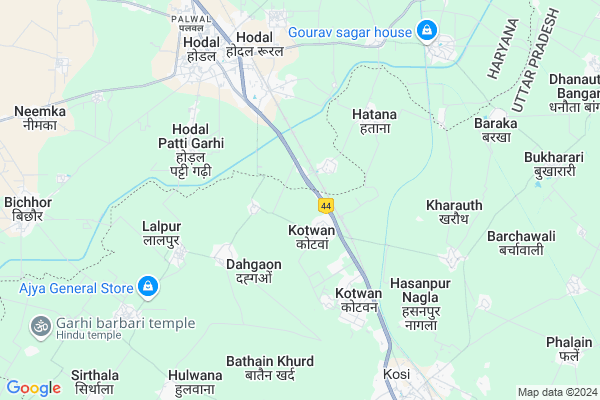
Kotban is a Village in Nandgaon Block in Mathura District of Uttar Pradesh State, India. It belongs to Agra Division . It is located 55 KM towards North from District head quarters Mathura. 10 KM from Nandgaon. 429 KM from State capital Lucknow
Kotban Pin code is 281403 and postal head office is Kosi Kalan .
Nabipur ( 3 KM ) , Hatana ( 4 KM ) , Lalpur ( 5 KM ) , Kharauth ( 5 KM ) , Bathain Khurd ( 6 KM ) are the nearby Villages to Kotban. Kotban is surrounded by Chhata Block towards East , Hodal Block towards North , Hassanpur Block towards North , Punahana Block towards west .
Hodal , Palwal , Vrindavan , Mathura are the near by Cities to Kotban.
This Place is in the border of the Mathura District and Bharatpur District. Bharatpur District Kaman is west towards this place . It is near to the Rajasthan State Border.
Kotban 2011 Census Details
Kotban Local Language is Hindi. Kotban Village Total population is 5193 and number of houses are 802. Female Population is 47.2%. Village literacy rate is 58.0% and the Female Literacy rate is 21.8%.
Population
| Census Parameter | Census Data |
| Total Population | 5193 |
| Total No of Houses | 802 |
| Female Population % | 47.2 % ( 2452) |
| Total Literacy rate % | 58.0 % ( 3013) |
| Female Literacy rate | 21.8 % ( 1134) |
| Scheduled Tribes Population % | 0.0 % ( 0) |
| Scheduled Caste Population % | 19.6 % ( 1019) |
| Working Population % | 24.5 % |
| Child(0 -6) Population by 2011 | 790 |
| Girl Child(0 -6) Population % by 2011 | 44.4 % ( 351) |
Kotban Census More Deatils.
Politics in Kotban
ABLTC , BJP , RLD , BSP , INC are the major political parties in this area.Polling Stations /Booths near Kotban
1)Primary School Supana R. No. 012)Primary School Shrinagar
3)Poorv Madhyamik Vidyalay Maharana Room No 1
4)Primary School Jawahar Park Kosikalan Room No 3
5)Primary School Nadoovas Kosikalan Room No 3
HOW TO REACH Kotban
By Rail
Hodal Rail Way Station , Kosi Kalan Rail Way Station are the very nearby railway stations to Kotban.Colleges near Kotban
Shri Rati Ram MahavidyalayaSchools near Kotban
Shri Radha Bihari Int.collegGovt Health Centers near Kotban
1) Kosi Dehat , kosi dehat , kosi dehat , hamuman pyau2) Nand Gaon , nandgaon , nandgaon , temple
3) Barsana-Kosi kalan , kosi , kosi , bus stand
Hospitals in Kotban,Nandgaon
Metropolis Healthcare Ltd
C/O- Vijay Laxmi Clinic; Rama Residency; Shop No-1; Near C-79; Sec-53; Noida; Uttar Pradesh 201301; India
2.9 KM distance Detail
श्री त्यागी बाबा न्यू आश्रम संकटमोचन हनुमान मंदिर
Bhulwana; Hodal; Haryana 121106; India
4.5 KM distance Detail
more ..
Colleges in Kotban,Nandgaon
Aggarwal College of Education Hodal Palwal
Hodal;; Naya Nagla; Hodal; Haryana 121106; India
5.7 KM distance Detail
Scet Palwal
Hodal by pass;Near ashribad Banquet hall;palwal; Hodal; Haryana 121106; India
7.5 KM distance Detail
more ..
Schools in Kotban,Nandgaon
Vidya Anan D Public School Karman Hodal
Hodal - Hassanpur Rd; Karman; Uttar Pradesh 281403; India
0.9 KM distance Detail
Vidya Anand Public School; Karman;Border ;Hodal
karman border; Hodal; Haryana; India
1.0 KM distance Detail
government ploytechnic boys hostel kotwan
Kotwan; Uttar Pradesh 281403; India
1.4 KM distance Detail
Electronic Shops in Kotban,Nandgaon
Mangla Ji Spare Part
Prince Colony; Kartar Colony; Hodal; Haryana 121106; India
5.6 KM distance Detail
M K maruti mechanic and electronics
Kartar; Prince Colony; Kartar Colony; Hodal Rural; Haryana 121106; India
5.7 KM distance Detail
Super Markets in Kotban,Nandgaon
GirdhariLal
Hodal Hasanpur Rd; Friends Colony; Hodal Rural; Haryana 121106; India
6.1 KM distance Detail
Governement Offices near Kotban,Nandgaon
Regional Transport Office
Kosi Border; Mathura; NH-2; Delhi Agra Road; Kosi Kalan; Kosi Kalan; Uttar Pradesh 281403; India
0.7 KM distance Detail
Assistant Commissioner Office Commercial Tax
Kosi Border; Mathura; NH-2; Delhi Agra Road; Kosi Kalan; Kosi Kalan; Uttar Pradesh 281403; India
1.0 KM distance Detail
How to reach Kotban
Tourist Places Near By Kotban
Schools in Kotban
Colleges in Kotban
Temperature & weather of Kotban
places in Kotban
Kotban photos
More Information
Village Talk
Post News or Events about this Village
Hodal 5 KM near
Palwal 38 KM near
Vrindavan 47 KM near
Mathura 53 KM near
Nandgaon 10 KM near
Chhata 15 KM near
Hodal 16 KM near
Hassanpur 21 KM near
Indira Gandhi International Airport 93 KM near
Kheria Airport 106 KM near
Muzaffarnagar Airport 199 KM near
Gwalior Airport 214 KM near
Dabchick 7 KM near
Govardhan 44 KM near
Vrindavan 46 KM near
Nuh 53 KM near
Mathura 53 KM near
Palwal 38 KM near
Mathura 53 KM near
Mewat 53 KM near
Gautam Buddha Nagar 65 KM near
Hodal Rail Way Station 4.8 KM near
Kosi Kalan Rail Way Station 9 KM near
Chata Rail Way Station 19 KM near