| Home | City Bus | Maps | Villages | Cities | Rail | Tourist Places | School | College | Pin Codes | Corona Cases Count |
| Distance Calculator Bus Services IFSC Codes Trace Mobile Number Weather Search Place Trace IP Available Cash ATM/Banks Locate Polling Booth Report an Error contact People |
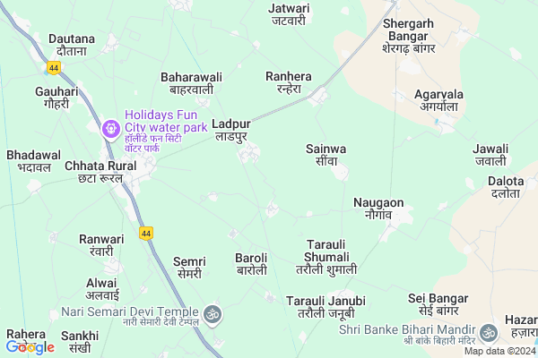
Undi
Undi Map
EDIT Map
Add Your House
 ..
..
Current Corona Virus Infected Patients Count in Mathura District
| City Name | District Name | Total Covid cases |
|---|---|---|
| Mathura District | Mathura | 10 |
Locality Name :
Undi
( ुंडी )
Block Name : Chhata
District : Mathura
State : Uttar Pradesh
Division : Agra
Language : Hindi and Urdu
Current Time 08:03 AM
Date: Tuesday , Apr 29,2025 (IST)
Time zone: IST (UTC+5:30)
Elevation / Altitude: 185 meters. Above Seal level
Telephone Code / Std Code: 05662
Assembly constituency : Chhata assembly constituency
Assembly MLA : Laxmi Narayan
Lok Sabha constituency : Mathura parliamentary constituency
Parliament MP : HEMA MALINI
Serpanch Name :
Pin Code : 281401
Post Office Name : Chhata (Mathura)
Commodities Prices : Kosikalan Market / Mandi
Undi Live Weather
Temperature: 26.3 °C
clear sky
Humidity: 31%
Wind : 3.87 mt/sec towards E
StationName : "ChhÄ\u0081ta"
observed on 2 Hours Back
Temperature: 26.3 °C
clear sky
Humidity: 31%
Wind : 3.87 mt/sec towards E
StationName : "ChhÄ\u0081ta"
observed on 2 Hours Back
Undi Weather Forecast for Next 5 days
30-04-2025
26.3°C to 40.1°C
clear sky
26.3°C to 40.1°C
clear sky
01-05-2025
28.2°C to 42.9°C
clear sky
28.2°C to 42.9°C
clear sky
02-05-2025
29.8°C to 43.5°C
scattered clouds, overcast clouds, few clouds, clear sky
29.8°C to 43.5°C
scattered clouds, overcast clouds, few clouds, clear sky
03-05-2025
29.6°C to 42.0°C
clear sky, scattered clouds, broken clouds, few clouds, light rain, overcast clouds
29.6°C to 42.0°C
clear sky, scattered clouds, broken clouds, few clouds, light rain, overcast clouds
Edit below overview about Undi
Edit below overview about Undi
OverView of Undi
undi village in ancient time was originated in the regim of kushans when kayasth community was main force in governence of kushan,mouryas and gupt kingdoms. mathur kayasth with andlay/ondlay alla ( gotra) were first resident of this area and based on their surname village called ondly or ondi now undi. later these groups of mathur kayasth shiftedto delhi and served,saltanats and mugal emperors. during disturbances by nadir shah and many more outsiders they left delhi andshifted to rajputana and narnol kingdoms.Edit below overview about Undi
National Highways Reachable To Undi
Nationa High Way :NH509
Nationa High Way :NH509
Rivers Near Undi
Karwan Nadi
यमुना (Yamuna) :যমুনা :Yamuna :યમુના :यमुना :ಯಮುನಾ :यमुना :யமுனை :Ямуна :https://1drv.ms/b/s!Ar-WXIFaX7UdgQuO6WpVrTr6YYsQ
Karwan Nadi
यमुना (Yamuna) :যমুনা :Yamuna :યમુના :यमुना :ಯಮುನಾ :यमुना :யமுனை :Ямуна :https://1drv.ms/b/s!Ar-WXIFaX7UdgQuO6WpVrTr6YYsQ
About Undi
Undi is a Village in Chhata Block in Mathura District of Uttar Pradesh State, India. It belongs to Agra Division . It is located 31 KM towards North from District head quarters Mathura. 9 KM from Chhata. 408 KM from State capital Lucknow
Undi Pin code is 281401 and postal head office is Chhata (Mathura).
Sainwa ( 3 KM ) , Chhata ( 3 KM ) , Tarauli Shumali ( 4 KM ) , Ranhera ( 4 KM ) , Baroli ( 4 KM ) are the nearby Villages to Undi. Undi is surrounded by Chhata Block towards North , Nandgaon Block towards west , Mat Block towards East , Vrindavan Block towards South .
Vrindavan , Hodal , Mathura , Hathras are the near by Cities to Undi.
Undi 2011 Census Details
Undi Local Language is Hindi. Undi Village Total population is 2743 and number of houses are 458. Female Population is 47.2%. Village literacy rate is 43.9% and the Female Literacy rate is 13.7%.
Population
| Census Parameter | Census Data |
| Total Population | 2743 |
| Total No of Houses | 458 |
| Female Population % | 47.2 % ( 1295) |
| Total Literacy rate % | 43.9 % ( 1203) |
| Female Literacy rate | 13.7 % ( 376) |
| Scheduled Tribes Population % | 0.0 % ( 0) |
| Scheduled Caste Population % | 11.4 % ( 314) |
| Working Population % | 35.4 % |
| Child(0 -6) Population by 2011 | 562 |
| Girl Child(0 -6) Population % by 2011 | 48.6 % ( 273) |
Undi Census More Deatils.
Politics in Undi
ABLTC , BJP , RLD , BSP , INC are the major political parties in this area.Polling Stations /Booths near Undi
1)Primary School Khitavita2)Primary School Ladpur Room No 1
3)Primary School Ajnaukh Room No 2
4)Primary School Kamar Room No 2
5)Primary School Barahara
HOW TO REACH Undi
By Rail
Chata Rail Way Station , Ajhai Rail Way Station are the very nearby railway stations to Undi.Colleges near Undi
Jaswant Singh Bhadauria Institute Of Technology Kosi Khurd Mathura
Address :
Captain Rakesh Iti College Bharnakalan
Address :
Sri Mohar Singh Mahavidyalaya, Nanakpur Mathura
Address : Nanakpur, Nohjheel
D. K. Institute Of Management & Technology
Address :
Captain Rakesh Polytechnic College Bharnakalan Mathura
Address :
Schools near Undi
Shri Sardar P.i.col.rec.
Address : sheragarh , chhata , mathura , Uttar Pradesh . PIN- 281403 , Post - Kosi Kalan
Gandhi Int.coll.chhata
Address : chhata , chhata , mathura , Uttar Pradesh . PIN- 281401 , Post - Chhata (Mathura)
J.h..s.mali
Address : g.mali , chhata , mathura , Uttar Pradesh . PIN- 281401 , Post - Chhata (Mathura)
J.h.s.bajid Pur
Address : bajid pur , chhata , mathura , Uttar Pradesh . PIN- 281404 , Post - Shergarh (Mathura)
Govt Health Centers near Undi
1) Ladpur , , jaatav oh. , satimata junior high school2) Ranhera , , kherapati moh. , syndicate bank
3) Main Centere (Chhata PHC) , , seengu thok , bsnl office
Hospitals in Undi,Chhata
Food for Life Hospital
Nangla Kiki; Sunrakh Bangar; Uttar Pradesh 281406; India
20.0 KM distance Detail
Nirphad Rural Eye Hospital Chattikara Mathura
Mathura; Uttar Pradesh 281406; India
20.8 KM distance Detail
more ..
Petrol Bunks in Undi,Chhata
Indian Oil Petrol Pump
Mathura; NH-2; Delhi Agra Road; Jait; Jait; Uttar Pradesh 281001; India
20.8 KM distance Detail
more ..
Schools in Undi,Chhata
Nishkalanka Mata School; Jait
Near Police Station; Chennai - Delhi Highway; Jait; Uttar Pradesh 281406; India
19.4 KM distance Detail
पानीगांबगंगांमन्दिरगांबपानीगांबबांगर
; 281121; Sunrakh Bangar; Uttar Pradesh 281121; India
21.9 KM distance Detail
Electronic Shops in Undi,Chhata
Anuradha Electronic Emporiyam
Vaidya Laxminarayan Marg; Nangla Kiki; Vrindavan; Uttar Pradesh 281121; India
19.5 KM distance Detail
Devendra Mobile Repair & Sale Ramtal
Sunrakh Bangar; Uttar Pradesh 281406; India
20.2 KM distance Detail
Local Parks in Undi,Chhata
Shri Ram Farm House
Sunrakh Road; Baraghat; Vrindavan; Uttar Pradesh 281121; India
22.5 KM distance Detail
About Undi &
History
How to reach Undi
Tourist Places Near By Undi
Schools in Undi
Colleges in Undi
Temperature & weather of Undi
places in Undi
Undi photos
More Information
How to reach Undi
Tourist Places Near By Undi
Schools in Undi
Colleges in Undi
Temperature & weather of Undi
places in Undi
Undi photos
More Information
Village Talk
Post News or Events about this Village
Near Cities
Vrindavan 23 KM near
Hodal 29 KM near
Mathura 30 KM near
Hathras 56 KM near
Vrindavan 23 KM near
Hodal 29 KM near
Mathura 30 KM near
Hathras 56 KM near
Near By Taluks
Chaumuha 5 KM near
Chhata 8 KM near
Nandgaon 21 KM near
Mat 21 KM near
Chaumuha 5 KM near
Chhata 8 KM near
Nandgaon 21 KM near
Mat 21 KM near
Near By Air Ports
Kheria Airport 82 KM near
Indira Gandhi International Airport 115 KM near
Gwalior Airport 192 KM near
Muzaffarnagar Airport 213 KM near
Kheria Airport 82 KM near
Indira Gandhi International Airport 115 KM near
Gwalior Airport 192 KM near
Muzaffarnagar Airport 213 KM near
Near By Tourist Places
Vrindavan 22 KM near
Govardhan 29 KM near
Dabchick 30 KM near
Mathura 30 KM near
Aligarh 60 KM near
Vrindavan 22 KM near
Govardhan 29 KM near
Dabchick 30 KM near
Mathura 30 KM near
Aligarh 60 KM near
Near By Districts
Mathura 30 KM near
Palwal 59 KM near
Aligarh 60 KM near
Bharatpur 62 KM near
Mathura 30 KM near
Palwal 59 KM near
Aligarh 60 KM near
Bharatpur 62 KM near
Near By RailWay Station
Chata Rail Way Station 7.3 KM near
Kosi Kalan Rail Way Station 15 KM near
Chata Rail Way Station 7.3 KM near
Kosi Kalan Rail Way Station 15 KM near