| Home | City Bus | Maps | Villages | Cities | Rail | Tourist Places | School | College | Pin Codes | Corona Cases Count |
| Distance Calculator Bus Services IFSC Codes Trace Mobile Number Weather Search Place Trace IP Available Cash ATM/Banks Locate Polling Booth Report an Error contact People |
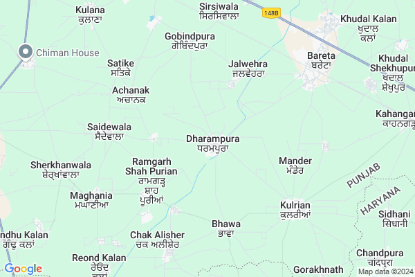
Dharampura Map
EDIT Map
Add Your House
 ..
..
Current Corona Virus Infected Patients Count in Mansa District
| City Name | District Name | Total Covid cases |
|---|---|---|
| Mansa District | Mansa | 13 |
Locality Name :
Dharampura
( ਧਰਮਪੁਰਾ )
Tehsil Name : Budhlada
District : Mansa
State : Punjab
Language : Punjabi
Current Time 12:37 PM
Date: Monday , Apr 28,2025 (IST)
Time zone: IST (UTC+5:30)
Elevation / Altitude: 223 meters. Above Seal level
Telephone Code / Std Code: 01652
Assembly constituency : Budhlada assembly constituency
Assembly MLA : Budh Ram
Lok Sabha constituency : Bathinda parliamentary constituency
Parliament MP : Harsimrat Kaur Badal
Serpanch Name :
Pin Code : 151501
Post Office Name : Bareta
Commodities Prices : Bareta Market / Mandi
National Highways Reachable To Dharampura
Nationa High Way :NH148B
Nationa High Way :NH148B
Rivers Near Dharampura
Ghaggar
Ghaggar
Ghaggar
Ghaggar
About Dharampura
Correct below Info and add more info about DharampuraDharampura is a Village in Budhlada Tehsil in Mansa District of Punjab State, India. It is located 35 KM towards East from District head quarters Mansa. 7 KM from Budhalada. 173 KM from State capital Chandigarh
Dharampura Pin code is 151501 and postal head office is Bareta .
Saspali ( 3 KM ) , Bhakhrial ( 4 KM ) , Andianwali ( 4 KM ) , Mander ( 4 KM ) , Achanak ( 5 KM ) are the nearby Villages to Dharampura. Dharampura is surrounded by Jakhal Tehsil towards East , Ratia Tehsil towards South , Lehragaga Tehsil towards East , Tohana Tehsil towards East .
Budhlada , Ratia , Tohana , Mansa are the near by Cities to Dharampura.
This Place is in the border of the Mansa District and Fatehabad District. Fatehabad District Ratia is South towards this place . It is near to the Haryana State Border.
Dharampura 2011 Census Details
Dharampura Local Language is Punjabi. Dharampura Village Total population is 5089 and number of houses are 939. Female Population is 47.3%. Village literacy rate is 46.9% and the Female Literacy rate is 20.6%.
Population
| Census Parameter | Census Data |
| Total Population | 5089 |
| Total No of Houses | 939 |
| Female Population % | 47.3 % ( 2408) |
| Total Literacy rate % | 46.9 % ( 2386) |
| Female Literacy rate | 20.6 % ( 1047) |
| Scheduled Tribes Population % | 0.0 % ( 0) |
| Scheduled Caste Population % | 27.5 % ( 1398) |
| Working Population % | 32.7 % |
| Child(0 -6) Population by 2011 | 552 |
| Girl Child(0 -6) Population % by 2011 | 46.2 % ( 255) |
Dharampura Census More Deatils.
Politics in Dharampura
Shiromani Akali Dal , SAD , CPI , INC are the major political parties in this area.Polling Stations /Booths near Dharampura
1)Sandli2)Ramgarh
3)Mander
4)Mall Singh Wala
5)Bhakhrial
HOW TO REACH Dharampura
By Rail
Bareta Rail Way Station , Datewas Rail Way Station are the very nearby railway stations to Dharampura.Colleges near Dharampura
Gimt Regular Degree College Budhlada
Address :
Guru Nanak College
Address :
Schools in Dharampura
Silver Vatika Pb Sch Dharampur
Address : dharampura , budhlada , mansa , Punjab . PIN- 151501 , Post - Bareta
Kalpna Chwla Mem Pb Sch Dharam
Address : dharampura , budhlada , mansa , Punjab . PIN- 151501 , Post - Bareta
Ghs Dharampura
Address : dharampura , budhlada , mansa , Punjab . PIN- 151501 , Post - Bareta
Govt Health Centers near Dharampura
1) Dharampura , SubCenter , Breta road , near Govt. High School2) Bhawa , SubCenter , kulriana road , near gurdwara sahib
3) PHC Kulrian , Primary Heath Centre , Out Of Village , Near Police Choki
Sub Villages in Dharampura
Petrol Bunks in Dharampura,Budhlada
HP PETROL PUMP - ARMAN HP AGRO CENTRE
HP Petrol Pump Bareta-boha Road Vill. Dharampura; Punjab 151507; India
1.0 KM distance Detail
more ..
Colleges in Dharampura,Budhlada
Sant Sukhchain Singh Institute Of Education
Bareta - Dharampura Rd; Bareta; Punjab 151501; India
3.6 KM distance Detail
Shaheed Nand Singh Government Polytechnical College
Bareta; Punjab 151501; India
7.8 KM distance Detail
Milkha Singh Educational Institute
Near Radha Swami Satsang Ghar; Budhlada Road; Bareta; Punjab 151501; India
8.3 KM distance Detail
more ..
Local Parks in Dharampura,Budhlada
Employees Colony Central Park
Jakhal Budhlada Rd; Bareta; Punjab 151501; India
8.1 KM distance Detail
About Dharampura &
History
How to reach Dharampura
Tourist Places Near By Dharampura
Schools in Dharampura
Colleges in Dharampura
Temperature & weather of Dharampura
places in Dharampura
Dharampura photos
More Information
How to reach Dharampura
Tourist Places Near By Dharampura
Schools in Dharampura
Colleges in Dharampura
Temperature & weather of Dharampura
places in Dharampura
Dharampura photos
More Information
Village Talk
Post News or Events about this Village
Near Cities
Budhlada 14 KM near
Ratia 19 KM near
Tohana 31 KM near
Mansa 33 KM near
Budhlada 14 KM near
Ratia 19 KM near
Tohana 31 KM near
Mansa 33 KM near
Near By Taluks
Budhlada 7 KM near
Jakhal 17 KM near
Ratia 20 KM near
Lehragaga 22 KM near
Budhlada 7 KM near
Jakhal 17 KM near
Ratia 20 KM near
Lehragaga 22 KM near
Near By Air Ports
Ludhiana Airport 135 KM near
Chandigarh Airport 163 KM near
Surat Gujarat Airport 197 KM near
Indira Gandhi International Airport 224 KM near
Ludhiana Airport 135 KM near
Chandigarh Airport 163 KM near
Surat Gujarat Airport 197 KM near
Indira Gandhi International Airport 224 KM near
Near By Tourist Places
Mansa 33 KM near
Sangrur 56 KM near
Bathinda 89 KM near
Fatehgarh-Sahib 93 KM near
Hansi 97 KM near
Mansa 33 KM near
Sangrur 56 KM near
Bathinda 89 KM near
Fatehgarh-Sahib 93 KM near
Hansi 97 KM near
Near By Districts
Mansa 33 KM near
Fatehabad 39 KM near
Sangrur 56 KM near
Barnala 68 KM near
Mansa 33 KM near
Fatehabad 39 KM near
Sangrur 56 KM near
Barnala 68 KM near
Near By RailWay Station
Bareta Rail Way Station 7.1 KM near
Datewas Rail Way Station 8.1 KM near
Budhlada Rail Way Station 15 KM near
Jakhal Junction Rail Way Station 20 KM near
Bareta Rail Way Station 7.1 KM near
Datewas Rail Way Station 8.1 KM near
Budhlada Rail Way Station 15 KM near
Jakhal Junction Rail Way Station 20 KM near