| Home | City Bus | Maps | Villages | Cities | Rail | Tourist Places | School | College | Pin Codes | Corona Cases Count |
| Distance Calculator Bus Services IFSC Codes Trace Mobile Number Weather Search Place Trace IP Available Cash ATM/Banks Locate Polling Booth Report an Error contact People |
G.h.koppalu
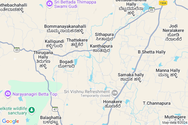
G.h.koppalu Map
EDIT Map
Add Your House
 ..
..
Current Corona Virus Infected Patients Count in Mandya District
| City Name | District Name | Total Covid cases |
|---|---|---|
| Mandya District | Mandya | 8 |
| Malavalli | Mandya | 7 |
| Malvalli | Mandya | 1 |
Locality Name :
G.h.koppalu
( G.h.ಕೊಪ್ಪಲು )
Taluk Name : Nagamangala
District : Mandya
State : Karnataka
Division : Mysore
Language : Kannada and Hindi And English
Current Time 11:37 AM
Date: Thursday , Feb 06,2025 (IST)
Time zone: IST (UTC+5:30)
Elevation / Altitude: 724 meters. Above Seal level
Telephone Code / Std Code: 08234
Assembly constituency : Nagamangala assembly constituency
Assembly MLA : N. Chaluvarayaswamy
Lok Sabha constituency : Mandya parliamentary constituency
Parliament MP : SUMALATHA AMBAREESH
Serpanch Name :
Pin Code : 571432
Post Office Name : Nagamangala
Main Village Name : Gejjehosahalli
Commodities Prices : Nagamangala Market / Mandi
G.h.koppalu Live Weather
Temperature: 22.5 °C
scattered clouds
Humidity: 41%
Wind : 4.22 mt/sec towards E
StationName : "Melukote"
observed on 1 Hours Back
Temperature: 22.5 °C
scattered clouds
Humidity: 41%
Wind : 4.22 mt/sec towards E
StationName : "Melukote"
observed on 1 Hours Back
G.h.koppalu Weather Forecast for Next 5 days
07-02-2025
17.5°C to 30.4°C
scattered clouds, broken clouds, clear sky
17.5°C to 30.4°C
scattered clouds, broken clouds, clear sky
08-02-2025
16.0°C to 31.4°C
clear sky, broken clouds, scattered clouds
16.0°C to 31.4°C
clear sky, broken clouds, scattered clouds
09-02-2025
16.7°C to 32.0°C
few clouds, scattered clouds, clear sky
16.7°C to 32.0°C
few clouds, scattered clouds, clear sky
10-02-2025
17.4°C to 32.2°C
few clouds, overcast clouds, broken clouds, scattered clouds, clear sky
17.4°C to 32.2°C
few clouds, overcast clouds, broken clouds, scattered clouds, clear sky
11-02-2025
17.5°C to 32.0°C
clear sky, few clouds
17.5°C to 32.0°C
clear sky, few clouds
National Highways Reachable To G.h.koppalu
Nationa High Way :NH275
Nationa High Way :NH75
Nationa High Way :NH275
Nationa High Way :NH75
Rivers Near G.h.koppalu
Hemavati :ಹೇಮಾವತಿ
Hemavati :ಹೇಮಾವತಿ
Hemavati :ಹೇಮಾವತಿ
Hemavati :ಹೇಮಾವತಿ
About G.h.koppalu
Correct below Info and add more info about G.h.koppaluG.h.koppalu is a small Village/hamlet in Nagamangala Taluk in Mandya District of Karnataka State, India. It comes under Gejjehosahalli Panchayath. It belongs to Mysore Division . It is located 39 KM towards North from District head quarters Mandya. 14 KM from Nagamangala. 119 KM from State capital Bangalore
G.h.koppalu Pin code is 571432 and postal head office is Nagamangala .
G.h.koppalu is surrounded by Krishnarajpet Taluk towards west , Pandavapura Taluk towards South , Mandya Taluk towards East , Channarayapatna Taluk towards west .
Mandya , Shrirangapattana , Maddur , Mysore are the near by Cities to G.h.koppalu.
Demographics of G.h.koppalu
Kannada is the Local Language here.Politics in G.h.koppalu
Independent , JD(S) , Janata Dal (Secular) (JD(S)) , INC are the major political parties in this area.Polling Stations /Booths near G.h.koppalu
1)Govt Higher Primary School Tattekere2)Govt Higher Primary School Bommanayakanahally
3)Govt Higher Primaryschool East Wing Room 1 Koppa 1
4)Govt Lower Primary School Hindasahally
5)Govt Higher Primary School Ganganahally
HOW TO REACH G.h.koppalu
By Rail
There is no railway station near to G.h.koppalu in less than 10 km. are the Rail way stations reachable from near by towns.By Road
Nagamangala , Krishnarajapet , Nelamangala are the nearby by towns to G.h.koppalu having road connectivity to G.h.koppaluColleges near G.h.koppalu
Government Junior College And High School
Address :
Govt Polytechnic
Address : Devalapura Hand Post
Schools near G.h.koppalu
Kitturu Rani Channama R School
Address : bellur (rural) , nagamangala , mandya , Karnataka . PIN- 571448 , Post - Balagangadaranathnagar
Ghs Morarji (r) Somanahalli
Address : somana hally2 , nagamangala , mandya , Karnataka . PIN- 571810
Murargi R.school Kotebetta
Address : kot betta , nagamangala , mandya , Karnataka . PIN- 571802 , Post - Bindiganavile
Morarji (r) School Kambadahalli
Address : kambada hally , nagamangala , mandya , Karnataka . PIN- 571432 , Post - Nagamangala
Govt Health Centers near G.h.koppalu
1) Hunaganahalli , , Hunaganahalli ,2) Chalya , JUNIOR HEALTH ASSISTANT FEMALE , ,
3) Mahadeshwarapura , , Mahadeshwarapura subcentre ,
Hospitals in G.h.koppalu,Nagamangala
Primary Health Assistant
Chinya; Mandya; SH-19; Srirangapatna Jevargi Road; Nagamangala; Nagamangala; Karnataka 571431; India
5.7 KM distance Detail
Primary Health Center
Honakere; Mandya; SH-19; Srirangapatna Jevargi Road; Nagamangala; Nagamangala; Karnataka 571431; India
6.6 KM distance Detail
more ..
Petrol Bunks in G.h.koppalu,Nagamangala
Kishore Fuel Station Indian Oil Petrol Pump
Nyamana Halli; Mandya; SH-19; Srirangapatna Jevargi Road; Pandavapura; Pandavapura; Karnataka 571431; India
12.9 KM distance Detail
more ..
Colleges in G.h.koppalu,Nagamangala
Government Pre University College
Honakere; Mandya; SH-19; Srirangapatna Jevargi Road; Nagamangala; Nagamangala; Karnataka 571431; India
6.4 KM distance Detail
Sri Ranganatha ITI College
Jakkana Halli; Mandya; SH-19; Srirangapatna Jevargi Road; Pandavapura; Pandavapura; Karnataka 571431; India
12.0 KM distance Detail
more ..
Schools in G.h.koppalu,Nagamangala
Government Higher Primary School
Chinya; Mandya; SH-19; Srirangapatna Jevargi Road; Nagamangala; Nagamangala; Karnataka 571431; India
5.8 KM distance Detail
Police Stations near G.h.koppalu,Nagamangala
Police Station Nagamangala
Mandya; SH-19; Srirangapatna Jevargi Road; Nagamangala; Nagamangala; Karnataka 571432; India
14.5 KM distance Detail
Governement Offices near G.h.koppalu,Nagamangala
Grama Panchayat Chinya
Chinya; Mandya; SH-19; Srirangapatna Jevargi Road; Nagamangala; Nagamangala; Karnataka 571431; India
5.5 KM distance Detail
Grama Panchayat Honakere
Honakere; Mandya; SH-19; Srirangapatna Jevargi Road; Nagamangala; Nagamangala; Karnataka 571431; India
6.5 KM distance Detail
Assistant RTO Office
Malenahalli; Mandya; SH-85; Nagamangala; Nagamangala; Karnataka 571432; India
11.7 KM distance Detail
About G.h.koppalu &
History
How to reach G.h.koppalu
Tourist Places Near By G.h.koppalu
Schools in G.h.koppalu
Colleges in G.h.koppalu
Temperature & weather of G.h.koppalu
places in G.h.koppalu
G.h.koppalu photos
More Information
How to reach G.h.koppalu
Tourist Places Near By G.h.koppalu
Schools in G.h.koppalu
Colleges in G.h.koppalu
Temperature & weather of G.h.koppalu
places in G.h.koppalu
G.h.koppalu photos
More Information
Village Talk
Post News or Events about this Village
Near Cities
Mandya 38 KM near
Shrirangapattana 41 KM near
Maddur 49 KM near
Mysore 55 KM near
Mandya 38 KM near
Shrirangapattana 41 KM near
Maddur 49 KM near
Mysore 55 KM near
Near By Taluks
Nagamangala 13 KM near
Krishnarajpet 26 KM near
Pandavapura 27 KM near
Mandya 30 KM near
Nagamangala 13 KM near
Krishnarajpet 26 KM near
Pandavapura 27 KM near
Mandya 30 KM near
Near By Air Ports
Mysore Airport 56 KM near
Bengaluru International Airport 136 KM near
Peelamedu Airport 218 KM near
Bajpe Airport 218 KM near
Mysore Airport 56 KM near
Bengaluru International Airport 136 KM near
Peelamedu Airport 218 KM near
Bajpe Airport 218 KM near
Near By Tourist Places
Sravanabelagola 27 KM near
Srirangapatna 42 KM near
Mysore 55 KM near
Hassan 76 KM near
Savandurga 78 KM near
Sravanabelagola 27 KM near
Srirangapatna 42 KM near
Mysore 55 KM near
Hassan 76 KM near
Savandurga 78 KM near
Near By Districts
Mandya 38 KM near
Mysore 54 KM near
Ramanagara 73 KM near
Hassan 76 KM near
Mandya 38 KM near
Mysore 54 KM near
Ramanagara 73 KM near
Hassan 76 KM near
Near By RailWay Station
Pandavapura Rail Way Station 35 KM near
Mandya Rail Way Station 38 KM near
Pandavapura Rail Way Station 35 KM near
Mandya Rail Way Station 38 KM near