| Home | City Bus | Maps | Villages | Cities | Rail | Tourist Places | School | College | Pin Codes | Corona Cases Count |
| Distance Calculator Bus Services IFSC Codes Trace Mobile Number Weather Search Place Trace IP Available Cash ATM/Banks Locate Polling Booth Report an Error contact People |
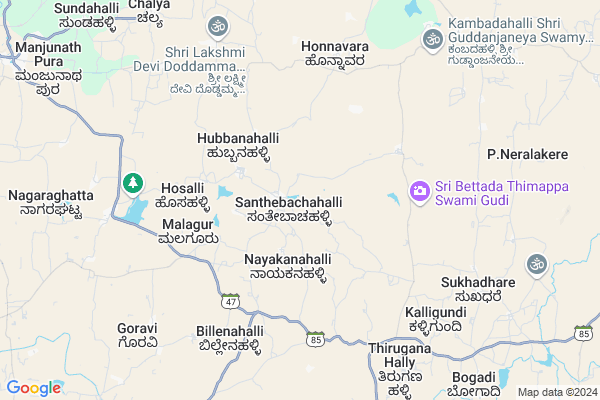
Santhebachahalli
Santhebachahalli Map
EDIT Map
Add Your House
 ..
..
Current Corona Virus Infected Patients Count in Mandya District
| City Name | District Name | Total Covid cases |
|---|---|---|
| Mandya District | Mandya | 8 |
| Malavalli | Mandya | 7 |
| Malvalli | Mandya | 1 |
Locality Name :
Santhebachahalli
( ಸಂತೇಬಾಚಹಳ್ಳಿ )
Taluk Name : Krishnarajpet
District : Mandya
State : Karnataka
Division : Mysore
Language : Kannada and Hindi And English
Current Time 12:49 PM
Date: Monday , Apr 28,2025 (IST)
Time zone: IST (UTC+5:30)
Elevation / Altitude: 798 meters. Above Seal level
Telephone Code / Std Code: 08230
Assembly constituency : Krishnarajpet assembly constituency
Assembly MLA : H.T.Manju
Lok Sabha constituency : Mandya parliamentary constituency
Parliament MP : SUMALATHA AMBAREESH
Serpanch Name :
Pin Code : 571436
Post Office Name : Santhebachahalli
Commodities Prices : Nagamangala Market / Mandi
Edit below overview about Santhebachahalli
Edit below overview about Santhebachahalli
OverView of Santhebachahalli
Santhebachahalli village which we have to visit this village. Here ther are 5 temples and 3 beutiful gardens to see this villages head isS.R MANJUNATH.
Edit below overview about Santhebachahalli
National Highways Reachable To Santhebachahalli
Nationa High Way :NH275
Nationa High Way :NH275
Rivers Near Santhebachahalli
Hemavati :ಹೇಮಾವತಿ
Hemavati :ಹೇಮಾವತಿ
Hemavati :ಹೇಮಾವತಿ
Hemavati :ಹೇಮಾವತಿ
About Santhebachahalli
Santhebachahalli is a Village in Krishnarajpet Taluk in Mandya District of Karnataka State, India. It belongs to Mysore Division . It is located 53 KM towards west from District head quarters Mandya. 22 KM from Krishnarajpet. 129 KM from State capital Bangalore
Santhebachahalli Pin code is 571436 and postal head office is Santhebachahalli .
Honnavara ( 7 KM ) , Aghalaya ( 8 KM ) , Bindiganavile ( 11 KM ) , Sarangi ( 12 KM ) , Doddabala ( 12 KM ) are the nearby Villages to Santhebachahalli. Santhebachahalli is surrounded by Krishnarajpet Taluk towards South , Channarayapatna Taluk towards North , Pandavapura Taluk towards South , Holenarsipur Taluk towards west .
Shrirangapattana , Mandya , Tiptur , Maddur are the near by Cities to Santhebachahalli.
Santhebachahalli 2011 Census Details
Santhebachahalli Local Language is Kannada. Santhebachahalli Village Total population is 2600 and number of houses are 666. Female Population is 51.0%. Village literacy rate is 75.0% and the Female Literacy rate is 35.1%.
Population
| Census Parameter | Census Data |
| Total Population | 2600 |
| Total No of Houses | 666 |
| Female Population % | 51.0 % ( 1325) |
| Total Literacy rate % | 75.0 % ( 1949) |
| Female Literacy rate | 35.1 % ( 913) |
| Scheduled Tribes Population % | 1.0 % ( 26) |
| Scheduled Caste Population % | 11.3 % ( 293) |
| Working Population % | 47.8 % |
| Child(0 -6) Population by 2011 | 221 |
| Girl Child(0 -6) Population % by 2011 | 46.2 % ( 102) |
Santhebachahalli Census More Deatils.
Politics in Santhebachahalli
Independent , JD(S) , Janata Dal (Secular) (JD(S)) , INC are the major political parties in this area.Polling Stations /Booths near Santhebachahalli
1)Government Higher Primary School (north Wing) Santhebachahalli-12)Government Higher Primary Schoo L Lakshimipura-1
3)Government Higher Primary School Doddasomanahalli
4)Government Higher Primary School Honnenahalli
5)Government Higher School Heggadahalli
HOW TO REACH Santhebachahalli
By Rail
There is no railway station near to Santhebachahalli in less than 10 km. Annechakanahali Rail Way Station (near to Hole Narasipur) , Alur Halt Rail Way Station (near to Hassan) , Hole Narsipur Rail Way Station (near to Hole Narasipur) , Hassan Junction Rail Way Station (near to Hassan) are the Rail way stations reachable from near by towns.By Road
Channarayapatna , Hole Narasipur , Hassan are the nearby by towns to Santhebachahalli having road connectivity to SanthebachahalliColleges near Santhebachahalli
Kadamba Pu College
Address : Kadamba P U College
main Road, Akshaya Plaza.
Gipucollage
Address :
Government Iti Institute
Address :
Krishnaraja P U Collegr
Address :
Sri Vishweshwaraiah Iti
Address :
Schools near Santhebachahalli
Muraji R.school K.r.pet
Address : k.r.pet ward -21 , krishnaraja pet , mandya , Karnataka . PIN- 571426 , Post - Krishnarajapete
Sri Murarji Resedential School Hosa
Address : k.r.pet ward -21 , krishnaraja pet , mandya , Karnataka . PIN- 571426 , Post - Krishnarajapete
Cambridge P School K.r.pete
Address : k.r.pet ward -4 , krishnaraja pet , mandya , Karnataka . PIN- 571426 , Post - Krishnarajapete
Infant Jesus Hs K.r.pet
Address : k.r.pet ward -5 , krishnaraja pet , mandya , Karnataka . PIN- 571426 , Post - Krishnarajapete
Govt Health Centers near Santhebachahalli
1) Chalya , JUNIOR HEALTH ASSISTANT FEMALE , ,2) Juttnally , JUNIOR HEALTH ASSISTANT FEMALE , ,
3) Hunaganahalli , , Hunaganahalli ,
Hospitals in Santhebachahalli,Krishnarajpet
Primary Health Centre
Aghalaya; Mandya; SH-47; Singapura Road; KR Pete; KR Pete; Karnataka 571436; India
8.1 KM distance Detail
Community Health Centre; Bindiganavile
Bindiganavile; Karnataka 571802; India
11.0 KM distance Detail
more ..
Petrol Bunks in Santhebachahalli,Krishnarajpet
HP PETROL PUMP - NAGAMANGALA TAPCMS LTD
HPC Dealers Upparahalli Village;kasaba Hobli Nagamangala Town;tb Extension; Bengaluru; Karnataka 571432; India
21.3 KM distance Detail
more ..
Colleges in Santhebachahalli,Krishnarajpet
National Institute of Technology Karnataka
NH 66; Srinivas Nagar; Surathkal; Mangaluru; Karnataka 575025; India
5.0 KM distance Detail
Government Pre University College
Aghalaya; Mandya; SH-47; Singapura Road; KR Pete; KR Pete; Karnataka 571436; India
7.8 KM distance Detail
G.P.U.College; Sindaghatta
State Highway 85; Sindaghatta; Karnataka 571426; India
16.2 KM distance Detail
more ..
Schools in Santhebachahalli,Krishnarajpet
Government Higher Primary School
Aghalaya; Mandya; SH-47; Singapura Road; KR Pete; KR Pete; Karnataka 571436; India
8.0 KM distance Detail
Neralekere rural school
Neralekere Rd; P. Neralakere; Karnataka 571432; India
10.2 KM distance Detail
Government Lower Primary School
Kotagahalli; Mandya; SH-85; Nagamangala Road; KR Pete; KR Pete; Karnataka 571436; India
10.3 KM distance Detail
Police Stations near Santhebachahalli,Krishnarajpet
Police Station Nagamangala
Mandya; SH-19; Srirangapatna Jevargi Road; Nagamangala; Nagamangala; Karnataka 571432; India
21.6 KM distance Detail
Governement Offices near Santhebachahalli,Krishnarajpet
Grama Panchayat Chinya
Chinya; Mandya; SH-19; Srirangapatna Jevargi Road; Nagamangala; Nagamangala; Karnataka 571431; India
19.0 KM distance Detail
Grama Panchayat Honakere
Honakere; Mandya; SH-19; Srirangapatna Jevargi Road; Nagamangala; Nagamangala; Karnataka 571431; India
19.6 KM distance Detail
About Santhebachahalli &
History
How to reach Santhebachahalli
Tourist Places Near By Santhebachahalli
Schools in Santhebachahalli
Colleges in Santhebachahalli
Temperature & weather of Santhebachahalli
places in Santhebachahalli
Santhebachahalli photos
More Information
How to reach Santhebachahalli
Tourist Places Near By Santhebachahalli
Schools in Santhebachahalli
Colleges in Santhebachahalli
Temperature & weather of Santhebachahalli
places in Santhebachahalli
Santhebachahalli photos
More Information
Village Talk
Post News or Events about this Village
Near Cities
Shrirangapattana 50 KM near
Mandya 51 KM near
Tiptur 57 KM near
Maddur 62 KM near
Shrirangapattana 50 KM near
Mandya 51 KM near
Tiptur 57 KM near
Maddur 62 KM near
Near By Taluks
Nagamangala 17 KM near
Krishnarajpet 22 KM near
Channarayapatna 26 KM near
Pandavapura 35 KM near
Nagamangala 17 KM near
Krishnarajpet 22 KM near
Channarayapatna 26 KM near
Pandavapura 35 KM near
Near By Air Ports
Mysore Airport 63 KM near
Bengaluru International Airport 143 KM near
Bajpe Airport 207 KM near
Calicut Airport 222 KM near
Mysore Airport 63 KM near
Bengaluru International Airport 143 KM near
Bajpe Airport 207 KM near
Calicut Airport 222 KM near
Near By Tourist Places
Sravanabelagola 14 KM near
Srirangapatna 51 KM near
Mysore 63 KM near
Hassan 63 KM near
Nanjangud 86 KM near
Sravanabelagola 14 KM near
Srirangapatna 51 KM near
Mysore 63 KM near
Hassan 63 KM near
Nanjangud 86 KM near
Near By Districts
Mandya 51 KM near
Mysore 62 KM near
Hassan 63 KM near
Ramanagara 84 KM near
Mandya 51 KM near
Mysore 62 KM near
Hassan 63 KM near
Ramanagara 84 KM near
Near By RailWay Station
Hole Narsipur Rail Way Station 41 KM near
Pandavapura Rail Way Station 44 KM near
Hole Narsipur Rail Way Station 41 KM near
Pandavapura Rail Way Station 44 KM near