| Home | City Bus | Maps | Villages | Cities | Rail | Tourist Places | School | College | Pin Codes | Corona Cases Count |
| Distance Calculator Bus Services IFSC Codes Trace Mobile Number Weather Search Place Trace IP Available Cash ATM/Banks Locate Polling Booth Report an Error contact People |
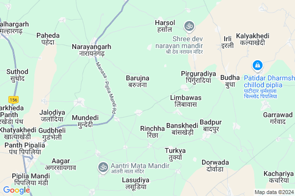
Umriya
Umriya Map
EDIT Map
Add Your House
 ..
..
Current Corona Virus Infected Patients Count in Mandsaur District
| City Name | District Name | Total Covid cases |
|---|---|---|
| Mandsaur District | Mandsaur | 9 |
Locality Name :
Umriya
( उमरिया )
Tehsil Name : Malhargarh
District : Mandsaur
State : Madhya Pradesh
Division : Ujjain
Language : Hindi and Malvi
Current Time 01:04 PM
Date: Monday , Apr 28,2025 (IST)
Time zone: IST (UTC+5:30)
Elevation / Altitude: 466 meters. Above Seal level
Telephone Code / Std Code: 07424
Assembly constituency : Malhargarh assembly constituency
Assembly MLA : Jagdish Devda
Lok Sabha constituency : Mandsaur parliamentary constituency
Parliament MP : Sudheer Gupta
Serpanch Name :
Pin Code : 458883
Post Office Name : Shamgarh
Alternate Village Name : Umariya
Commodities Prices : Piplya Market / Mandi
Umriya Live Weather
Temperature: 39.4 °C
clear sky
Humidity: 11%
Wind : 5.86 mt/sec towards W
StationName : "NÄ\u0081rÄ\u0081yangarh"
observed on 22 Mins Back
Temperature: 39.4 °C
clear sky
Humidity: 11%
Wind : 5.86 mt/sec towards W
StationName : "NÄ\u0081rÄ\u0081yangarh"
observed on 22 Mins Back
Umriya Weather Forecast for Next 5 days
29-04-2025
30.3°C to 41.7°C
clear sky, few clouds
30.3°C to 41.7°C
clear sky, few clouds
30-04-2025
28.1°C to 43.1°C
clear sky, scattered clouds
28.1°C to 43.1°C
clear sky, scattered clouds
01-05-2025
28.0°C to 43.3°C
clear sky, broken clouds, overcast clouds
28.0°C to 43.3°C
clear sky, broken clouds, overcast clouds
02-05-2025
29.0°C to 43.5°C
clear sky, scattered clouds, broken clouds, few clouds
29.0°C to 43.5°C
clear sky, scattered clouds, broken clouds, few clouds
03-05-2025
28.3°C to 41.9°C
scattered clouds, clear sky
28.3°C to 41.9°C
scattered clouds, clear sky
Rivers Near Umriya
Jakam
Chambal River :चम्बल
Jakam
Chambal River :चम्बल
About Umriya
Correct below Info and add more info about UmriyaUmriya is a Village in Malhargarh Tehsil in Mandsaur District of Madhya Pradesh State, India. It belongs to Ujjain Division . It is located 22 KM towards North from District head quarters Mandsaur. 304 KM from State capital Bhopal
Umriya Pin code is 458883 and postal head office is Shamgarh .
Umriya is surrounded by Mandsaur Tehsil towards South , Manasa Tehsil towards North , Neemuch Tehsil towards North , Sitamau Tehsil towards East .
Mandsaur , Manasa , Neemuch , Pratapgarh are the near by Cities to Umriya.
Umariya 2011 Census Details
Umriya Local Language is Hindi. Umariya Village Total population is 965 and number of houses are 206. Female Population is 49.0%. Village literacy rate is 72.6% and the Female Literacy rate is 28.8%.
Population
| Census Parameter | Census Data |
| Total Population | 965 |
| Total No of Houses | 206 |
| Female Population % | 49.0 % ( 473) |
| Total Literacy rate % | 72.6 % ( 701) |
| Female Literacy rate | 28.8 % ( 278) |
| Scheduled Tribes Population % | 8.1 % ( 78) |
| Scheduled Caste Population % | 31.2 % ( 301) |
| Working Population % | 55.5 % |
| Child(0 -6) Population by 2011 | 99 |
| Girl Child(0 -6) Population % by 2011 | 55.6 % ( 55) |
Umariya Census More Deatils.
Politics in Umriya
Bharatiya Janata Party , BJP , INC are the major political parties in this area.Polling Stations /Booths near Umriya
1)Ratikhedi2)Barkheda Jaisingh
3)Bandapipalya
4)Lilada
5)Badavan
HOW TO REACH Umriya
By Rail
Piplia Rail Way Station is the very nearby railway stations to Umriya.Colleges near Umriya
Safal College
Address :
Mahatma Gandhi College Of It, Bolia
Address : 357, Teacher Colony, Bolia
Dr. Shri R.m.s. Institute Of Science & Technology College Of Pharmacy
Address : Dr. Shri R.m.s. Institute Of Science & Technology
Mandsaur Institute Of Pharmacy
Address : Mandsaur Institute Of Pharmacy,dewas Road, Near Mi
Shri J. N. Vidhi Mahavidyalaya
Address : Shri J. N. Vidhi Mahavidyalayasanjeet Roadmandsaur
Schools in Umriya
Ms. Umariya
Address : umariya , malhargarh , mandsaur , Madhya Pradesh . PIN- 458664 , Post - Piplia
Govt Health Centers near Umriya
1) SHC Richha , SHC , ,2) SHC Limbawas , SHC Building , ,
3) SHC Turkiya , SHC , ,
Hospitals in Umriya,Malhargarh
Sayyed Clinic
Gulzar Medical; Budha;; Badri; Budha; Madhya Pradesh 458556; India
6.8 KM distance Detail
more ..
Petrol Bunks in Umriya,Malhargarh
Shree Sanwaliya Set Petrol Pump
Pipliya Mandi Rd; Budha; Madhya Pradesh 458556; India
6.1 KM distance Detail
Indian Oil Petrol Pump
Somiya; Mandsaur; SH-31; Manasa Mandsaur Road; Somia; Somia; Madhya Pradesh 458113; India
7.4 KM distance Detail
Balaji Fuels Hindustan Petroleum
Tilakheda; Mandsaur; SH-31; Manasa Mandsaur Road; Pivalia; Pivalia; Madhya Pradesh 458441; India
9.0 KM distance Detail
HP PETROL PUMP - H. NARAYAN & SONS
Mandsaur Sanjeet Road Village : Dhabla TEH : Malhargarh; Indore; Madhya Pradesh 458001; India
9.2 KM distance Detail
more ..
Colleges in Umriya,Malhargarh
Pandit Atal Bihari Vajpayee College
Virat Colony; Mandsaur; SH-31; Manasa Mandsaur Road; Neemach; Neemach; Madhya Pradesh 458441; India
10.0 KM distance Detail
Atal Bihari Vajpai Govt PG College Pipliyamandi
Khokhara; Madhya Pradesh 458664; India
12.8 KM distance Detail
Shreeji Institute of Nursing
MP SH 31; Hedarwas; Madhya Pradesh 458002; India
16.7 KM distance Detail
more ..
Schools in Umriya,Malhargarh
Rajendra Vyas ज्ञान ज्योति School दोरवाड़ा
Badpur; Madhya Pradesh 458556; India
5.6 KM distance Detail
Super Markets in Umriya,Malhargarh
SAJ DHAJ SUPER STORES..
Manasa - Piplia Mandi Rd; Panth Pipalia; Madhya Pradesh 458664; India
10.2 KM distance Detail
Police Stations near Umriya,Malhargarh
Police Station
458553; Manasa - Piplia Mandi Rd; Narayangarh; Madhya Pradesh 458553; India
6.4 KM distance Detail
Governement Offices near Umriya,Malhargarh
Police Chowki (पुलिस चौकी)
Budha;; Badri; Budha; Madhya Pradesh 458556; India
7.0 KM distance Detail
About Umriya &
History
How to reach Umriya
Tourist Places Near By Umriya
Schools in Umriya
Colleges in Umriya
Temperature & weather of Umriya
places in Umriya
Umriya photos
More Information
How to reach Umriya
Tourist Places Near By Umriya
Schools in Umriya
Colleges in Umriya
Temperature & weather of Umriya
places in Umriya
Umriya photos
More Information
Village Talk
Post News or Events about this Village
Near Cities
Mandsaur 19 KM near
Manasa 29 KM near
Neemuch 37 KM near
Pratapgarh 43 KM near
Mandsaur 19 KM near
Manasa 29 KM near
Neemuch 37 KM near
Pratapgarh 43 KM near
Near By Taluks
Malhargarh 0 KM near
Mandsaur 29 KM near
Manasa 33 KM near
Neemuch 35 KM near
Malhargarh 0 KM near
Mandsaur 29 KM near
Manasa 33 KM near
Neemuch 35 KM near
Near By Air Ports
Dabok Airport 143 KM near
Indore Airport 205 KM near
Bhopal Airport 282 KM near
Ahmedabad Airport 316 KM near
Dabok Airport 143 KM near
Indore Airport 205 KM near
Bhopal Airport 282 KM near
Ahmedabad Airport 316 KM near
Near By Tourist Places
Neemuch 37 KM near
Jhalawar 103 KM near
Banswara 114 KM near
Ratlam 115 KM near
Bijolia 117 KM near
Neemuch 37 KM near
Jhalawar 103 KM near
Banswara 114 KM near
Ratlam 115 KM near
Bijolia 117 KM near
Near By Districts
Mandsaur 21 KM near
Neemuch 36 KM near
Pratapgarh 42 KM near
Chittorgarh 95 KM near
Mandsaur 21 KM near
Neemuch 36 KM near
Pratapgarh 42 KM near
Chittorgarh 95 KM near
Near By RailWay Station
Piplia Rail Way Station 10 KM near
Mandsor Rail Way Station 20 KM near
Piplia Rail Way Station 10 KM near
Mandsor Rail Way Station 20 KM near