| Home | City Bus | Maps | Villages | Cities | Rail | Tourist Places | School | College | Pin Codes | Corona Cases Count |
| Distance Calculator Bus Services IFSC Codes Trace Mobile Number Weather Search Place Trace IP Available Cash ATM/Banks Locate Polling Booth Report an Error contact People |
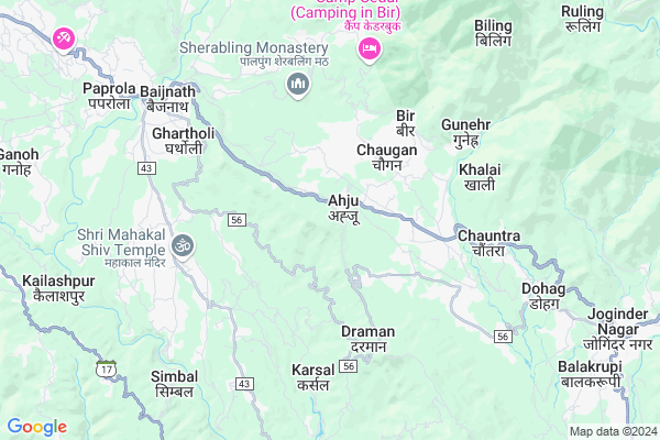
Ahju
Ahju Map
EDIT Map
Add Your House
 ..
..
Current Corona Virus Infected Patients Count in Mandi District
| City Name | District Name | Total Covid cases |
|---|
Locality Name :
Ahju
( ाःजु )
Tehsil Name : Chauntra
District : Mandi
State : Himachal Pradesh
Language : Hindi and English, Pahari And Mandyali
Current Time 10:59 AM
Date: Tuesday , Apr 29,2025 (IST)
Time zone: IST (UTC+5:30)
Elevation / Altitude: 1081 meters. Above Seal level
Telephone Code / Std Code: 01908
Assembly constituency : Joginder Nagar assembly constituency
Assembly MLA : Prakash Prem Kumar
Lok Sabha constituency : Mandi parliamentary constituency
Parliament MP : RAM SWAROOP SHARMA
Serpanch Name :
Pin Code : 175032
Post Office Name : Chauntra
Alternate Village Name : Aihju
Commodities Prices : Kangra(Baijnath) Market / Mandi
Ahju Live Weather
Temperature: 30.2 °C
clear sky
Humidity: 17%
Wind : 3.46 mt/sec towards SW
StationName : "Jogindarnagar"
observed on 36 Mins Back
Temperature: 30.2 °C
clear sky
Humidity: 17%
Wind : 3.46 mt/sec towards SW
StationName : "Jogindarnagar"
observed on 36 Mins Back
Ahju Weather Forecast for Next 5 days
30-04-2025
20.3°C to 29.6°C
clear sky
20.3°C to 29.6°C
clear sky
01-05-2025
20.0°C to 31.7°C
clear sky, scattered clouds, broken clouds
20.0°C to 31.7°C
clear sky, scattered clouds, broken clouds
02-05-2025
19.0°C to 32.2°C
broken clouds, light rain, overcast clouds
19.0°C to 32.2°C
broken clouds, light rain, overcast clouds
03-05-2025
17.9°C to 31.0°C
scattered clouds, clear sky, few clouds, light rain, moderate rain
17.9°C to 31.0°C
scattered clouds, clear sky, few clouds, light rain, moderate rain
04-05-2025
19.0°C to 30.7°C
light rain
19.0°C to 30.7°C
light rain
Edit below overview about Ahju
Edit below overview about Ahju
OverView of Ahju
Anju is a village of princy state of bhangal ruled by paul dynasty it was the winter capital of ancient baghal state near bir .two old fort are there on the top of sikander dhaar .so many sign of house are there in the anju jungle which says that there was any civilization in this area in ancient time so many wells and babri are there near the forest says that in ancient time there was a town in this place. .Edit below overview about Ahju
National Highways Reachable To Ahju
Nationa High Way :NH3
Nationa High Way :NH503
Nationa High Way :NH3
Nationa High Way :NH503
Rivers Near Ahju
Ghoralatinu Nala
Sainj River
Ghoralatinu Nala
Sainj River
About Ahju
Ahju is a Village in Chauntra Tehsil in Mandi District of Himachal Pradesh State, India. It is located 48 KM towards North from District head quarters Mandi. 12 KM from Chauntra. 130 KM from State capital Shimla
Ahju Pin code is 175032 and postal head office is Chauntra .
Chauntra ( 3 KM ) , Golwan ( 4 KM ) , Trambli ( 8 KM ) , Menbharela ( 8 KM ) , Dhelu ( 9 KM ) are the nearby Villages to Ahju. Ahju is surrounded by Chauntra Tehsil towards South , Panchrukhi Tehsil towards west , Lambagaon Tehsil towards west , Bhawarna Tehsil towards west .
Mandi , Hamirpur , Dharamsala , Sundarnagar are the near by Cities to Ahju.
This Place is in the border of the Mandi District and Kangra District. Kangra District Baijnath is North towards this place .
Aihju 2011 Census Details
Ahju Local Language is Hindi. Aihju Village Total population is 751 and number of houses are 170. Female Population is 50.9%. Village literacy rate is 83.8% and the Female Literacy rate is 41.5%.
Population
| Census Parameter | Census Data |
| Total Population | 751 |
| Total No of Houses | 170 |
| Female Population % | 50.9 % ( 382) |
| Total Literacy rate % | 83.8 % ( 629) |
| Female Literacy rate | 41.5 % ( 312) |
| Scheduled Tribes Population % | 0.5 % ( 4) |
| Scheduled Caste Population % | 27.4 % ( 206) |
| Working Population % | 49.8 % |
| Child(0 -6) Population by 2011 | 69 |
| Girl Child(0 -6) Population % by 2011 | 44.9 % ( 31) |
Aihju Census More Deatils.
Politics in Ahju
BJP , INC are the major political parties in this area.Polling Stations /Booths near Ahju
1)Gps Yora(right Part)(at Dhelu)2)Gsss Ahju(left Part
3)Gps Sarohali
4)Gps Pihar
5)Gps Langna
HOW TO REACH Ahju
By Rail
Ahju Rail Way Station , Chauntra Bhater Rail Way Station are the very nearby railway stations to Ahju.Colleges near Ahju
Govt. Degree College Ladbharol
Address :
Schools in Ahju
Gsss Ahju
Address : ahju , chauntra-1 , mandi , Himachal Pradesh . PIN- 175032 , Post - Chauntra
Aryan.public.school.ahju
Address : ahju , chauntra-1 , mandi , Himachal Pradesh . PIN- 175032 , Post - Chauntra
Govt Health Centers near Ahju
1) Utpur PHC , VPO Utpur Tehsil Tauni Devi Distt. Hamirpur H.P. , Utpur ,2) Chauri PHC , VPO Chauri Tehsil Sujanpur Distt. Hamirpur H.P. , Chauri ,
3) Dhaned Seribaloni PHC , VPO Dhaned Tehsil &Distt. Hamirpur H.P. , Dhaned ,
Hospitals in Ahju,Chauntra
Shashi Medical Center
Bir; Mandi; NH-20; Mandi Pathankot Road; Bhankher; Bhankher; Himachal Pradesh 175032; India
1.2 KM distance Detail
Dr. Sudarshan K. Thakur Residence
Sukhbag - Chaugan Rd; Chaugan; Himachal Pradesh 175032; India
3.1 KM distance Detail
more ..
Petrol Bunks in Ahju,Chauntra
BK Enterprises Indian Oil Petrol Pump
Bir; Mandi; NH-20; Mandi Pathankot Road; Bhankher; Bhankher; Himachal Pradesh 175032; India
2.2 KM distance Detail
Indian Oil Petrol Pump
Mandi - Pathankot Rd; Gadiyada; Himachal Pradesh 176120; India
8.9 KM distance Detail
more ..
Colleges in Ahju,Chauntra
Industrial Traning Institute Joginder Nagar
Ladruhin- Dohag Rd; Dohag; Himachal Pradesh 176120; India
7.6 KM distance Detail
Industrial Training Institute
Chauntra - Delhu Rd; Dohag; Himachal Pradesh 176120; India
7.6 KM distance Detail
Nursing College;Joginder Nagar
Joginder Nagar; Himachal Pradesh 175015; India
10.4 KM distance Detail
more ..
Schools in Ahju,Chauntra
Government High School
Taramat - Raja Rd; Raja; Himachal Pradesh 175032; India
3.4 KM distance Detail
Government Senior Secondary School
National Highway 20; Chauntra; Himachal Pradesh 175032; India
4.1 KM distance Detail
Electronic Shops in Ahju,Chauntra
Kamaksha Computer
Mandi - Pathankot Rd; Talkehr; Himachal Pradesh 175032; India
1.2 KM distance Detail
Police Stations near Ahju,Chauntra
Police Station Joginder Nagar
Mandi - Pathankot Rd; Joginder Nagar; Himachal Pradesh 176120; India
10.9 KM distance Detail
Governement Offices near Ahju,Chauntra
Block Development Office
Sukhbag - Chaugan Rd; Chauntra; Himachal Pradesh 175032; India
2.9 KM distance Detail
उद्यान विभाग हिमाचल प्रदेश
Sukhbag - Chaugan Rd; Pasal; Himachal Pradesh 175032; India
3.0 KM distance Detail
About Ahju &
History
How to reach Ahju
Tourist Places Near By Ahju
Schools in Ahju
Colleges in Ahju
Temperature & weather of Ahju
places in Ahju
Ahju photos
More Information
How to reach Ahju
Tourist Places Near By Ahju
Schools in Ahju
Colleges in Ahju
Temperature & weather of Ahju
places in Ahju
Ahju photos
More Information
Village Talk
Post News or Events about this Village
Near Cities
Mandi 46 KM near
Hamirpur 46 KM near
Dharamsala 47 KM near
Sundarnagar 64 KM near
Mandi 46 KM near
Hamirpur 46 KM near
Dharamsala 47 KM near
Sundarnagar 64 KM near
Near By Taluks
Baijnath 6 KM near
Chauntra 11 KM near
Panchrukhi 12 KM near
Lambagaon 21 KM near
Baijnath 6 KM near
Chauntra 11 KM near
Panchrukhi 12 KM near
Lambagaon 21 KM near
Near By Air Ports
Bhuntar Airport 42 KM near
Gaggal Airport 57 KM near
Pathankot Airport 115 KM near
Simla Airport 122 KM near
Bhuntar Airport 42 KM near
Gaggal Airport 57 KM near
Pathankot Airport 115 KM near
Simla Airport 122 KM near
Near By Tourist Places
Bir 5 KM near
Palampur 19 KM near
Jawalaji 43 KM near
Kullu 44 KM near
Mandi 46 KM near
Bir 5 KM near
Palampur 19 KM near
Jawalaji 43 KM near
Kullu 44 KM near
Mandi 46 KM near
Near By Districts
Kullu 43 KM near
Hamirpur 45 KM near
Mandi 46 KM near
Kangra 46 KM near
Kullu 43 KM near
Hamirpur 45 KM near
Mandi 46 KM near
Kangra 46 KM near
Near By RailWay Station
Ahju Rail Way Station 0.9 KM near
Chauntra Bhater Rail Way Station 5.4 KM near
Baijnath Paprola Rail Way Station 6.6 KM near
Nangal Dam Rail Way Station 88 KM near
Anandpur Sahib Rail Way Station 100 KM near
Ahju Rail Way Station 0.9 KM near
Chauntra Bhater Rail Way Station 5.4 KM near
Baijnath Paprola Rail Way Station 6.6 KM near
Nangal Dam Rail Way Station 88 KM near
Anandpur Sahib Rail Way Station 100 KM near