| Home | City Bus | Maps | Villages | Cities | Rail | Tourist Places | School | College | Pin Codes | Corona Cases Count |
| Distance Calculator Bus Services IFSC Codes Trace Mobile Number Weather Search Place Trace IP Available Cash ATM/Banks Locate Polling Booth Report an Error contact People |
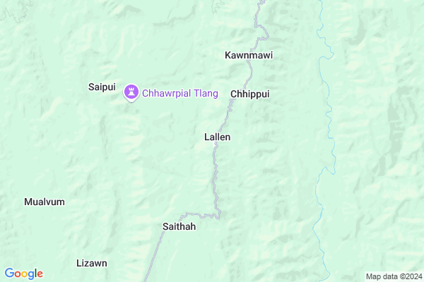
Lallen
Lallen Map
EDIT Map
Add Your House
 ..
..
Current Corona Virus Infected Patients Count in Mamit District
| City Name | District Name | Total Covid cases |
|---|
Locality Name :
Lallen
( ललन )
Block Name : West Phaileng
District : Mamit
State : Mizoram
Language : Mizo
Current Time 11:43 AM
Date: Friday , Mar 14,2025 (IST)
Time zone: IST (UTC+5:30)
Elevation / Altitude: 48 meters. Above Seal level
Telephone Code / Std Code: 0389
Assembly constituency : Dampa assembly constituency
Assembly MLA : Lalrintluanga Sailo
Lok Sabha constituency : Mizoram parliamentary constituency
Parliament MP : C LALROSANGA
Serpanch Name :
Pin Code : 796431
Post Office Name : Phaileng
Commodities Prices : Kanchanpur Market / Mandi
Lallen Live Weather
Temperature: 30.9 °C
clear sky
Humidity: 26%
Wind : 3.27 mt/sec towards SW
StationName : "Aizawl"
observed on Now
Temperature: 30.9 °C
clear sky
Humidity: 26%
Wind : 3.27 mt/sec towards SW
StationName : "Aizawl"
observed on Now
Lallen Weather Forecast for Next 5 days
15-03-2025
17.6°C to 31.5°C
clear sky, few clouds, light rain
17.6°C to 31.5°C
clear sky, few clouds, light rain
16-03-2025
16.9°C to 33.3°C
clear sky, broken clouds, scattered clouds
16.9°C to 33.3°C
clear sky, broken clouds, scattered clouds
17-03-2025
17.8°C to 35.0°C
clear sky, scattered clouds, few clouds
17.8°C to 35.0°C
clear sky, scattered clouds, few clouds
18-03-2025
18.7°C to 35.1°C
clear sky, few clouds, light rain
18.7°C to 35.1°C
clear sky, few clouds, light rain
19-03-2025
17.6°C to 34.0°C
clear sky, scattered clouds, light rain
17.6°C to 34.0°C
clear sky, scattered clouds, light rain
National Highways Reachable To Lallen
Nationa High Way :NH6
Nationa High Way :NH6
Rivers Near Lallen
Tut
Manu
Tut
Manu
About Lallen
Correct below Info and add more info about LallenLallen is a Village in West Phaileng Block in Mamit District of Mizoram State, India. It is located 41 KM towards South from District head quarters Mamit. 2 KM from West Phaileng. 33 KM from State capital Aizawl
Lallen Pin code is 796431 and postal head office is Phaileng .
Saithah ( 5 KM ) , West Phaileng ( 10 KM ) , Damparengpui ( 13 KM ) , Khawhnai ( 14 KM ) , Chungtlang ( 15 KM ) are the nearby Villages to Lallen. Lallen is surrounded by Reiek Block towards East , Aizawl Block towards East , Aibawk Block towards East , Tlangnuam Block towards East .
Aizawl , Lunglei , Dharmanagar , Champhai are the near by Cities to Lallen.
Lallen 2011 Census Details
Lallen Local Language is Mizo. Lallen Village Total population is 824 and number of houses are 163. Female Population is 48.4%. Village literacy rate is 88.2% and the Female Literacy rate is 42.1%.
Population
| Census Parameter | Census Data |
| Total Population | 824 |
| Total No of Houses | 163 |
| Female Population % | 48.4 % ( 399) |
| Total Literacy rate % | 88.2 % ( 727) |
| Female Literacy rate | 42.1 % ( 347) |
| Scheduled Tribes Population % | 97.9 % ( 807) |
| Scheduled Caste Population % | 0.0 % ( 0) |
| Working Population % | 55.5 % |
| Child(0 -6) Population by 2011 | 89 |
| Girl Child(0 -6) Population % by 2011 | 55.1 % ( 49) |
Lallen Census More Deatils.
Politics in Lallen
Mizo National Front , INC are the major political parties in this area.Polling Stations /Booths near Lallen
1)Khawrihnim2)S.sabual
3)Kanghmun
4)W.phaileng I
5)W.phaileng Dinthar Veng - Ii
HOW TO REACH Lallen
By Rail
There is no railway station near to Lallen in less than 10 km.Schools in Lallen
Govt. M S Lallen
Address : lallen , west phaileng , mamit , Mizoram . PIN- 796431 , Post - Phaileng
Govt Health Centers near Lallen
1) Mamit District Hospital , , ,2) Damrengpui , , ,
3) Parvatui , , ,
Electronic Shops in Lallen,West Phaileng
Super Markets in Lallen,West Phaileng
Local Parks in Lallen,West Phaileng
Police Stations near Lallen,West Phaileng
Governement Offices near Lallen,West Phaileng
About Lallen &
History
How to reach Lallen
Tourist Places Near By Lallen
Schools in Lallen
Colleges in Lallen
Temperature & weather of Lallen
places in Lallen
Lallen photos
More Information
How to reach Lallen
Tourist Places Near By Lallen
Schools in Lallen
Colleges in Lallen
Temperature & weather of Lallen
places in Lallen
Lallen photos
More Information
Village Talk
Post News or Events about this Village
Near Cities
Aizawl 33 KM near
Lunglei 94 KM near
Dharmanagar 99 KM near
Champhai 100 KM near
Aizawl 33 KM near
Lunglei 94 KM near
Dharmanagar 99 KM near
Champhai 100 KM near
Near By Taluks
West Phaileng 1 KM near
Reiek 19 KM near
Aizawl 31 KM near
Aibawk 35 KM near
West Phaileng 1 KM near
Reiek 19 KM near
Aizawl 31 KM near
Aibawk 35 KM near
Near By Air Ports
Aizawl Airport 33 KM near
Singerbhil Airport 142 KM near
Kumbhirgram Airport 171 KM near
Imphal Municipal Airport 216 KM near
Aizawl Airport 33 KM near
Singerbhil Airport 142 KM near
Kumbhirgram Airport 171 KM near
Imphal Municipal Airport 216 KM near
Near By Tourist Places
Aizawl 32 KM near
Mamit 39 KM near
Serchhip 59 KM near
Ambassa 79 KM near
Kolasib 79 KM near
Aizawl 32 KM near
Mamit 39 KM near
Serchhip 59 KM near
Ambassa 79 KM near
Kolasib 79 KM near
Near By Districts
Aizawl 33 KM near
Mamit 39 KM near
Serchhip 59 KM near
Dhalai 63 KM near
Aizawl 33 KM near
Mamit 39 KM near
Serchhip 59 KM near
Dhalai 63 KM near
Near By RailWay Station
Ambassa Rail Way Station 78 KM near
Dharmanagar Rail Way Station 98 KM near
Ambassa Rail Way Station 78 KM near
Dharmanagar Rail Way Station 98 KM near