| Home | City Bus | Maps | Villages | Cities | Rail | Tourist Places | School | College | Pin Codes | Corona Cases Count |
| Distance Calculator Bus Services IFSC Codes Trace Mobile Number Weather Search Place Trace IP Available Cash ATM/Banks Locate Polling Booth Report an Error contact People |
Nuaguda
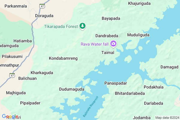
Nuaguda Map
EDIT Map
Add Your House
 ..
..
Current Corona Virus Infected Patients Count in Malkangiri District
| City Name | District Name | Total Covid cases |
|---|
Locality Name :
Nuaguda
( ନୂଆଗଉଡ )
Tehsil Name : Kudumulugumma
District : Malkangiri
State : Odisha
Language : Oriya and Hindi
Current Time 09:26 AM
Date: Wednesday , Apr 30,2025 (IST)
Time zone: IST (UTC+5:30)
Elevation / Altitude: 877 meters. Above Seal level
Telephone Code / Std Code: 06864
Assembly constituency : Chitrakonda assembly constituency
Assembly MLA : dambaru sisa
Lok Sabha constituency : Nabarangpur parliamentary constituency
Parliament MP : RAMESH CHANDRA MAJHI
Serpanch Name :
Commodities Prices : Malkanagiri Market / Mandi
Nuaguda Live Weather
Temperature: 27.7 °C
broken clouds
Humidity: 53%
Wind : 1.65 mt/sec towards S
StationName : "Balimila"
observed on 2 Hours Back
Temperature: 27.7 °C
broken clouds
Humidity: 53%
Wind : 1.65 mt/sec towards S
StationName : "Balimila"
observed on 2 Hours Back
Nuaguda Weather Forecast for Next 5 days
01-05-2025
21.7°C to 37.5°C
broken clouds, overcast clouds, clear sky
21.7°C to 37.5°C
broken clouds, overcast clouds, clear sky
02-05-2025
20.9°C to 37.2°C
clear sky, few clouds, scattered clouds
20.9°C to 37.2°C
clear sky, few clouds, scattered clouds
03-05-2025
21.0°C to 37.3°C
clear sky, scattered clouds, light rain
21.0°C to 37.3°C
clear sky, scattered clouds, light rain
04-05-2025
20.7°C to 36.0°C
few clouds, clear sky, moderate rain, overcast clouds
20.7°C to 36.0°C
few clouds, clear sky, moderate rain, overcast clouds
05-05-2025
22.1°C to 34.4°C
overcast clouds, scattered clouds, broken clouds, light rain, clear sky
22.1°C to 34.4°C
overcast clouds, scattered clouds, broken clouds, light rain, clear sky
National Highways Reachable To Nuaguda
Nationa High Way :NH30
Nationa High Way :NH30
Rivers Near Nuaguda
Sabari :శబరి
Sileru
Sabari :శబరి
Sileru
About Nuaguda
Correct below Info and add more info about NuagudaNuaguda is a small Village/hamlet in Kudumulugumma Tehsil in Malkangiri District of Odisha State, India. It is located 38 KM towards East from District head quarters Malkangiri. 513 KM from State capital Bhubaneswar
Nuaguda is surrounded by Khairaput Tehsil towards North , Korukonda Tehsil towards west , Mathili Tehsil towards North , Munchingi Puttu Tehsil towards East .
Malkangiri , Jeypur , Koraput , Sunabeda are the near by Cities to Nuaguda.
Nuaguda 2011 Census Details
Nuaguda Local Language is Oriya. Nuaguda Village Total population is 231 and number of houses are 57. Female Population is 48.9%. Village literacy rate is 14.3% and the Female Literacy rate is 4.3%.
Population
| Census Parameter | Census Data |
| Total Population | 231 |
| Total No of Houses | 57 |
| Female Population % | 48.9 % ( 113) |
| Total Literacy rate % | 14.3 % ( 33) |
| Female Literacy rate | 4.3 % ( 10) |
| Scheduled Tribes Population % | 100.0 % ( 231) |
| Scheduled Caste Population % | 0.0 % ( 0) |
| Working Population % | 79.2 % |
| Child(0 -6) Population by 2011 | 41 |
| Girl Child(0 -6) Population % by 2011 | 41.5 % ( 17) |
Nuaguda Census More Deatils.
Politics in Nuaguda
BJP , BJD , INC are the major political parties in this area.Polling Stations /Booths near Nuaguda
1)Bariabahal Primary School2)Sindhiguda U.p.school
3)P.u.p. School Patraput
4)Doraguda
5)Doraguda Primary School
HOW TO REACH Nuaguda
By Rail
There is no railway station near to Nuaguda in less than 10 km.Pincodes near Nuaguda
764042 ( Onukadeli ) , 764044 ( Mathili ) , 764052 ( Chitrakonda )Colleges near Nuaguda
Regional Junior College,podia
Address :
Malkangiri College
Address : Malkangiri, Berhampur-760007.
Biju Patnaik College Of Education
Address : Biju Patnaik College Of Education, Govindapalli, B
Schools near Nuaguda
Govt Health Centers near Nuaguda
1) PADAGHAT , , PHC (N) Podaghat , Main Roadsite2) SC Kumarput , , , Kasthuraba Gandhi School and Field
3) Jaugali , AWC , Jaugali , TUBEL
Schools in Nuaguda,Kudumulugumma
Electronic Shops in Nuaguda,Kudumulugumma
Super Markets in Nuaguda,Kudumulugumma
Local Parks in Nuaguda,Kudumulugumma
Police Stations near Nuaguda,Kudumulugumma
Governement Offices near Nuaguda,Kudumulugumma
About Nuaguda &
History
How to reach Nuaguda
Tourist Places Near By Nuaguda
Schools in Nuaguda
Colleges in Nuaguda
Temperature & weather of Nuaguda
places in Nuaguda
Nuaguda photos
More Information
How to reach Nuaguda
Tourist Places Near By Nuaguda
Schools in Nuaguda
Colleges in Nuaguda
Temperature & weather of Nuaguda
places in Nuaguda
Nuaguda photos
More Information
Village Talk
Post News or Events about this Village
Near Cities
Malkangiri 36 KM near
Jeypur 81 KM near
Koraput 87 KM near
Sunabeda 89 KM near
Malkangiri 36 KM near
Jeypur 81 KM near
Koraput 87 KM near
Sunabeda 89 KM near
Near By Taluks
Kudumulugumma 0 KM near
Khairaput 24 KM near
Korukonda 29 KM near
Mathili 32 KM near
Kudumulugumma 0 KM near
Khairaput 24 KM near
Korukonda 29 KM near
Mathili 32 KM near
Near By Air Ports
Vishakhapatnam Airport 140 KM near
Rajahmundry Airport 156 KM near
Vijayawada Airport 278 KM near
Raipur Airport 362 KM near
Vishakhapatnam Airport 140 KM near
Rajahmundry Airport 156 KM near
Vijayawada Airport 278 KM near
Raipur Airport 362 KM near
Near By Tourist Places
Araku Valley 77 KM near
Ananthagiri 77 KM near
Jeypore 81 KM near
Jagdalpur 98 KM near
Bastar 101 KM near
Araku Valley 77 KM near
Ananthagiri 77 KM near
Jeypore 81 KM near
Jagdalpur 98 KM near
Bastar 101 KM near
Near By Districts
Malkangiri 37 KM near
Koraput 86 KM near
Bastar 115 KM near
Dantewada 120 KM near
Malkangiri 37 KM near
Koraput 86 KM near
Bastar 115 KM near
Dantewada 120 KM near
Near By RailWay Station
Koraput Junction Rail Way Station 84 KM near
Elamanchili Rail Way Station 121 KM near
Koraput Junction Rail Way Station 84 KM near
Elamanchili Rail Way Station 121 KM near