| Home | City Bus | Maps | Villages | Cities | Rail | Tourist Places | School | College | Pin Codes | Corona Cases Count |
| Distance Calculator Bus Services IFSC Codes Trace Mobile Number Weather Search Place Trace IP Available Cash ATM/Banks Locate Polling Booth Report an Error contact People |
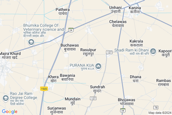
Dhana
Dhana Map
EDIT Map
Add Your House
 ..
..
Current Corona Virus Infected Patients Count in Mahendragarh District
| City Name | District Name | Total Covid cases |
|---|
Locality Name :
Dhana
( धना )
Tehsil Name : Kanina
District : Mahendragarh
State : Haryana
Division : Gurgaon
Language : Hindi and Punjabi
Current Time 05:57 AM
Date: Saturday , Apr 26,2025 (IST)
Time zone: IST (UTC+5:30)
Elevation / Altitude: 256 meters. Above Seal level
Assembly constituency : Ateli assembly constituency
Assembly MLA : Sitaram
Lok Sabha constituency : Bhiwani-Mahendragarh parliamentary constituency
Parliament MP : Dharambir Singh S/o Bhale Ram
Serpanch Name :
Pin Code : 123034
Post Office Name : Bawania
Commodities Prices : Mohindergarh Market / Mandi
Dhana Live Weather
Temperature: 26.4 °C
clear sky
Humidity: 9%
Wind : 1.31 mt/sec towards E
StationName : "KanÄ«na KhÄ\u0081s"
observed on 4 Mins Back
Temperature: 26.4 °C
clear sky
Humidity: 9%
Wind : 1.31 mt/sec towards E
StationName : "KanÄ«na KhÄ\u0081s"
observed on 4 Mins Back
Dhana Weather Forecast for Next 5 days
27-04-2025
28.6°C to 41.6°C
few clouds, scattered clouds, overcast clouds
28.6°C to 41.6°C
few clouds, scattered clouds, overcast clouds
28-04-2025
29.4°C to 42.7°C
overcast clouds, broken clouds, scattered clouds, clear sky
29.4°C to 42.7°C
overcast clouds, broken clouds, scattered clouds, clear sky
29-04-2025
28.8°C to 43.7°C
clear sky
28.8°C to 43.7°C
clear sky
30-04-2025
28.1°C to 43.8°C
clear sky
28.1°C to 43.8°C
clear sky
01-05-2025
29.2°C to 45.0°C
clear sky, overcast clouds
29.2°C to 45.0°C
clear sky, overcast clouds
Edit below overview about Dhana
Edit below overview about Dhana
OverView of Dhana
Nearest railway station Kanina Khash is 8 Km from Dhana. Nearby villages are West- Partal, North-Bhojawas, East-ManpuraEdit below overview about Dhana
National Highways Reachable To Dhana
Nationa High Way :NH919
Nationa High Way :NH352W
Nationa High Way :NH919
Nationa High Way :NH352W
About Dhana
Dhana is a Village in Kanina Tehsil in Mahendragarh District of Haryana State, India. It belongs to Gurgaon Division . It is located 35 KM towards North from District head quarters Narnaul. 323 KM from State capital Chandigarh
Dhana Pin code is 123034 and postal head office is Bawania .
Dhana is surrounded by Mahendragarh Tehsil towards west , Ateli Nangal Tehsil towards South , Nahar Tehsil towards East , Khol At Rewari Tehsil towards East .
Mahendragarh , Narnaul , Charkhi Dadri , Rewari are the near by Cities to Dhana.
This Place is in the border of the Mahendragarh District and Rewari District. Rewari District Nahar is East towards this place . Also it is in the Border of other district Jhajjar .
Demographics of Dhana
Hindi is the Local Language here.Politics in Dhana
BJP , INLD , INC are the major political parties in this area.Polling Stations /Booths near Dhana
1)Ghs Right Wing Karira2)Ghs Left Wing Karira
3)Gms Katkai
4)Gms Left Wing Rampura
5)Gps Mohlara
HOW TO REACH Dhana
By Rail
Bojawas Rail Way Station , Gurha Kemla Rail Way Station are the very nearby railway stations to Dhana.Colleges near Dhana
Govt.college For Women Unhani
Address : Dadri Mode Unhani
Modern College Of Education
Address :
Dav College Of Engineering And Technology (davcet), Kanina
Address :
Pkspg College Kanina
Address :
Schools in Dhana
Gms Dhana
Address : dhana , kanina , mahendragarh , Haryana . PIN- 123034 , Post - Bawania
Govt Health Centers near Dhana
1) PHC Salhawas , , ,2) PHC Jamalpur , , ,
3) Sasroli , , ,
Hospitals in Dhana,Kanina
Ravi Yadav Smacky
Nangal(mohanpur; Narnaul - Kanina Rd; Rasulpur; Haryana 123034; India
3.0 KM distance Detail
more ..
Petrol Bunks in Dhana,Kanina
Mangla Singh Filling Station Hindustan Petroleum
Kanina Khas; Mahendergarh; SH-24; Mahendragarh Road; Mahendergarh; Mahendergarh; Haryana 123302; India
6.2 KM distance Detail
HP PETROL PUMP - MANGALDEEP FILLING STATION
HPC Petrol Pump Vill. Chelawas Kanina M'garh Road; Gurgaon; Haryana 123027; India
6.9 KM distance Detail
Essar Pump
Ateli - Kanina Road; Near Baba Jinda Dev Temple; Bhojawas; Haryana 123034; India
7.1 KM distance Detail
more ..
Schools in Dhana,Kanina
Satya Bharti School Bachini Haryana
Khub Ram Rd; Bachini; Haryana 123034; India
2.3 KM distance Detail
Electronic Shops in Dhana,Kanina
Joshi Communications and Hardwares
JOSHI Communications and Hardwares; Mohanpur; Haryana 123034; India
3.5 KM distance Detail
About Dhana &
History
How to reach Dhana
Tourist Places Near By Dhana
Schools in Dhana
Colleges in Dhana
Temperature & weather of Dhana
places in Dhana
Dhana photos
More Information
How to reach Dhana
Tourist Places Near By Dhana
Schools in Dhana
Colleges in Dhana
Temperature & weather of Dhana
places in Dhana
Dhana photos
More Information
Village Talk
Post News or Events about this Village
Near Cities
Mahendragarh 10 KM near
Narnaul 34 KM near
Charkhi Dadri 39 KM near
Rewari 43 KM near
Mahendragarh 10 KM near
Narnaul 34 KM near
Charkhi Dadri 39 KM near
Rewari 43 KM near
Near By Taluks
Kanina 0 KM near
Mahendragarh 13 KM near
Ateli Nangal 21 KM near
Khol At Rewari 24 KM near
Kanina 0 KM near
Mahendragarh 13 KM near
Ateli Nangal 21 KM near
Khol At Rewari 24 KM near
Near By Air Ports
Indira Gandhi International Airport 99 KM near
Sanganeer Airport 188 KM near
Muzaffarnagar Airport 210 KM near
Kheria Airport 234 KM near
Indira Gandhi International Airport 99 KM near
Sanganeer Airport 188 KM near
Muzaffarnagar Airport 210 KM near
Kheria Airport 234 KM near
Near By Tourist Places
Narnaul 33 KM near
Bhindawas Lake 45 KM near
Bhiwani 63 KM near
Manesar 76 KM near
Nuh 85 KM near
Narnaul 33 KM near
Bhindawas Lake 45 KM near
Bhiwani 63 KM near
Manesar 76 KM near
Nuh 85 KM near
Near By Districts
Mahendragarh 33 KM near
Rewari 40 KM near
Jhajjar 60 KM near
Bhiwani 65 KM near
Mahendragarh 33 KM near
Rewari 40 KM near
Jhajjar 60 KM near
Bhiwani 65 KM near
Near By RailWay Station
Bojawas Rail Way Station 4.1 KM near
Gurha Kemla Rail Way Station 7.1 KM near
Kanina Khas Rail Way Station 8.2 KM near
Mahendragarh Rail Way Station 11 KM near
Rewari Junction Rail Way Station 40 KM near
Bojawas Rail Way Station 4.1 KM near
Gurha Kemla Rail Way Station 7.1 KM near
Kanina Khas Rail Way Station 8.2 KM near
Mahendragarh Rail Way Station 11 KM near
Rewari Junction Rail Way Station 40 KM near