| Home | City Bus | Maps | Villages | Cities | Rail | Tourist Places | School | College | Pin Codes | Corona Cases Count |
| Distance Calculator Bus Services IFSC Codes Trace Mobile Number Weather Search Place Trace IP Available Cash ATM/Banks Locate Polling Booth Report an Error contact People |
Atali
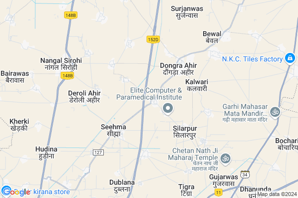
Atali Map
EDIT Map
Add Your House
 ..
..
Current Corona Virus Infected Patients Count in Mahendragarh District
| City Name | District Name | Total Covid cases |
|---|
Locality Name :
Atali
( अटाली )
Tehsil Name : Ateli Nangal
District : Mahendragarh
State : Haryana
Division : Gurgaon
Language : Hindi and Punjabi
Current Time 12:38 PM
Date: Monday , Apr 28,2025 (IST)
Time zone: IST (UTC+5:30)
Elevation / Altitude: 290 meters. Above Seal level
Assembly constituency : Narnaul assembly constituency
Assembly MLA : Om Prakash Yadav
Lok Sabha constituency : Bhiwani-Mahendragarh parliamentary constituency
Parliament MP : Dharambir Singh S/o Bhale Ram
Serpanch Name :
Pin Code : 123021
Post Office Name : Mandi Ateli
Commodities Prices : Mohindergarh Market / Mandi
National Highways Reachable To Atali
Nationa High Way :NH919
Nationa High Way :NH48
Nationa High Way :NH919
Nationa High Way :NH48
About Atali
Correct below Info and add more info about AtaliAtali is a Village in Ateli Nangal Tehsil in Mahendragarh District of Haryana State, India. It belongs to Gurgaon Division . It is located 19 KM towards North from District head quarters Narnaul. 9 KM from Ateli. 339 KM from State capital Chandigarh
Atali Pin code is 123021 and postal head office is Mandi Ateli .
Dongra Ahir ( 3 KM ) , Silarpur ( 3 KM ) , Sihma ( 3 KM ) , Bhalkhi ( 4 KM ) , Sagarpur ( 4 KM ) are the nearby Villages to Atali. Atali is surrounded by Mahendragarh Tehsil towards North , Kanina Tehsil towards North , Narnaul Tehsil towards west , Nimrana Tehsil towards East .
Mahendragarh , Narnaul , Bawal , Rewari are the near by Cities to Atali.
This Place is in the border of the Mahendragarh District and Rewari District. Rewari District Khol At Rewari is East towards this place . Also it is in the Border of other district Alwar . It is near to the Rajasthan State Border.
Atali 2011 Census Details
Atali Local Language is Hindi. Atali Village Total population is 1928 and number of houses are 365. Female Population is 47.6%. Village literacy rate is 69.5% and the Female Literacy rate is 28.6%.
Population
| Census Parameter | Census Data |
| Total Population | 1928 |
| Total No of Houses | 365 |
| Female Population % | 47.6 % ( 917) |
| Total Literacy rate % | 69.5 % ( 1339) |
| Female Literacy rate | 28.6 % ( 552) |
| Scheduled Tribes Population % | 0.0 % ( 0) |
| Scheduled Caste Population % | 7.9 % ( 153) |
| Working Population % | 39.7 % |
| Child(0 -6) Population by 2011 | 213 |
| Girl Child(0 -6) Population % by 2011 | 39.9 % ( 85) |
Atali Census More Deatils.
Politics in Atali
HJCBL , BJP , INLD , INC are the major political parties in this area.Polling Stations /Booths near Atali
1)Sihma2)Shahpur Doyam
3)Sihma
4)Chindlia
5)Daroli Ahir
HOW TO REACH Atali
By Rail
Ateli Rail Way Station , Mirzapur Bachhaud Rail Way Station are the very nearby railway stations to Atali.Colleges near Atali
G.r. College Of Education
Address : Kuksi Deroli Road , Deroli Ahir, Mahendergarh, Hr-123028
Rps College Of Education, Mahendergarh
Address : Village: - Khor, 13th Km Stonenarnaul- Rewari Road
Schools in Atali
Gms Atali
Address : atali , ateli , mahendragarh , Haryana . PIN- 123021 , Post - Mandi Ateli
Govt Health Centers near Atali
1) Atali , , ,2) Sagarpur , , ,
3) PHC Bahu , , ,
Petrol Bunks in Atali,Ateli Nangal
SAMRAT FILLING STATION; ESSAR OIL
TO; Ateli Rd; NEAR HANUMAN TAMPAL; Narnaul; Haryana 123035; India
4.5 KM distance Detail
H.P. PETROL PUMP - GANPATI FILLING STATION
HPC Petrol Pump Vill. Sihma; Narnaul - Kanina Rd; Gurgaon; Haryana 123028; India
4.8 KM distance Detail
Swagat Filling Station Indian Oil Petrol Pump
Nangal; Mahendergarh; SH-17; Narnaul Road; Narnaul; Narnaul; Haryana 123302; India
7.3 KM distance Detail
more ..
Colleges in Atali,Ateli Nangal
Gr College Of Education
Seehma - Deroli - Kuksi Rd; Deroli Ahir; Haryana 123028; India
5.2 KM distance Detail
more ..
Schools in Atali,Ateli Nangal
Indus Valley Public School Dongra Ahir
Sub Tehsil; Kanina; Haryana 123021; India
2.1 KM distance Detail
About Atali &
History
How to reach Atali
Tourist Places Near By Atali
Schools in Atali
Colleges in Atali
Temperature & weather of Atali
places in Atali
Atali photos
More Information
How to reach Atali
Tourist Places Near By Atali
Schools in Atali
Colleges in Atali
Temperature & weather of Atali
places in Atali
Atali photos
More Information
Village Talk
Post News or Events about this Village
Near Cities
Mahendragarh 14 KM near
Narnaul 19 KM near
Bawal 44 KM near
Rewari 48 KM near
Mahendragarh 14 KM near
Narnaul 19 KM near
Bawal 44 KM near
Rewari 48 KM near
Near By Taluks
Ateli Nangal 9 KM near
Mahendragarh 14 KM near
Kanina 15 KM near
Narnaul 19 KM near
Ateli Nangal 9 KM near
Mahendragarh 14 KM near
Kanina 15 KM near
Narnaul 19 KM near
Near By Air Ports
Indira Gandhi International Airport 110 KM near
Sanganeer Airport 173 KM near
Muzaffarnagar Airport 225 KM near
Kheria Airport 232 KM near
Indira Gandhi International Airport 110 KM near
Sanganeer Airport 173 KM near
Muzaffarnagar Airport 225 KM near
Kheria Airport 232 KM near
Near By Tourist Places
Narnaul 18 KM near
Bhindawas Lake 60 KM near
Bhiwani 76 KM near
Manesar 85 KM near
Jhunjhunu 87 KM near
Narnaul 18 KM near
Bhindawas Lake 60 KM near
Bhiwani 76 KM near
Manesar 85 KM near
Jhunjhunu 87 KM near
Near By Districts
Mahendragarh 18 KM near
Rewari 46 KM near
Jhajjar 74 KM near
Bhiwani 78 KM near
Mahendragarh 18 KM near
Rewari 46 KM near
Jhajjar 74 KM near
Bhiwani 78 KM near
Near By RailWay Station
Mahendragarh Rail Way Station 14 KM near
Rewari Junction Rail Way Station 46 KM near
Mahendragarh Rail Way Station 14 KM near
Rewari Junction Rail Way Station 46 KM near