| Home | City Bus | Maps | Villages | Cities | Rail | Tourist Places | School | College | Pin Codes | Corona Cases Count |
| Distance Calculator Bus Services IFSC Codes Trace Mobile Number Weather Search Place Trace IP Available Cash ATM/Banks Locate Polling Booth Report an Error contact People |
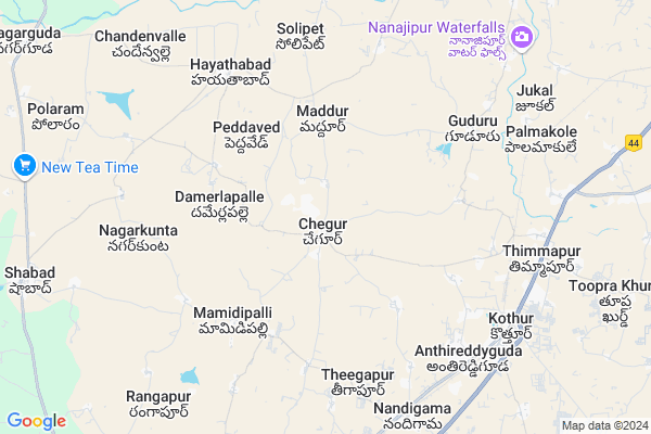
Chegur
Chegur Map
EDIT Map
Add Your House
 ..
..
Current Corona Virus Infected Patients Count in Mahbubnagar District
| City Name | District Name | Total Covid cases |
|---|---|---|
| Jogulamba Gadwal District | Jogulamba Gadwal | 40 |
| Mahabubnagar District | Mahabubnagar | 11 |
Locality Name :
Chegur
( చిగురు )
Mandal Name : Kothur
District : Mahbubnagar
State : Telangana
Region : Telangana
Language : Telugu and Hindi, Urdu
Current Time 08:23 AM
Date: Wednesday , Apr 30,2025 (IST)
Time zone: IST (UTC+5:30)
Elevation / Altitude: 582 meters. Above Seal level
Telephone Code / Std Code: 08548
Assembly constituency : Shadnagar assembly constituency
Assembly MLA : K Shankaraiah
Lok Sabha constituency : Mahabubnagar parliamentary constituency
Parliament MP : MANNE SRINIVAS REDDY
Serpanch Name :
Pin Code : 509325
Post Office Name : Palmakole
Alternate Village Name : Chegur tanda
Commodities Prices : Sardarnagar Market / Mandi
Chegur Live Weather
Temperature: 25.1 °C
scattered clouds
Humidity: 45%
Wind : 4.7 mt/sec towards S
StationName : "SrÄ«rÄ\u0081mnagar"
observed on 2 Hours Back
Temperature: 25.1 °C
scattered clouds
Humidity: 45%
Wind : 4.7 mt/sec towards S
StationName : "SrÄ«rÄ\u0081mnagar"
observed on 2 Hours Back
Chegur Weather Forecast for Next 5 days
01-05-2025
25.1°C to 37.4°C
scattered clouds, broken clouds
25.1°C to 37.4°C
scattered clouds, broken clouds
02-05-2025
27.0°C to 39.8°C
broken clouds, few clouds, clear sky, scattered clouds
27.0°C to 39.8°C
broken clouds, few clouds, clear sky, scattered clouds
03-05-2025
27.0°C to 39.8°C
few clouds, clear sky, broken clouds, scattered clouds
27.0°C to 39.8°C
few clouds, clear sky, broken clouds, scattered clouds
04-05-2025
25.4°C to 39.5°C
scattered clouds, clear sky, light rain
25.4°C to 39.5°C
scattered clouds, clear sky, light rain
National Highways Reachable To Chegur
Nationa High Way :NH163
Nationa High Way :Old NH7
Nationa High Way :NH163
Nationa High Way :Old NH7
Rivers Near Chegur
Kagina :ಕಾಗಿನಾ
Musa River
Kagina :ಕಾಗಿನಾ
Musa River
About Chegur
Correct below Info and add more info about ChegurChegur is a Village in Kothur Mandal in Mahbubnagar District of Telangana State, India. It belongs to Telangana region . As part Telangana Districts re-organisation , Chegur Village Kothur Mandal re organised from Mahbubnagar District to Ranga Reddy district. It is located 63 KM towards North from District head quarters Mahabubnagar. 5 KM from Kothur.
Chegur Pin code is 509325 and postal head office is Palmakole .
Gudur ( 3 KM ) , Narsappaguda ( 4 KM ) , Veerlapalle ( 5 KM ) , Theegapur ( 6 KM ) , Edulapalle ( 6 KM ) are the nearby Villages to Chegur. Chegur is surrounded by Shabad Mandal towards west , Moinabad Mandal towards North , Farooqnagar Mandal towards South , Shamshabad Mandal towards East .
Farooqnagar , Singapur , Hyderabad , Vicarabad are the near by Cities to Chegur.
This Place is in the border of the Mahbubnagar District and Rangareddi District. Rangareddi District Maheswaram is East towards this place .
Chegur 2011 Census Details
Chegur Local Language is Telugu. Chegur Village Total population is 7832 and number of houses are 1857. Female Population is 47.8%. Village literacy rate is 48.7% and the Female Literacy rate is 18.8%.
Population
| Census Parameter | Census Data |
| Total Population | 7832 |
| Total No of Houses | 1857 |
| Female Population % | 47.8 % ( 3742) |
| Total Literacy rate % | 48.7 % ( 3816) |
| Female Literacy rate | 18.8 % ( 1472) |
| Scheduled Tribes Population % | 1.7 % ( 132) |
| Scheduled Caste Population % | 15.9 % ( 1247) |
| Working Population % | 51.2 % |
| Child(0 -6) Population by 2011 | 1034 |
| Girl Child(0 -6) Population % by 2011 | 46.4 % ( 480) |
Chegur Census More Deatils.
Politics in Chegur
TDP , TRS , BJP , INC are the major political parties in this area.Polling Stations /Booths near Chegur
1)Chegireddy Ghanpur2)Chegur
3)Chegur
4)Chegur
5)Chegur
HOW TO REACH Chegur
By Road
Mahbubnagar is the Nearest Town to Chegur. Mahbubnagar is 57 km from Chegur. Road connectivity is there from Mahbubnagar to Chegur.By Rail
Timmapur Rail Way Station , Hbl Nagar Rail Way Station are the very nearby railway stations to Chegur. Also you can consider railway Stations from Near By town Mahbubnagar. Mahbubnagar Town Halt Rail Way Station , Mahbubnagar Rail Way Station are the railway Stations near to Mahbubnagar. You can reach from Mahbubnagar to Chegur by road after .Colleges near Chegur
Vardhaman Engineering College
Address :
Schools in Chegur
Zphs Narsappaguda
Address : chegur , kothur , mahbubnagar , Andhra Pradesh . PIN- 509285
Zphs Chegur
Address : chegur , kothur , mahbubnagar , Andhra Pradesh . PIN- 509325 , Post - Palmakole
St.joseps Gnanajyoti
Address : chegur , kothur , mahbubnagar , Andhra Pradesh . PIN- 509325 , Post - Palmakole
Shanthiniketan Model
Address : chegur , kothur , mahbubnagar , Andhra Pradesh . PIN- 509325 , Post - Palmakole
Govt Health Centers near Chegur
1) SubCentre,Hythabad , GOVT , GRAMPANCHAYATH ROAD , NEAR GRAMPANCHAYATH2) Primary Health Centre, Kothur , Kothur , Near by pass , Dharga Road
3) Primary Health Centre, Nandigam , Nandhigam , Main road , Near Bus Stop
Sub Villages in Chegur
Hospitals in Chegur,Kothur
Life Hospital
Thimmapur; Mahbubnagar; NH-7; Kurnool Road; Kothur; Kothur; Telangana 500014; India
8.4 KM distance Detail
more ..
Petrol Bunks in Chegur,Kothur
HP PETROL PUMP - SRI AYYAPPA FUEL POINT KOTHUR
Opp:ayyappa Temple SY NO.1950 Ayyappanagar; Secunderabad; Andhra Pradesh 509223; India
8.0 KM distance Detail
Sri Ayyappa Fuel Station-Hindustan Petroleum
Nandigama; Mahbubnagar; NH-7; Kurnool Road; Kothur; Kothur; Telangana 509228; India
8.0 KM distance Detail
more ..
Colleges in Chegur,Kothur
Symbiosis Institute of Business Management; Hyderabad
Survey Number 292; Off Bangalore Highway; Mamidipalle; Telangana 509217; India
4.5 KM distance Detail
Symbiosis Law School; Hyderabad
Survey Number 292; Off Bangalore Highway; Kothur Mandal; Village: Mamidipalli; Dist: Mahboobnagar; Hyderabad (Telangana); Telangana 509217; India
4.6 KM distance Detail
Shreejicity;Nagulapally vil;Farooqnagar;mandal;Andhra pradesh
Mahabubnagar; Telangana 509325; India
10.0 KM distance Detail
more ..
Schools in Chegur,Kothur
SRCM Heartfulness Meditation Centre
Kanha Shanti Vanam; Chegur Village Kothur Mandal; Mehaboob Nagar Dist; Hyderabad; Telangana 509325; India
1.6 KM distance Detail
Govt School ;Manchanpahad Village
Govt Primary School Rd; Padmarao Nagar; Hyderabad; Telangana 500020; India
3.9 KM distance Detail
Electronic Shops in Chegur,Kothur
Sri Vinaya Digital studio
Chegur;Kothur;Mahabubnagar;Telangana 509325; Near said baba Temple; Mallapur Rd; Chegur; Telangana 509325; India
0.7 KM distance Detail
About Chegur &
History
How to reach Chegur
Tourist Places Near By Chegur
Schools in Chegur
Colleges in Chegur
Temperature & weather of Chegur
places in Chegur
Chegur photos
More Information
How to reach Chegur
Tourist Places Near By Chegur
Schools in Chegur
Colleges in Chegur
Temperature & weather of Chegur
places in Chegur
Chegur photos
More Information
Village Talk
Post News or Events about this Village
Near Cities
Farooqnagar 13 KM near
Singapur 38 KM near
Hyderabad 41 KM near
Vicarabad 43 KM near
Farooqnagar 13 KM near
Singapur 38 KM near
Hyderabad 41 KM near
Vicarabad 43 KM near
Near By Taluks
Kothur 6 KM near
Shabad 9 KM near
Moinabad 17 KM near
Shamshabad 18 KM near
Kothur 6 KM near
Shabad 9 KM near
Moinabad 17 KM near
Shamshabad 18 KM near
Near By Air Ports
Rajiv Gandhi International Airport 24 KM near
Latur Airport 259 KM near
Nanded Airport 271 KM near
Sholapur Airport 278 KM near
Rajiv Gandhi International Airport 24 KM near
Latur Airport 259 KM near
Nanded Airport 271 KM near
Sholapur Airport 278 KM near
Near By Tourist Places
Hyderabad 39 KM near
Medak 108 KM near
Bidar 120 KM near
Nagarjunsagar 150 KM near
Srisailam 157 KM near
Hyderabad 39 KM near
Medak 108 KM near
Bidar 120 KM near
Nagarjunsagar 150 KM near
Srisailam 157 KM near
Near By Districts
Rangareddi 19 KM near
Hyderabad 42 KM near
Medak 57 KM near
Mahbubnagar 61 KM near
Rangareddi 19 KM near
Hyderabad 42 KM near
Medak 57 KM near
Mahbubnagar 61 KM near
Near By RailWay Station
Timmapur Rail Way Station 7.5 KM near
Kottur Rail Way Station 8.0 KM near
Hbl Nagar Rail Way Station 8.1 KM near
Shadnagar Rail Way Station 14 KM near
Shankarpalli Rail Way Station 35 KM near
Timmapur Rail Way Station 7.5 KM near
Kottur Rail Way Station 8.0 KM near
Hbl Nagar Rail Way Station 8.1 KM near
Shadnagar Rail Way Station 14 KM near
Shankarpalli Rail Way Station 35 KM near