| Home | City Bus | Maps | Villages | Cities | Rail | Tourist Places | School | College | Pin Codes | Corona Cases Count |
| Distance Calculator Bus Services IFSC Codes Trace Mobile Number Weather Search Place Trace IP Available Cash ATM/Banks Locate Polling Booth Report an Error contact People |
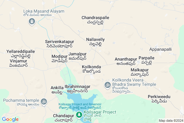
Chandapur
Chandapur Map
EDIT Map
Add Your House
 ..
..
Current Corona Virus Infected Patients Count in Mahbubnagar District
| City Name | District Name | Total Covid cases |
|---|---|---|
| Jogulamba Gadwal District | Jogulamba Gadwal | 40 |
| Mahabubnagar District | Mahabubnagar | 11 |
Locality Name :
Chandapur
( చందాపూర్ )
Mandal Name : Koilkonda
District : Mahbubnagar
State : Telangana
Region : Telangana
Language : Telugu and Hindi, Urdu
Current Time 11:44 AM
Date: Tuesday , Apr 29,2025 (IST)
Time zone: IST (UTC+5:30)
Elevation / Altitude: 409 meters. Above Seal level
Telephone Code / Std Code: 08542
Assembly constituency : Narayanpet assembly constituency
Assembly MLA : Chittem Parnika Reddy
Lok Sabha constituency : Mahabubnagar parliamentary constituency
Parliament MP : MANNE SRINIVAS REDDY
Serpanch Name :
Pin Code : 509371
Post Office Name : Koilkonda
Commodities Prices : Devarakadra Market / Mandi
Chandapur Live Weather
Temperature: 34.8 °C
clear sky
Humidity: 29%
Wind : 3.28 mt/sec towards S
StationName : "GopÄ\u0081lur"
observed on 44 Mins Back
Temperature: 34.8 °C
clear sky
Humidity: 29%
Wind : 3.28 mt/sec towards S
StationName : "GopÄ\u0081lur"
observed on 44 Mins Back
Chandapur Weather Forecast for Next 5 days
30-04-2025
31.2°C to 38.4°C
clear sky, scattered clouds, broken clouds
31.2°C to 38.4°C
clear sky, scattered clouds, broken clouds
01-05-2025
30.5°C to 38.1°C
broken clouds, few clouds
30.5°C to 38.1°C
broken clouds, few clouds
02-05-2025
28.2°C to 41.2°C
broken clouds, scattered clouds, few clouds, clear sky
28.2°C to 41.2°C
broken clouds, scattered clouds, few clouds, clear sky
03-05-2025
28.8°C to 40.4°C
scattered clouds, few clouds, clear sky, overcast clouds, broken clouds
28.8°C to 40.4°C
scattered clouds, few clouds, clear sky, overcast clouds, broken clouds
04-05-2025
29.7°C to 42.5°C
scattered clouds, clear sky, broken clouds
29.7°C to 42.5°C
scattered clouds, clear sky, broken clouds
National Highways Reachable To Chandapur
Nationa High Way :NH167
Nationa High Way :NH 150
Nationa High Way :NH167
Nationa High Way :NH 150
Rivers Near Chandapur
Dindi
Hattikuni :ಹತ್ತಿಕುಣಿ
Dindi
Hattikuni :ಹತ್ತಿಕುಣಿ
About Chandapur
Correct below Info and add more info about ChandapurChandapur is a Village in Koilkonda Mandal in Mahbubnagar District of Telangana State, India. It belongs to Telangana region . It is located 24 KM towards west from District head quarters Mahabubnagar.
Chandapur Pin code is 509371 and postal head office is Koilkonda .
Chandapur is surrounded by Hanwada Mandal towards East , Gandeed Mandal towards North , Maddur Mandal towards west , Dhanwada Mandal towards South .
Mahbubnagar , Narayanpet , Badepalle , Wanaparthy are the near by Cities to Chandapur.
This Place is in the border of the Mahbubnagar District and Rangareddi District. Rangareddi District Gandeed is North towards this place .
Chandapur 2011 Census Details
Chandapur Local Language is Telugu. Chandapur Village Total population is 660 and number of houses are 133. Female Population is 49.2%. Village literacy rate is 29.7% and the Female Literacy rate is 11.7%.
Population
| Census Parameter | Census Data |
| Total Population | 660 |
| Total No of Houses | 133 |
| Female Population % | 49.2 % ( 325) |
| Total Literacy rate % | 29.7 % ( 196) |
| Female Literacy rate | 11.7 % ( 77) |
| Scheduled Tribes Population % | 0.0 % ( 0) |
| Scheduled Caste Population % | 31.4 % ( 207) |
| Working Population % | 57.7 % |
| Child(0 -6) Population by 2011 | 88 |
| Girl Child(0 -6) Population % by 2011 | 52.3 % ( 46) |
Chandapur Census More Deatils.
Politics in Chandapur
TDP , TRS , INC are the major political parties in this area.Polling Stations /Booths near Chandapur
1)Mogalmadka2)Ammireddy Pally
3)Keshavapur
4)Kistapur
5)Koilkonda
HOW TO REACH Chandapur
By Road
Mahbubnagar is the Nearest Town to Chandapur. Mahbubnagar is 33 km from Chandapur. Road connectivity is there from Mahbubnagar to Chandapur.By Rail
There is no railway station near to Chandapur in less than 10 km. How ever there are railway Stations from Near By town Mahbubnagar. are the railway Stations near to Mahbubnagar. You can reach from Mahbubnagar to Chandapur by road after .Colleges near Chandapur
Telangana Model School And Govt Junior College Pebbair
Address :
Govt.junior College
Address :
Vijwala Junior College Mahabubnagar
Address :
Anu's Institute Of Computers
Address : Kodangal Govt. College Road Kodangal
Telangana Model School And Jr College Pebbair Wanaparthy
Address : Telangana Model School And Jr College Pebbair Wanaparthy
Schools in Chandapur
Mpps Chandapur
Address : chandapur , koilkonda , mahbubnagar , Andhra Pradesh . PIN- 509371 , Post - Koilkonda
Govt Health Centers near Chandapur
1) Community Health Centre, Koilkonda , , Near Post office , Main Road2) SubCentre, Koilkonda , , In the Civil Hospital Kiolkonda , In the Civil Hospital Kiolkonda
3) SubCentre, Kohtlabad , , PHC Back side , PHC Back side
Petrol Bunks in Chandapur,Koilkonda
HP PETROL PUMP - KOILKONDA FILLING STATION
HPC Dealers Koilkonda Village Koilkonda Mandal; Secunderabad; 509001; India
1.5 KM distance Detail
HP PETROL PUMP - MAHIMA SERVICE STATION MOHMMADABD
SNO.406 B2; Mohammadabad Village Gandeed Mandal; Secunderabad; 509337; India
17.9 KM distance Detail
more ..
Colleges in Chandapur,Koilkonda
Sree Visvesvaraya Polytechnic
Ist Floor; Opp:Rose Garden Function Hall; Near Boyapally Gate; Mahabubnagar; Telangana 509204; India
18.6 KM distance Detail
more ..
Schools in Chandapur,Koilkonda
KHAZIPUR GOVT.SCHOOL
(VI)KHAZIPUR; (M)KOILKONDA; (DI)MAHABUBANGAR; Telangana 509371; India
2.2 KM distance Detail
Dargah Hazrat Syed Shah Abdur Rahman Hussaini Chishti Rahmatullah
Mahbubnagar; Telangana 509371; India
2.2 KM distance Detail
Local Parks in Chandapur,Koilkonda
Koil Sagar Lake View
Koilsagar lake view Village Deverakadra Mandal; Ayyawarpalle; Telangana 509204; India
9.2 KM distance Detail
Governement Offices near Chandapur,Koilkonda
MeeSeva Center
1-3; Gp Office; Gandeed; Mohammadabad; Telangana 509337; India
18.1 KM distance Detail
About Chandapur &
History
How to reach Chandapur
Tourist Places Near By Chandapur
Schools in Chandapur
Colleges in Chandapur
Temperature & weather of Chandapur
places in Chandapur
Chandapur photos
More Information
How to reach Chandapur
Tourist Places Near By Chandapur
Schools in Chandapur
Colleges in Chandapur
Temperature & weather of Chandapur
places in Chandapur
Chandapur photos
More Information
Village Talk
Post News or Events about this Village
Near Cities
Mahbubnagar 21 KM near
Narayanpet 35 KM near
Badepalle 42 KM near
Wanaparthy 61 KM near
Mahbubnagar 21 KM near
Narayanpet 35 KM near
Badepalle 42 KM near
Wanaparthy 61 KM near
Near By Taluks
Koilkonda 0 KM near
Hanwada 15 KM near
Gandeed 18 KM near
Maddur 20 KM near
Koilkonda 0 KM near
Hanwada 15 KM near
Gandeed 18 KM near
Maddur 20 KM near
Near By Air Ports
Rajiv Gandhi International Airport 95 KM near
Sholapur Airport 245 KM near
Latur Airport 257 KM near
Nanded Airport 305 KM near
Rajiv Gandhi International Airport 95 KM near
Sholapur Airport 245 KM near
Latur Airport 257 KM near
Nanded Airport 305 KM near
Near By Tourist Places
Mantralayam 111 KM near
Hyderabad 112 KM near
Kurnool 122 KM near
Gulbarga 133 KM near
Bidar 143 KM near
Mantralayam 111 KM near
Hyderabad 112 KM near
Kurnool 122 KM near
Gulbarga 133 KM near
Bidar 143 KM near
Near By Districts
Mahbubnagar 24 KM near
Rangareddi 73 KM near
Yadgir 78 KM near
Raichur 87 KM near
Mahbubnagar 24 KM near
Rangareddi 73 KM near
Yadgir 78 KM near
Raichur 87 KM near
Near By RailWay Station
Mahbubnagar Rail Way Station 25 KM near
Jadcherla Rail Way Station 41 KM near
Mahbubnagar Rail Way Station 25 KM near
Jadcherla Rail Way Station 41 KM near