| Home | City Bus | Maps | Villages | Cities | Rail | Tourist Places | School | College | Pin Codes | Corona Cases Count |
| Distance Calculator Bus Services IFSC Codes Trace Mobile Number Weather Search Place Trace IP Available Cash ATM/Banks Locate Polling Booth Report an Error contact People |
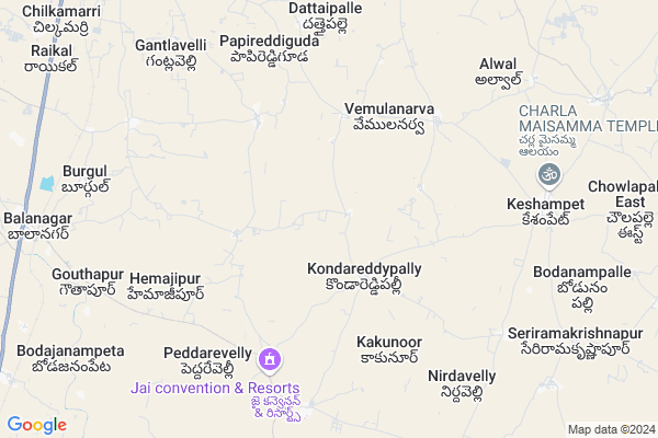
Valya Tanda
Valya Tanda Map
EDIT Map
Add Your House
 ..
..
Current Corona Virus Infected Patients Count in Mahbubnagar District
| City Name | District Name | Total Covid cases |
|---|---|---|
| Jogulamba Gadwal District | Jogulamba Gadwal | 40 |
| Mahabubnagar District | Mahabubnagar | 11 |
Locality Name :
Valya Tanda
( వాల్య తండా )
Mandal Name : Keshampeta
District : Mahbubnagar
State : Telangana
Region : Telangana
Language : Telugu and Hindi, Urdu
Current Time 01:52 PM
Date: Tuesday , Apr 29,2025 (IST)
Time zone: IST (UTC+5:30)
Elevation / Altitude: 648 meters. Above Seal level
Telephone Code / Std Code: 08548
Assembly constituency : Shadnagar assembly constituency
Assembly MLA : K Shankaraiah
Lok Sabha constituency : Mahabubnagar parliamentary constituency
Parliament MP : MANNE SRINIVAS REDDY
Serpanch Name :
Pin Code : 509202
Post Office Name : Balanagar
Main Village Name : Pomalpally
Commodities Prices : Shadnagar Market / Mandi
Valya Tanda Live Weather
Temperature: 35.0 °C
clear sky
Humidity: 21%
Wind : 1.5 mt/sec towards S
StationName : "Farrukhnagar"
observed on 12 Mins Back
Temperature: 35.0 °C
clear sky
Humidity: 21%
Wind : 1.5 mt/sec towards S
StationName : "Farrukhnagar"
observed on 12 Mins Back
Valya Tanda Weather Forecast for Next 5 days
30-04-2025
30.3°C to 37.2°C
few clouds, scattered clouds, broken clouds
30.3°C to 37.2°C
few clouds, scattered clouds, broken clouds
01-05-2025
28.1°C to 37.3°C
broken clouds, scattered clouds, few clouds, light rain
28.1°C to 37.3°C
broken clouds, scattered clouds, few clouds, light rain
02-05-2025
27.0°C to 40.5°C
broken clouds, clear sky, scattered clouds
27.0°C to 40.5°C
broken clouds, clear sky, scattered clouds
03-05-2025
26.9°C to 39.7°C
broken clouds, clear sky, few clouds, overcast clouds
26.9°C to 39.7°C
broken clouds, clear sky, few clouds, overcast clouds
04-05-2025
28.2°C to 40.9°C
scattered clouds, clear sky, few clouds, broken clouds, overcast clouds
28.2°C to 40.9°C
scattered clouds, clear sky, few clouds, broken clouds, overcast clouds
National Highways Reachable To Valya Tanda
Nationa High Way :Old NH7
Nationa High Way :Old NH7
Rivers Near Valya Tanda
Dindi
Dindi
About Valya Tanda
Correct below Info and add more info about Valya TandaValya Tanda is a small Village/hamlet in Keshampeta Mandal in Mahbubnagar District of Telangana State, India. It comes under Pomalpally Panchayath. It belongs to Telangana region . As part Telangana Districts re-organisation , Valya Tanda Village Keshampeta Mandal re organised from Mahbubnagar District to Ranga Reddy district. It is located 45 KM towards East from District head quarters Mahabubnagar. 3 KM from Keshampet.
Valya Tanda Pin code is 509202 and postal head office is Balanagar .
Valya Tanda is surrounded by Balanagar Mandal towards west , Farooqnagar Mandal towards west , Talakondapalle Mandal towards East , Kothur Mandal towards North .
Farooqnagar , Badepalle , Mahbubnagar , Nagarkurnool are the near by Cities to Valya Tanda.
This Place is in the border of the Mahbubnagar District and Rangareddi District. Rangareddi District Maheswaram is North towards this place .
Demographics of Valya Tanda
Telugu is the Local Language here. Total population of Valya Tanda is 2664 .Males are 1389 and Females are 1,275 living in 552 Houses. Total area of Valya Tanda is 1675 hectares.Politics in Valya Tanda
TDP , TRS , BJP , INC are the major political parties in this area.Polling Stations /Booths near Valya Tanda
1)Penjerla2)Kondanna Guda
3)Kondareddy Pally
4)Dattayapally
5)Chintaguda
HOW TO REACH Valya Tanda
By Road
Mahbubnagar is the Nearest Town to Valya Tanda. Mahbubnagar is 67 km from Valya Tanda. Road connectivity is there from Mahbubnagar to Valya Tanda.By Rail
Burgula Rail Way Station is the very nearby railway stations to Valya Tanda. Also you can consider railway Stations from Near By town Mahbubnagar. Mahbubnagar Town Halt Rail Way Station , Mahbubnagar Rail Way Station are the railway Stations near to Mahbubnagar. You can reach from Mahbubnagar to Valya Tanda by road after .Colleges near Valya Tanda
Telangana Model School And Govt Junior College Pebbair
Address :
Govt.junior College
Address :
Vijwala Junior College Mahabubnagar
Address :
Anu's Institute Of Computers
Address : Kodangal Govt. College Road Kodangal
Telangana Model School And Jr College Pebbair Wanaparthy
Address : Telangana Model School And Jr College Pebbair Wanaparthy
Schools in Valya Tanda
Mpups Pomalpalle
Address : pomalpalle , keshampet , mahbubnagar , Andhra Pradesh . PIN- 509202 , Post - Balanagar
Mpups Kondareddipalle
Address : pomalpalle , keshampet , mahbubnagar , Andhra Pradesh . PIN- 509202 , Post - Balanagar
Govt Health Centers near Valya Tanda
1) SubCentre Elumulnarva , , INMULA NARVA , ANGANWADI CENTER2) SubCentre, Burgula , Burgula , Behind PHC , PHC
3) Burgula , , Main road ,
Hospitals in Valya Tanda,Keshampeta
Keshampet Govt Hospital
16°57'16.0"N 78°20'52.; 3rd Street; Coachella; Telangana 92236; India
8.5 KM distance Detail
more ..
Petrol Bunks in Valya Tanda,Keshampeta
essar padmavathi filling station
Keshampet Rd; Vemulanarva; Telangana 509202; India
5.9 KM distance Detail
more ..
Colleges in Valya Tanda,Keshampeta
Sri Ramakrishna Educational Society
Thommidi Rekula; Telangana 509408; India
10.4 KM distance Detail
more ..
Schools in Valya Tanda,Keshampeta
UPS Kondareddypally
Konded Jadcherla Rd; Kondareddypally; Telangana 509408; India
2.7 KM distance Detail
Government School
Ippalapally Village; Keshampet mandal; Ranga Reddy Dist; Telangana 509202; India
4.3 KM distance Detail
Governement Offices near Valya Tanda,Keshampeta
CSC DIGITAL SEEVA
Konded Jadcherla Rd; Chinnarevalli; Telangana 509408; India
7.4 KM distance Detail
About Valya Tanda &
History
How to reach Valya Tanda
Tourist Places Near By Valya Tanda
Schools in Valya Tanda
Colleges in Valya Tanda
Temperature & weather of Valya Tanda
places in Valya Tanda
Valya Tanda photos
More Information
How to reach Valya Tanda
Tourist Places Near By Valya Tanda
Schools in Valya Tanda
Colleges in Valya Tanda
Temperature & weather of Valya Tanda
places in Valya Tanda
Valya Tanda photos
More Information
Village Talk
Post News or Events about this Village
Near Cities
Farooqnagar 18 KM near
Badepalle 29 KM near
Mahbubnagar 45 KM near
Nagarkurnool 57 KM near
Farooqnagar 18 KM near
Badepalle 29 KM near
Mahbubnagar 45 KM near
Nagarkurnool 57 KM near
Near By Taluks
Keshampeta 3 KM near
Balanagar 11 KM near
Farooqnagar 14 KM near
Talakondapalle 20 KM near
Keshampeta 3 KM near
Balanagar 11 KM near
Farooqnagar 14 KM near
Talakondapalle 20 KM near
Near By Air Ports
Rajiv Gandhi International Airport 40 KM near
Latur Airport 281 KM near
Sholapur Airport 291 KM near
Nanded Airport 300 KM near
Rajiv Gandhi International Airport 40 KM near
Latur Airport 281 KM near
Sholapur Airport 291 KM near
Nanded Airport 300 KM near
Near By Tourist Places
Hyderabad 59 KM near
Srisailam 129 KM near
Nagarjunsagar 132 KM near
Medak 137 KM near
Kurnool 143 KM near
Hyderabad 59 KM near
Srisailam 129 KM near
Nagarjunsagar 132 KM near
Medak 137 KM near
Kurnool 143 KM near
Near By Districts
Mahbubnagar 43 KM near
Rangareddi 46 KM near
Hyderabad 64 KM near
Medak 87 KM near
Mahbubnagar 43 KM near
Rangareddi 46 KM near
Hyderabad 64 KM near
Medak 87 KM near
Near By RailWay Station
Shadnagar Rail Way Station 16 KM near
Jadcherla Rail Way Station 29 KM near
Shadnagar Rail Way Station 16 KM near
Jadcherla Rail Way Station 29 KM near