| Home | City Bus | Maps | Villages | Cities | Rail | Tourist Places | School | College | Pin Codes | Corona Cases Count |
| Distance Calculator Bus Services IFSC Codes Trace Mobile Number Weather Search Place Trace IP Available Cash ATM/Banks Locate Polling Booth Report an Error contact People |
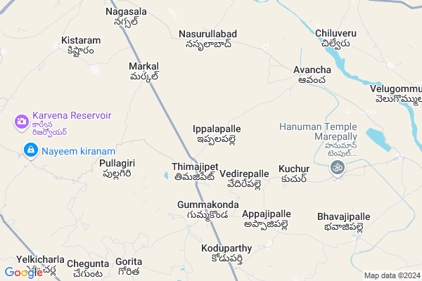
Gguttlagadda Tanda
Gguttlagadda Tanda Map
EDIT Map
Add Your House
 ..
..
Current Corona Virus Infected Patients Count in Mahbubnagar District
| City Name | District Name | Total Covid cases |
|---|---|---|
| Jogulamba Gadwal District | Jogulamba Gadwal | 40 |
| Mahabubnagar District | Mahabubnagar | 11 |
Locality Name :
Gguttlagadda Tanda
( ఙ్గుట్ఠలగడ్డ తండా )
Mandal Name : Keshampeta
District : Mahbubnagar
State : Telangana
Region : Telangana
Language : Telugu and Hindi, Urdu
Current Time 01:34 PM
Date: Tuesday , Apr 29,2025 (IST)
Time zone: IST (UTC+5:30)
Elevation / Altitude: 648 meters. Above Seal level
Telephone Code / Std Code: 08548
Assembly constituency : Nagarkurnool assembly constituency
Assembly MLA : Dr. Kuchkulla Rajesh Reddy
Lok Sabha constituency : Nagarkurnool parliamentary constituency
Parliament MP : POTHUGANTI RAMULU
Serpanch Name :
Pin Code : 509408
Post Office Name : Keshampet
Main Village Name : Ippalapally
Commodities Prices : Badepalli Market / Mandi
Gguttlagadda Tanda Live Weather
Temperature: 34.1 °C
clear sky
Humidity: 27%
Wind : 3.19 mt/sec towards S
StationName : "Mahbūbnagar"
observed on 1 Hours Back
Temperature: 34.1 °C
clear sky
Humidity: 27%
Wind : 3.19 mt/sec towards S
StationName : "Mahbūbnagar"
observed on 1 Hours Back
Gguttlagadda Tanda Weather Forecast for Next 5 days
30-04-2025
30.2°C to 38.2°C
clear sky, few clouds, broken clouds, scattered clouds
30.2°C to 38.2°C
clear sky, few clouds, broken clouds, scattered clouds
01-05-2025
29.0°C to 38.1°C
broken clouds, clear sky, overcast clouds
29.0°C to 38.1°C
broken clouds, clear sky, overcast clouds
02-05-2025
27.8°C to 40.2°C
broken clouds, few clouds, clear sky, scattered clouds
27.8°C to 40.2°C
broken clouds, few clouds, clear sky, scattered clouds
03-05-2025
27.7°C to 39.3°C
scattered clouds, clear sky, broken clouds
27.7°C to 39.3°C
scattered clouds, clear sky, broken clouds
04-05-2025
28.3°C to 40.7°C
broken clouds, clear sky, overcast clouds
28.3°C to 40.7°C
broken clouds, clear sky, overcast clouds
National Highways Reachable To Gguttlagadda Tanda
Nationa High Way :Old NH7
Nationa High Way :Old NH7
Rivers Near Gguttlagadda Tanda
Dindi
Dindi
About Gguttlagadda Tanda
Correct below Info and add more info about Gguttlagadda TandaGguttlagadda Tanda is a small Village/hamlet in Keshampeta Mandal in Mahbubnagar District of Telangana State, India. It comes under Ippalapally Panchayath. It belongs to Telangana region . As part Telangana Districts re-organisation , Gguttlagadda Tanda Village Keshampeta Mandal re organised from Mahbubnagar District to Ranga Reddy district. It is located 26 KM towards East from District head quarters Mahabubnagar. 40 KM from Keshampet.
Gguttlagadda Tanda Pin code is 509408 and postal head office is Keshampet .
Gguttlagadda Tanda is surrounded by Jadcherla Mandal towards North , Bhoothpur Mandal towards west , Bijinapalle Mandal towards South , Midjil Mandal towards East .
Badepalle , Nagarkurnool , Mahbubnagar , Wanaparthy are the near by Cities to Gguttlagadda Tanda.
This Place is in the border of the Mahbubnagar District and Rangareddi District. Rangareddi District Maheswaram is North towards this place .
Demographics of Gguttlagadda Tanda
Telugu is the Local Language here. Total population of Gguttlagadda Tanda is 1820 .Males are 942 and Females are 878 living in 351 Houses. Total area of Gguttlagadda Tanda is 944 hectares.Politics in Gguttlagadda Tanda
TDP , TRS , INC are the major political parties in this area.Polling Stations /Booths near Gguttlagadda Tanda
1)Guttalapalli H/o Polmoor2)Thimmajipet
3)Timmaji Peta
4)Telkapally
5)Puljala
HOW TO REACH Gguttlagadda Tanda
By Road
Mahbubnagar is the Nearest Town to Gguttlagadda Tanda. Road connectivity is there from Mahbubnagar to Gguttlagadda Tanda.By Rail
Jadcherla Rail Way Station is the very nearby railway stations to Gguttlagadda Tanda. Also you can consider railway Stations from Near By town Mahbubnagar. Mahbubnagar Town Halt Rail Way Station , Mahbubnagar Rail Way Station are the railway Stations near to Mahbubnagar. You can reach from Mahbubnagar to Gguttlagadda Tanda by road after .Colleges near Gguttlagadda Tanda
Telangana Model School And Govt Junior College Pebbair
Address :
Govt.junior College
Address :
Vijwala Junior College Mahabubnagar
Address :
Anu's Institute Of Computers
Address : Kodangal Govt. College Road Kodangal
Telangana Model School And Jr College Pebbair Wanaparthy
Address : Telangana Model School And Jr College Pebbair Wanaparthy
Schools in Gguttlagadda Tanda
Sri Saraswati Ippalapalle
Address : ippalapalle , keshampet , mahbubnagar , Andhra Pradesh . PIN- 509408 , Post - Keshampet
Mpups Ippalapalle
Address : ippalapalle , keshampet , mahbubnagar , Andhra Pradesh . PIN- 509408 , Post - Keshampet
Govt Health Centers near Gguttlagadda Tanda
1) Primary Health Centre, Timmajipet , , behind Jr.Clollege , Marepally Road2) SubCentre Kuchur , , B.c.colony , Z.P.H. school
3) SubCentre, Koduparthy , , appajipally road , Opp UPS
Hospitals in Gguttlagadda Tanda,Keshampeta
Golla Nagaiah Ortho Care (Natu Vaidyam)
charlapally; jadcharla; Telangana; India
8.4 KM distance Detail
more ..
Petrol Bunks in Gguttlagadda Tanda,Keshampeta
DKR VIJAYA LAXMI FILLING STATION
Timmajipet - Avancha Rd; Thimajipet; Telangana 509406; India
1.7 KM distance Detail
Chennakeshava Filling Station Bharat Petroleum
Gangapur; Mahbubnagar; SH-18; Kalwakurthy Jadcharla Road; Jadcherla; Jadcherla; Telangana 509301; India
11.7 KM distance Detail
more ..
Colleges in Gguttlagadda Tanda,Keshampeta
Srinivasa ITI
Badepally; Jadcherla;MAHABOOBNAGAR (Dist)-pin:509301; Andhrapradesh; Telangana; India
11.8 KM distance Detail
more ..
Schools in Gguttlagadda Tanda,Keshampeta
Krishnaveni Talent School
Beside Police Quarters; Thimmajipet; Telangana 509406; India
1.8 KM distance Detail
Hanuman thanda school
Hanuman thanda; Ippalapally; Thimmajipet; Mahabubnagar; Telangana 509001; India
2.4 KM distance Detail
Good Shepherd School - Thimmajipet
State Highway 21; Nagarkurnool District; Thimmajipet; Telangana 509406; India
2.5 KM distance Detail
Electronic Shops in Gguttlagadda Tanda,Keshampeta
Lakshmi Prasida Engineering And Electricals
Badepally; Jadcherla; Telangana 509301; India
11.5 KM distance Detail
Governement Offices near Gguttlagadda Tanda,Keshampeta
MeeSeva Center
Near Gramapanchyathi; Thimmajipeta(M); 8-80; Avancha; Telangana 509301; India
7.3 KM distance Detail
About Gguttlagadda Tanda &
History
How to reach Gguttlagadda Tanda
Tourist Places Near By Gguttlagadda Tanda
Schools in Gguttlagadda Tanda
Colleges in Gguttlagadda Tanda
Temperature & weather of Gguttlagadda Tanda
places in Gguttlagadda Tanda
Gguttlagadda Tanda photos
More Information
How to reach Gguttlagadda Tanda
Tourist Places Near By Gguttlagadda Tanda
Schools in Gguttlagadda Tanda
Colleges in Gguttlagadda Tanda
Temperature & weather of Gguttlagadda Tanda
places in Gguttlagadda Tanda
Gguttlagadda Tanda photos
More Information
Village Talk
Post News or Events about this Village
Near Cities
Badepalle 11 KM near
Nagarkurnool 26 KM near
Mahbubnagar 28 KM near
Wanaparthy 42 KM near
Badepalle 11 KM near
Nagarkurnool 26 KM near
Mahbubnagar 28 KM near
Wanaparthy 42 KM near
Near By Taluks
Thimmajipeta 1 KM near
Jadcherla 14 KM near
Midjil 17 KM near
Bhoothpur 17 KM near
Thimmajipeta 1 KM near
Jadcherla 14 KM near
Midjil 17 KM near
Bhoothpur 17 KM near
Near By Air Ports
Rajiv Gandhi International Airport 74 KM near
Sholapur Airport 294 KM near
Latur Airport 297 KM near
Vijayawada Airport 310 KM near
Rajiv Gandhi International Airport 74 KM near
Sholapur Airport 294 KM near
Latur Airport 297 KM near
Vijayawada Airport 310 KM near
Near By Tourist Places
Hyderabad 94 KM near
Kurnool 109 KM near
Srisailam 109 KM near
Mantralayam 130 KM near
Nagarjunsagar 134 KM near
Hyderabad 94 KM near
Kurnool 109 KM near
Srisailam 109 KM near
Mantralayam 130 KM near
Nagarjunsagar 134 KM near
Near By Districts
Mahbubnagar 26 KM near
Rangareddi 75 KM near
Hyderabad 99 KM near
Kurnool 109 KM near
Mahbubnagar 26 KM near
Rangareddi 75 KM near
Hyderabad 99 KM near
Kurnool 109 KM near
Near By RailWay Station
Jadcherla Rail Way Station 11 KM near
Mahbubnagar Rail Way Station 25 KM near
Jadcherla Rail Way Station 11 KM near
Mahbubnagar Rail Way Station 25 KM near