| Home | City Bus | Maps | Villages | Cities | Rail | Tourist Places | School | College | Pin Codes | Corona Cases Count |
| Distance Calculator Bus Services IFSC Codes Trace Mobile Number Weather Search Place Trace IP Available Cash ATM/Banks Locate Polling Booth Report an Error contact People |
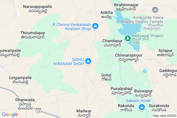
Kistapur
Kistapur Map
EDIT Map
Add Your House
 ..
..
Current Corona Virus Infected Patients Count in Mahbubnagar District
| City Name | District Name | Total Covid cases |
|---|---|---|
| Jogulamba Gadwal District | Jogulamba Gadwal | 40 |
| Mahabubnagar District | Mahabubnagar | 11 |
Locality Name :
Kistapur
( కిష్టాపూర్ )
Mandal Name : Dhanwada
District : Mahbubnagar
State : Telangana
Region : Telangana
Language : Telugu and Hindi, Urdu
Current Time 11:04 AM
Date: Monday , Apr 28,2025 (IST)
Time zone: IST (UTC+5:30)
Elevation / Altitude: 390 meters. Above Seal level
Telephone Code / Std Code: 08503
Assembly constituency : Narayanpet assembly constituency
Assembly MLA : Chittem Parnika Reddy
Lok Sabha constituency : Mahabubnagar parliamentary constituency
Parliament MP : MANNE SRINIVAS REDDY
Serpanch Name :
Pin Code : 509204
Post Office Name : Devarkadra
Commodities Prices : Devarakadra Market / Mandi
Edit below overview about Kistapur
Edit below overview about Kistapur
OverView of Kistapur
There is a famous Krishna temple in that village and it is a historical temple that temple is located far from housesEdit below overview about Kistapur
National Highways Reachable To Kistapur
Nationa High Way :NH150
Nationa High Way :NH167
Nationa High Way :NH150
Nationa High Way :NH167
Rivers Near Kistapur
Dindi
Bhima :ಭೀಮಾ :भीमा :కృష్ణా
Dindi
Bhima :ಭೀಮಾ :भीमा :కృష్ణా
About Kistapur
Kistapur is a Village in Dhanwada Mandal in Mahbubnagar District of Telangana State, India. It belongs to Telangana region . It is located 33 KM towards west from District head quarters Mahabubnagar. 9 KM from Dhanwada.
Kistapur Pin code is 509204 and postal head office is Devarkadra .
Ankilla ( 7 KM ) , Bollaram ( 7 KM ) , Madwar ( 8 KM ) , Ibrahimnagar ( 8 KM ) , Nagaram ( 8 KM ) are the nearby Villages to Kistapur. Kistapur is surrounded by Koilkonda Mandal towards North , Devarakadara Mandal towards East , Narayanpet Mandal towards west , Maddur Mandal towards North .
Mahbubnagar , Narayanpet , Badepalle , Gadwal are the near by Cities to Kistapur.
Kistapur 2011 Census Details
Kistapur Local Language is Telugu. Kistapur Village Total population is 6193 and number of houses are 1161. Female Population is 48.5%. Village literacy rate is 31.1% and the Female Literacy rate is 10.8%.
Population
| Census Parameter | Census Data |
| Total Population | 6193 |
| Total No of Houses | 1161 |
| Female Population % | 48.5 % ( 3005) |
| Total Literacy rate % | 31.1 % ( 1924) |
| Female Literacy rate | 10.8 % ( 671) |
| Scheduled Tribes Population % | 16.2 % ( 1004) |
| Scheduled Caste Population % | 15.9 % ( 986) |
| Working Population % | 60.4 % |
| Child(0 -6) Population by 2011 | 929 |
| Girl Child(0 -6) Population % by 2011 | 47.6 % ( 442) |
Kistapur Census More Deatils.
Politics in Kistapur
TDP , TRS , INC are the major political parties in this area.Polling Stations /Booths near Kistapur
1)Kistapur2)Khajipur
3)Kistapur
4)Rakonda
5)Gotoor
HOW TO REACH Kistapur
By Road
Narayanpet is the Nearest Town to Kistapur. Narayanpet is 31 km from Kistapur. Road connectivity is there from Narayanpet to Kistapur.By Rail
There is no railway station near to Kistapur in less than 10 km.Colleges near Kistapur
Govt.junior College
Address :
Schools in Kistapur
Zphs
Address : kistapur , dhanwada , mahbubnagar , Andhra Pradesh . PIN- 509204 , Post - Devarkadra
Govt Health Centers near Kistapur
1) SubCentre Kistapur , Subcenter Kistapur , , SC wada2) SubCentre, Gutur , , SC Wada , Near GP
3) SubCentre, Teelair , , Harizan Wada , Near Shivalayam
Sub Villages in Kistapur
Petrol Bunks in Kistapur,Dhanwada
Bhavani Filling Station-Indian Oil Petrol Pump
Mahbubnagar; SH-18; Marikal; Marikal; Telangana 509351; India
11.4 KM distance Detail
more ..
Colleges in Kistapur,Dhanwada
GOVERNMENT JUNIOR COLLEGE
Jajapur - Dhanwada Rd; Dhanwada; Telangana 509205; India
11.1 KM distance Detail
Sri Manikanta Junior College
S.B.L Complex; Mahbubnagar; SH-18; Marikal; Marikal; Telangana 509351; India
11.3 KM distance Detail
more ..
Super Markets in Kistapur,Dhanwada
Srinivas Kiranam
Dhanwada - Marikal Rd; BC Colony; Marikal; Telangana 509351; India
11.1 KM distance Detail
Local Parks in Kistapur,Dhanwada
Koil Sagar Lake View
Koilsagar lake view Village Deverakadra Mandal; Ayyawarpalle; Telangana 509204; India
7.1 KM distance Detail
About Kistapur &
History
How to reach Kistapur
Tourist Places Near By Kistapur
Schools in Kistapur
Colleges in Kistapur
Temperature & weather of Kistapur
places in Kistapur
Kistapur photos
More Information
How to reach Kistapur
Tourist Places Near By Kistapur
Schools in Kistapur
Colleges in Kistapur
Temperature & weather of Kistapur
places in Kistapur
Kistapur photos
More Information
Village Talk
Post News or Events about this Village
Near Cities
Mahbubnagar 29 KM near
Narayanpet 29 KM near
Badepalle 50 KM near
Gadwal 57 KM near
Mahbubnagar 29 KM near
Narayanpet 29 KM near
Badepalle 50 KM near
Gadwal 57 KM near
Near By Taluks
Dhanwada 9 KM near
Koilkonda 12 KM near
Devarakadara 18 KM near
Narayanpet 20 KM near
Dhanwada 9 KM near
Koilkonda 12 KM near
Devarakadara 18 KM near
Narayanpet 20 KM near
Near By Air Ports
Rajiv Gandhi International Airport 107 KM near
Sholapur Airport 243 KM near
Latur Airport 261 KM near
Nanded Airport 314 KM near
Rajiv Gandhi International Airport 107 KM near
Sholapur Airport 243 KM near
Latur Airport 261 KM near
Nanded Airport 314 KM near
Near By Tourist Places
Mantralayam 100 KM near
Kurnool 115 KM near
Hyderabad 124 KM near
Gulbarga 133 KM near
Bidar 152 KM near
Mantralayam 100 KM near
Kurnool 115 KM near
Hyderabad 124 KM near
Gulbarga 133 KM near
Bidar 152 KM near
Near By Districts
Mahbubnagar 31 KM near
Yadgir 71 KM near
Raichur 75 KM near
Rangareddi 85 KM near
Mahbubnagar 31 KM near
Yadgir 71 KM near
Raichur 75 KM near
Rangareddi 85 KM near
Near By RailWay Station
Mahbubnagar Rail Way Station 33 KM near
Jadcherla Rail Way Station 49 KM near
Mahbubnagar Rail Way Station 33 KM near
Jadcherla Rail Way Station 49 KM near