| Home | City Bus | Maps | Villages | Cities | Rail | Tourist Places | School | College | Pin Codes | Corona Cases Count |
| Distance Calculator Bus Services IFSC Codes Trace Mobile Number Weather Search Place Trace IP Available Cash ATM/Banks Locate Polling Booth Report an Error contact People |
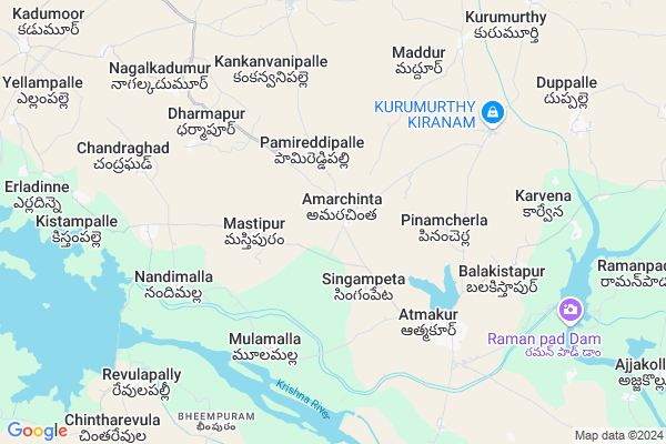
Amarchinta
Amarchinta Map
EDIT Map
Add Your House
 ..
..
Current Corona Virus Infected Patients Count in Mahbubnagar District
| City Name | District Name | Total Covid cases |
|---|---|---|
| Jogulamba Gadwal District | Jogulamba Gadwal | 40 |
| Mahabubnagar District | Mahabubnagar | 11 |
Locality Name :
Amarchinta
( అమరచింత )
Mandal Name : Atmakur
District : Mahbubnagar
State : Telangana
Region : Telangana
Language : Telugu and Hindi, Urdu
Current Time 10:52 AM
Date: Tuesday , Apr 29,2025 (IST)
Time zone: IST (UTC+5:30)
Elevation / Altitude: 311 meters. Above Seal level
Telephone Code / Std Code: 08546
Assembly constituency : Makthal assembly constituency
Assembly MLA : Vakiti Srihari
Lok Sabha constituency : Mahabubnagar parliamentary constituency
Parliament MP : MANNE SRINIVAS REDDY
Serpanch Name :
Pin Code : 509130
Post Office Name : Amerchinta
Commodities Prices : Atmakur Market / Mandi
Edit below overview about Amarchinta
Edit below overview about Amarchinta
OverView of Amarchinta
Now amarchintha became muncipality mandal. Its separate from atmakur. The 13 villages in Amarchinta mandal include: Amarchintha Mastipur Pamireddipalle Kankanvanipalle Singampeta Nandimalla Chinthareddipalle Mittanandimalla Erladinne ChandraghadDharmapur Nagalkadumur KistampalleEdit below overview about Amarchinta
National Highways Reachable To Amarchinta
Nationa High Way :NH150
Nationa High Way :NH 167
Nationa High Way :NH150
Nationa High Way :NH 167
Rivers Near Amarchinta
Krishna :クリシュナ :ಕೃಷ್ಣಾ :कृष्णा :కృష్ణా
Bhima :ಭೀಮಾ :भीमा :కృష్ణా
Krishna :クリシュナ :ಕೃಷ್ಣಾ :कृष्णा :కృష్ణా
Bhima :ಭೀಮಾ :भीमा :కృష్ణా
About Amarchinta
Amarchinta is a Village in Atmakur Mandal in Mahbubnagar District of Telangana State, India. It belongs to Telangana region . It is located 55 KM towards South from District head quarters Mahabubnagar. 6 KM from Atmakur.
Amarchinta Pin code is 509130 and postal head office is Amerchinta .
Pinamcherla ( 3 KM ) , Singampeta ( 3 KM ) , Mastipur ( 3 KM ) , Allipur ( 5 KM ) , Atmakur ( 5 KM ) are the nearby Villages to Amarchinta. Amarchinta is surrounded by Chinnachintakunta Mandal towards North , Kothakota Mandal towards East , Narva Mandal towards North , Gadwal Mandal towards South .
Gadwal , Wanaparthy , Mahbubnagar , Raichur are the near by Cities to Amarchinta.
Amarchinta 2011 Census Details
Amarchinta Local Language is Telugu. Amarchinta Village Total population is 11225 and number of houses are 2431. Female Population is 50.6%. Village literacy rate is 48.1% and the Female Literacy rate is 19.9%.
Population
| Census Parameter | Census Data |
| Total Population | 11225 |
| Total No of Houses | 2431 |
| Female Population % | 50.6 % ( 5685) |
| Total Literacy rate % | 48.1 % ( 5401) |
| Female Literacy rate | 19.9 % ( 2238) |
| Scheduled Tribes Population % | 7.2 % ( 812) |
| Scheduled Caste Population % | 16.1 % ( 1803) |
| Working Population % | 51.5 % |
| Child(0 -6) Population by 2011 | 1351 |
| Girl Child(0 -6) Population % by 2011 | 48.9 % ( 661) |
Amarchinta Census More Deatils.
Politics in Amarchinta
INC , TDP , IND , TRS , BJP , INC are the major political parties in this area.Polling Stations /Booths near Amarchinta
1)Amarchinta2)Amarchinta
3)Amarchinta
4)Alampally
5)Amarchinta
HOW TO REACH Amarchinta
By Road
Wanaparthy is the Nearest Town to Amarchinta. Wanaparthy is 47 km from Amarchinta. Road connectivity is there from Wanaparthy to Amarchinta.By Rail
There is no railway station near to Amarchinta in less than 10 km.Colleges near Amarchinta
Vikas Jr. And Degree College - Atmakur- 509131
Address :
Govt.degree College,atmakur-509 131
Address :
Schools in Amarchinta
Zphs Amarchinta
Address : amarchinta , atmakur , mahbubnagar , Andhra Pradesh . PIN- 509130 , Post - Amerchinta
Gowthami Hs
Address : amarchinta , atmakur , mahbubnagar , Andhra Pradesh . PIN- 509130 , Post - Amerchinta
Zphs Amarchinta
Address : amarchinta , atmakur , mahbubnagar , Andhra Pradesh . PIN- 509130 , Post - Amerchinta
Mphs(u M) Amarchinta
Address : amarchinta , atmakur , mahbubnagar , Andhra Pradesh . PIN- 509130 , Post - Amerchinta
Sri Vijetha Ups
Address : amarchinta , atmakur , mahbubnagar , Andhra Pradesh . PIN- 509130 , Post - Amerchinta
Govt Health Centers near Amarchinta
1) SC-Dupally , , DUPALLY , MAINROAD2) SubCentre, Damagnapur , , DAMAGNAPUR , MAINROAD GP OFFICE
3) Community Health Center, Atmakur , , near main road , Bus Stand
Sub Villages in Amarchinta
Petrol Bunks in Amarchinta,Atmakur
Hanuman Filling Station Indian Oil Petrol Pump
Ammarakotha; Mahbubnagar; Atmkur; Telangana 509131; India
2.1 KM distance Detail
HP PETROL PUMP - RAGHAVENDRA FILLING STN. ATMAKUR
HP Dealers Atmakur Dist Mahabubngr; Secunderabad; 509131; India
4.6 KM distance Detail
more ..
Schools in Amarchinta,Atmakur
mamatha studio and internet
Mamatha studio and Internet; Amarchinta; Telangana; India
0.7 KM distance Detail
Super Markets in Amarchinta,Atmakur
Raja Rajeshwari Kiranam Store
Amarchinta Rd; Khanapur; Telangana 509131; India
3.0 KM distance Detail
About Amarchinta &
History
How to reach Amarchinta
Tourist Places Near By Amarchinta
Schools in Amarchinta
Colleges in Amarchinta
Temperature & weather of Amarchinta
places in Amarchinta
Amarchinta photos
More Information
How to reach Amarchinta
Tourist Places Near By Amarchinta
Schools in Amarchinta
Colleges in Amarchinta
Temperature & weather of Amarchinta
places in Amarchinta
Amarchinta photos
More Information
Village Talk
Post News or Events about this Village
Near Cities
Gadwal 17 KM near
Wanaparthy 36 KM near
Mahbubnagar 51 KM near
Raichur 54 KM near
Gadwal 17 KM near
Wanaparthy 36 KM near
Mahbubnagar 51 KM near
Raichur 54 KM near
Near By Taluks
Atmakur 5 KM near
Chinnachintakunta 12 KM near
Kothakota 16 KM near
Narva 16 KM near
Atmakur 5 KM near
Chinnachintakunta 12 KM near
Kothakota 16 KM near
Narva 16 KM near
Near By Air Ports
Rajiv Gandhi International Airport 133 KM near
Sholapur Airport 269 KM near
Latur Airport 297 KM near
Hubli Airport 345 KM near
Rajiv Gandhi International Airport 133 KM near
Sholapur Airport 269 KM near
Latur Airport 297 KM near
Hubli Airport 345 KM near
Near By Tourist Places
Mantralayam 67 KM near
Kurnool 76 KM near
Srisailam 136 KM near
Hyderabad 152 KM near
Gulbarga 163 KM near
Mantralayam 67 KM near
Kurnool 76 KM near
Srisailam 136 KM near
Hyderabad 152 KM near
Gulbarga 163 KM near
Near By Districts
Mahbubnagar 53 KM near
Raichur 54 KM near
Kurnool 76 KM near
Yadgir 90 KM near
Mahbubnagar 53 KM near
Raichur 54 KM near
Kurnool 76 KM near
Yadgir 90 KM near
Near By RailWay Station
Gadwal Junction Rail Way Station 18 KM near
Krishna Rail Way Station 52 KM near
Gadwal Junction Rail Way Station 18 KM near
Krishna Rail Way Station 52 KM near