| Home | City Bus | Maps | Villages | Cities | Rail | Tourist Places | School | College | Pin Codes | Corona Cases Count |
| Distance Calculator Bus Services IFSC Codes Trace Mobile Number Weather Search Place Trace IP Available Cash ATM/Banks Locate Polling Booth Report an Error contact People |
 ..
..
Current Corona Virus Infected Patients Count in Mahbubnagar District
| City Name | District Name | Total Covid cases |
|---|---|---|
| Jogulamba Gadwal District | Jogulamba Gadwal | 40 |
| Mahabubnagar District | Mahabubnagar | 11 |
Mandal Name : Amrabad
District : Mahbubnagar
State : Telangana
Region : Telangana
Language : Telugu and Hindi, Urdu
Current Time 11:04 AM
Date: Monday , Apr 28,2025 (IST)
Time zone: IST (UTC+5:30)
Elevation / Altitude: 145 meters. Above Seal level
Telephone Code / Std Code: 08524
Assembly constituency : Achampet assembly constituency
Assembly MLA : Chikkudu Vamshi Krishna
Lok Sabha constituency : Nagarkurnool parliamentary constituency
Parliament MP : POTHUGANTI RAMULU
Serpanch Name :
Pin Code : 509201
Post Office Name : Amrabad
Commodities Prices : Devarkonda(Mallepalli) Market / Mandi
Temperature: 32.9 °C
few clouds
Humidity: 34%
Wind : 1.63 mt/sec towards NE
StationName : "Devarkonda"
observed on 42 Mins Back
26.4°C to 36.4°C
few clouds, scattered clouds, broken clouds
26.4°C to 38.7°C
scattered clouds, few clouds, clear sky, broken clouds, overcast clouds
27.0°C to 37.6°C
broken clouds, clear sky, scattered clouds, light rain
26.3°C to 39.7°C
few clouds, clear sky, scattered clouds
25.9°C to 39.2°C
few clouds, clear sky, light rain, broken clouds, scattered clouds
OverView of Padra
Padra (actually it is PADARA, పదర): Originally it was named Parashurameshwaram, why, how it became to this short form of name 'Padara' have no idea. But the original name is proven by some of the village ancestors. The village is populated well balanced by all kind of people. Agriculture is main source. Education is good in percentage. The village generated Leaders, Educationists, Businessmen, Sports persons and Security Forces. Village has a Good School, Hospital. After bifurcation, Padara become Mandal. Village is surrounded by Agriculture Land and Hills. Atmosphere is quite good in all seasons.
Hai my dear villagers; our name of the village 'parashurameshwaram' than it will be called 'padara'
In my village great school of the education proceeder run away past years,now it change total education situations. but still it bounding good students for mmy country.
All the peoples are following traditional festivals. ningamaiah jatha, Occupation of the vikkage agriculture.
Edit below overview about Padra
Krishna :クリシュナ :ಕೃಷ್ಣಾ :कृष्णा :కృష్ణా
Dindi
About Padra
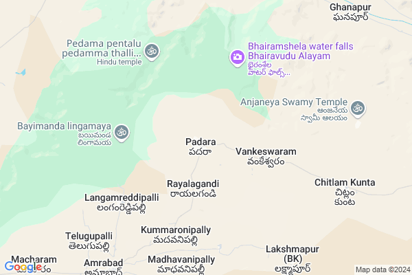
Padra is a Village in Amrabad Mandal in Mahbubnagar District of Telangana State, India. It belongs to Telangana region . It is located 117 KM towards East from District head quarters Mahabubnagar. 6 KM from Amrabad.
Padra Pin code is 509201 and postal head office is Amrabad .
Kummaronipally ( 5 KM ) , Madhavanipally ( 6 KM ) , Jangam Reddy Pally ( 8 KM ) , Chitlamkunta ( 9 KM ) , Amrabad ( 9 KM ) are the nearby Villages to Padra. Padra is surrounded by Chandampet Mandal towards North , Gundlapally (Dindi) Mandal towards North , Achampeta Mandal towards west , Uppununthala Mandal towards west .
Devarakonda , Srisailam Project (Right Flank Colony) Township , Macherla , Nagarkurnool are the near by Cities to Padra.
Padra 2011 Census Details
Padra Local Language is Telugu. Padra Village Total population is 5464 and number of houses are 1509. Female Population is 48.1%. Village literacy rate is 45.6% and the Female Literacy rate is 16.8%.
Population
| Census Parameter | Census Data |
| Total Population | 5464 |
| Total No of Houses | 1509 |
| Female Population % | 48.1 % ( 2626) |
| Total Literacy rate % | 45.6 % ( 2494) |
| Female Literacy rate | 16.8 % ( 918) |
| Scheduled Tribes Population % | 17.3 % ( 946) |
| Scheduled Caste Population % | 24.3 % ( 1330) |
| Working Population % | 56.3 % |
| Child(0 -6) Population by 2011 | 611 |
| Girl Child(0 -6) Population % by 2011 | 44.4 % ( 271) |
Padra Census More Deatils.
Politics in Padra
TDP , TRS , INC are the major political parties in this area.Polling Stations /Booths near Padra
1)Padmannapally2)Padra
3)Padra
4)Padra
5)Vangoor
HOW TO REACH Padra
By Road
Wanaparthy is the Nearest Town to Padra. Wanaparthy is 80 km from Padra. Road connectivity is there from Wanaparthy to Padra.By Rail
There is no railway station near to Padra in less than 10 km.Colleges near Padra
Degree Goverment CollegeSchools in Padra
Zphs PadraGovt Health Centers near Padra
1) Primary Health Centre, Padra , , , MAIN ROAD2) SubCentre, Padra(A) , Feb-81 , BADAIGADDA , BADAIGADDA
3) Subcentre, Padra(B) , Mar-64 , SC COLONY , PADRA
Sub Villages in Padra
Super Markets in Padra,Amrabad
Sri shanth Tent House and General store
Theldevarapalle; Telangana 508248; India
13.5 KM distance Detail
Police Stations near Padra,Amrabad
How to reach Padra
Tourist Places Near By Padra
Schools in Padra
Colleges in Padra
Temperature & weather of Padra
places in Padra
Padra photos
More Information
Village Talk
Post News or Events about this Village
Devarakonda 31 KM near
Srisailam Project (Right Flank Colony) Township 44 KM near
Macherla 67 KM near
Nagarkurnool 69 KM near
Amrabad 7 KM near
Chandampet 18 KM near
Gundlapally (Dindi) 21 KM near
Achampeta 29 KM near
Rajiv Gandhi International Airport 113 KM near
Vijayawada Airport 229 KM near
Tirupati Airport 358 KM near
Rajahmundry Airport 360 KM near
Srisailam 45 KM near
Nagarjunsagar 54 KM near
Nagarjunakonda 123 KM near
Kurnool 126 KM near
Hyderabad 126 KM near
Nalgonda 88 KM near
Mahbubnagar 112 KM near
Kurnool 126 KM near
Hyderabad 133 KM near
Nalgonda Rail Way Station 91 KM near
Miryalaguda Rail Way Station 93 KM near