| Home | City Bus | Maps | Villages | Cities | Rail | Tourist Places | School | College | Pin Codes | Corona Cases Count |
| Distance Calculator Bus Services IFSC Codes Trace Mobile Number Weather Search Place Trace IP Available Cash ATM/Banks Locate Polling Booth Report an Error contact People |
Ryalampad
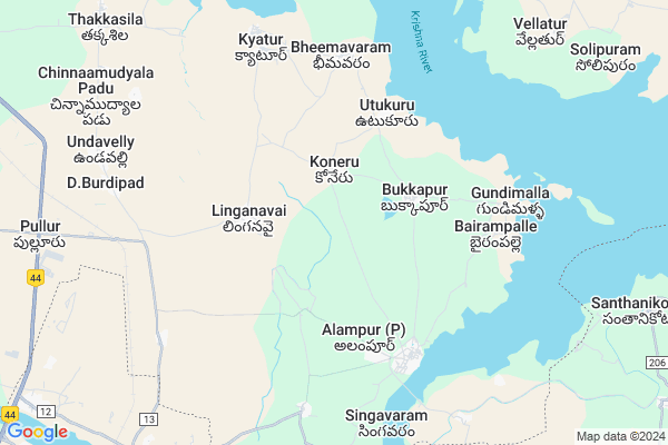
Ryalampad Map
EDIT Map
Add Your House
 ..
..
Current Corona Virus Infected Patients Count in Mahbubnagar District
| City Name | District Name | Total Covid cases |
|---|---|---|
| Jogulamba Gadwal District | Jogulamba Gadwal | 40 |
| Mahabubnagar District | Mahabubnagar | 11 |
Locality Name :
Ryalampad
( ర్యాలంపాడు )
Mandal Name : Alampur
District : Mahbubnagar
State : Telangana
Region : Telangana
Language : Telugu and Hindi, Urdu
Current Time 04:21 PM
Date: Monday , Apr 28,2025 (IST)
Time zone: IST (UTC+5:30)
Elevation / Altitude: 308 meters. Above Seal level
Telephone Code / Std Code: 08502
Assembly constituency : Alampur assembly constituency
Assembly MLA : Vijayudu
Lok Sabha constituency : Nagarkurnool parliamentary constituency
Parliament MP : POTHUGANTI RAMULU
Serpanch Name :
Pin Code : 509152
Post Office Name : Alampur (Mahabub Nagar)
Alternate Village Name : Ryalampadu
Commodities Prices : Kurnool Market / Mandi
Rivers Near Ryalampad
Tungabhadra :ತುಂಗಭದ್ರಾ :తుంగభద్ర
Tungabhadra :ತುಂಗಭದ್ರಾ :తుంగభద్ర
Tungabhadra :ತುಂಗಭದ್ರಾ :తుంగభద్ర
Tungabhadra :ತುಂಗಭದ್ರಾ :తుంగభద్ర
About Ryalampad
Correct below Info and add more info about RyalampadRyalampad is a Village in Alampur Mandal in Mahbubnagar District of Telangana State, India. It belongs to Telangana region . It is located 107 KM towards South from District head quarters Mahabubnagar.
Ryalampad Pin code is 509152 and postal head office is Alampur (Mahabub Nagar).
Ryalampad is surrounded by Kurnool Mandal towards South , Nandikotkur Mandal towards East , Veepangandla Mandal towards North , Manopadu Mandal towards west .
Kurnool , Gadwal , Wanaparthy , Bethamcherla are the near by Cities to Ryalampad.
This Place is in the border of the Mahbubnagar District and Kurnool District. Kurnool District Kurnool is South towards this place . It is near to the Andhra Pradesh State Border.
Ryalampadu 2011 Census Details
Ryalampad Local Language is Telugu. Ryalampadu Village Total population is 832 and number of houses are 188. Female Population is 50.7%. Village literacy rate is 46.5% and the Female Literacy rate is 20.6%.
Population
| Census Parameter | Census Data |
| Total Population | 832 |
| Total No of Houses | 188 |
| Female Population % | 50.7 % ( 422) |
| Total Literacy rate % | 46.5 % ( 387) |
| Female Literacy rate | 20.6 % ( 171) |
| Scheduled Tribes Population % | 0.0 % ( 0) |
| Scheduled Caste Population % | 17.4 % ( 145) |
| Working Population % | 49.0 % |
| Child(0 -6) Population by 2011 | 125 |
| Girl Child(0 -6) Population % by 2011 | 51.2 % ( 64) |
Ryalampadu Census More Deatils.
Politics in Ryalampad
TDP , TRS , BJP , INC are the major political parties in this area.Polling Stations /Booths near Ryalampad
1)Konderu Jinkalapally2)Kyatur
3)Lingan Wai
4)Buda Marsu
5)Bukkapur
HOW TO REACH Ryalampad
By Road
Kurnool is the Nearest Town to Ryalampad. Road connectivity is there from Kurnool to Ryalampad.By Rail
Alampur Road Rail Way Station , Sri Bala Brahmeswara Jogulamba Halt Rail Way Station are the very nearby railway stations to Ryalampad. Also you can consider railway Stations from Near By town Kurnool. Kotla Rail Way Station , Kurnool City Rail Way Station are the railway Stations near to Kurnool. You can reach from Kurnool to Ryalampad by road after .Colleges near Ryalampad
Govt Junior College Alampur
Address : Govt Junior College Alampur
Sri Sri Sri Jogulamba Devi Jr Clg, Alampur
Address : Alampur
Schools in Ryalampad
Mpps Ryalampad
Address : ryalampadu , alampur , mahbubnagar , Andhra Pradesh . PIN- 509152 , Post - Alampur (Mahabub Nagar)
Govt Health Centers near Ryalampad
1) Community Health Center, Alampur , , Near Court , Alampur2) Primary Health Centre, Kythur , , KYATHUR , Govt School Back Side
3) SubCentre, Khajipur , , Kashapur , School
Hospitals in Ryalampad,Alampur
Government General hospital
9th street; Rd; Alampur; Alampur; Telangana 509152; India
5.7 KM distance Detail
more ..
Colleges in Ryalampad,Alampur
vyshnavi junior college(lakshminarayana)
D.Burdipadu; Andhra Pradesh 509153; India
10.3 KM distance Detail
vyshnavi junior college [17372]alampur 'x' road
Srinagar - Kanyakumari Hwy; Pullur; Telangana 509128; India
11.4 KM distance Detail
more ..
Super Markets in Ryalampad,Alampur
Venkata ramaiah Kirana Stores
52/72f; King Market;near State Bank Of India; Kurnool; Andhra Pradesh 518001; India
13.3 KM distance Detail
Local Parks in Ryalampad,Alampur
M.K. Garden
56/67-A; Khander St; N R Peta; Kurnool; Andhra Pradesh 518001; India
13.1 KM distance Detail
About Ryalampad &
History
How to reach Ryalampad
Tourist Places Near By Ryalampad
Schools in Ryalampad
Colleges in Ryalampad
Temperature & weather of Ryalampad
places in Ryalampad
Ryalampad photos
More Information
How to reach Ryalampad
Tourist Places Near By Ryalampad
Schools in Ryalampad
Colleges in Ryalampad
Temperature & weather of Ryalampad
places in Ryalampad
Ryalampad photos
More Information
Village Talk
Post News or Events about this Village
Near Cities
Kurnool 14 KM near
Gadwal 54 KM near
Wanaparthy 54 KM near
Bethamcherla 58 KM near
Kurnool 14 KM near
Gadwal 54 KM near
Wanaparthy 54 KM near
Bethamcherla 58 KM near
Near By Taluks
Alampur 0 KM near
Kurnool 13 KM near
Nandikotkur 17 KM near
Veepangandla 18 KM near
Alampur 0 KM near
Kurnool 13 KM near
Nandikotkur 17 KM near
Veepangandla 18 KM near
Near By Air Ports
Rajiv Gandhi International Airport 168 KM near
Vijayawada Airport 330 KM near
Tirupati Airport 332 KM near
Sholapur Airport 335 KM near
Rajiv Gandhi International Airport 168 KM near
Vijayawada Airport 330 KM near
Tirupati Airport 332 KM near
Sholapur Airport 335 KM near
Near By Tourist Places
Kurnool 14 KM near
Mantralayam 81 KM near
Srisailam 92 KM near
Nagarjunsagar 165 KM near
Hyderabad 187 KM near
Kurnool 14 KM near
Mantralayam 81 KM near
Srisailam 92 KM near
Nagarjunsagar 165 KM near
Hyderabad 187 KM near
Near By Districts
Kurnool 14 KM near
Raichur 97 KM near
Mahbubnagar 103 KM near
Yadgir 156 KM near
Kurnool 14 KM near
Raichur 97 KM near
Mahbubnagar 103 KM near
Yadgir 156 KM near
Near By RailWay Station
Alampur Road Rail Way Station 8.5 KM near
Sri Bala Brahmeswara Jogulamba Halt Rail Way Station 8.6 KM near
Kurnool City Rail Way Station 14 KM near
Gadwal Junction Rail Way Station 52 KM near
Alampur Road Rail Way Station 8.5 KM near
Sri Bala Brahmeswara Jogulamba Halt Rail Way Station 8.6 KM near
Kurnool City Rail Way Station 14 KM near
Gadwal Junction Rail Way Station 52 KM near