| Home | City Bus | Maps | Villages | Cities | Rail | Tourist Places | School | College | Pin Codes | Corona Cases Count |
| Distance Calculator Bus Services IFSC Codes Trace Mobile Number Weather Search Place Trace IP Available Cash ATM/Banks Locate Polling Booth Report an Error contact People |
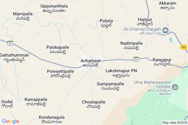
Achampet
Achampet Map
EDIT Map
Add Your House
 ..
..
Current Corona Virus Infected Patients Count in Mahbubnagar District
| City Name | District Name | Total Covid cases |
|---|---|---|
| Jogulamba Gadwal District | Jogulamba Gadwal | 40 |
| Mahabubnagar District | Mahabubnagar | 11 |
Locality Name :
Achampet
( అచంపేట్ )
Mandal Name : Achampeta
District : Mahbubnagar
State : Telangana
Region : Telangana
Language : Telugu and Hindi, Urdu
Current Time 10:57 AM
Date: Tuesday , Apr 29,2025 (IST)
Time zone: IST (UTC+5:30)
Elevation / Altitude: 545 meters. Above Seal level
Telephone Code / Std Code: 08549
Assembly constituency : Achampet assembly constituency
Assembly MLA : Chikkudu Vamshi Krishna
Lok Sabha constituency : Nagarkurnool parliamentary constituency
Parliament MP : POTHUGANTI RAMULU
Serpanch Name :
Pin Code : 509375
Post Office Name : Achampet
Alternate Village Name : Achampeta
Commodities Prices : Kalwakurthy Market / Mandi
Edit below overview about Achampet
Edit below overview about Achampet
OverView of Achampet
SriSaraSwathi Shishu mandi is one of the school in achampet.The famous historical places surrounding of achampet are :Srisailam:- Which is 90 KM from achampet.UmaMaheshwarm:- It is 8 KM from achampet.MallelaTheertham:- It is 15 KM from achampet.MaddigMadugu:- It is 70 KM frm achampet.No railway connectivity.Border of Andhrapradesh and telangana.Edit below overview about Achampet
Rivers Near Achampet
Krishna :クリシュナ :ಕೃಷ್ಣಾ :कृष्णा :కృష్ణా
Dindi
Krishna :クリシュナ :ಕೃಷ್ಣಾ :कृष्णा :కృష్ణా
Dindi
About Achampet
Achampet is a Town in Achampeta Mandal in Mahbubnagar District of Telangana State, India. It belongs to Telangana region . It is located 92 KM towards East from District head quarters Mahabubnagar. It is a Mandal head quarter.
Achampet Pin code is 509375 and postal head office is Achampet .
Lingotam ( 4 KM ) , Uppununthala ( 8 KM ) , Ramajipally ( 9 KM ) , Chennaram ( 9 KM ) , Banala ( 9 KM ) are the nearby Villages to Achampet. Achampet is surrounded by Balmoor Mandal towards west , Uppununthala Mandal towards North , Lingal Mandal towards west , Vangoor Mandal towards North .
Nagarkurnool , Srisailam Project (Right Flank Colony) Township , Devarakonda , Wanaparthy are the nearby Cities to Achampet.
This Place is in the border of the Mahbubnagar District and Nalgonda District. Nalgonda District Gundlapally (dindi) is North towards this place .
Demographics of Achampet
Telugu is the Local Language here. Total population of Achampet (CT) is 20721 according to census 2011.Among them Males are 11031 and Females are 9690 living in 3400 Houses. children's below 6 years are 2203 . Among them literate people are 14914. All the numbers are according to 2011 census.Politics in Achampet
TDP , TRS , INC are the major political parties in this area.Polling Stations /Booths near Achampet
1)Achampet Block2)Achampeta
3)Achampeta
4)Achampeta
5)Achampeta
HOW TO REACH Achampet
By Road
Wanaparthy is the Nearest Town to Achampet. Wanaparthy is 57 km from Achampet. Road connectivity is there from Wanaparthy to Achampet.By Rail
There is no railway station near to Achampet in less than 10 km.Govt Health Centers near Achampet
1) SubCentre, Achampet-B , 20-111 , TEACHERS COLONY , Palkapally road2) SubCentre, Achampet-A , , Peddmmagudi , TANGAPOOR
3) Community Health Center, Achampet , , MAIN ROAD , NEAR BUS STAND
Sub Villages in Achampet
Hospitals in Achampet,Achampeta
Guru Raghavnedra Medical And General Stores
Achampet; Telangana 509375; India
0.1 KM distance Detail
more ..
Petrol Bunks in Achampet,Achampeta
Sri Chaitanya Filling Station Indian Oil Petrol Pump
Mahbubnagar; SH-20; Nagarkurnool Achampet Road; Achampet; Achampet; Telangana 509375; India
0.3 KM distance Detail
M/S B Shanker Lingam Indian Oil Petrol Pump
Lingal - Achampet Rd; Achampet; Telangana 509375; India
1.0 KM distance Detail
more ..
Colleges in Achampet,Achampeta
Chaitanya College
11-103/1A; Vijaya Nagar Colony; Near RTC Bus Stand; Mahabubnagar District; Achampet; Telangana 509375; India
1.1 KM distance Detail
Sri Chaitanya Junior and Degree College
Teachers Colony; Achampet; Telangana 509375; India
1.1 KM distance Detail
more ..
Super Markets in Achampet,Achampeta
Murali Krishna Kiranam And Complex
Lingal - Achampet Road; Teachers Colony; Achampet; Telangana 509375; India
0.6 KM distance Detail
Local Parks in Achampet,Achampeta
Park
Srisailam Rd; Teachers Colony; Maruthi Nagar; Achampet; Telangana 509375; India
1.8 KM distance Detail
Police Stations near Achampet,Achampeta
Police Station Achampet
Lingal - Achampet Road; Achampet; Telangana 509375; India
0.3 KM distance Detail
About Achampet &
History
How to reach Achampet
Tourist Places Near By Achampet
Schools in Achampet
Colleges in Achampet
Temperature & weather of Achampet
places in Achampet
Achampet photos
More Information
How to reach Achampet
Tourist Places Near By Achampet
Schools in Achampet
Colleges in Achampet
Temperature & weather of Achampet
places in Achampet
Achampet photos
More Information
Town Talk
Post News or Events about this Town
Near Cities
Nagarkurnool 41 KM near
Srisailam Project (Right Flank Colony) Township 47 KM near
Devarakonda 49 KM near
Wanaparthy 67 KM near
Nagarkurnool 41 KM near
Srisailam Project (Right Flank Colony) Township 47 KM near
Devarakonda 49 KM near
Wanaparthy 67 KM near
Near By Taluks
Achampeta 3 KM near
Balmoor 11 KM near
Uppununthala 11 KM near
Lingal 20 KM near
Achampeta 3 KM near
Balmoor 11 KM near
Uppununthala 11 KM near
Lingal 20 KM near
Near By Air Ports
Rajiv Gandhi International Airport 107 KM near
Vijayawada Airport 258 KM near
Sholapur Airport 357 KM near
Latur Airport 359 KM near
Rajiv Gandhi International Airport 107 KM near
Vijayawada Airport 258 KM near
Sholapur Airport 357 KM near
Latur Airport 359 KM near
Near By Tourist Places
Srisailam 49 KM near
Nagarjunsagar 83 KM near
Kurnool 101 KM near
Hyderabad 124 KM near
Nagarjunakonda 152 KM near
Srisailam 49 KM near
Nagarjunsagar 83 KM near
Kurnool 101 KM near
Hyderabad 124 KM near
Nagarjunakonda 152 KM near
Near By Districts
Mahbubnagar 88 KM near
Kurnool 101 KM near
Nalgonda 109 KM near
Rangareddi 126 KM near
Mahbubnagar 88 KM near
Kurnool 101 KM near
Nalgonda 109 KM near
Rangareddi 126 KM near
Near By RailWay Station
Jadcherla Rail Way Station 73 KM near
Mahbubnagar Rail Way Station 88 KM near
Jadcherla Rail Way Station 73 KM near
Mahbubnagar Rail Way Station 88 KM near