| Home | City Bus | Maps | Villages | Cities | Rail | Tourist Places | School | College | Pin Codes | Corona Cases Count |
| Distance Calculator Bus Services IFSC Codes Trace Mobile Number Weather Search Place Trace IP Available Cash ATM/Banks Locate Polling Booth Report an Error contact People |
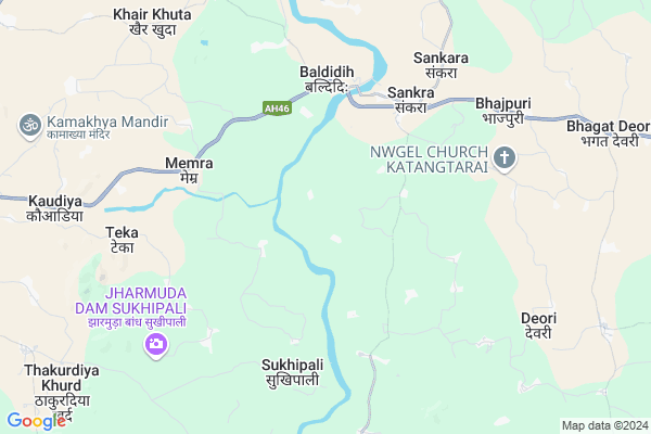
Barekel
Barekel Map
EDIT Map
Add Your House
 ..
..
Current Corona Virus Infected Patients Count in Mahasamund District
| City Name | District Name | Total Covid cases |
|---|
Locality Name :
Barekel
( बर्केल )
Tehsil Name : Pithora
District : Mahasamund
State : Chattisgarh
Language : Chhattisgarhi and Hindi, Oriya
Current Time 04:26 PM
Date: Wednesday , Feb 05,2025 (IST)
Time zone: IST (UTC+5:30)
Elevation / Altitude: 358 meters. Above Seal level
Telephone Code / Std Code: 07707
Assembly constituency : Basna assembly constituency
Assembly MLA : Sampat Agrawal
Lok Sabha constituency : Mahasamund parliamentary constituency
Parliament MP : CHUNNI LAL SAHU
Serpanch Name :
Pin Code : 493551
Post Office Name : Pithora
Commodities Prices : Sakra Market / Mandi
Barekel Live Weather
Temperature: 34.7 °C
scattered clouds
Humidity: 18%
Wind : 3.01 mt/sec towards NW
StationName : "Pithora"
observed on 2 Hours Back
Temperature: 34.7 °C
scattered clouds
Humidity: 18%
Wind : 3.01 mt/sec towards NW
StationName : "Pithora"
observed on 2 Hours Back
Barekel Weather Forecast for Next 5 days
06-02-2025
22.7°C to 34.9°C
scattered clouds, clear sky
22.7°C to 34.9°C
scattered clouds, clear sky
07-02-2025
19.9°C to 33.3°C
clear sky
19.9°C to 33.3°C
clear sky
08-02-2025
18.5°C to 32.9°C
clear sky
18.5°C to 32.9°C
clear sky
09-02-2025
17.2°C to 32.6°C
clear sky
17.2°C to 32.6°C
clear sky
10-02-2025
17.1°C to 33.5°C
clear sky
17.1°C to 33.5°C
clear sky
Rivers Near Barekel
Chirnāli Nadi :Chirnali Nadi
Kolār Nadi :Kolar Nadi
Chirnāli Nadi :Chirnali Nadi
Kolār Nadi :Kolar Nadi
About Barekel
Correct below Info and add more info about BarekelBarekel is a Village in Pithora Tehsil in Mahasamund District of Chattisgarh State, India. It is located 68 KM towards East from District head quarters Mahasamund. 122 KM from State capital Raipur
Barekel Pin code is 493551 and postal head office is Pithora .
Barekel is surrounded by Jharbandh Tehsil towards East , Basna Tehsil towards East , Bagbahara Tehsil towards South , Paikmal Tehsil towards South .
Basna , Mahasamund , Baloda Bazar , Naila Janjgir are the near by Cities to Barekel.
Barekel 2011 Census Details
Barekel Local Language is Chhattisgarhi. Barekel Village Total population is 677 and number of houses are 173. Female Population is 52.7%. Village literacy rate is 61.0% and the Female Literacy rate is 25.7%.
Population
| Census Parameter | Census Data |
| Total Population | 677 |
| Total No of Houses | 173 |
| Female Population % | 52.7 % ( 357) |
| Total Literacy rate % | 61.0 % ( 413) |
| Female Literacy rate | 25.7 % ( 174) |
| Scheduled Tribes Population % | 56.6 % ( 383) |
| Scheduled Caste Population % | 6.9 % ( 47) |
| Working Population % | 49.8 % |
| Child(0 -6) Population by 2011 | 86 |
| Girl Child(0 -6) Population % by 2011 | 55.8 % ( 48) |
Barekel Census More Deatils.
Politics in Barekel
Bharatiya Janata Party , BJP , INC are the major political parties in this area.Polling Stations /Booths near Barekel
1)Lohrindongari2)Garhapatni
3)Tongopathra
4)Chhuvalipatera
5)Roopapali
HOW TO REACH Barekel
By Rail
There is no railway station near to Barekel in less than 10 km.Colleges near Barekel
Chandrapal Dadsena Government College
Address : Pithora, Raipur
Schools in Barekel
Govt. Primary School
Address : barekel , pithora , mahasamund , Chattisgarh . PIN- 493555 , Post - Jagdishpur (Mahasamund)
Govt Health Centers near Barekel
1) Sagundhap , SHC Sagundhap , Sagundhap road ke pas , Parswani marg2) SHC Sankra , PHC Sankara , Thana para , NH 53 main rod sankara
3) PHC Sankara , PHC sankara , Main road sankara , NH 53 main rod sankara
Petrol Bunks in Barekel,Pithora
Bharat Petroleum
Pithora; Mahasamund; NH-6; Raipur Highway; Pethara; Pethara; Chhattisgarh 493551; India
13.4 KM distance Detail
M/S S.M FUELS POINTS
Bagbahra to Pithora; Pithora; Chhattisgarh 493445; India
14.3 KM distance Detail
more ..
Colleges in Barekel,Pithora
Govt. College Of ITI Pithora Dongaripali
Dongaripali po distt.; Pithora; Chhattisgarh 493551; India
10.4 KM distance Detail
Ramdarshan Institute of Education;Pithora
SH 19; BAGBAHARA ROAD; JANGHORA POST-PITHORA; Mahasamund District;; Pithora; Chhattisgarh 493551; India
15.1 KM distance Detail
Government Chandrapal Dadsena College Pithora
Atharagudi; Chhattisgarh 493551; India
15.2 KM distance Detail
more ..
About Barekel &
History
How to reach Barekel
Tourist Places Near By Barekel
Schools in Barekel
Colleges in Barekel
Temperature & weather of Barekel
places in Barekel
Barekel photos
More Information
How to reach Barekel
Tourist Places Near By Barekel
Schools in Barekel
Colleges in Barekel
Temperature & weather of Barekel
places in Barekel
Barekel photos
More Information
Village Talk
Post News or Events about this Village
Near Cities
Basna 23 KM near
Mahasamund 65 KM near
Baloda Bazar 76 KM near
Naila Janjgir 95 KM near
Basna 23 KM near
Mahasamund 65 KM near
Baloda Bazar 76 KM near
Naila Janjgir 95 KM near
Near By Taluks
Pithora 0 KM near
Jharbandh 25 KM near
Basna 29 KM near
Bagbahara 37 KM near
Pithora 0 KM near
Jharbandh 25 KM near
Basna 29 KM near
Bagbahara 37 KM near
Near By Air Ports
Raipur Airport 104 KM near
Jabalpur Airport 359 KM near
Bhubaneswar Airport 390 KM near
Ranchi Airport 402 KM near
Raipur Airport 104 KM near
Jabalpur Airport 359 KM near
Bhubaneswar Airport 390 KM near
Ranchi Airport 402 KM near
Near By Tourist Places
Mahasamund 65 KM near
Janjgir 94 KM near
Janjgir-Champa 112 KM near
Raipur 117 KM near
Bilaspur 118 KM near
Mahasamund 65 KM near
Janjgir 94 KM near
Janjgir-Champa 112 KM near
Raipur 117 KM near
Bilaspur 118 KM near
Near By Districts
Nuapada 55 KM near
Mahasamund 65 KM near
Janjgir-Champa 91 KM near
Bargarh 114 KM near
Nuapada 55 KM near
Mahasamund 65 KM near
Janjgir-Champa 91 KM near
Bargarh 114 KM near
Near By RailWay Station
Bagbahra Rail Way Station 39 KM near
Khariar Road Rail Way Station 45 KM near
Bagbahra Rail Way Station 39 KM near
Khariar Road Rail Way Station 45 KM near