| Home | City Bus | Maps | Villages | Cities | Rail | Tourist Places | School | College | Pin Codes | Corona Cases Count |
| Distance Calculator Bus Services IFSC Codes Trace Mobile Number Weather Search Place Trace IP Available Cash ATM/Banks Locate Polling Booth Report an Error contact People |
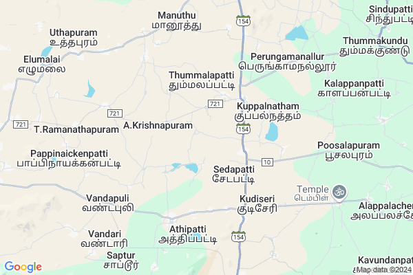
Uthappuram
Uthappuram Map
EDIT Map
Add Your House
 ..
..
Current Corona Virus Infected Patients Count in Madurai District
| City Name | District Name | Total Covid cases |
|---|---|---|
| Madurai District | Madurai | 74 |
| Madurai | Madurai | 1 |
Locality Name :
Uthappuram
( உத்தப்புரம் )
Block Name : Sedapatti
District : Madurai
State : Tamil Nadu
Language : Tamil and Telegu, Sourashtra, English, Hindi
Current Time 09:11 AM
Date: Wednesday , Apr 30,2025 (IST)
Time zone: IST (UTC+5:30)
Elevation / Altitude: 215 meters. Above Seal level
Telephone Code / Std Code: 04552
Assembly constituency : Usilampatti assembly constituency
Assembly MLA : Ayyappan P
Lok Sabha constituency : Theni parliamentary constituency
Parliament MP : RAVEENDRANATH KUMAR, P
Serpanch Name :
Pin Code : 625535
Post Office Name : Yelumalai
Alternate Village Name : Uthapuram
Commodities Prices : Usilampatty Market / Mandi
Uthappuram Live Weather
Temperature: 30.7 °C
overcast clouds
Humidity: 59%
Wind : 1.29 mt/sec towards SE
StationName : "Peraiyur"
observed on Now
Temperature: 30.7 °C
overcast clouds
Humidity: 59%
Wind : 1.29 mt/sec towards SE
StationName : "Peraiyur"
observed on Now
Uthappuram Weather Forecast for Next 5 days
01-05-2025
28.5°C to 36.0°C
overcast clouds
28.5°C to 36.0°C
overcast clouds
02-05-2025
27.9°C to 35.8°C
overcast clouds, moderate rain, light rain
27.9°C to 35.8°C
overcast clouds, moderate rain, light rain
03-05-2025
28.1°C to 36.9°C
overcast clouds, broken clouds, light rain
28.1°C to 36.9°C
overcast clouds, broken clouds, light rain
04-05-2025
27.6°C to 36.3°C
overcast clouds, light rain
27.6°C to 36.3°C
overcast clouds, light rain
05-05-2025
27.6°C to 37.3°C
broken clouds, scattered clouds, overcast clouds, light rain
27.6°C to 37.3°C
broken clouds, scattered clouds, overcast clouds, light rain
National Highways Reachable To Uthappuram
Nationa High Way :NH38
Nationa High Way :NH744
Nationa High Way :NH38
Nationa High Way :NH744
Rivers Near Uthappuram
Kiruthumal :Kiruthumal :கிருதுமால் நதி
Kiruthumal :Kiruthumal :கிருதுமால் நதி
About Uthappuram
Correct below Info and add more info about UthappuramUthappuram is a Village in Sedapatti Block in Madurai District of Tamil Nadu State, India. It is located 44 KM towards west from District head quarters Madurai. 524 KM from State capital Chennai
Uthappuram Pin code is 625535 and postal head office is Yelumalai .
Uthappuram is surrounded by T.Kallupatti Block towards South , Usilampatti Block towards North , Chellampatti Block towards North , Tirumangalam Block towards East .
Usilampatti , Thirumangalam , Sholavandan , Virudhunagar are the near by Cities to Uthappuram.
Uthapuram 2011 Census Details
Uthappuram Local Language is Tamil. Uthapuram Village Total population is 5149 and number of houses are 1381. Female Population is 49.3%. Village literacy rate is 57.4% and the Female Literacy rate is 23.6%.
Population
| Census Parameter | Census Data |
| Total Population | 5149 |
| Total No of Houses | 1381 |
| Female Population % | 49.3 % ( 2539) |
| Total Literacy rate % | 57.4 % ( 2957) |
| Female Literacy rate | 23.6 % ( 1215) |
| Scheduled Tribes Population % | 0.0 % ( 0) |
| Scheduled Caste Population % | 42.2 % ( 2172) |
| Working Population % | 62.4 % |
| Child(0 -6) Population by 2011 | 570 |
| Girl Child(0 -6) Population % by 2011 | 45.4 % ( 259) |
Uthapuram Census More Deatils.
Politics in Uthappuram
FBL , DMK , AIADMK , AIFB , ADMK are the major political parties in this area.Polling Stations /Booths near Uthappuram
1)Pt.union Middle School2)Pt. Union Ele.school
3)Pt. Union Primary Schoolnorth Building Thimmanatham
4)Pt.union Ele.schooladdl. R.c.c. Building Mondikundu - 625537
5)Govt. Higher Sec. School North Addl. New Building Saptur - 625705
HOW TO REACH Uthappuram
By Rail
There is no railway station near to Uthappuram in less than 10 km.Colleges near Uthappuram
Arul Anandar College
Address :
Sri Nagalakshmi Ammal College Of Sciences.
Address :
Government Polytechnic College
Address : Melur Sivagangai Road Ambalakaranpatty.
N.a.s Catering & Hotel Management College
Address : N.a.s Avenue, K.othapatti,
karupaiurani Post,
madurai – 625020,
tamil Nadu,
Government. Arts College, Melur
Address : Melur,madurai
Schools in Uthappuram
P.u.m.s Uthapuram - Ii
Address : uthapuram , sedapatti , madurai , Tamil Nadu . PIN- 625535 , Post - Yelumalai
P.u.m.s. Uthapuram - I
Address : uthapuram , sedapatti , madurai , Tamil Nadu . PIN- 625535 , Post - Yelumalai
Govt Health Centers near Uthappuram
1) THUMMAKUNDU , Sub Centres THUMMAKUNDU , WEST STREET THUMMAKUNDU , P.U..PRIMARY SCHOOL2) Devipriya Hospital , 0 , T.B.Road , Near Government Hospital
3) Kallupatti , Health Sub centre , Main Raod, , Thendral Nagar,
Sub Villages in Uthappuram
Hospitals in Uthappuram,Sedapatti
Government Hospital
T.Kallupatti-Theni Road - SH 154; Tamil Nadu 625527; India
3.2 KM distance Detail
goverment hospital
Village-Allikundam; Alligundam; Tahsil; Usilampatti; Tamil Nadu 625527; India
6.3 KM distance Detail
more ..
Petrol Bunks in Uthappuram,Sedapatti
Hindustan Petroleum
Thirumangalam - Athipatti Rd; Tirumangalam; Tamil Nadu 625703; India
5.0 KM distance Detail
Indian Oil Petrol Pump
Alampatti - Sedapatti Rd; Tirumangalam; Tamilnadu 625703; India
5.1 KM distance Detail
HP PETROL PUMP - PARASAKTHI PETROLEUM AGENCIES
S.NO. 44/2B Peraiyur Sedapatti Road Managalrevu Village Peraiyur Taluk; Tamil Nadu 625703; India
8.7 KM distance Detail
Ex Servicemens Oil Agency( IOC Petrolpump
name];; 1/373; [no name]; Saptur; Tamil Nadu 625705; India
8.8 KM distance Detail
more ..
Colleges in Uthappuram,Sedapatti
Parasakthi College of Education
Kottaipatti; Sedapatti; Peraiyur; Tamil Nadu 625537; India
4.6 KM distance Detail
Pasumpon Muthuramaling Thevar College
Madurai-Theni Main Road; Usilampatti; Tamil Nadu 625535; India
12.0 KM distance Detail
more ..
Schools in Uthappuram,Sedapatti
Government Higher Secondary School
T.Kallupatti - Theni Rd; Sedapatti; Tamil Nadu 625527; India
2.4 KM distance Detail
Panchayat Union Primary School Selanayakkanpatti
Sedapatti; Madurai; Selanayakkanpatti; Tamil Nadu 625527; India
2.5 KM distance Detail
Cheran Global Matric School
T.Kallupatti - Theni Rd; Sedapatti; Tamil Nadu 625527; India
2.5 KM distance Detail
Police Stations near Uthappuram,Sedapatti
Sedapatti Police Station
T.Kallupatti-Theni Road - SH 154; Sedapatti; Tamil Nadu 625527; India
2.3 KM distance Detail
Governement Offices near Uthappuram,Sedapatti
Panchayat Union Office
Alampatti - Sedapatti Rd; Tirumangalam; Tamilnadu 625703; India
2.5 KM distance Detail
About Uthappuram &
History
How to reach Uthappuram
Tourist Places Near By Uthappuram
Schools in Uthappuram
Colleges in Uthappuram
Temperature & weather of Uthappuram
places in Uthappuram
Uthappuram photos
More Information
How to reach Uthappuram
Tourist Places Near By Uthappuram
Schools in Uthappuram
Colleges in Uthappuram
Temperature & weather of Uthappuram
places in Uthappuram
Uthappuram photos
More Information
Village Talk
Post News or Events about this Village
Near Cities
Usilampatti 17 KM near
Thirumangalam 24 KM near
Sholavandan 33 KM near
Virudhunagar 36 KM near
Usilampatti 17 KM near
Thirumangalam 24 KM near
Sholavandan 33 KM near
Virudhunagar 36 KM near
Near By Taluks
Sedapatti 0 KM near
T.Kallupatti 15 KM near
Usilampatti 16 KM near
Chellampatti 19 KM near
Sedapatti 0 KM near
T.Kallupatti 15 KM near
Usilampatti 16 KM near
Chellampatti 19 KM near
Near By Air Ports
Madurai Airport 38 KM near
Tuticorin Airport 142 KM near
Civil Airport 162 KM near
Peelamedu Airport 174 KM near
Madurai Airport 38 KM near
Tuticorin Airport 142 KM near
Civil Airport 162 KM near
Peelamedu Airport 174 KM near
Near By Tourist Places
Madurai 43 KM near
Sivakasi 47 KM near
Kodaikanal 62 KM near
Dindigul 71 KM near
Palani Hills 74 KM near
Madurai 43 KM near
Sivakasi 47 KM near
Kodaikanal 62 KM near
Dindigul 71 KM near
Palani Hills 74 KM near
Near By Districts
Virudhunagar 36 KM near
Madurai 43 KM near
Theni 43 KM near
Dindigul 69 KM near
Virudhunagar 36 KM near
Madurai 43 KM near
Theni 43 KM near
Dindigul 69 KM near
Near By RailWay Station
Sholavandan Rail Way Station 33 KM near
Virudunagar Junction Rail Way Station 36 KM near
Sholavandan Rail Way Station 33 KM near
Virudunagar Junction Rail Way Station 36 KM near