| Home | City Bus | Maps | Villages | Cities | Rail | Tourist Places | School | College | Pin Codes | Corona Cases Count |
| Distance Calculator Bus Services IFSC Codes Trace Mobile Number Weather Search Place Trace IP Available Cash ATM/Banks Locate Polling Booth Report an Error contact People |
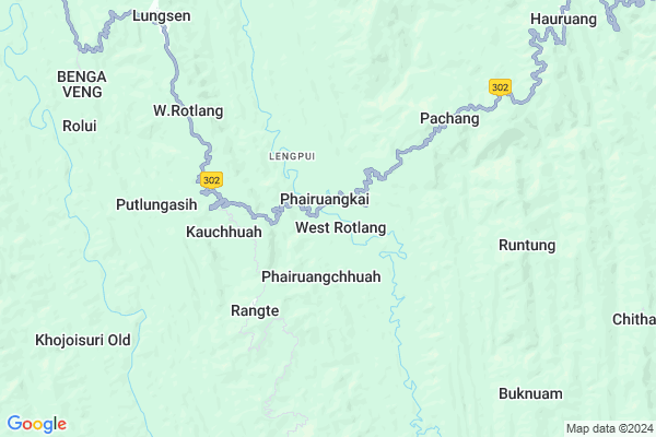
Phairuangkai Map
EDIT Map
Add Your House
 ..
..
Current Corona Virus Infected Patients Count in Lunglei District
| City Name | District Name | Total Covid cases |
|---|
Locality Name :
Phairuangkai
( फैरुजंगके )
Block Name : Lungsen
District : Lunglei
State : Mizoram
Language : Mizo
Current Time 06:58 AM
Date: Saturday , Apr 26,2025 (IST)
Time zone: IST (UTC+5:30)
Telephone Code / Std Code: 03834
Assembly constituency : Thorang assembly constituency
Assembly MLA : R. Rohmingliana
Lok Sabha constituency : Mizoram parliamentary constituency
Parliament MP : C LALROSANGA
Serpanch Name :
Pin Code : 796730
Post Office Name : Lungsen
Rivers Near Phairuangkai
Tyao :Tyao River
s
Tyao :Tyao River
s
About Phairuangkai
Correct below Info and add more info about PhairuangkaiPhairuangkai is a Village in Lungsen Block in Lunglei District of Mizoram State, India. It is located 16 KM towards west from District head quarters Lunglei. 9 KM from Lungsen. 118 KM from State capital Aizawl
Phairuangkai Pin code is 796730 and postal head office is Lungsen .
Rangte ( 4 KM ) , Runtung ( 7 KM ) , Lungsen ( 9 KM ) , Rolui ( 9 KM ) , Buknuam ( 10 KM ) are the nearby Villages to Phairuangkai. Phairuangkai is surrounded by Lunglei Block towards East , Chawngte Block towards South , Hnahthial Block towards East , Lawngtlai Block towards South .
Lunglei , Saiha , Champhai , Aizawl are the near by Cities to Phairuangkai.
Phairuangkai 2011 Census Details
Phairuangkai Local Language is Mizo. Phairuangkai Village Total population is 1222 and number of houses are 255. Female Population is 49.0%. Village literacy rate is 62.4% and the Female Literacy rate is 27.0%.
Population
| Census Parameter | Census Data |
| Total Population | 1222 |
| Total No of Houses | 255 |
| Female Population % | 49.0 % ( 599) |
| Total Literacy rate % | 62.4 % ( 762) |
| Female Literacy rate | 27.0 % ( 330) |
| Scheduled Tribes Population % | 99.5 % ( 1216) |
| Scheduled Caste Population % | 0.0 % ( 0) |
| Working Population % | 52.6 % |
| Child(0 -6) Population by 2011 | 247 |
| Girl Child(0 -6) Population % by 2011 | 47.4 % ( 117) |
Phairuangkai Census More Deatils.
Politics in Phairuangkai
Mizo National Front , INC are the major political parties in this area.Polling Stations /Booths near Phairuangkai
1)Phairuangchhuah2)Changpui
3)Putlungasih
4)Lungsen I
5)Lungchem
HOW TO REACH Phairuangkai
By Rail
There is no railway station near to Phairuangkai in less than 10 km.Colleges near Phairuangkai
Government Hnahthial College
Address : Hnahthial
Higher And Technical Institute Of Mizoram
Address :
Schools near Phairuangkai
Lalnutui M S
Address : lungrang , tlabung , lunglei , Mizoram . PIN- 796730 , Post - Lungsen
Samuksuri M S
Address : samuksuri , tlabung , lunglei , Mizoram . PIN- 796751 , Post - Demagiri
H.k. Chakma Aided M S
Address : kalapani , tlabung , lunglei , Mizoram . PIN- 796751 , Post - Demagiri
Merino English Medium M S
Address : tlabung , tlabung , lunglei , Mizoram . PIN- 796751 , Post - Demagiri
Govt Health Centers near Phairuangkai
1) Christian Hospital Serkawn , , ,2) Lairam Christian Medical Centre , , ,
3) Marpara , , ,
About Phairuangkai &
History
How to reach Phairuangkai
Tourist Places Near By Phairuangkai
Schools in Phairuangkai
Colleges in Phairuangkai
Temperature & weather of Phairuangkai
places in Phairuangkai
Phairuangkai photos
More Information
How to reach Phairuangkai
Tourist Places Near By Phairuangkai
Schools in Phairuangkai
Colleges in Phairuangkai
Temperature & weather of Phairuangkai
places in Phairuangkai
Phairuangkai photos
More Information
Village Talk
Post News or Events about this Village
Near Cities
Lunglei 16 KM near
Saiha 56 KM near
Champhai 113 KM near
Aizawl 116 KM near
Lunglei 16 KM near
Saiha 56 KM near
Champhai 113 KM near
Aizawl 116 KM near
Near By Taluks
Lungsen 9 KM near
Lunglei 16 KM near
Chawngte 27 KM near
Hnahthial 42 KM near
Lungsen 9 KM near
Lunglei 16 KM near
Chawngte 27 KM near
Hnahthial 42 KM near
Near By Air Ports
Aizawl Airport 126 KM near
Singerbhil Airport 208 KM near
Kumbhirgram Airport 263 KM near
Imphal Municipal Airport 281 KM near
Aizawl Airport 126 KM near
Singerbhil Airport 208 KM near
Kumbhirgram Airport 263 KM near
Imphal Municipal Airport 281 KM near
Near By Tourist Places
Lunglei 17 KM near
Saiha 56 KM near
Serchhip 65 KM near
Champhai 111 KM near
Aizawl 113 KM near
Lunglei 17 KM near
Saiha 56 KM near
Serchhip 65 KM near
Champhai 111 KM near
Aizawl 113 KM near
Near By Districts
Lunglei 16 KM near
Lawngtlai 45 KM near
Saiha 55 KM near
Serchhip 65 KM near
Lunglei 16 KM near
Lawngtlai 45 KM near
Saiha 55 KM near
Serchhip 65 KM near
Near By RailWay Station
Ambassa Rail Way Station 164 KM near
Agartala Rail Way Station 197 KM near
Ambassa Rail Way Station 164 KM near
Agartala Rail Way Station 197 KM near