| Home | City Bus | Maps | Villages | Cities | Rail | Tourist Places | School | College | Pin Codes | Corona Cases Count |
| Distance Calculator Bus Services IFSC Codes Trace Mobile Number Weather Search Place Trace IP Available Cash ATM/Banks Locate Polling Booth Report an Error contact People |
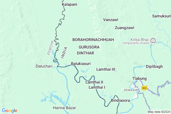
Dinthar Map
EDIT Map
Add Your House
 ..
..
Current Corona Virus Infected Patients Count in Lunglei District
| City Name | District Name | Total Covid cases |
|---|
Locality Name :
Dinthar
( दिनतर )
Block Name : Lungsen
District : Lunglei
State : Mizoram
Language : Mizo
Current Time 08:48 AM
Date: Wednesday , Apr 30,2025 (IST)
Time zone: IST (UTC+5:30)
Telephone Code / Std Code: 03834
Assembly constituency : West Tuipui assembly constituency
Assembly MLA : Prova Chakma
Lok Sabha constituency : Mizoram parliamentary constituency
Parliament MP : C LALROSANGA
Serpanch Name :
Pin Code : 796751
Post Office Name : Demagiri
Commodities Prices : Manubazar Market / Mandi
Rivers Near Dinthar
Tyao :Tyao River
s
Tyao :Tyao River
s
About Dinthar
Correct below Info and add more info about DintharDinthar is a Village in Lungsen Block in Lunglei District of Mizoram State, India. It is located 41 KM towards west from District head quarters Lunglei. 22 KM from Lungsen. 108 KM from State capital Aizawl
Dinthar Pin code is 796751 and postal head office is Demagiri .
Kalapani ( 7 KM ) , Serhuan ( 7 KM ) , Tlabung ( 8 KM ) , Chanmari ( 9 KM ) , Sugarbasora ( 9 KM ) are the nearby Villages to Dinthar. Dinthar is surrounded by Bunghmun Block towards North , Lunglei Block towards East , Chawngte Block towards South , Hnahthial Block towards East .
Lunglei , Saiha , Aizawl , Champhai are the near by Cities to Dinthar.
Dinthar 2011 Census Details
Dinthar Local Language is Mizo. Dinthar Village Total population is and number of houses are . Female Population is -1.0%. Village literacy rate is -1.0% and the Female Literacy rate is -1.0%.
Population
| Census Parameter | Census Data |
| Total Population | |
| Total No of Houses | |
| Female Population % | -1.0 % ( ) |
| Total Literacy rate % | -1.0 % ( ) |
| Female Literacy rate | -1.0 % ( ) |
| Scheduled Tribes Population % | -1.0 % ( ) |
| Scheduled Caste Population % | -1.0 % ( ) |
| Working Population % | -1.0 % |
| Child(0 -6) Population by 2011 | |
| Girl Child(0 -6) Population % by 2011 | -1.0 % ( ) |
Dinthar Census More Deatils.
Politics in Dinthar
Mizo National Front , INC are the major political parties in this area.Polling Stations /Booths near Dinthar
1)Devasora2)Khojoysuri
3)Tiperaghat
4)Tlabung I
5)Tlabung Ii
HOW TO REACH Dinthar
By Rail
There is no railway station near to Dinthar in less than 10 km.Colleges near Dinthar
Government Hnahthial College
Address : Hnahthial
Higher And Technical Institute Of Mizoram
Address :
Schools near Dinthar
Lalnutui M S
Address : lungrang , tlabung , lunglei , Mizoram . PIN- 796730 , Post - Lungsen
Samuksuri M S
Address : samuksuri , tlabung , lunglei , Mizoram . PIN- 796751 , Post - Demagiri
H.k. Chakma Aided M S
Address : kalapani , tlabung , lunglei , Mizoram . PIN- 796751 , Post - Demagiri
Merino English Medium M S
Address : tlabung , tlabung , lunglei , Mizoram . PIN- 796751 , Post - Demagiri
Govt Health Centers near Dinthar
1) Marpara , , ,2) Marpara , , ,
3) Christian Hospital Serkawn , , ,
Schools in Dinthar,Lungsen
Government High School Tlabung
Tlabung - Lunglei Rd; Zodin Veng; Tlabung; Mizoram 796751; India
8.3 KM distance Detail
LZM English Medium School
Tlabung-Borapansury Rd; Tlabung; Mizoram 796751; India
8.5 KM distance Detail
Electronic Shops in Dinthar,Lungsen
Super Markets in Dinthar,Lungsen
About Dinthar &
History
How to reach Dinthar
Tourist Places Near By Dinthar
Schools in Dinthar
Colleges in Dinthar
Temperature & weather of Dinthar
places in Dinthar
Dinthar photos
More Information
How to reach Dinthar
Tourist Places Near By Dinthar
Schools in Dinthar
Colleges in Dinthar
Temperature & weather of Dinthar
places in Dinthar
Dinthar photos
More Information
Village Talk
Post News or Events about this Village
Near Cities
Lunglei 38 KM near
Saiha 86 KM near
Aizawl 106 KM near
Champhai 124 KM near
Lunglei 38 KM near
Saiha 86 KM near
Aizawl 106 KM near
Champhai 124 KM near
Near By Taluks
Lungsen 21 KM near
Bunghmun 37 KM near
Lunglei 40 KM near
Chawngte 47 KM near
Lungsen 21 KM near
Bunghmun 37 KM near
Lunglei 40 KM near
Chawngte 47 KM near
Near By Air Ports
Aizawl Airport 114 KM near
Singerbhil Airport 178 KM near
Kumbhirgram Airport 254 KM near
Imphal Municipal Airport 283 KM near
Aizawl Airport 114 KM near
Singerbhil Airport 178 KM near
Kumbhirgram Airport 254 KM near
Imphal Municipal Airport 283 KM near
Near By Tourist Places
Lunglei 39 KM near
Serchhip 68 KM near
Saiha 86 KM near
Aizawl 104 KM near
Champhai 123 KM near
Lunglei 39 KM near
Serchhip 68 KM near
Saiha 86 KM near
Aizawl 104 KM near
Champhai 123 KM near
Near By Districts
Lunglei 39 KM near
Serchhip 68 KM near
Lawngtlai 75 KM near
Saiha 85 KM near
Lunglei 39 KM near
Serchhip 68 KM near
Lawngtlai 75 KM near
Saiha 85 KM near
Near By RailWay Station
Ambassa Rail Way Station 138 KM near
Agartala Rail Way Station 167 KM near
Ambassa Rail Way Station 138 KM near
Agartala Rail Way Station 167 KM near