| Home | City Bus | Maps | Villages | Cities | Rail | Tourist Places | School | College | Pin Codes | Corona Cases Count |
| Distance Calculator Bus Services IFSC Codes Trace Mobile Number Weather Search Place Trace IP Available Cash ATM/Banks Locate Polling Booth Report an Error contact People |
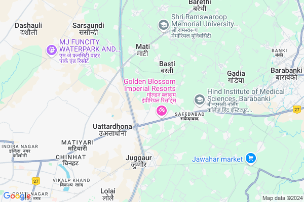
Papnamau
Papnamau Map
EDIT Map
Add Your House
 ..
..
Current Corona Virus Infected Patients Count in Lucknow District
| City Name | District Name | Total Covid cases |
|---|---|---|
| Lucknow District | Lucknow | 185 |
| Lucknow | Lucknow | 7 |
Locality Name :
Papnamau
( पपनामऊ )
City Name : Chinhat
District : Lucknow
State : Uttar Pradesh
Division : Lucknow
Language : Hindi and Urdu, Awadhi
Current Time 02:24 PM
Date: Tuesday , Apr 29,2025 (IST)
Time zone: IST (UTC+5:30)
Elevation / Altitude: 121 meters. Above Seal level
Telephone Code / Std Code: 0522
Assembly constituency : Bakshi Kaa Talab assembly constituency
Assembly MLA : Yogesh Shukla
Lok Sabha constituency : Mohanlalganj parliamentary constituency
Parliament MP : Kaushal Kishore
Pin Code : 227105
Post Office Name : Chinhat
Commodities Prices : Barabanki Market / Mandi
Papnamau Live Weather
Temperature: 33.0 °C
clear sky
Humidity: 19%
Wind : 4.72 mt/sec towards SE
StationName : "Satrikh"
observed on 1 Hours Back
Temperature: 33.0 °C
clear sky
Humidity: 19%
Wind : 4.72 mt/sec towards SE
StationName : "Satrikh"
observed on 1 Hours Back
Papnamau Weather Forecast for Next 5 days
30-04-2025
29.0°C to 38.4°C
few clouds, scattered clouds
29.0°C to 38.4°C
few clouds, scattered clouds
01-05-2025
27.0°C to 40.3°C
clear sky, scattered clouds
27.0°C to 40.3°C
clear sky, scattered clouds
02-05-2025
28.9°C to 41.3°C
few clouds, clear sky, scattered clouds
28.9°C to 41.3°C
few clouds, clear sky, scattered clouds
03-05-2025
28.2°C to 40.9°C
few clouds, broken clouds, clear sky, light rain
28.2°C to 40.9°C
few clouds, broken clouds, clear sky, light rain
04-05-2025
28.9°C to 41.1°C
scattered clouds, light rain, broken clouds, overcast clouds
28.9°C to 41.1°C
scattered clouds, light rain, broken clouds, overcast clouds
National Highways Reachable To Papnamau
Nationa High Way :NH27;NH30
Nationa High Way :NH30
Nationa High Way :NH27;NH30
Nationa High Way :NH30
Rivers Near Papnamau
Gomtī :Gomti River :गोमती
Gomtī :Gomti River :गोमती
About Papnamau
Correct below Info and add more info about PapnamauPapnamau is a Locality in Chinhat City in Uttar Pradesh State, India. It is belongs to Lucknow Division .
Papnamau Pin code is 227105 and postal head office is Chinhat .
Uattardhauna , Juggaur , Ganeshpur Rahmanpur , Semra , Goila are the nearby Localities to Papnamau.
Lucknow , Zaidpur , Purwa , Sandila are the nearby Cities to Chinhat.
Demographics of Papnamau
Hindi is the Local Language here.Politics in Papnamau
SP , BSP are the major political parties in this area.Polling Stations /Booths near Papnamau
1)Pra.vi. Amaniganj Banauga Room No-12)Pra.vi. Anaura Kala Room No-1
3)Pu.ma.vi. Paikramau Room No.-2
4)Pu.ma.vi. Papnamau Room No-1
5)Pra.vi. Nandpur Room No-1
HOW TO REACH Papnamau
By Rail
Safedabad Rail Way Station , Jugaur Rail Way Station are the very nearby railway station to Papnamau.Govt Health Centers near Papnamau
1) Juggaur , Juggaur , Juggaur ,2) Mati , , Mati ,
3) Jasmanda , , ,
Hospitals in Papnamau,Chinhat
Health Care & Eye Care Clinic
new tara ka purwa tiwariganj; Chinhat; Lucknow; Uttar Pradesh 226028; India
3.2 KM distance Detail
more ..
Petrol Bunks in Papnamau,Chinhat
Prakash Automobile
Anaura kala; Chinhat; Lucknow; Uttar Pradesh 226028; India
1.7 KM distance Detail
HP PETROL PUMP - MAYUR FILLING CENTRE
Safedabad; NH 28; Barabanki; Uttar Pradesh 225003; India
2.9 KM distance Detail
HP PETROL PUMP - JANTA AUTO
Tiwariganj PO Chinhat DT Lucknow UP; Lucknow; Uttar Pradesh 226001; India
3.0 KM distance Detail
more ..
Colleges in Papnamau,Chinhat
Techno Group of Institutions
331; Near Indira Canal; Faizabad Road; Lucknow; Uttar Pradesh 226028; India
1.8 KM distance Detail
Goel Group Of Institutions
Faizabad Road; Near Indira Canal; Lucknow; Uttar Pradesh 226028; India
2.2 KM distance Detail
GITM(Goel Institute Of Technology And Management)
Anora Kala; Uttar Pradesh 226010; India
2.2 KM distance Detail
more ..
Schools in Papnamau,Chinhat
Prayag Public School
Goel Tower; फैजाबाद मार्ग; छातेनागार्ही; उत्तर प्रदेश 225003; India
0.6 KM distance Detail
Electronic Shops in Papnamau,Chinhat
Lucky Mobile Shop
Papnamau Road; Anaura Khurd; Anora Kala; Uttar Pradesh 226028; India
1.6 KM distance Detail
Aj motors
anaura chinhat lucknow uttar pardes; Chinhat; Lucknow; Uttar Pradesh; India
1.8 KM distance Detail
Local Parks in Papnamau,Chinhat
Community Park
Behind sarsawti Dental College; Near Pragya vidyalaya; Faizabad Rd; Uttardhauna; Uttar Pradesh 227105; India
3.1 KM distance Detail
Police Stations near Papnamau,Chinhat
Police Station Faizabad Road
Faizabad Road; Faizabad Road; Mathyari Road; Chinhat; Lucknow; Uttar Pradesh 227105; India
7.1 KM distance Detail
About Papnamau &
History
How to reach Papnamau
Tourist Places Near By Papnamau
Schools in Papnamau
Colleges in Papnamau
Temperature & weather of Papnamau
places in Papnamau
Papnamau photos
More Information
How to reach Papnamau
Tourist Places Near By Papnamau
Schools in Papnamau
Colleges in Papnamau
Temperature & weather of Papnamau
places in Papnamau
Papnamau photos
More Information
Locality Talk
Post News or Events about this Locality
Near Cities
Lucknow 17 KM near
Zaidpur 28 KM near
Purwa 65 KM near
Sandila 67 KM near
Lucknow 17 KM near
Zaidpur 28 KM near
Purwa 65 KM near
Sandila 67 KM near
Near By Taluks
Chinhat 7 KM near
Banki 7 KM near
Barabanki 11 KM near
Dewa 14 KM near
Chinhat 7 KM near
Banki 7 KM near
Barabanki 11 KM near
Dewa 14 KM near
Near By Air Ports
Amausi Airport 29 KM near
Kanpur Airport 98 KM near
Bamrauli Airport 196 KM near
Gorakhpur Airport 262 KM near
Amausi Airport 29 KM near
Kanpur Airport 98 KM near
Bamrauli Airport 196 KM near
Gorakhpur Airport 262 KM near
Near By Tourist Places
Lucknow 21 KM near
Rae Bareli 87 KM near
Naimisharanya 93 KM near
Bithur 98 KM near
Kanpur 101 KM near
Lucknow 21 KM near
Rae Bareli 87 KM near
Naimisharanya 93 KM near
Bithur 98 KM near
Kanpur 101 KM near
Near By Districts
Barabanki 11 KM near
Lucknow 19 KM near
Unnao 82 KM near
Rae Bareli 87 KM near
Barabanki 11 KM near
Lucknow 19 KM near
Unnao 82 KM near
Rae Bareli 87 KM near
Near By RailWay Station
Safedabad Rail Way Station 3.5 KM near
Jugaur Rail Way Station 3.9 KM near
Malhaur Rail Way Station 8.8 KM near
Barabanki Junction Rail Way Station 10 KM near
Gomti Nagar Rail Way Station 11 KM near
Safedabad Rail Way Station 3.5 KM near
Jugaur Rail Way Station 3.9 KM near
Malhaur Rail Way Station 8.8 KM near
Barabanki Junction Rail Way Station 10 KM near
Gomti Nagar Rail Way Station 11 KM near